Lafayette, Ohio

Last updated

Lafayette, Ohio
High below Sugar, Lafayette.jpg
Buildings on High Street
Nickname: 
Patriot City USA
OHMap-doton-Lafayette.png
Location of Lafayette, Ohio
Map of Allen County Ohio Highlighting Lafayette Village.png
Location of Lafayette in Allen County
Coordinates: 40°45′32″N83°57′00″W / 40.75889°N 83.95000°W / 40.75889; -83.95000
Country United States
State Ohio
County Allen
Township Jackson
Government
  MayorJeff McVicker[ citation needed ]
Area
[1]
  Total0.23 sq mi (0.60 km2)
  Land0.23 sq mi (0.60 km2)
  Water0.00 sq mi (0.00 km2)
Elevation
[2]
929 ft (283 m)
Population
 (2020)
  Total406
  Density1,742.49/sq mi (674.06/km2)
Time zone UTC-5 (Eastern (EST))
  Summer (DST) UTC-4 (EDT)
ZIP code
45854
Area code 419
FIPS code 39-41118 [3]
GNIS feature ID2398373 [2]
Website http://www.lafayetteoh.com/

Lafayette is a village in Allen County, Ohio, United States. The population was 406 at the 2020 census. It is included in the Lima, Ohio Metropolitan Statistical Area.

Contents

A house seen on a postcard mailed from Lafayette on November 10, 1910 Nov 10 1910 Lafayette OH.jpg
A house seen on a postcard mailed from Lafayette on November 10, 1910

History

The village was incorporated in 1868. [4]

Geography

According to the United States Census Bureau, the village has a total area of 0.25 square miles (0.65 km2), all land. [5]

Demographics

Historical population
CensusPop.Note
1870 337
1880 333−1.2%
1900 316
1910 41832.3%
1920 383−8.4%
1930 382−0.3%
1940 4117.6%
1950 4448.0%
1960 4767.2%
1970 4862.1%
1980 4880.4%
1990 449−8.0%
2000 304−32.3%
2010 44546.4%
2020 406−8.8%
U.S. Decennial Census [6]

2010 census

As of the census [7] of 2010, there were 445 people, 161 households, and 120 families living in the village. The population density was 1,780.0 inhabitants per square mile (687.3/km2). There were 172 housing units at an average density of 688.0 per square mile (265.6/km2). The racial makeup of the village was 97.8% White, 0.2% Native American, 1.3% Asian, and 0.7% from two or more races. Hispanic or Latino of any race were 1.1% of the population.

There were 161 households, of which 46.0% had children under the age of 18 living with them, 54.7% were married couples living together, 10.6% had a female householder with no husband present, 9.3% had a male householder with no wife present, and 25.5% were non-families. 21.7% of all households were made up of individuals, and 11.2% had someone living alone who was 65 years of age or older. The average household size was 2.76 and the average family size was 3.21.

The median age in the village was 33.4 years. 32.1% of residents were under the age of 18; 6.7% were between the ages of 18 and 24; 29.9% were from 25 to 44; 20.9% were from 45 to 64; and 10.3% were 65 years of age or older. The gender makeup of the village was 47.9% male and 52.1% female.

2000 census

As of the census [3] of 2000, there were 304 people, 118 households, and 86 families living in the village. The population density was 1,483.3 inhabitants per square mile (572.7/km2). There were 126 housing units at an average density of 614.8 per square mile (237.4/km2). The racial makeup of the village was 99.34% White and 0.66% African American.

There were 118 households, out of which 38.1% had children under the age of 18 living with them, 58.5% were married couples living together, 9.3% had a female householder with no husband present, and 26.3% were non-families. 23.7% of all households were made up of individuals, and 14.4% had someone living alone who was 65 years of age or older. The average household size was 2.58 and the average family size was 3.06.

In the village, the population was spread out, with 26.6% under the age of 18, 8.9% from 18 to 24, 32.2% from 25 to 44, 17.8% from 45 to 64, and 14.5% who were 65 years of age or older. The median age was 35 years. For every 100 females there were 86.5 males. For every 100 females age 18 and over, there were 82.8 males.

The median income for a household in the village was $41,250, and the median income for a family was $47,969. Males had a median income of $44,821 versus $19,375 for females. The per capita income for the village was $17,822. About 3.7% of families and 3.5% of the population were below the poverty line, including 1.5% of those under the age of eighteen and 7.9% of those 65 or over.

Education

Allen East is the name of the high school formerly located in Lafayette. The school relocated in 2006 to a new campus two miles south of town, at Napoleon Rd. and State Route 309.

Lafayette high school sports participate in the Northwest Conference, an athletic body sanctioned by the Ohio High School Athletic Association (OHSAA) which includes the Ada Bulldogs, Allen East Mustangs, Bluffton Pirates, Columbus Grove Bulldogs, Convoy Crestview Knights, Delphos Jefferson Wildcats, Lincolnview Lancers, Paulding Panthers, and Spencerville Bearcats.

Lafayette has a public library, a branch of the Allen County Library. [8]

Related Research Articles

<span class="mw-page-title-main">Elida, Ohio</span> Village in Ohio, United States

Elida is a village in Allen County, Ohio, United States. The population was 1,923 at the 2020 census. It is included in the Lima, Ohio Metropolitan Statistical Area.

<span class="mw-page-title-main">Fort Shawnee, Ohio</span> CDP in Ohio, United States

Fort Shawnee is census-designated place (CDP) in Allen County, Ohio, United States. The population was 6,263 at the 2020 census. It is included in the Lima, Ohio Metropolitan Statistical Area. Fort Shawnee is adjacent to the city of Lima and the village of Cridersville in Auglaize County. In 2012, village residents voted to disincorporate the village. According to the United States Census Bureau, the village had a total area of 7.25 square miles (18.78 km2), of which 7.21 square miles (18.67 km2) is land and 0.04 square miles (0.10 km2) is water.

<span class="mw-page-title-main">Harrod, Ohio</span> Village in Ohio, United States

Harrod is a village in Allen County, Ohio, United States. The population was 423 at the 2020 census. It is included in the Lima, Ohio Metropolitan Statistical Area.

<span class="mw-page-title-main">Spencerville, Ohio</span> Village in Ohio, United States

Spencerville is a village in Allen County, Ohio, United States. The population was 2,198 at the 2020 census. It is included in the Lima, Ohio Metropolitan Statistical Area.

<span class="mw-page-title-main">Trimble, Ohio</span> Village in Ohio, United States

Trimble is a village in Trimble Township, Athens County, Ohio, United States. The population was 329 at the 2020 census.

<span class="mw-page-title-main">Cridersville, Ohio</span> Village in Ohio, United States

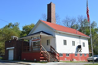
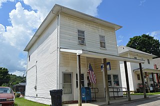
Cridersville is a village in Auglaize County, Ohio, United States. The population was 1,791 at the 2020 census. It is included in the Wapakoneta, Ohio Micropolitan Statistical Area.

<span class="mw-page-title-main">Warsaw, Ohio</span> Village in Ohio, United States

Warsaw is a village in Coshocton County, Ohio, United States, along the Walhonding River. The population was 624 at the 2020 census.

<span class="mw-page-title-main">West Lafayette, Ohio</span> Village in Ohio, United States

West Lafayette is a village in Coshocton County, Ohio, United States. The population was 2,417 at the 2020 census.

<span class="mw-page-title-main">Ithaca, Ohio</span> Village in Ohio, United States

Ithaca is a village in Darke County, Ohio, United States. The population was 81 at the 2020 census.

<span class="mw-page-title-main">Jeffersonville, Ohio</span> Village in Ohio, United States

Jeffersonville is a village in Fayette County, Ohio, United States. The population was 1,258 at the 2020 census.

<span class="mw-page-title-main">Pleasant City, Ohio</span> Village in Ohio, United States

Pleasant City is a village in Guernsey County, Ohio, United States. The population was 400 at the 2020 census.

<span class="mw-page-title-main">Cleves, Ohio</span> City in Ohio, United States

Cleves is a village in Miami Township, Hamilton County, Ohio, United States. Located along the Ohio River, it is a western suburb of Cincinnati. The population was 3,414 at the 2020 census.

<span class="mw-page-title-main">Evendale, Ohio</span> Village in Ohio, United States

Evendale is a village in Hamilton County, Ohio, United States, within the Cincinnati metropolitan area. The population was 2,669 at the 2020 census.

<span class="mw-page-title-main">Hartford, Ohio</span> Village in Ohio, United States

Hartford is a village in the township of the same name in Licking County, Ohio, United States. The population was 404 at the 2020 census.

<span class="mw-page-title-main">St. Louisville, Ohio</span> Village in Ohio, United States

St. Louisville or Saint Louisville is a village in Licking County, Ohio, United States, along the North Fork of the Licking River. The population was 352 at the 2020 census.

<span class="mw-page-title-main">LaGrange, Ohio</span> Village in Ohio, United States

LaGrange is a village in Lorain County, Ohio, United States. The population was 2,595 at the 2020 census.

<span class="mw-page-title-main">Chesterville, Ohio</span> Village in Ohio, United States

Chesterville is a village in Morrow County, Ohio, United States, along the Kokosing River. The population was 191 at the 2020 census. Chesterville is southeast of Mount Gilead, the county seat.

<span class="mw-page-title-main">Darbyville, Ohio</span> Village in Ohio, United States

Darbyville is a village in Pickaway County, Ohio, United States. The population was 186 at the 2020 census.

<span class="mw-page-title-main">Gratiot, Ohio</span> Village in Ohio, United States

Gratiot is a village in Licking and Muskingum counties in the U.S. state of Ohio. The population was 215 at the 2020 census.

<span class="mw-page-title-main">Verona, Ohio</span> Village in Ohio, United States

Verona is a village in Montgomery and Preble counties in the U.S. state of Ohio. The population was 403 at the 2020 census. It is part of the Dayton Metropolitan Statistical Area.

References

  1. "ArcGIS REST Services Directory". United States Census Bureau. Retrieved September 20, 2022.
  2. 1 2 U.S. Geological Survey Geographic Names Information System: Lafayette, Ohio
  3. 1 2 "U.S. Census website". United States Census Bureau . Retrieved January 31, 2008.
  4. Rusler, William (1921). A Standard History of Allen County, Ohio: An Authentic Narrative of the Past, with Particular Attention to the Modern Era in the Commercial, Industrial, Educational, Civic and Social Development. American Historical Society. p.  194.
  5. "US Gazetteer files 2010". United States Census Bureau. Archived from the original on July 2, 2012. Retrieved January 6, 2013.
  6. "Census of Population and Housing". Census.gov. Retrieved June 4, 2015.
  7. "U.S. Census website". United States Census Bureau . Retrieved January 6, 2013.
  8. "Lafayette Branch". Lima Public Library. Retrieved February 25, 2018.