Spencerville, Ohio

Last updated

Spencerville, Ohio
Broadway south from Fourth, Spencerville.jpg
Broadway Street downtown
OHMap-doton-Spencerville.png
Location of Spencerville, Ohio
Map of Allen County Ohio Highlighting Spencerville Village.png
Location of Spencerville in Allen County
Coordinates: 40°42′29″N84°21′10″W / 40.70806°N 84.35278°W / 40.70806; -84.35278
Country United States
State Ohio
County Allen
Township Spencer
Government
   Mayor Phillip Briggs[ citation needed ]
   Administrator Sean Chapman[ citation needed ]
Area
[1]
  Total0.96 sq mi (2.50 km2)
  Land0.96 sq mi (2.50 km2)
  Water0.00 sq mi (0.00 km2)
Elevation
[2]
830 ft (250 m)
Population
 (2020)
  Total2,198
  Density2,277.72/sq mi (879.72/km2)
Time zone UTC-5 (Eastern (EST))
  Summer (DST) UTC-4 (EDT)
ZIP code
45887
Area code 419
FIPS code 39-74034 [3]
GNIS feature ID2399872 [2]
Website spencervilleoh.com

Spencerville is a village in Allen County, Ohio, United States. The population was 2,198 at the 2020 census. It is included in the Lima, Ohio Metropolitan Statistical Area.

Contents

History

Spencerville was platted in 1844 when the Miami and Erie Canal was extended to that point. [4] The village was named after William Spencer, a canal planner. [5] An early variant name was Acadia. [6] A post office called Acadia was established in 1854, and the name was changed to Spencerville in 1867. [7]

Geography

According to the United States Census Bureau, the village has a total area of 0.97 square miles (2.51 km2), all land. [8]

Demographics

Historical population
CensusPop.Note
1870 364
1880 53246.2%
1890 1,266138.0%
1900 1,87448.0%
1910 1,748−6.7%
1920 1,543−11.7%
1930 1,6124.5%
1940 1,6230.7%
1950 1,82612.5%
1960 2,06112.9%
1970 2,2418.7%
1980 2,184−2.5%
1990 2,2884.8%
2000 2,235−2.3%
2010 2,223−0.5%
2020 2,198−1.1%
U.S. Decennial Census [9]

2010 census

As of the census [10] of 2010, there were 2,223 people, 817 households, and 583 families living in the village. The population density was 2,291.8 inhabitants per square mile (884.9/km2). There were 886 housing units at an average density of 913.4 per square mile (352.7/km2). The racial makeup of the village was 96.5% White, 0.4% African American, 0.2% Native American, 0.4% Asian, and 2.5% from two or more races. Hispanic or Latino of any race were 0.7% of the population.

There were 817 households, of which 40.3% had children under the age of 18 living with them, 49.3% were married couples living together, 16.2% had a female householder with no husband present, 5.9% had a male householder with no wife present, and 28.6% were non-families. 24.6% of all households were made up of individuals, and 12.2% had someone living alone who was 65 years of age or older. The average household size was 2.66 and the average family size was 3.15.

The median age in the village was 33.4 years. 30.6% of residents were under the age of 18; 7.8% were between the ages of 18 and 24; 25.5% were from 25 to 44; 20.8% were from 45 to 64; and 15.2% were 65 years of age or older. The gender makeup of the village was 48.7% male and 51.3% female.

2000 census

As of the census [3] of 2000, there were 2,235 people, 845 households, and 599 families living in the village. The population density was 2,454.9 people per square mile (947.8 people/km2). There were 903 housing units at an average density of 991.8 per square mile (382.9/km2). The racial makeup of the village was 97.72% White, 0.63% African American, 0.18% Native American, 0.09% Asian, and 1.39% from two or more races. Hispanic or Latino of any race were 0.31% of the population.

There were 845 households, out of which 35.9% had children under the age of 18 living with them, 53.4% were married couples living together, 13.1% had a female householder with no husband present, and 29.1% were non-families. 25.4% of all households were made up of individuals, and 13.0% had someone living alone who was 65 years of age or older. The average household size was 2.54 and the average family size was 3.03.

In the village, the population was spread out, with 28.5% under the age of 18, 7.2% from 18 to 24, 27.2% from 25 to 44, 20.4% from 45 to 64, and 16.6% who were 65 years of age or older. The median age was 35 years. For every 100 females there were 89.9 males. For every 100 females age 18 and over, there were 82.9 males.

The median income for a household in the village was $32,619, and the median income for a family was $40,625. Males had a median income of $30,701 versus $22,708 for females. The per capita income for the village was $17,140. About 12.3% of families and 13.0% of the population were below the poverty line, including 20.4% of those under age 18 and 7.9% of those age 65 or over.

Education

Spencerville built a new school that houses K-12 and opened in 2008. Spencerville High School sports participate in the Northwest Conference, an athletic body sanctioned by the Ohio High School Athletic Association.

Notable residents

Related Research Articles

<span class="mw-page-title-main">Fort Shawnee, Ohio</span> CDP in Ohio, United States

Fort Shawnee is census-designated place (CDP) in Allen County, Ohio, United States. The population was 6,263 at the 2020 census. It is included in the Lima, Ohio Metropolitan Statistical Area. Fort Shawnee is adjacent to the city of Lima and the village of Cridersville in Auglaize County. In 2012, village residents voted to disincorporate the village. According to the United States Census Bureau, the village had a total area of 7.25 square miles (18.78 km2), of which 7.21 square miles (18.67 km2) is land and 0.04 square miles (0.10 km2) is water.

<span class="mw-page-title-main">Harrod, Ohio</span> Village in Ohio, United States

Harrod is a village in Allen County, Ohio, United States. The population was 423 at the 2020 census. It is included in the Lima, Ohio Metropolitan Statistical Area.

<span class="mw-page-title-main">Lafayette, Ohio</span> Village in Ohio, United States

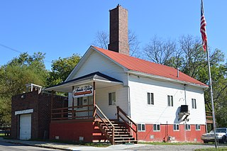
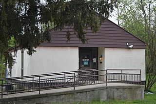
Lafayette is a village in Allen County, Ohio, United States. The population was 406 at the 2020 census. It is included in the Lima, Ohio Metropolitan Statistical Area.

<span class="mw-page-title-main">Trimble, Ohio</span> Village in Ohio, United States

Trimble is a village in Trimble Township, Athens County, Ohio, United States. The population was 329 at the 2020 census.

<span class="mw-page-title-main">Cridersville, Ohio</span> Village in Ohio, United States

Cridersville is a village in Auglaize County, Ohio, United States. The population was 1,791 at the 2020 census. It is included in the Wapakoneta, Ohio Micropolitan Statistical Area.

<span class="mw-page-title-main">Gordon, Ohio</span> Village in Ohio, United States

Gordon is a village in Darke County, Ohio, United States. The population was 245 at the 2020 census.

<span class="mw-page-title-main">Ithaca, Ohio</span> Village in Ohio, United States

Ithaca is a village in Darke County, Ohio, United States. The population was 81 at the 2020 census.

<span class="mw-page-title-main">New Weston, Ohio</span> Village in Ohio, United States

New Weston is a village in Darke County, Ohio, United States. The population was 124 at the 2020 census.

<span class="mw-page-title-main">Bloomingburg, Ohio</span> Village in Ohio, United States

Bloomingburg is a village in Fayette County, Ohio, United States. The population was 878 at the 2020 census.

<span class="mw-page-title-main">Jeffersonville, Ohio</span> Village in Ohio, United States

Jeffersonville is a village in Fayette County, Ohio, United States. The population was 1,258 at the 2020 census.

<span class="mw-page-title-main">Valleyview, Ohio</span> Village in Ohio, United States

Valleyview is a village in Franklin County, Ohio, United States. The population was 669 at the 2020 census.

<span class="mw-page-title-main">Cleves, Ohio</span> City in Ohio, United States

Cleves is a village in Miami Township, Hamilton County, Ohio, United States. Located along the Ohio River, it is a western suburb of Cincinnati. The population was 3,414 at the 2020 census.

<span class="mw-page-title-main">North Bend, Ohio</span> Village in Ohio, United States

North Bend is a village in Miami Township, Hamilton County, Ohio, United States, along the Ohio River. It is a part of the Greater Cincinnati area. The population was 835 at the 2020 census.

<span class="mw-page-title-main">New Athens, Ohio</span> Village in Ohio, United States

New Athens is a village in Harrison County, Ohio, United States. The population was 222 at the 2020 census.

<span class="mw-page-title-main">Mowrystown, Ohio</span> Village in Ohio, United States

Mowrystown is a village in Highland County, Ohio, United States. The population was 385 at the 2020 census.

<span class="mw-page-title-main">Hartford, Ohio</span> Village in Ohio, United States

Hartford is a village in the township of the same name in Licking County, Ohio, United States. The population was 404 at the 2020 census.

<span class="mw-page-title-main">Port Jefferson, Ohio</span> Village in Ohio, United States

Port Jefferson is a village in Salem Township, Shelby County, Ohio, United States. The population was 308 at the 2020 census.

<span class="mw-page-title-main">Convoy, Ohio</span> Village in Ohio, United States

Convoy is a village in Van Wert County, Ohio, United States. The population was 1,012 at the 2020 census. It is included in the Van Wert, Ohio Micropolitan Statistical Area.

<span class="mw-page-title-main">Bairdstown, Ohio</span> Village in Ohio, United States

Bairdstown is a village in Wood County, Ohio, United States. The population was 115 at the 2020 census.

<span class="mw-page-title-main">Bluffton, Ohio</span> Village in Ohio, United States

Bluffton, originally known as Shannon, is a village in Allen and Hancock counties in the U.S. state of Ohio. The population was 3,967 at the 2020 census. Bluffton is home to Bluffton University, a four-year educational institution affiliated with Mennonite Church USA. Bluffton is served by the Bluffton general aviation airport. Bluffton participates in the Tree City USA program.

References

  1. "ArcGIS REST Services Directory". United States Census Bureau. Retrieved September 20, 2022.
  2. 1 2 U.S. Geological Survey Geographic Names Information System: Spencerville, Ohio
  3. 1 2 "U.S. Census website". United States Census Bureau . Retrieved January 31, 2008.
  4. History of Allen County, Ohio: Containing a History of the County, Its Townships, Towns, Villages, Schools, Churches, Industries, Etc. Warner, Beers & Company. 1885. p.  546.
  5. Overman, William Daniel (1958). Ohio Town Names. Akron, OH: Atlantic Press. p. 129.
  6. Rusler, William (1921). A Standard History of Allen County, Ohio: An Authentic Narrative of the Past, with Particular Attention to the Modern Era in the Commercial, Industrial, Educational, Civic and Social Development. American Historical Society. p.  350.
  7. "Allen County". Jim Forte Postal History. Retrieved January 10, 2016.
  8. "US Gazetteer files 2010". United States Census Bureau. Archived from the original on July 2, 2012. Retrieved January 6, 2013.
  9. "Census of Population and Housing". Census.gov. Retrieved June 4, 2015.
  10. "U.S. Census website". United States Census Bureau . Retrieved January 6, 2013.