Lake City, Georgia

Last updated

Lake City, Georgia
Lake City, Georgia municipal hall.JPG
Lake City Municipal Hall
Flag of Lake City, Georgia.png
Seal of Lake City, Georgia.png
Motto: 
The city of friendly people
Clayton County Georgia Incorporated and Unincorporated areas Lake City Highlighted.svg
Location in Clayton County and the state of Georgia
Coordinates: 33°36′29″N84°20′26″W / 33.60806°N 84.34056°W / 33.60806; -84.34056
Country United States
State Georgia
County Clayton
Area
[1]
  Total1.85 sq mi (4.78 km2)
  Land1.85 sq mi (4.78 km2)
  Water0.00 sq mi (0.00 km2)
Elevation
968 ft (295 m)
Population
 (2020)
  Total2,952
  Density1,598.27/sq mi (616.99/km2)
Time zone UTC-5 (Eastern (EST))
  Summer (DST) UTC-4 (EDT)
ZIP code
30260
Area code 770
FIPS code 13-44508 [2]
GNIS feature ID0332165 [3]
Website www.lakecityga.net

Lake City is a city in Clayton County, Georgia, United States. The population was 2,612 at the 2010 census. [4]

Contents

History

The Georgia General Assembly incorporated Lake City in 1951. [5] The community was named for a lake which once was located at the town site, but since has been filled in. [6]

Geography

Lake City is located in northern Clayton County at 33°36′29″N84°20′26″W / 33.60806°N 84.34056°W / 33.60806; -84.34056 (33.608109, -84.340481). [7] It is bordered to the south by Morrow and to the west and north by Forest Park. Fort Gillem is directly to the north, within the Forest Park city limits. Downtown Atlanta is 11 miles (18 km) to the north.

According to the United States Census Bureau, Lake City has a total area of 1.9 square miles (4.8 km2), all land. [4]

Demographics

Historical population
CensusPop.Note
1960 1,042
1970 2,306121.3%
1980 2,96328.5%
1990 2,733−7.8%
2000 2,8865.6%
2010 2,612−9.5%
2020 2,95213.0%
U.S. Decennial Census [8]

2020 census

Lake City racial composition [9]
RaceNum.Perc.
White (non-Hispanic)48316.36%
Black or African American (non-Hispanic)1,16939.6%
Native American 110.37%
Asian 52217.68%
Pacific Islander 10.03%
Other/Mixed 893.01%
Hispanic or Latino 67722.93%

As of the 2020 United States census, there were 2,952 people, 597 households, and 410 families residing in the city.

2000 census

As of the census [2] of 2000, there were 2,886 people, 950 households, and 690 families residing in the city. The population density was 1,594.5 inhabitants per square mile (615.6/km2). There were 1,022 housing units at an average density of 564.6 per square mile (218.0/km2). The racial makeup of the city was 51.91% White, 32.22% African American, 0.94% Native American, 9.67% Asian, 0.14% Pacific Islander, 3.19% from other races, and 1.94% from two or more races. Hispanic or Latino people of any race were 7.48% of the population.

There were 950 households, out of which 32.4% had children under the age of 18 living with them, 47.5% were married couples living together, 17.4% had a female householder with no husband present, and 27.3% were non-families. 21.2% of all households were made up of individuals, and 7.5% had someone living alone who was 65 years of age or older. The average household size was 2.78 and the average family size was 3.18.

In the city, the population was spread out, with 23.6% under the age of 18, 8.3% from 18 to 24, 28.8% from 25 to 44, 21.3% from 45 to 64, and 18.0% who were 65 years of age or older. The median age was 37 years. For every 100 females, there were 92.0 males. For every 100 females age 18 and over, there were 85.8 males.

The median income for a household in the city was $38,929, and the median income for a family was $42,600. Males had a median income of $26,875 versus $24,490 for females. The per capita income for the city was $15,877. About 8.5% of families and 8.7% of the population were below the poverty line, including 16.2% of those under age 18 and none of those age 65 or over.

Infrastructure

Transit systems

MARTA serves the city.

Education

Clayton County Public Schools operates public schools.

Related Research Articles

<span class="mw-page-title-main">Williams County, Ohio</span> County in Ohio, United States

Williams County is a county located in the U.S. state of Ohio. As of the 2020 census, the population was 37,102. Its county seat is Bryan. The county was created in 1820 and later organized in 1824. It is named for David Williams, one of the captors of John André in the American Revolutionary War.

<span class="mw-page-title-main">Clayton County, Georgia</span> County in Georgia, United States

Clayton County is located in the north central portion of the U.S. state of Georgia. As of 2021, the population was estimated to be 297,100 by the Census Bureau. The county seat is Jonesboro.

<span class="mw-page-title-main">Highland Lake, Alabama</span> Town in Alabama, United States

Highland Lake is a town in Blount County, Alabama, United States. At the 2020 census, the population was 412.

<span class="mw-page-title-main">Jenkinsburg, Georgia</span> City in Georgia, United States

Jenkinsburg is a city in Butts County, Georgia, United States. The population was 370 at the 2010 census.

<span class="mw-page-title-main">Mount Zion, Georgia</span> City in Georgia, United States

Mount Zion is a city in Carroll County, Georgia, United States. The population was 1,696 at the 2010 census.

<span class="mw-page-title-main">Bonanza, Georgia</span> Place in Georgia, United States

Bonanza is an unincorporated community and census-designated place (CDP) in Clayton County, Georgia, United States. The population was 3,135 at the 2010 census.

<span class="mw-page-title-main">Forest Park, Georgia</span> City in Georgia, United States

Forest Park is a city in Clayton County, Georgia, United States. It is located approximately nine miles (14 km) south of Atlanta and is part of the Atlanta–Sandy Springs–Marietta Metropolitan Statistical Area. As of the 2020 census, the city had a population of 19,932.

<span class="mw-page-title-main">Irondale, Georgia</span> Place in Georgia, United States

Irondale is an unincorporated community and census-designated place (CDP) in Clayton County, Georgia, United States. The population was 8,740 at the 2020 census.

<span class="mw-page-title-main">Jonesboro, Georgia</span> City in Georgia, United States

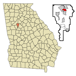
Jonesboro is a city in and the county seat of Clayton County, Georgia, United States. The population was 4,724 as of the 2010 census.

<span class="mw-page-title-main">Lovejoy, Georgia</span> City in Georgia, United States

Lovejoy is a city in Clayton County, Georgia, United States. As of the 2010 census, the city had a population of 6,422, up from 2,495 in 2000. During the American Civil War, it was the site of the Battle of Lovejoy's Station during the Atlanta Campaign of 1864. Lovejoy was incorporated as a town on September 16, 1861.

<span class="mw-page-title-main">Morrow, Georgia</span> City in Georgia, United States

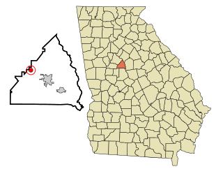
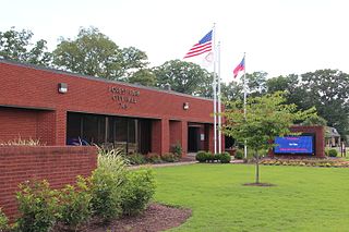
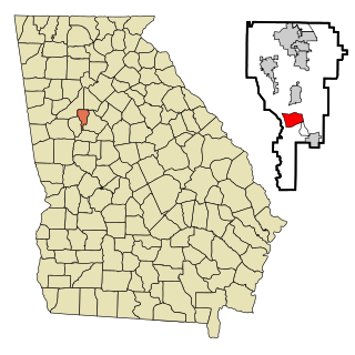
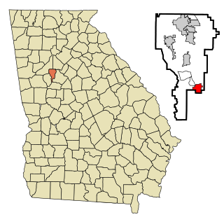
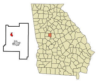
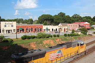
Morrow is a city in Clayton County, Georgia, United States. It is part of the Atlanta metropolitan area. Its population was 6,445 at the 2010 census, up from 4,882 in 2000. It is the home of Clayton State University and the Georgia Archives.

<span class="mw-page-title-main">Pine Lake, Georgia</span> City in Georgia, United States

Pine Lake is the smallest city in DeKalb County, Georgia, United States. The population was 752 at the 2020 census.

<span class="mw-page-title-main">Hampton, Georgia</span> City in Georgia, United States

Hampton is a city in southwestern Henry County, Georgia, United States. The 2020 census was 8,368. As of the 2010 census, the city had a population of 6,987, up from 3,857 at the 2000 census. By 2018 the estimated population was 7,922. "Hampton" mailing addresses outside the city limits reach into rural parts of eastern Clayton County and northern Spalding County. It is a southeastern suburb in the Atlanta metropolitan area.

<span class="mw-page-title-main">Milner, Georgia</span> City in Georgia, United States

Milner is a city in Lamar County, Georgia, United States. The population was 610 at the 2010 census, up from 522 at the 2000 census. Milner is part of Metro Atlanta.

<span class="mw-page-title-main">Lone Oak, Georgia</span> Town in Georgia, United States

Lone Oak is a town in Meriwether County, Georgia, United States. The population was 114 at the 2020 census.

<span class="mw-page-title-main">Hiram, Georgia</span> City in Georgia, United States

Hiram is a city in Paulding County, Georgia, United States. As of the 2020 census, the population is 4,929.

<span class="mw-page-title-main">Clayton, Georgia</span> City in Georgia, United States

Clayton is a city in Rabun County, Georgia, United States. Its population was 2,003 at the 2020 census. The county seat of Rabun County, it is in the Blue Ridge Mountains.

<span class="mw-page-title-main">Clayton, Iowa</span> City in Iowa, United States

Clayton is a city in Clayton County, Iowa, United States. The population was 45 at the 2020 census, down from 55 in 2000. Clayton is located directly on the Mississippi River and is only accessible via a very steep road.

<span class="mw-page-title-main">Keego Harbor, Michigan</span> City in Michigan, United States

Keego Harbor is a city in Oakland County in the U.S. state of Michigan. A northern suburb of Detroit, Keego Harbor is located roughly 27 miles (43.5 km) from downtown Detroit, and about 3 miles (4.8 km) southwest of Pontiac. As of the 2010 census, the city had a population of 2,970. With a land area of 0.50 square miles (1.29 km2), Keego Harbor is the third-smallest city by land area in the state of Michigan, after Petersburg and Clarkston.

<span class="mw-page-title-main">Lakeland South, Washington</span> Census-designated place in Washington, United States

Lakeland South is a census-designated place (CDP) in King County, Washington, United States. The population was 13,169 at the 2020 census.

References

  1. "2020 U.S. Gazetteer Files". United States Census Bureau. Retrieved December 18, 2021.
  2. 1 2 "U.S. Census website". United States Census Bureau . Retrieved January 31, 2008.
  3. "US Board on Geographic Names". United States Geological Survey. October 25, 2007. Retrieved January 31, 2008.
  4. 1 2 "Geographic Identifiers: 2010 Demographic Profile Data (G001): Lake City city, Georgia". U.S. Census Bureau, American Factfinder. Archived from the original on February 12, 2020. Retrieved July 28, 2014.
  5. "City of Lake City". georgiainfo. Retrieved February 24, 2019.
  6. Krakow, Kenneth K. (1975). Georgia Place-Names: Their History and Origins (PDF). Macon, GA: Winship Press. p. 128. ISBN   0-915430-00-2.
  7. "US Gazetteer files: 2010, 2000, and 1990". United States Census Bureau. February 12, 2011. Retrieved April 23, 2011.
  8. "Census of Population and Housing". Census.gov. Retrieved June 4, 2015.
  9. "Explore Census Data". data.census.gov. Retrieved December 13, 2021.