Clayton County | |
---|---|
Coordinates: 33°32′N84°22′W / 33.54°N 84.36°W | |
Country | United States |
State | Georgia |
Founded | November 30, 1858 |
Named for | Augustin Smith Clayton |
Seat | Jonesboro |
Largest city | Ellenwood |
Area | |
• Total | 144 sq mi (370 km2) |
• Land | 142 sq mi (370 km2) |
• Water | 2.8 sq mi (7 km2) 1.9% |
Population | |
• Estimate (2021) | 297,100 |
• Density | 2,101/sq mi (811/km2) |
Time zone | UTC−5 (Eastern) |
• Summer (DST) | UTC−4 (EDT) |
Congressional districts | 5th, 13th |
Website | claytoncountyga.gov |
Clayton County is located in the north central portion of the U.S. state of Georgia. As of 2021, the population was estimated to be 297,100 by the Census Bureau. [1] The county seat is Jonesboro. [2]
Clayton County is included in the Atlanta metropolitan area, and it is the fifth most-populous county in the state. It is the home of most of Hartsfield–Jackson Atlanta International Airport, [3] the busiest airport in the world by total passengers. [4]
The county was established in 1858 and named in honor of Augustin Smith Clayton (1783–1839), who served in the United States House of Representatives from 1832 until 1835. [5]
Clayton County was a battle site during the American Civil War, with the Battle of Jonesborough and the Battle of Lovejoy's Station taking place in the area.
According to the U.S. Census Bureau, the county has a total area of 144 square miles (370 km2), of which 142 square miles (370 km2) is land and 2.8 square miles (7.3 km2) (1.9%) is water. [6] It is the third-smallest county by area in Georgia.
The eastern portion of Clayton County, between Forest Park and Lovejoy, is located in the Upper Ocmulgee River sub-basin of the Altamaha River basin. The western portion of the county is located in the Upper Flint River sub-basin of the ACF River Basin (Apalachicola-Chattahoochee-Flint River Basin). [7]
Census | Pop. | Note | %± |
---|---|---|---|
1860 | 4,466 | — | |
1870 | 5,477 | 22.6% | |
1880 | 8,027 | 46.6% | |
1890 | 8,295 | 3.3% | |
1900 | 9,598 | 15.7% | |
1910 | 10,453 | 8.9% | |
1920 | 11,159 | 6.8% | |
1930 | 10,260 | −8.1% | |
1940 | 11,655 | 13.6% | |
1950 | 22,872 | 96.2% | |
1960 | 46,365 | 102.7% | |
1970 | 98,043 | 111.5% | |
1980 | 150,357 | 53.4% | |
1990 | 182,052 | 21.1% | |
2000 | 236,517 | 29.9% | |
2010 | 259,424 | 9.7% | |
2020 | 297,595 | 14.7% | |
2023 (est.) | 298,300 | [8] | 0.2% |
U.S. Decennial Census [9] 1790-1880 [10] 1890-1910 [11] 1920-1930 [12] 1930-1940 [13] 1940-1950 [14] 1960-1980 [15] 1980-2000 [16] 2010 [17] 2020 [18] |
Race / Ethnicity (NH = Non-Hispanic) | Pop 2000 [19] | Pop 2010 [17] | Pop 2020 [18] | % 2000 | % 2010 | % 2020 |
---|---|---|---|---|---|---|
White alone (NH) | 82,637 | 36,610 | 25,902 | 34.94% | 14.11% | 8.70% |
Black or African American alone (NH) | 120,816 | 169,020 | 205,301 | 51.08% | 65.15% | 68.99% |
Native American or Alaska Native alone (NH) | 545 | 562 | 601 | 0.23% | 0.22% | 0.20% |
Asian alone (NH) | 10,562 | 12,839 | 13,491 | 4.47% | 4.95% | 4.53% |
Pacific Islander alone (NH) | 126 | 103 | 119 | 0.05% | 0.04% | 0.04% |
Other race alone (NH) | 513 | 467 | 1,800 | 0.22% | 0.18% | 0.60% |
Mixed race or Multiracial (NH) | 3,590 | 4,376 | 7,835 | 1.52% | 1.69% | 2.63% |
Hispanic or Latino (any race) | 17,728 | 35,447 | 42,546 | 7.50% | 13.66% | 14.30% |
Total | 236,517 | 259,424 | 297,595 | 100.00% | 100.00% | 100.00% |
As of the 2020 United States census, there were 297,595 people, 97,030 households, and 62,746 families residing in the county.
As of the 2010 United States Census, there were 259,424 people, 90,633 households, and 62,389 families residing in the county. [20] The population density was 1,832.5 inhabitants per square mile (707.5/km2). There were 104,705 housing units at an average density of 739.6 per square mile (285.6/km2). [21] The racial makeup of the county was 66.1% black or African American, 18.87% white, 5.0% Asian, 0.4% American Indian, 0.1% Pacific islander, 7.1% from other races, and 2.5% from two or more races. Those of Hispanic or Latino origin made up 13.66% of the population. [20] In terms of ancestry, 4.9% were "American". [22]
Of the 90,633 households, 42.1% had children under the age of 18 living with them, 36.4% were married couples living together, 25.3% had a female householder with no husband present, 31.2% were non-families, and 25.4% of all households were made up of individuals. The average household size was 2.82 and the average family size was 3.37. The median age was 31.6 years. [20]
The median income for a household in the county was $43,311, and the median income for a family was $48,064. Males had a median income of $36,177 and $32,460 for females. The per capita income for the county was $18,958. About 13.6% of families and 16.7% of the population were below the poverty line, including 24.5% of those under age 18 and 8.8% of those age 65 or over. [23]
As of the 2000 census, [24] there were 236,517 people, 82,243 households, and 59,214 families residing in the county. The population density was 1,658 inhabitants per square mile (640/km2). There were 86,461 housing units at an average density of 606 per square mile (234/km2). The racial makeup of the county was 37.94% White, 51.55% Black or African American, 0.32% Native American, 4.49% Asian, 0.07% Pacific Islander, 3.55% from other races, and 2.08% from two or more races. 7.50% of the population were Hispanic or Latino of any race.
Estimated 2006 population is 271,240, with a racial make-up of 20.4% white non-Hispanic, 62.9% African American, 5% Asian, 11.3% Hispanic or Latino, 0.4% American Indian or Alaska Native, and 0.1% Pacific Islander. 1.5% were reported as multi-racial.
There were 82,243 households, out of which 40.70% had children under the age of 18 living with them, 45.70% were married couples living together, 20.30% had a female householder with no husband present, and 28.00% were non-families. 21.80% of all households were made up of individuals, and 3.60% had someone living alone who was 65 years of age or older. The average household size was 2.84 and the average family size was 3.30.
In the county, the population was spread out, with 30.00% under the age of 18, 10.40% from 18 to 24, 35.40% from 25 to 44, 18.40% from 45 to 64, and 5.90% who were 65 years of age or older. The median age was 30 years. For every 100 females, there were 94.50 males. For every 100 females age 18 and over, there were 90.90 males.
The median income for a household in the county was $42,697, and the median income for a family was $46,782. Males had a median income of $32,118 versus $26,926 for females. The per capita income for the county was $18,079. About 8.20% of families and 10.10% of the population were below the poverty line, including 13.20% of those under age 18 and 8.90% of those age 65 or over.
The last quarter-century has seen significant change in the racial composition of the county's population. In 1980, Clayton county's population was 150,357 — 91% white and 9% minority, [25] while in 2006 the population was approximately 271,240 — 20% white and 80% minority. [26]
The Clayton County Police Department has an authorized strength of 525 personnel headed by Chief Kevin Roberts. [27] Other law enforcement services (courts, jail, warrants) are provided by the Clayton County Sheriff's Office. [28]
On April 26, 2021, Sheriff Victor Hill was indicted on charges of federal civil rights violations. [29] On June 2, 2021, he was suspended by Governor Brian Kemp following a review of the indictment. [30] On October 26, 2022, Sheriff Victor Hill was found guilty of violating civil rights of jail detainees. [31]
The unemployment rate in Clayton County was 3.4% as of November 2019. Future job growth over the next ten years was predicted to be at 29.90%. Clayton County's sales tax rate is 8.00%. The income tax is 6.00%. Clayton County's income and salaries per capita is $18,735, which includes all adults and children. The median household income is $39,699.
ValuJet Airlines was headquartered in northern, unincorporated Clayton County, near Hartsfield Jackson Atlanta International Airport, in the 1990s. [32]
Commuter rail service is proposed to serve Clayton County along the Norfolk Southern line, [33] with proposed stations in Forest Park, Morrow, Jonesboro, and initially ending at Lovejoy.
The Metropolitan Atlanta Rapid Transit Authority's Airport station is located in Clayton.
Clayton County Public Schools is the fifth largest school system in Georgia. The district currently[ when? ] has 52,000 students enrolled in its 63 schools. Under the current Superintendent Dr. Anthony W. Smith, the district has a strategic plan that includes the vision and mission statements and its motto “Building a Better Tomorrow, Today!” Clayton County has 22 elementary and five middle schools that have been deemed by the Georgia Department of Education as Distinguished Schools. This is based on the number of consecutive years of making AYP.
Lovejoy High School hosts the district International Baccalaureate Program (IB). The IB Diploma Program is designed as an academically challenging and balanced program of education with final exams that prepare students for success at the university level and life beyond.
CCPS has two charter schools. Unidos Dual Language, Georgia's first public dual language school is a model of excellence in language education. Unidos serves students in pre-kindergarten through sixth grades. The second charter school is the Elite Scholars Academy; the school serves grades 6-10 and planned to expand to the twelfth grade by 2014. The school operates on a year-round calendar. Any student in the district may apply to enroll. Selection is based on a random lottery.
Clayton County also has a Math and Science Magnet and three fine arts magnet programs at Jackson Elementary, MD Robert's Middle, and Martha Ellen Stilwell. Enrollment is based on application and/or audition.
The 50,000-student school system was the first in the nation to lose accreditation since 1969. The Southern Association of Colleges and Schools (SACS) revoked the school district's accreditation on August 28, 2008. [34] It was only the second system in the nation to do so since 1960. A grand jury investigated and considered possible criminal indictments against the Clayton County School Board. At issue was whether the school board committed malfeasance in ignoring the shortcomings of the school system and violating its own rules concerning the awarding of bids of contracts.
School Board Chairwoman Ericka Davis announced her resignation on April 2, 2008, amidst the allegations. Clayton County Commission Chairman Eldrin Bell called for the resignations of all Clayton County School Board members. [35] Amid controversy and orders for the police to quiet citizens, the Clayton County School Board hired a new temporary superintendent on April 26, 2008. This was despite the fact that the new superintendent did not meet the qualifications set forth by SACS. [36]
The Clayton County Public School System was re-accredited by SACS on May 1, 2009. [37]
Clayton State University is located in Morrow.
For most of the 1960s to the 1980s, Clayton County was a swing county. It voted for Governor Jimmy Carter in 1976 with around 65 percent of the vote, but then voted for Ronald Reagan with over 70 percent of the vote in 1984. However, due to extensive section 8 black in-migration, starting in 1992 Clayton County has swung heavily Democratic and is now one of the most Democratic counties in the country.
Year | Republican | Democratic | Third party | |||
---|---|---|---|---|---|---|
No. | % | No. | % | No. | % | |
2020 | 15,811 | 14.07% | 95,466 | 84.94% | 1,114 | 0.99% |
2016 | 12,645 | 13.51% | 78,220 | 83.59% | 2,715 | 2.90% |
2012 | 14,164 | 14.72% | 81,479 | 84.67% | 587 | 0.61% |
2008 | 16,506 | 16.59% | 82,527 | 82.93% | 481 | 0.48% |
2004 | 23,106 | 29.01% | 56,113 | 70.46% | 424 | 0.53% |
2000 | 19,966 | 32.52% | 40,042 | 65.21% | 1,394 | 2.27% |
1996 | 20,625 | 37.34% | 30,687 | 55.55% | 3,930 | 7.11% |
1992 | 23,965 | 41.33% | 25,890 | 44.65% | 8,134 | 14.03% |
1988 | 28,225 | 65.43% | 14,689 | 34.05% | 223 | 0.52% |
1984 | 31,553 | 72.84% | 11,763 | 27.16% | 0 | 0.00% |
1980 | 19,160 | 50.35% | 17,540 | 46.10% | 1,351 | 3.55% |
1976 | 12,905 | 37.58% | 21,432 | 62.42% | 0 | 0.00% |
1972 | 23,681 | 86.36% | 3,740 | 13.64% | 0 | 0.00% |
1968 | 8,256 | 35.22% | 3,517 | 15.01% | 11,665 | 49.77% |
1964 | 10,488 | 64.08% | 5,869 | 35.86% | 10 | 0.06% |
1960 | 2,953 | 33.39% | 5,892 | 66.61% | 0 | 0.00% |
1956 | 1,593 | 22.39% | 5,522 | 77.61% | 0 | 0.00% |
1952 | 1,230 | 23.26% | 4,058 | 76.74% | 0 | 0.00% |
1948 | 339 | 10.29% | 2,192 | 66.50% | 765 | 23.21% |
1944 | 245 | 11.81% | 1,828 | 88.14% | 1 | 0.05% |
1940 | 161 | 10.42% | 1,382 | 89.45% | 2 | 0.13% |
1936 | 175 | 11.44% | 1,352 | 88.37% | 3 | 0.20% |
1932 | 35 | 2.49% | 1,361 | 97.01% | 7 | 0.50% |
1928 | 619 | 50.28% | 612 | 49.72% | 0 | 0.00% |
1924 | 46 | 11.68% | 273 | 69.29% | 75 | 19.04% |
1920 | 34 | 6.68% | 475 | 93.32% | 0 | 0.00% |
1916 | 3 | 0.50% | 517 | 86.89% | 75 | 12.61% |
1912 | 3 | 0.54% | 443 | 79.25% | 113 | 20.21% |
1908 | 223 | 38.32% | 248 | 42.61% | 111 | 19.07% |
1904 | 59 | 10.50% | 333 | 59.25% | 170 | 30.25% |
1900 | 179 | 32.02% | 346 | 61.90% | 34 | 6.08% |
1896 | 472 | 46.41% | 516 | 50.74% | 29 | 2.85% |
1892 | 335 | 27.59% | 518 | 42.67% | 361 | 29.74% |
1888 | 224 | 27.05% | 604 | 72.95% | 0 | 0.00% |
1884 | 279 | 35.59% | 505 | 64.41% | 0 | 0.00% |
1880 | 148 | 27.92% | 382 | 72.08% | 0 | 0.00% |
Board of Commissioners | ||
---|---|---|
District | Commissioner | Party |
CHAIR (at-large) | Jeffrey E. Turner (chairman) | Democratic |
District 1 | Dr. Alieka Anderson | Democratic |
District 2 | Gail Hambrick | Democratic |
District 3 | Felicia Franklin | Democratic |
District 4 | DeMont Davis | Democratic |
Parts of Margaret Mitchell's epic 1936 novel Gone with the Wind and the famous 1939 motion picture Gone with the Wind were set in Clayton County, including the location of the fictional plantation Tara. Tara Boulevard was named for the plantation; it is the main north–south road through the county, carrying U.S. 41 and lesser-known State Route 3. Parts of the novels Rhett Butler's People and Scarlett and the Scarlett television miniseries also took place in Clayton County. Rhett Butler's People is a prequel, sequel, and companion to Gone with the Wind . Scarlett is a sequel to Gone with the Wind , taking place briefly in Clayton County. The fictional Twelve Oaks Plantation and others mentioned in these novels are located in and around Clayton County. Mitchell's family's plantation Rural Home was located in Clayton County.
The 2012 film Flight features Clayton County throughout the film.
Parts of the film Smokey and the Bandit were shot in and around Clayton County, namely in Jonesboro, as evidenced by a sign in the background of one of the scenes. Although this particular scene was supposed to be set in Arkansas, a "Willow Bend" sign advertising brick homes in Clayton County can be spotted behind Sheriff George Branford. Many back roads and the movie town of Texarkana are the roads and the town of Jonesboro.[ citation needed ]
On March 4, 2024, a remix of the 4Batz song "Act II: Date @ 8", featuring Canadian rapper Drake, was released. Drake’s verse features the line “How you got all that body and face though? What kind of water they serving in Clayco?” Clayco is a portmanteau of Clayton and County.
Barbour County is a county in the southeastern part of the U.S. state of Alabama. As of the 2020 census, the population was 25,223. Its county seat is Clayton. Its largest city is Eufaula. Its name is in honor of James Barbour, who served as Governor of Virginia.
Chambers County is a county located in the east central portion of the U.S. state of Alabama. As of the 2020 census the population was 34,772. Its county seat is LaFayette. Its largest city is Valley. Its name is in honor of Henry H. Chambers, who served as a United States Senator from Alabama.
Whitfield County is a county located in the northwestern part of the U.S. state of Georgia. As of the 2020 census shows a population of 102,864. The county seat is Dalton. The county was created on December 30, 1851, and named after George Whitefield, Methodist evangelist. The "e" was omitted to reflect the pronunciation of his name.
Henry County is located in the north central portion of the U.S. state of Georgia. According to the 2020 census, the population of Henry County was 240,712, up from 203,922 in 2010. The seat of government is McDonough. The county was named for Patrick Henry.
Hall County is a county located in the northeast portion of the U.S. state of Georgia. As of the 2020 census, the population was 203,136, up from 179,684 at the 2010 census. The county seat is Gainesville. The entirety of Hall County comprises the Gainesville, Georgia, Metropolitan Statistical Area, which is also part of the Atlanta-Athens-Clarke County-Sandy Springs, Combined Statistical Area.
Fulton County is a county in the north-central portion of the U.S. state of Georgia. As of the 2020 United States census, the population was 1,066,710, making it the state's most populous county and its only one with over one million inhabitants. Its county seat and most populous city is Atlanta, the state capital. About 90% of the City of Atlanta is within Fulton County; the remaining portion is in DeKalb County. Fulton County is part of the Atlanta–Sandy Springs–Roswell, GA Metropolitan Statistical Area.
Floyd County is a county located in the northwestern part of the U.S. state of Georgia. As of the 2020 United States Census, the population was 98,584. The county seat is Rome.
Fayette County is a county located in the north central portion of the U.S. state of Georgia. As of the 2020 census, the population was 119,194, an increase from 106,567 in 2010. Fayette County was established in 1821. The county seat, Fayetteville, was established in 1823. Much of Fayette County is bordered on the east side by the Flint River.
Cherokee County is located in the US state of Georgia. As of the 2020 Census, the population was 266,620. The county seat is Canton. The county Board of Commissioners is the governing body, with members elected to office. Cherokee County is included in the Atlanta Metropolitan Area.
Chattooga County is a county located in the northwestern part of the U.S. state of Georgia. As of the 2020 census, the population was 24,965. The county seat is Summerville. The county was created on December 28, 1838.
Catoosa County is a county located in the northwestern part of the U.S. state of Georgia. As of the 2020 census, the population was 67,872. The county seat is Ringgold. The county was created on December 5, 1853. The meaning of the Cherokee language name "Catoosa" is obscure: "Catoosa" may come from the Cherokee words gatusi or gatu'gitse.
Barrow County is a county located in the north central portion of the U.S. state of Georgia. As of the 2020 census, the population was 83,505. The county seat is Winder. Barrow County is included in the Atlanta-Sandy Springs-Roswell metropolitan statistical area.
Bonanza is an unincorporated community and census-designated place (CDP) in Clayton County, Georgia, United States. The population was 3,135 at the 2010 census.
Forest Park is a city in Clayton County, Georgia, United States. It is located approximately nine miles (14 km) south of Atlanta and is part of the Atlanta–Sandy Springs–Marietta Metropolitan Statistical Area. As of the 2020 census, the city had a population of 19,932.
Irondale is an unincorporated community and census-designated place (CDP) in Clayton County, Georgia, United States. The population was 8,740 at the 2020 census.
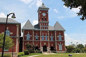
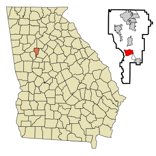
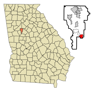
Jonesboro is a city in and the county seat of Clayton County, Georgia, United States. The population was 4,724 as of the 2010 census.
Lovejoy is a city in Clayton County, Georgia, United States. As of the 2010 census, the city had a population of 6,422, up from 2,495 in 2000. During the American Civil War, it was the site of the Battle of Lovejoy's Station during the Atlanta Campaign of 1864. Lovejoy was incorporated as a town on September 16, 1861.
Morrow is a city in Clayton County, Georgia, United States. It is part of the Atlanta metropolitan area. Its population was 6,445 at the 2010 census, up from 4,882 in 2000. It is the home of Clayton State University and the Georgia Archives.
Riverdale is a city in Clayton County, Georgia, United States. The population was 15,134 at the 2010 census, up from 12,478 in 2000. Riverdale is a suburb just south of Hartsfield–Jackson Atlanta International Airport and is part of the Atlanta metropolitan area.
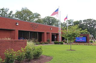
Hampton is a city in southwestern Henry County, Georgia, United States. The 2020 census was 8,368. As of the 2010 census, the city had a population of 6,987, up from 3,857 at the 2000 census. By 2018 the estimated population was 7,922. "Hampton" mailing addresses outside the city limits reach into rural parts of eastern Clayton County and northern Spalding County. It is a southeastern suburb in the Atlanta metropolitan area.