Letcher, South Dakota

Last updated

Letcher, South Dakota
Motto: 
"The Right Place...To Call Home!" [1]
Sanborn County South Dakota Incorporated and Unincorporated areas Letcher Highlighted.svg
Location in Sanborn County and the state of South Dakota
Coordinates: 43°53′58″N98°08′39″W / 43.89944°N 98.14417°W / 43.89944; -98.14417
Country United States
State South Dakota
County Sanborn
Settled1883 [2]
Area
[3]
  Total0.65 sq mi (1.69 km2)
  Land0.62 sq mi (1.59 km2)
  Water0.04 sq mi (0.10 km2)
Elevation
[4]
1,303 ft (397 m)
Population
 (2020) [5]
  Total159
  Density258.12/sq mi (99.71/km2)
Time zone UTC-6 (Central (CST))
  Summer (DST) UTC-5 (CDT)
ZIP code
57359
Area code 605
FIPS code 46-36620 [6]
GNIS feature ID1267462 [4]
Website http://www.letchersd.com/

Letcher is a town in Sanborn County, South Dakota, United States. The population was 159 at the 2020 census. [7]

Contents

Letcher has the name of O. T. Letcher, a local landowner. [8]

Geography

According to the United States Census Bureau, the town has a total area of 0.66 square miles (1.71 km2), of which 0.62 square miles (1.61 km2) is land and 0.04 square miles (0.10 km2) is water. [9]

Demographics

Historical population
CensusPop.Note
1900 130
1910 402209.2%
1920 45412.9%
1930 414−8.8%
1940 344−16.9%
1950 291−15.4%
1960 2961.7%
1970 201−32.1%
1980 22110.0%
1990 164−25.8%
2000 1777.9%
2010 173−2.3%
2020 159−8.1%
U.S. Decennial Census [5]

2010 census

As of the census [10] of 2010, there were 173 people, 77 households, and 42 families residing in the town. The population density was 279.0 inhabitants per square mile (107.7/km2). There were 83 housing units at an average density of 133.9 per square mile (51.7/km2). The racial makeup of the town was 100.0% White.

There were 77 households, of which 31.2% had children under the age of 18 living with them, 41.6% were married couples living together, 7.8% had a female householder with no husband present, 5.2% had a male householder with no wife present, and 45.5% were non-families. 39.0% of all households were made up of individuals, and 15.6% had someone living alone who was 65 years of age or older. The average household size was 2.25 and the average family size was 3.07.

The median age in the town was 38.6 years. 23.7% of residents were under the age of 18; 8.7% were between the ages of 18 and 24; 25.4% were from 25 to 44; 30% were from 45 to 64; and 12.1% were 65 years of age or older. The gender makeup of the town was 51.4% male and 48.6% female.

2000 census

As of the census [6] of 2000, there were 177 people, 75 households, and 51 families residing in the town. The population density was 291.5 inhabitants per square mile (112.5/km2). There were 84 housing units at an average density of 138.4 per square mile (53.4/km2). The racial makeup of the town was 97.74% White, 0.56% Asian, 0.56% Pacific Islander, and 1.13% from two or more races.

There were 75 households, out of which 32.0% had children under the age of 18 living with them, 54.7% were married couples living together, 6.7% had a female householder with no husband present, and 32.0% were non-families. 24.0% of all households were made up of individuals, and 10.7% had someone living alone who was 65 years of age or older. The average household size was 2.36 and the average family size was 2.78.

In the town, the population was spread out, with 24.9% under the age of 18, 9.0% from 18 to 24, 26.6% from 25 to 44, 20.9% from 45 to 64, and 18.6% who were 65 years of age or older. The median age was 40 years. For every 100 females, there were 103.4 males. For every 100 females age 18 and over, there were 101.5 males.

The median income for a household in the town was $27,083, and the median income for a family was $37,083. Males had a median income of $22,917 versus $15,208 for females. The per capita income for the town was $14,164. About 18.6% of families and 24.0% of the population were below the poverty line, including 42.9% of those under the age of eighteen and 10.7% of those 65 or over.

Education

Letcher Public Schools are part of the Sanborn Central School District. The district includes an elementary school, middle school and high school. Students attend Sanborn Central High School. [1] [11]

Related Research Articles

<span class="mw-page-title-main">Sanborn County, South Dakota</span> County in South Dakota, United States

Sanborn County is a county in the U.S. state of South Dakota. As of the 2020 census, the population was 2,330. Its county seat and largest city is Woonsocket. The county was created by the Dakota Territorial legislature on May 1, 1883, with land partitioned from Miner County. It was fully organized by July 18, 1883.

<span class="mw-page-title-main">Sanborn, North Dakota</span> City in North Dakota, United States

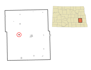
Sanborn is a city in Barnes County, North Dakota, United States. The population was 161 at the 2020 census. Sanborn was founded in 1879.

<span class="mw-page-title-main">Raymond, South Dakota</span> Town in South Dakota, United States

Raymond is a rural small village in western Clark County, South Dakota, United States. The population was 53 at the 2020 census. There is a post office at Raymond, also a fire station, a church, and a bar.

<span class="mw-page-title-main">Pierpont, South Dakota</span> Town in South Dakota, United States

Pierpont is a town in northwestern Day County, South Dakota, United States. The population was 129 at the 2020 census.

<span class="mw-page-title-main">Webster, South Dakota</span> City in South Dakota, United States

Webster is a city in and the county seat of Day County, South Dakota, United States. The population was 1,728 at the 2020 census.

<span class="mw-page-title-main">Kadoka, South Dakota</span> City in South Dakota, United States

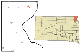
Kadoka is a city in, and the county seat of, Jackson County, South Dakota, United States. The population was 543 at the 2020 census. The town occupies about 2.3 square miles.

<span class="mw-page-title-main">Hudson, South Dakota</span> Town in South Dakota, United States

Hudson is a town in Lincoln County, South Dakota, United States. The population was 311 at the 2020 census. It is the easternmost community in South Dakota.

<span class="mw-page-title-main">Lennox, South Dakota</span> City in South Dakota, United States

Lennox is a city in Lincoln County, South Dakota, United States, located 20 miles (32 km) southwest of Sioux Falls. The population was 2,423 at the 2020 census.

<span class="mw-page-title-main">Tea, South Dakota</span> City in South Dakota, United States

Tea is a city in Lincoln County, South Dakota, United States and is a suburb of Sioux Falls. The population was 5,598 at the 2020 census, and was estimated to be 6,918 in 2022.

<span class="mw-page-title-main">Leola, South Dakota</span> City in South Dakota, United States

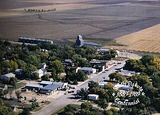
Leola is a small city in, and the county seat of, McPherson County, South Dakota, United States. It was founded on May 1, 1884, and named for Leola Haynes, daughter of one of the town's founders. The population was 434 as of the 2020 census.

<span class="mw-page-title-main">Howard, South Dakota</span> City in South Dakota, United States

Howard is a city in Miner County, South Dakota, United States. The population was 848 at the 2020 census. It is the county seat and most populous city in Miner County.

<span class="mw-page-title-main">Garretson, South Dakota</span> City in South Dakota, United States

Garretson is a city in Minnehaha County, South Dakota, United States. The city had a population of 1,228 at the 2020 census.

<span class="mw-page-title-main">Sherman, South Dakota</span> Town in South Dakota, United States

Sherman is a town in Minnehaha County, South Dakota, United States. The population was 81 at the 2020 census.

<span class="mw-page-title-main">Rosholt, South Dakota</span> Town in South Dakota, United States

Rosholt is a town in Roberts County, South Dakota, United States. The population was 379 at the 2020 census.

<span class="mw-page-title-main">Wilmot, South Dakota</span> City in South Dakota, United States

Wilmot is a city in Roberts County, South Dakota, United States. The population was 432 at the 2020 census.

<span class="mw-page-title-main">Woonsocket, South Dakota</span> City in South Dakota, United States

Woonsocket is a city in Sanborn County, South Dakota. The population was 631 at the 2020 census. It is the county seat of Sanborn County.

<span class="mw-page-title-main">Turton, South Dakota</span> Town in South Dakota, United States

Turton is a town in Spink County, South Dakota, United States. The population was 55 at the 2020 census. The town was served by Turton High School from 1915 to 1956; students attended Doland High School thereafter.

<span class="mw-page-title-main">St. Francis, South Dakota</span> Town in South Dakota, United States

St. Francis also Sápauŋ thí is a town on the Rosebud Indian Reservation in Todd County, South Dakota, United States. The population was 469 at the 2020 census.

<span class="mw-page-title-main">Chancellor, South Dakota</span> Town in South Dakota, United States

Chancellor is a town in Turner County, South Dakota, United States. The population was 300 at the 2020 census.

<span class="mw-page-title-main">Lowry, South Dakota</span> Town in South Dakota, United States

Lowry is a town in Walworth County, South Dakota, United States. The population was 10 at the 2020 census. The town is home to Lowry Pilgrim Community Church, Swan Creek Harness Shop, J & C Repair, Karst Service and a fire station. Lowry also has an abandoned school, and a post office, which closed to service in the early 1970s.

References

  1. 1 2 "Letcher South Dakota". Letcher South Dakota. Retrieved September 29, 2012.
  2. "SD Towns" (PDF). South Dakota State Historical Society. Archived from the original (PDF) on February 10, 2010. Retrieved February 14, 2010.
  3. "ArcGIS REST Services Directory". United States Census Bureau. Retrieved October 15, 2022.
  4. 1 2 U.S. Geological Survey Geographic Names Information System: Letcher, South Dakota
  5. 1 2 "Census Population API". United States Census Bureau. Retrieved October 15, 2022.
  6. 1 2 "U.S. Census website". United States Census Bureau . Retrieved January 31, 2008.
  7. "U.S. Census Bureau: Letcher town, South Dakota". www.census.gov. United States Census Bureau. Retrieved January 28, 2022.
  8. Federal Writers' Project (1940). South Dakota place-names, v.1-3. University of South Dakota. p. 48.
  9. "US Gazetteer files 2010". United States Census Bureau. Archived from the original on January 12, 2012. Retrieved June 21, 2012.
  10. "U.S. Census website". United States Census Bureau . Retrieved June 21, 2012.
  11. "Sanborn Central School District". Sanborn Central School District. Archived from the original on June 19, 2013. Retrieved October 3, 2012.