List of Interstate Highways in Ohio

Last updated

Interstate Highways of Ohio

I-71.svg

I-275.svg

Business Loop 75.svg

Highway markers for I-71, I-275, and BL-75
Ohio Interstates.svg
A map of all the Interstate Highways in Ohio
System information
Length1,572.35 mi [1]  (2,530.45 km)
FormedJune 29, 1956 [2]
Highway names
Interstates Interstate nn (I-nn)
Business Loops:Business Loop Interstate nn (BL I-nn)
System links
  • Ohio State Highway System

There are a total of 21 Interstate Highways in Ohio, including both primary and auxiliary routes. With the exception of the Ohio Turnpike (which carries portions of Interstate 76 (I-76), I-80, and I-90), all of the Interstate Highways are owned and maintained by the U.S. state of Ohio through the Ohio Department of Transportation (ODOT); however, they were all built with money from the U.S. federal government. [3] The road miles of these 21 Interstates add up to a total of 1,572.35 miles (2,530.45 km). Ohio has more route miles than this, most of which comes from I-80 running concurrently with I-90 for 142.80 miles (229.81 km). The Interstate Highways in Ohio range in length from I-71, at 248.15 miles (399.36 km), all the way down to I-471, at 0.73 miles (1.17 km). [1]

Contents

As of 2019, out of all the states, Ohio has the fifth-largest Interstate Highway System. [4] Ohio also has the fifth-largest traffic volume and the third-largest quantity of truck traffic. Ohio ranks second in the nation in terms of the number of bridges for its Interstates. [2]

History

On June 29, 1956, President Dwight D. Eisenhower signed the Federal Aid Highway Act of 1956, which called for the construction of up to 41,000 miles (66,000 km) of Interstate Highways. Of that, up to 1,500 miles (2,400 km) were to be built in Ohio. The same year, Ohio passed a law which raised the state's speed limit to 60 mph (97 km/h), and in 1957, Ohio began the construction of its Interstate Highway allotment. By 1958, Ohio had spent more money on its Interstate Highways than either New York or California. Ohio had completed the construction of 522 miles (840 km) of pavement by 1960, 684 miles (1,101 km) by 1962, and 1,000 miles (1,600 km) by 1970. By the end of 1971, Ohio had only 167 miles (269 km) of Interstate still to build. On September 19, 2003, Ohio finally finished the originally planned Interstate Highway System. [2]

Primary Interstates

NumberLength (mi) [5] Length (km)Southern or western terminusNorthern or eastern terminusFormedRemovedNotes
I-70.svg I-70 225.60363.07 I-70 at the Indiana state line I-70 at the West Virginia state line01960-01-011960current
I-71.svg I-71 248.15399.36 I-71/I-75 at the Kentucky state line I-90 at Cleveland 01960-01-011960current
I-73.svg I-73 I-73 at West Virginia state line I-73 at Michigan state line01991-01-011991Highway that would have entered from West Virginia along U.S. Route 52 to Portsmouth, then used US 23 and other highways to Toledo before crossing into Michigan. [6]
I-74.svg I-74 19.4731.33 I-74 at the Indiana state line I-75 at Cincinnati 01962-01-011962current
I-75.svg I-75 211.55340.46 I-71/I-75 at the Kentucky state line I-75 at the Michigan state line01960-01-011960current
I-76.svg I-76 81.65131.40 I-71 near Lodi I-76 at the Pennsylvania state line01972-01-011972current
I-77.svg I-77 163.03262.37 I-77 at the West Virginia state line I-90 at Cleveland 01964-01-011964current
I-80.svg I-80 237.48382.19 I-80/I-90 at the Indiana state line I-80 at the Pennsylvania state line01960-01-011960current218 miles (351 km) of I-80 is part of the Ohio Turnpike
I-80N.svg I-80N I-90/I-80 in Lorain County I-80S/SR 5 in Braceville Township 01960-01-01196001962-01-011962Redesignated as I-80
I-80S.svg I-80S 81.65131.40 I-71 near Lodi I-80S at the Pennsylvania state line01960-01-01196001971-01-011971Redesignated as I-76
I-90.svg I-90 244.75393.89 I-80/I-90 at the Indiana state line I-90 at the Pennsylvania state line01960-01-011960current142 miles (229 km) of I-90 is part of the Ohio Turnpike
  •       Former
  •       Proposed and unbuilt

Auxiliary Interstates

NumberLength (mi) [5] Length (km)Southern or western terminusNorthern or eastern terminusFormedRemovedNotes
I-270.svg I-270 54.9788.47 I-71 at Grove City US 23 at Columbus 01964-01-011964currentBeltway around Columbus
I-271.svg I-271 40.2264.73 I-71 at Medina I-90 at Willoughby Hills 01964-01-011964currentI-271 is east of Cleveland
I-275.svg I-275 56.04190.189I-275 at the Indiana state lineI-275 at the Kentucky state line01962-01-011962currentBeltway around Cincinnati
I-277.svg I-277 4.146.66 I-76 at Akron I-77/US 224 at Akron 01970-01-011970current
I-280.svg I-280 12.4119.97 I-80/I-90 at Lake Township I-75 at Toledo 01959-01-011959currentFirst completed interstate in Ohio
I-290.svg I-290 I-90 in Cleveland I-90/I-271 in Willoughby Hills 01964-01-01196401968-01-011968Signed along I-271 concurrency
I-290.svg I-290 I-90 in Cleveland I-271 in Beachwood 01971-01-01197101973-01-011973Completed segment never opened (redesignated as I-490)
I-380.svg I-380 I-76/I-77 in Akron I-271/SR 8 in Macedonia proposedPlanned redesignation of the SR 8 freeway
I-470.svg I-470 6.6910.77 I-70 at Blaine I-470 at the West Virginia state line01976-01-011976current
I-471.svg I-471 0.731.17I-471 at the Kentucky state line I-71 at Cincinnati 01981-01-011981current
I-475.svg I-475 20.3732.78 I-75 at Perrysburg I-75 at Toledo 01964-01-011964currentHalf beltway around Toledo
I-480.svg I-480 41.7767.22 I-80 at North Ridgeville I-80 at Streetsboro 01971-01-011971current
I-480N.svg I-480N 1.993.20 I-480 at Maple Heights US-422 at Warrensville Heights 01974-01-011974currentspur freeway connecting I-480 to I-271 and US 422
I-490.svg I-490 2.433.91 I-71/I-90 at Cleveland I-77 at Cleveland01990-01-011990currentWill extend into SR 10
I-670.svg I-670 10.4316.79 I-70 at Columbus I-270 at Gahanna 02003-01-012003current
I-675.svg I-675 26.5342.70 I-75 near Miamisburg I-70 near Fairborn 01987-01-011987current
I-680.svg I-680 16.4326.44 I-76 at North Lima I-80 near Mineral Ridge 01964-01-011964current
  •       Former
  •       Proposed and unbuilt

Business routes

NumberLength (mi)Length (km)Southern or western terminusNorthern or eastern terminusFormedRemovedNotes
Business Loop 75.svg I-75 BL 8.513.7 I-75 in Troy I-75 in Piqua Runs along a former segment of US 25
Business Loop 75.svg I-75 BL 4.57.2 I-75 in Sidney I-75 in SidneyRuns along a former segment of US 25
Business Loop 75.svg I-75 BL 4.47.1 I-75 in Findlay I-75 in FindlayMost if not all segments were a former segment of US 25.

See also

Related Research Articles

<span class="mw-page-title-main">Interstate 71</span> Interstate Highway in Ohio and Kentucky

Interstate 71 (I-71) is a north–south Interstate Highway in the midwestern and southeastern regions of the United States. Its southern terminus is at an interchange with I-64 and I-65 in Louisville, Kentucky, and its northern terminus at an interchange with I-90 in Cleveland, Ohio. I-71 runs concurrently with I-75 from a point about 20 miles (32 km) south of Cincinnati, Ohio, into Downtown Cincinnati. While most odd numbered Interstates run north–south, I-71 takes more of a northeast–southwest course, with some east–west sections, and is mainly a regional route serving Kentucky and Ohio. It links I-80 and I-90 to I-70 and ultimately links to I-40. Major metropolitan areas served by I-71 include Louisville, Cincinnati, Columbus, and Cleveland.

<span class="mw-page-title-main">Interstate 691</span> Interstate Highway in Connecticut

Interstate 691 (I-691) is an auxiliary Interstate Highway in Connecticut beginning at I-91 in Meriden and ending at I-84 near the Cheshire–Southington town line. According to the Federal Highway Administration, it is 8.38 miles (13.49 km) in length; however, the Connecticut Department of Transportation (CTDOT) includes the 0.54 miles of the exit ramp that I-691 uses to the merge with westbound I-84, making their recorded length 8.92 miles (14.36 km) long.

<span class="mw-page-title-main">Interstate 180 (Illinois)</span> Interstate Highway in Illinois

Interstate 180 (I-180) is a north–south spur highway in Illinois that runs from Princeton to the small town of Hennepin at its southern terminus. It is 13.19 miles (21.23 km) long.

<span class="mw-page-title-main">Interstate 180 (Wyoming)</span> Interstate Highway in Cheyenne, Wyoming, United States

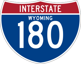
Interstate 180 (I-180) is a 1.09-mile-long (1.75 km) expressway in the US state of Wyoming between I-80 and downtown Cheyenne.

<span class="mw-page-title-main">Interstate 490 (Ohio)</span> Highway in Ohio

Interstate 490 (I-490) is a 2.43-mile (3.91 km) auxiliary Interstate Highway in Cleveland, Ohio. The western terminus is a junction with I-90 and I-71 on Cleveland's west side. After spanning the Cuyahoga River, I-490 reaches its eastern terminus at a junction with East 55th Street, just east of I-77.

<span class="mw-page-title-main">Interstate 275 (Ohio–Indiana–Kentucky)</span> Highway in the United States

Interstate 275 (I-275) is an 83.71-mile-long (134.72 km) highway in Ohio, Indiana, and Kentucky that forms a complete beltway around the Cincinnati metropolitan area and includes a part in a state (Indiana) not entered by the parent route. It had been the only auxiliary Interstate that enters three states, but that changed in July 2018 when I-295 in Delaware and New Jersey was extended into Pennsylvania. It is the longest beltway with an Interstate highway designation in the United States, enclosing an area of over 250,000 acres (100,000 ha). It is also the third longest beltway overall in the United States—only the Sam Houston Tollway and the Grand Parkway encircling Greater Houston are longer. For a short distance in northwest Hamilton County, it overlaps with I-74 and US Route 52 (US 52).

<span class="mw-page-title-main">Interstate 480 (Ohio)</span> Highway in Ohio

Interstate 480 (I-480) is a 41.77-mile-long (67.22 km) auxiliary Interstate Highway of I-80 in the US state of Ohio that passes through much of the Greater Cleveland area, including the southern parts of the city of Cleveland. I-480 is one of 13 auxiliary Interstate Highways in the state. The western terminus of I-480 is an interchange with I-80 and the Ohio Turnpike in North Ridgeville. Starting east through suburban Lorain County, I-480 enters Cuyahoga County, then approaches Cleveland Hopkins International Airport, which serves as the primary airport for Northeast Ohio. After traversing Brooklyn and crossing the Cuyahoga River on the Valley View Bridge, the highway continues east toward the communities of Bedford and Twinsburg toward its eastern terminus at I-80 and the Ohio Turnpike in Streetsboro. On its route, I-480 crosses I-71 and I-77 and is concurrent with I-271 for approximately four miles (6.4 km). In 1998, the governor of Ohio, George Voinovich, gave I-480 the additional name of the "Senator John Glenn Highway", in honor of the former NASA astronaut and US senator from Ohio for 24 years.

<span class="mw-page-title-main">Interstate 680 (Ohio)</span> Highway in Ohio

Interstate 680 (I-680) in the US state of Ohio is an auxiliary Interstate Highway passing through Youngstown. Its northern terminus is at I-80, and its southern terminus is at I-76, the Ohio Turnpike.

<span class="mw-page-title-main">Interstate 115</span> Highway in Montana

Interstate 115 (I-115) is a 1.194-mile-long (1.922 km) auxiliary Interstate Highway which connects I-15/I-90 to Butte in the U.S. state of Montana. The highway is concurrent with I-15 Bus./I-90 Bus. for its entire length. The highway travels from an incomplete interchange with I-15/I-90 through generally rural areas in western Butte. It also has an interchange with Excelsior Avenue before terminating. The entire route was improved to Interstate standards during the 1960s, and was further improved in 2005.

<span class="mw-page-title-main">Interstate 235 (Kansas)</span> Highway in Kansas

Interstate 235 (I-235) in Kansas is a 16.52-mile-long (26.59 km) north–south bypass spur route of I-35 that travels through the western part of Wichita. Its northern terminus is at an interchange with I-135/U.S. Highway 81 (US-81)/K-15/K-96/K-254 north of the city, where the freeway continues east as K-254. The southern is at I-135/US-81 shortly before US-81 separates from I-135 and I-135 connects to I-35 at I-135's own southern terminus.

<span class="mw-page-title-main">Interstate 164</span> Highway in Indiana

Interstate 164 (I-164) was a spur highway of I-64, between that highway and U.S. Highway 41 (US 41) in Evansville, Indiana. I-164, also known as the Robert D. Orr Highway, had a total length of 21.24 miles (34.18 km) and was the only auxiliary route of I-64 in Indiana. Requested as an Interstate and approved in 1968, the freeway was opened to traffic on August 2, 1990.

<span class="mw-page-title-main">Interstate 277 (Ohio)</span> Highway in Ohio

Interstate 277 (I-277) is a 4.14-mile (6.66 km) auxiliary Interstate Highway connecting I-76 and I-77 in Akron, Ohio. It was completed in 1970 and shares its entire length with U.S. Route 224 (US 224).

<span class="mw-page-title-main">Interstate 81 in West Virginia</span> Section of the Interstate in West Virginia

Interstate 81 (I-81) in the US state of West Virginia crosses the Eastern Panhandle region, linking Virginia to Maryland. The Interstate Highway, completed in 1966, spans 26 miles (42 km) through Berkeley County, paralleling U.S. Route 11 (US 11) for its entire length. I-81 enters the state near Ridgeway, travels northeast, bypassing the city of Martinsburg, and leaves the state at the Potomac River, which serves as the state line. The first solicitations for the construction of I-81 were published in 1959, with the first six miles (9.7 km) of freeway being opened in 1963, and the full length was completed by 1966. On average, between 45,000 and 60,000 vehicles use the freeway through the panhandle per day.

<span class="mw-page-title-main">Interstate 80 in Ohio</span>

Interstate 80 (I-80) in the US state of Ohio runs across the northern part of the state. Most of the route is part of the Ohio Turnpike; only an 18.78-mile (30.22 km) stretch is not part of the toll road. That stretch of road is the feeder route to the Keystone Shortway, a shortcut through northern Pennsylvania that provides access to New York City.

<span class="mw-page-title-main">Interstate 90 in Ohio</span> Section of Interstate Highway in Ohio, United States

Interstate 90 (I-90) runs east–west across the northern tier of the US state of Ohio. Much of it is along the Ohio Turnpike, but sections outside the turnpike pass through Cleveland and northeast into Pennsylvania.

References

  1. 1 2 Adderly, Kevin (January 27, 2016). "Table 3: Interstate Routes in Each of the 50 States, District of Columbia, and Puerto Rico". Route Log and Finder List. Federal Highway Administration . Retrieved June 7, 2016.
  2. 1 2 3 Ohio Department of Transportation (n.d.). "Ohio's Timeline". Ohio Department of Transportation. Archived from the original on May 6, 2008. Retrieved January 20, 2011.
  3. Federal Highway Administration (November 18, 2015). "Frequently Asked Questions". Celebrating the Eisenhower Interstate Highway System. Federal Highway Administration. Retrieved June 7, 2016.
  4. "Transportation Asset Management Plan (TAMP)".
  5. 1 2 Adderly, Kevin (January 27, 2016). "Table 1: Main Routes of the Dwight D. Eisenhower National System of Interstate and Defense Highways as of December 31, 2015". Route Log and Finder List. Federan Highway Administration. Retrieved June 7, 2016.
  6. Staff (December 18, 1991). "Intermodal Surface Transportation Efficiency Act of 1991". U.S. Congress . Retrieved September 28, 2010. §1105(c)(5) I-73/74 North–South Corridor from Charleston, South Carolina, through Winston-Salem, North Carolina, to Portsmouth, Ohio, to Cincinnati, Ohio, and Detroit, Michigan.