
This is a list of the sources of some of the place names in the city of Philadelphia, Pennsylvania:
This is a list of the sources of some of the place names in the city of Philadelphia, Pennsylvania:
| Street Name | Source |
|---|---|
| Allegheny Avenue | Named for the Allegheny River and Allegheny County, Pennsylvania. |
| Arch Street | Formerly known as Mulberry Street (one of William Penn's streets named for trees, this one was named for the Mulberry tree). Became known as Arch Street because Front Street formed an arch or bridge when it passed over Mulberry Street, with the latter going down to the riverside to form a public landing up until the 1720s. The name nevertheless stuck, long after most people had forgotten the arch itself. |
| Aramingo Avenue | Named for Aramingo Borough whose name was a corruption of the Lenni Lenapi stream name Tumanaraming, meaning "Wolf Walk." [1] |
| Baltimore Avenue | Originally Baltimore Pike , named for the destination city of Baltimore, Maryland |
| Blair Street | Named for John Blair. [1] |
| Broad Street | As with "Broad Street" in various other towns and cities, it was named for its breadth, and laid out and developed as a central thoroughfare. |
| Cecil B. Moore Avenue | Named in honor of the late Philadelphia civil rights attorney Cecil B. Moore, who led the fight to integrate Girard College, president of the local NAACP, and member of Philadelphia's City Council. Was formerly called Columbia Avenue. |
| Callowhill Street | Named for Hannah Callowhill Penn, William Penn's second wife and acting proprietor of the colony of Pennsylvania from 1712 to 1726. |
| Cheltenham Avenue | Follows the border between Cheltenham Township, Montgomery County and Philadelphia County. |
| Cherry Street | One of William Penn's streets named for trees, this one was named for the cherry tree. |
| Chestnut Street | One of William Penn's streets named for trees, this one was named for the chestnut tree. |
| Chew Avenue | Named after Chief Justice of the Supreme Court of Province of Pennsylvania, Benjamin Chew |
| City Avenue | The street is also U.S. 1, and its name refers to its role as both the Philadelphia city line and the Montgomery County line. |
| Columbus Boulevard | Formerly Delaware Avenue because it ran along the Delaware River. Renamed in honor of explorer Christopher Columbus upon the 500th anniversary of his famous 1492 voyage, as requested by various Italian Americans of South Philadelphia. |
| Dauphin Street | Named for Dauphin County, Pennsylvania |
| Dickinson Street | Named for John Dickinson, Continental Congressman and one of the signers of the Constitution. |
| Elfreth's Alley | Named after Jeremiah Elfreth, an 18th-century blacksmith and property owner. It is one of the oldest continuously inhabited residential streets in the United States of America, dating to 1702. |
| Federal Street | The road between two Federal properties, the Philadelphia Navy Yard and the Schuylkill Arsenal [2] |
| Benjamin Franklin Parkway | Named for Benjamin Franklin. |
| Front Street | Like "Front Street" in various other towns and cities, it was named after a riverfront, in this case the Delaware riverfront, which for several centuries was the economic and social heart of the city. |
| Germantown Avenue | It was the road to Germantown back when Germantown was a separate town, several miles outside Philadelphia. |
| Girard Avenue, Girard Point, and Girard Point Bridge | Named for financier Stephen Girard. |
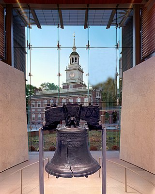
| Independence Mall East, Independence Mall West | Named for Independence Mall, the district whose heart is Independence Hall. |
| Kelly Drive | Formerly East River Drive, because it runs along the east bank of the Schuylkill River, it was renamed in honor of Olympic athlete John B. Kelly Jr. [3] |
| John F. Kennedy Boulevard | Built in the 1950s as part of the large redevelopment of the Pennsylvania Railroad "Chinese Wall" and former Broad Street Station that created Penn Center; it was for several years called Pennsylvania Boulevard before being renamed for John F. Kennedy after his assassination. It serves as part of Pennsylvania Route 3. |
| Lancaster Avenue | Originally Lancaster Pike, named for the destination city of Lancaster, Pennsylvania. |
| Locust Street | One of William Penn's streets named for trees, this one was named for the locust tree. |
| Market Street | As with "Market Street" in many other towns and cities, it was for several centuries the main market site, due to the addition of the High Street Market in 1745. Market Street was previously known as High Street, part of William Penn's original names for the city of Philadelphia. |
| Manayunk | The neighborhood's name comes from the word "manaiung," place where we go to drink, in the language of the Lenape [4] |
| Martin Luther King Jr. Drive [5] | Formerly called West River Drive because it runs along the west bank of the Schuylkill River, it was renamed in honor of slain civil rights leader Martin Luther King Jr. |
| Mount Pleasant Drive | Named for the historic mansion Mount Pleasant, built in what was then the countryside outside of the city by a privateer. [6] It is now an off-premises gallery of the Philadelphia Museum of Art in Fairmount Park. [7] |
| Moyamensing Avenue | Named for Lenni Lenape word meaning "pigeon droppings." [8] |
| Old York Road, York Road, King's Highway | The old road to New York City was named, as was that city and its province, for James, Duke of York (later James II & VII.) |
| Passyunk Avenue | Named for the Lenape word meaning "in the valley; in the Valleys." [9] |
| Philmont Ave | Named for the county line between Philadelphia and Montgomery counties, which it runs along for part of its route (Phil + Mont). |
| Pine Street | One of William Penn's streets named for trees, this one was named for the pine tree. |
| Race Street | Race Street was originally called Sassafras Street and until the mid-19th century was often used as a horse race track—the era's equivalent of today's street racing. Eventually the name Race Street became the official name. |
| Reed Street | Named for Joseph Reed, statesmen of the American Revolution. |
| Ridge Avenue | Named for the ridge of high ground between the Wissahickon and Schuylkill valleys, which the avenue follows. |
| Rising Sun Avenue | Named after the Rising Sun Tavern, which was an important roadhouse in colonial times. |
| Roosevelt Boulevard/Roosevelt Expressway | Named for President Theodore Roosevelt. |
| Sansom Street | Named by developer William Sansom for himself (See Jewelers' Row) |
| Shackamaxon Street | Named for the historic village where the Shackamaxon Treaty was signed between William Penn and the village leaders of the Delaware/Lenape Indian tribe. |
| South Street | Formerly known as Cedar Street (originally one of William Penn's streets named for trees, in this case cedar trees), it is the original southern border of the city of Philadelphia, before the 1854 Act of Consolidation. |
| Susquehanna Avenue | Named after the Susquehanna River and Susquehanna County, Pennsylvania. |
| Spruce Street | One of William Penn's streets named for trees, this one was named for the spruce tree. |
| Walnut Street | One of William Penn's streets named for trees, this one was named for the walnut tree. |
| Vine Street | One of William Penn's streets named for trees, this one was named after vines. |
| Place Name | Source |
|---|---|
| Clark Park | Built on land donated by Clarence Howard Clark, originally known as "Clarence H. Clark Park". [10] |
| Delaware River | Named for the Delaware Bay which was named after Thomas West, 3rd Baron De La Warr, governor of the Jamestown Colony. |
| Fern Rock | The neighborhood is named after the ancestral estate of Elisha Kent Kane, a renowned arctic explorer and naval surgeon from Philadelphia. |
| Fox Chase | Named for the "Fox Chase Inn" which catered to affluent fox hunters.[ citation needed ] |
| Franklin Square | Named for Benjamin Franklin. |
| Independence Mall | Named for Independence Hall. |
| Lemon Hill | Named for the numerous lemon trees in Robert Morris's greenhouse.[ citation needed ] |
| Logan Circle | Named Logan Square after Philadelphia statesman James Logan. [11] |
| Manayunk | From the Lenape name for the Schuylkill River, "Manaiung", their word for "river", which literally translates as "place to drink". [12] [13] |
| Marconi Plaza | in honor of the Nobel Prize Laureate Guglielmo Marconi, the inventor of radio. |
| Mount Airy | Named for the estate of William Allen |
| Nicetown | Named after immigrants to the area whose surname has appeared with many spellings over the centuries, including Neues, Neus, Neiss, Nice, and Nyce. |
| Pastorius Park | Named in honor of Francis Pastorius, a leader of early German immigrants to the area.[ citation needed ] |
| Queen Village | Named for Queen Christina of Sweden who promoted European settlement of the area. [14] |
| Rittenhouse Square | Named for David Rittenhouse. [15] |
| RittenhouseTown | Named after William Rittenhouse. |
| Roxborough | The area was likely named for Roxburghshire, Scotland, the original home of Andrew Robeson, one of the early settlers of what is now Roxborough. |
| Society Hill | Named after the Free Society of Traders, which had its offices in the area. |
| Southwark | Named for a district in London. [16] |
| Torresdale | Originally Torrisdale, named by Charles Macalester for his Scotland home. [17] |
| Washington Square | Named for George Washington. |
| Wicaco | From the Lenni Lenapi name for the area meaning "Pleasant Place". [16] |
| Wissahickon Creek | From the Lenape language for "catfish creek" or "stream of yellowish color". [13] |
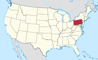
Philadelphia, commonly referred to as Philly, is the most populous city in the U.S. state of Pennsylvania. Philadelphia is the nation's sixth-most populous city, with a population of 1,603,797 in the 2020 census and is the urban core of the larger Delaware Valley, the nation's seventh-largest and one of the world's largest metropolitan regions consisting of 6.245 million residents in the metropolitan statistical area and 7.366 million residents in its combined statistical area. Philadelphia is known for its extensive contributions to United States history, especially the American Revolution, and served as the nation's capital until 1800. It maintains contemporary influence in business and industry, culture, sports, and music.

Conshohocken is a borough on the Schuylkill River in Montgomery County, Pennsylvania in suburban Philadelphia. Historically a large mill town and industrial and manufacturing center, after the decline of industry in recent years Conshohocken has developed into a center of riverfront commercial and residential development. In the regional slang, it is sometimes referred to by the colloquial nickname Conshy.

Lenapehoking is widely translated as 'homelands of the Lenape', which in the 16th and 17th centuries, ranged along the Eastern seaboard from western Connecticut to Delaware, and encompassed the territory adjacent to the Delaware and lower Hudson river valleys, and the territory between them.

Roxborough is a neighborhood in Northwest Philadelphia, Pennsylvania, United States. It is bordered to the southwest, along the Schuylkill River, by the neighborhood of Manayunk, along the northeast by the Wissahickon Creek section of Fairmount Park, and to the southeast by the neighborhood of East Falls. Beyond Roxborough to the northwest is Montgomery County. Roxborough's ZIP Code is 19128. Most of Roxborough is in Philadelphia's 21st Ward.

The Schuylkill River is a river in eastern Pennsylvania. It flows for 135 miles (217 km) from Pottsville southeast to Philadelphia, where it joins the Delaware River as one of its largest tributaries.

Fairmount Park is the largest municipal park in Philadelphia and the historic name for a group of parks located throughout the city. Fairmount Park consists of two park sections named East Park and West Park, divided by the Schuylkill River, with the two sections together totalling 2,052 acres (830 ha). Management of Fairmount Park and the entire citywide park system is overseen by Philadelphia Parks & Recreation, a city department created in 2010 from the merger of the Fairmount Park Commission and the Department of Recreation.
The Philadelphia Main Line, known simply as the Main Line, is an informally delineated historical and social region of suburban Philadelphia, Pennsylvania. Lying along the former Pennsylvania Railroad's once prestigious Main Line, it runs northwest from Center City Philadelphia parallel to Lancaster Avenue, also known as U.S. Route 30.

Wissahickon Creek is a tributary of the Schuylkill River in Montgomery and Philadelphia Counties, Pennsylvania.
Kingsessing is a neighborhood in the Southwest section of Philadelphia, Pennsylvania, United States. On the west side of the Schuylkill River, it is next to the neighborhoods of Cedar Park, Southwest Schuylkill, and Mount Moriah, as well as the borough of Yeadon in Delaware County. It is roughly bounded by 53rd Street to the northeast, Baltimore Avenue to the northwest, Cobbs Creek and 60th Street to the southwest, and Woodland Avenue to the southeast.

Manayunk is a neighborhood in the section of Lower Northwest Philadelphia in the state of Pennsylvania. Located adjacent to the neighborhoods of Roxborough and Wissahickon and also on the banks of the Schuylkill River, Manayunk contains the first canal begun in the United States.
Roosevelt Boulevard, officially named the Theodore Roosevelt Memorial Boulevard and often referred to, chiefly by local Philadelphians, simply as "the Boulevard," is a major traffic artery through North and Northeast Philadelphia. The road begins at Interstate 76 in Fairmount Park, running as a freeway also known as the Roosevelt Boulevard Extension or the Roosevelt Expressway through North Philadelphia, then transitioning into a twelve-lane boulevard that forms the spine of Northeast Philadelphia to its end at the city line.

East Falls is a neighborhood in Lower Northwest, Philadelphia, Pennsylvania, United States. It lies on the east bank of the "Falls of the Schuylkill," cataracts submerged in 1822 by the Schuylkill Canal and Fairmount Water Works projects. East Falls sits next to the Germantown, Roxborough, Allegheny West, and the Nicetown-Tioga neighborhoods. Wissahickon Valley Park separates it from Manayunk, Philadelphia.

Ivy Ridge station is a SEPTA Regional Rail station in Philadelphia, Pennsylvania. Located at Umbria Street and Parker Avenue in Northwest Philadelphia, it serves the Manayunk/Norristown Line. The initial station was built in a minimalist design similar to that of Elm Street, Norristown. The current station has a 204-space parking lot. In FY 2013, Ivy Ridge station had a weekday average of 602 boardings and 582 alightings.

Grays Ferry, also known as Gray's Ferry, is a neighborhood in South Philadelphia, Pennsylvania, United States, bounded (roughly) by 25th Street on the east, the Schuylkill River on the west, Vare Avenue on the south, and Grays Ferry Avenue on the north. The section of this neighborhood west of 34th Street is also known as Forgotten Bottom.

The Schuylkill River Trail is a multi-use trail along the banks of the Schuylkill River in southeastern Pennsylvania. Partially complete as of 2018, the trail is ultimately planned to run about 140 miles (230 km) from the river's headwaters in Schuylkill County to Fort Mifflin in Philadelphia.

Mount Pleasant is a historic mansion in Philadelphia, Pennsylvania, atop cliffs overlooking the Schuylkill River. It was built about 1761–62 in what was then the countryside outside the city by John Macpherson and his wife Margaret. Macpherson was a privateer, or perhaps a pirate, who had had "an arm twice shot off" according to John Adams. He named the house "Clunie" after the ancient seat of his family's clan in Scotland.

The Cynwyd Line is a SEPTA Regional Rail line from Center City Philadelphia to Cynwyd in Montgomery County, Pennsylvania. Originally known as the Ivy Ridge Line, service was truncated on May 17, 1986, at its current terminus at Cynwyd.

The Manayunk/Norristown Line is a commuter rail service in Southeastern Pennsylvania between Center City Philadelphia and Norristown, and one of the 13 lines in SEPTA's Regional Rail network. It has the second highest operating ratio (19.9%) on the SEPTA Regional Rail network.

John Macpherson was a Scottish-born privateer. After emigrating to colonial America, he built Mount Pleasant in Philadelphia, Pennsylvania, in 1762.
It was built in 1761-62 by Captain John Macpherson, a privateer who had had "an arm twice shot off" according to John Adams. The pirate called the house "Clunie" after the seat of his family's ancient clan in Scotland.
Scottish ship captain John Macpherson (1726–1792) and his first wife, Margaret, built their grand country estate on this site—high atop cliffs overlooking the Schuylkill River—between 1762 and 1765. They employed as their builder-architect Thomas Nevell (1721–1797), an apprentice of Edmund Woolley, the builder of Independence Hall.
{{cite web}}: Missing or empty |title= (help)[ title missing ]