Baltimore Pike

Last updated

Baltimore Pike marker.svg

Baltimore Pike

Route information
Maintained by MDSHA, PennDOT, West Nottingham Township, and Borough of Kennett Square
Component
highways
Major junctions
South endUS 1.svg US 1 in Baltimore, MD
Major intersections
North endUS 13.svg US 13 in Philadelphia, PA
Location
Country United States
States Maryland, Pennsylvania, U.S.
Highway system
Auto Trails

The Baltimore Pike was an auto trail connecting Baltimore, Maryland, with Philadelphia, Pennsylvania.

Contents

Today, parts of the road are signed as U.S. Route 1 (US 1), US 13, and a small portion of Pennsylvania Route 41 (PA 41). A section of the road within the city limits of Philadelphia and surrounding boroughs is known as Baltimore Avenue, although locals are known to call the Delaware County portion "Baltimore Pike". In suburbs farther west, some sections retain the formal name "Baltimore Pike." Today, Baltimore Avenue's eastern terminus is at 38th Street in Philadelphia, where it intersects with Woodland Avenue (from Southwest Philadelphia and the borough of Darby) and funnels into University Avenue. The road used to continue to Market Street until the University City area was redeveloped.

Route description

Maryland

The routing of the Baltimore Pike in Maryland follows US 1 from Baltimore northeast to the Pennsylvania border near Rising Sun in Cecil County. The road passes through Bel Air and crosses the Susquehanna River on the Conowingo Dam. [1]

The name Baltimore Pike is given to a section of US 1 Bus. in Harford County between Benson and Main Street in Bel Air. South of Benson, US 1 is named Belair Road. From Main Street, US 1 Bus. follows several streets of various other names before joining with US 1 as Conowingo Road.

Pennsylvania

Chester County

The Baltimore Pike enters Pennsylvania from Maryland in West Nottingham Township, Chester County, with the southernmost part of the road in the state a part of US 1, which is a four-lane divided highway at this point. North of the Ridge Road intersection, US 1 becomes a freeway called the Kennett Oxford Bypass and Baltimore Pike continues northeast as a two-lane undivided road that dead ends near the US 1 freeway. The road heads through wooded areas with some homes, with an older alignment of the road known as Old Baltimore Pike looping to the west of the road. Baltimore Pike comes to the Herr's Snacks plant in the community of Nottingham, at which point the alignments of both Baltimore Pike and Old Baltimore Pike are severed, with traffic having to head west and north along Herr Drive to access PA 272. A short distance to the east along PA 272, the alignment of Baltimore Pike resumes as State Route 3026 (SR 3026), an unsigned quadrant route. The Baltimore Pike is a two-lane undivided road and runs north-northeast past a few businesses, crossing into East Nottingham Township. The road curves northeast and passes through a mix of farmland and woodland with some residential and commercial development, running a short distance to the northwest of an East Penn Railroad line. [2] [3]

Oxford Hotel, at 3rd and Market Streets, Oxford Oxford PA Hotel.jpg
Oxford Hotel, at 3rd and Market Streets, Oxford

Baltimore Pike turns to the north-northeast at the Barnsley Road intersection and passes through commercial areas with some residences before crossing into the borough of Oxford. At this point, the road becomes South 3rd Street and heads north past more homes and businesses. In the commercial center of Oxford, the road comes to an intersection with PA 472 and the southern terminus of PA 10, where Baltimore Pike turns east to briefly follow PA 472 on Market Street before heading northeast on Lincoln Street. The road heads through more residential and commercial areas, crossing an East Penn Railroad spur to a plant at-grade before becoming the border between Lower Oxford Township to the northwest and Oxford to the southeast. The roadway fully enters Lower Oxford Township and the name returns to Baltimore Pike. [2] [3]

Baltimore Pike continues through a mix of farmland and woodland with some homes and businesses, crossing the West Branch Big Elk Creek and passing to the north of the Lincoln University campus. The road continues into Upper Oxford Township and runs through more agricultural areas with some housing developments, coming to an intersection with PA 896. Baltimore Pike heads through more rural areas of with some residential development and curves to the east, crossing the East Branch Big Elk Creek into Penn Township. At this point, the road name becomes West Baltimore Pike and it passes between residential development to the north and farmland to the south before passing north of the former Jennersville Hospital. The road heads past a few commercial establishments, reaching an intersection with PA 796 in the community of Jennersville. Following this intersection, West Baltimore Pike heads through farmland before heading into wooded areas with residential developments and crossing into London Grove Township. The road heads near more residences, crossing the Middle Branch White Clay Creek, and enters the borough of West Grove, becoming West Evergreen Street. Here, the road is lined with more homes and comes to an intersection with PA 841, at which point that route joins the road with the name changing to East Evergreen Street. This road curves to the northeast and PA 841 splits north onto Chatham Road. The road heads back into London Grove Township and becomes East Baltimore Pike, continuing through a mix of farms, woods, and development. East Baltimore Pike heads to the east and comes to an intersection with PA 41, at which point SR 3026 ends and Baltimore Pike merges onto PA 41, heading southeast as Gap Newport Pike. [2] [3]

State Street in Kennett Square Kennett Square.JPG
State Street in Kennett Square

The road runs through areas of residential and commercial development before crossing into the borough of Avondale, where the name changes to Pennsylvania Avenue. Through this area, the road passes several homes and crosses the East Branch White Clay Creek. Baltimore Pike splits east from PA 41 as SR 3046, heading northeast into industrial areas to the south of a quarry as a three-lane road with two eastbound lanes and one westbound lane. The road heads into New Garden Township and narrows to two lanes, passing through commercial areas to the south of New Garden Airport. Baltimore Pike continues past more homes and businesses in the community of Toughkenamon. The road heads through more rural areas with some residential and commercial development before splitting into a one-way pair that carries two-lane West Cypress Street eastbound and two-lane West Baltimore Pike westbound. The one-way pair continues through business areas with some farm fields and residential developments, crossing the West Branch Red Clay Creek and entering Kennett Township. Upon crossing into the borough of Kennett Square, the one-way pair becomes borough-maintained and the name of the westbound direction becomes West State Street. The roads continue through residential areas before heading into the commercial downtown. Here, Baltimore Pike intersects PA 82 and the name of the one-way pair becomes East Cypress Street eastbound and East State Street westbound, leaving the downtown area and heading into wooded residential areas with some businesses. The one-way pair becomes SR 3046 at the bridges across the East Branch Red Clay Creek, becoming borough-maintained again after crossing the creek. The roads curve to the northeast and cross back into Kennett Township, becoming SR 3046 again, with the westbound direction becoming Millers Hill. The two one-way roads join again and become four-lane divided East Baltimore Pike, heading into commercial areas and merging into the northbound direction of US 1 at the end of the Kennett Oxford Bypass, where SR 3046 ends. [2] [3]

At this point, US 1 continues northeast along East Baltimore Pike into East Marlborough Township and passes more businesses, widening to six lanes. Along this divided highway stretch of Baltimore Pike, a few intersections are controlled by jughandles. The road narrows to four lanes and passes near homes and businesses before coming to an interchange that provides access to Longwood Gardens and the Brandywine Valley Tourism Information visitor center to the north of the road, at which point it crosses back into Kennett Township. A short distance later, US 1 comes to an intersection with PA 52, at which point that route heads onto East Baltimore Pike along with US 1. The road heads into wooded areas with some homes and businesses, at which point PA 52 splits in the community of Hamorton to continue southeast toward the city of Wilmington, Delaware. East Baltimore Pike turns to the northeast and crosses into Pennsbury Township, where the official name becomes Baltimore Pike. The road curves to the east again and passes through more woodland with some residential and commercial development, crossing an East Penn Railroad line at-grade before heading across the Brandywine Creek. [2] [3]

Delaware County

Newlin Mills, a mile north of Concordville. NewlinMills3.JPG
Newlin Mills, a mile north of Concordville.

Upon crossing the Brandywine Creek, the Baltimore Pike continues into Chadds Ford Township in Delaware County and passes to the north of the Brandywine Museum of Art. US 1 heads into the community of Chadds Ford and intersects Creek Road in a commercial area. The road continues through wooded areas with some development, passing to the south of the Brandywine Battlefield. [2] [3] Baltimore Pike curves northeast and heads into areas of businesses, intersecting US 202/US 322 in Painters Crossroads. Here, US 322 turns east to join US 1 in a concurrency along Baltimore Pike, running past more commercial establishments in Concord Township. In Concordville, US 322 splits to the southeast and US 1 continues along Baltimore Pike, intersecting Concord Road before heading into more wooded areas with occasional businesses and crossing the West Branch Chester Creek. [2] [4]

Baltimore Pike curves to the east and enters the borough of Chester Heights, running past businesses before heading into forested areas, where it passes north of the corporate headquarters of Wawa. The road turns northeast and crosses the Chester Creek into Middletown Township. The route passes under SEPTA's West Chester Branch northwest of Wawa station, which serves as the terminus of SEPTA's Media/Wawa Line. US 1 continues into commercial areas, coming to an intersection with PA 452 in the community of Lima. Following this, Baltimore Pike continues east and passes between the Promenade at Granite Run residential and retail center to the north and Riddle Memorial Hospital to the south, coming to an interchange with PA 352. A short distance later, US 1 splits from Baltimore Pike by heading northeast onto the limited-access Media Bypass. [2] [4]

Baltimore Pike eastbound in Upper Darby Township Baltimore Pike EB past Bishop Avenue.jpeg
Baltimore Pike eastbound in Upper Darby Township

Past this interchange, Baltimore Pike continues east as SR 2016, passing through woodland and crossing the Ridley Creek into Upper Providence Township. Here, the road turns northeast and enters the borough of Media, narrowing into a two-lane undivided road and becoming West Baltimore Avenue. West Baltimore Avenue curves east and heads into residential areas with some businesses. Upon reaching the commercial downtown of Media, the road intersects Jackson Street and becomes East Baltimore Avenue, passing more businesses and intersecting PA 252. A short distance past this intersection, the road heads into Nether Providence Township and becomes Baltimore Pike again, heading into wooded residential areas with some businesses. Baltimore Pike widens into a four-lane divided highway and comes to an interchange with I-476. Immediately after the interchange, the road crosses the Crum Creek into Springfield Township and passes between the Springfield Mall to the north and wooded areas of homes to the south, at which point it becomes the border between Springfield Township to the north and the borough of Swarthmore to the south. Baltimore Pike comes to an intersection with PA 320 and continues past more businesses, fully entering Springfield Township again and becoming a five-lane road with a center left-turn lane. The road curves to the east-northeast and crosses PA 420, becoming the border between Springfield Township to the north and the borough of Morton to the south past this intersection. Baltimore Pike fully enters Springfield Township and is lined with more businesses. [2] [4]

Baltimore Avenue westbound in Lansdowne 2022-10-24 14 49 11 View southwest along Baltimore Avenue just southwest of Lansdowne Avenue in Lansdowne, Delaware County, Pennsylvania.jpg
Baltimore Avenue westbound in Lansdowne

At the intersection with South Bishop Avenue, the road becomes a four-lane divided highway and enters Upper Darby Township, where the name changes to Baltimore Avenue. The median turns into a center left-turn lane as the road passes more commercial establishments, becoming the border between the borough of Clifton Heights to the north and Upper Darby Township to the south. Baltimore Avenue fully enters Clifton Heights and passes through residential and commercial areas as a two-lane undivided road. After passing through the commercial downtown, the road crosses SEPTA's Route 102 trolley line at the Baltimore Pike station and runs past more businesses. Baltimore Avenue crosses the Darby Creek into the borough of Lansdowne and heads into wooded areas of homes, curving to the east. The road passes through the commercial downtown of Lansdowne, where it intersects Lansdowne Avenue, before heading past more businesses, crossing back into Upper Darby Township. Baltimore Avenue crosses the abandoned Newtown Square Branch railroad right-of-way and becomes the border between the borough of East Lansdowne to the north and Upper Darby Township to the south, lined with more businesses. The road comes to an intersection with US 13 at Church Lane, at which point SR 2016 ends and US 13 turns east to join the road, which changes names to Baltimore Pike. Baltimore Pike fully enters Upper Darby Township again, passing between Fernwood Cemetery to the north and urban residential and commercial development to the south, becoming the border between Upper Darby Township to the north and the borough of Yeadon to the south. [2] [4]

Philadelphia

SEPTA's Route 34 trolley line runs through the 4500 block of Baltimore Avenue in West Philadelphia 4500 Baltimore Avenue.jpg
SEPTA's Route 34 trolley line runs through the 4500 block of Baltimore Avenue in West Philadelphia

Baltimore Avenue crosses Cobbs Creek into the West Philadelphia section of the city of Philadelphia in Philadelphia County. Immediately after crossing the creek, the road comes to the Angora Loop at 61st Street, which serves as the terminus of SEPTA's Route 34 trolley line. At this point, the trolley tracks follow Baltimore Avenue as it continues through urban neighborhoods consisting of rowhouses along with a few businesses. The road curves to the east, passing through more urban development with the Route 34 trolley line splitting from Baltimore Avenue at 40th Street, where it heads underground at the 40th Street Portal. The road heads into the University City neighborhood and becomes four lanes at the 39th Street/Woodland Avenue intersection, at which point it runs between the University of Pennsylvania campus to the north and the Philadelphia VA Medical Center to the south. A block later, Baltimore Avenue ends at an intersection with University Avenue, with US 13 turning north onto University Avenue. [2] [4]

Streetcar service

The West Philadelphia section of Baltimore Avenue has carried streetcars since 1890, when tracks were laid for horsecar service. Electric-powered trolleys began operating on the avenue on January 13, 1895. [5] Today, the avenue is served by SEPTA Route 34, which runs on Baltimore from the subway mouth at 40th Street to the Angora terminal loop at 61st Street.

History

PA 12 (1924-1930) PA-12 (1926).svg
PA 12 (1924-1930)

Despite its name, the road was not itself a former turnpike, but portions were, including Baltimore and Jerusalem Turnpike between Baltimore and Bel Air, Maryland. The road's easternmost part was another such section: the Chaddsford Turnpike, depicted on an 1843 map running from Mill Creek (present-day 43rd Street in West Philadelphia) to the western limits of Philadelphia County, in the direction of Chadds Ford Township in Delaware County, Pennsylvania. [6]

Its northern section was designated Pennsylvania Route 12 in 1924. [7] Much of the route was designated as part of US 1 in 1926.

Until 1928, the route crossed the Susquehanna River on the Conowingo Bridge, which was destroyed and replaced by the Conowingo Dam.

Baltimore Avenue formerly continued northward to Market Street as part of Woodland Avenue; this segment was stricken from the City street plan in the late 1950s due to redevelopment by the University of Pennsylvania and what is now Drexel University.[ citation needed ]

Major intersections

Maryland

See U.S. Route 1 in Maryland#Junction list

Pennsylvania

CountyLocationmikmDestinationsNotes
Chester West Nottingham Township Dead endBaltimore Pike continued south on nearby US 1 to Maryland border
PA-272.svgTo plate.svg
US 1.svg
PA 272 (Christine Road) to US 1
Road severed south of intersection; Herr Drive used to access Baltimore Pike south of PA 272
Oxford North plate.svg
PA-10.svg
North plate.svg
PA-472.svg
PA 10 north / PA 472 north (North 3rd Street) Cochranville, Quarryville
South end of PA 472 overlap; southern terminus of PA 10
South plate.svg
PA-472.svg
PA 472 south (Market Street) Lewisville
North end of PA 472 overlap
Upper Oxford Township PA-896.svg PA 896 (Newark Road)
Penn Township PA-796.svgTo plate.svg
US 1.svg
PA 796 (Jennersville Road) to US 1
West Grove South plate.svg
PA-841.svg
PA 841 south (Prospect Avenue)
South end of PA 841 overlap
North plate.svg
PA-841.svg
To plate.svg
US 1.svg
PA 841 north (Chatham Road) to US 1
North end of PA 841 overlap
London Grove Township North plate.svg
PA-41.svg
To plate.svg
US 1.svg
PA 41 north (Gap Newport Pike) to US 1  Cochranville
South end of PA 41 overlap
Avondale South plate.svg
PA-41.svg
PA 41 south (Gap Newport Pike) Wilmington
North end of PA 41 overlap
Kennett Square PA-82.svg PA 82 (Union Street)
Kennett Township South plate.svg
US 1.svg
US 1 south (Kennett Oxford Bypass)
Southbound exit and northbound entrance; south end of US 1 overlap
Longwood Gardens Interchange; access via Longwood Road
North plate.svg
PA-52.svg
PA 52 north (Lenape Road) West Chester
South end of PA 52 overlap
South plate.svg
PA-52.svg
PA 52 south (Kennett Pike) Wilmington
North end of PA 52 overlap
Delaware Chadds Ford Township US 202.svgWest plate.svg
US 322.svg
US 202  / US 322 west (Wilmington-West Chester Pike) West Chester, Wilmington, DE
South end of US 322 overlap
Concord Township East plate.svg
US 322.svg
To plate blue.svg
I-95.svg
US 322 east (Conchester Highway) to I-95  Chester
North end of US 322 overlap
Middletown Township PA-452.svg PA 452 (Pennell Road) Frazer, Marcus Hook
PA-352.svg PA 352 (Middletown Road) Chester, Frazer, Gradyville Interchange
North plate.svg
US 1.svg
US 1 north (Media Bypass) Springfield
Northbound exit and southbound entrance; north end of US 1 overlap
Media PA-252.svg PA 252 (Providence Road) Newtown Square, Chester
Nether Providence Township I-476.svg I-476 (Mid-County Expressway) Chester, Plymouth Meeting Exit 3 on I-476
Springfield Township PA-320.svg PA 320 (West Sproul Road/Cedar Lane) Marple, Swarthmore
PA-420.svg PA 420 (East Woodland Avenue)
East Lansdowne South plate.svg
US 13.svg
US 13 south (Church Lane)
South end of US 13 overlap
Philadelphia Philadelphia North plate.svg
US 13.svg
US 13 north (South University Avenue)
North end of US 13 overlap
1.000 mi = 1.609 km; 1.000 km = 0.621 mi

See also

Related Research Articles

<span class="mw-page-title-main">Pennsylvania Route 309</span> State highway in Pennsylvania, United States

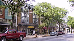
Pennsylvania Route 309 is a state highway that runs for 134 miles (216 km) through eastern Pennsylvania. The route runs from an interchange between PA 611 and Cheltenham Avenue on the border of Philadelphia and Cheltenham Township north to an intersection with PA 29 in Bowman Creek, a village in Monroe Township in Wyoming County. The highway connects Philadelphia and its northern suburbs to Allentown and the Lehigh Valley, and Hazleton and Wilkes-Barre in Wyoming Valley.

<span class="mw-page-title-main">Pennsylvania Route 191</span> State highway in Pennsylvania, US

Pennsylvania Route 191 is a 111.54 mi (179.51 km)-long state highway in the U.S. state of Pennsylvania. The route, a major non-freeway corridor connecting the Lehigh Valley to the Pocono Mountains in eastern Pennsylvania, is designated from U.S. Route 22 in Brodhead near Bethlehem to the New York state line over the Delaware River at Hancock, New York.

<span class="mw-page-title-main">U.S. Route 422</span> Highway in Ohio and Pennsylvania

U.S. Route 422 (US 422) is a 271-mile (436 km) long spur route of US 22 split into two segments in the U.S. states of Ohio and Pennsylvania. The western segment of US 422 runs from downtown Cleveland, Ohio, east to Ebensburg, Pennsylvania. The eastern segment, located entirely within Pennsylvania, runs from Hershey east to King of Prussia, near Philadelphia. US 422 Business serves as a business route into each of four towns along the way.

<span class="mw-page-title-main">Pennsylvania Route 29</span> State highway in Pennsylvania, US

Pennsylvania Route 29 is a 118-mile-long (190 km) north–south state highway that runs through most of eastern Pennsylvania.

<span class="mw-page-title-main">Pennsylvania Route 352</span> State highway in Pennsylvania, US

Pennsylvania Route 352 is a 19-mile (31 km) north–south route that runs from U.S. Route 13 Business in Chester, Delaware County, north to US 30 in Frazer, Chester County. The route passes through suburban areas of Delaware and Chester counties west of Philadelphia, serving Parkside, Brookhaven, Elwyn, Lima, Gradyville, and Goshenville. PA 352 is a four- to five-lane road between Brookhaven and US 1, otherwise it is generally a two-lane road. The route intersects Interstate 95 (I-95) in Chester and US 1 near Lima at interchanges. PA 352 was first designated by 1928 to run between its current termini. A portion of the route between Brookhaven and US 1 was realigned to a straighter alignment in the 1950s. By 1980, PA 352 was realigned to a short concurrency with PA 3 to avoid intersecting it at a sharp angle.

<span class="mw-page-title-main">Pennsylvania Route 63</span> 37.4-mile-long (60.2 km) state highway located in Pennsylvania

Pennsylvania Route 63 (PA 63) is a 37.4-mile-long (60.2 km) state highway located in the Philadelphia, Pennsylvania, area. The western terminus of the route is at PA 29 in Green Lane, Montgomery County. The eastern terminus is at Interstate 95 (I-95) in Bensalem Township, Bucks County. PA 63 runs northwest to southeast for most of its length. The route heads through a mix of suburban and rural areas of northern Montgomery County as a two-lane road, passing through Harleysville, before coming to an interchange with I-476 in Kulpsville. From this point, PA 63 continues through predominantly suburban areas of eastern Montgomery County as a two- to four-lane road, passing through Lansdale, Maple Glen, Willow Grove, and Huntingdon Valley. Upon entering Northeast Philadelphia, the route follows Red Lion Road and U.S. Route 1 (US 1) before heading southeast on a freeway called Woodhaven Road to I-95.

<span class="mw-page-title-main">Pennsylvania Route 232</span> State highway in Pennsylvania, US

Pennsylvania Route 232 (PA 232) is a 25.2-mile-long (40.6 km) state highway located in southeastern Pennsylvania. The southern terminus of the route is at U.S. Route 1 (US 1)/US 13 at the Oxford Circle in Philadelphia. The northern terminus is at PA 32 in the borough of New Hope, Bucks County, on the banks of the Delaware River. The route passes through the urban areas of Northeast Philadelphia as Oxford Avenue, serving the Lawncrest, Burholme, and Fox Chase neighborhoods. Upon entering Montgomery County, PA 232 becomes Huntingdon Pike and through suburban areas, serving the communities of Rockledge, Huntingdon Valley, and Bryn Athyn. The route passes through more suburban development in Bucks County as Second Street Pike, running through Southampton and Richboro. In Wrightstown Township, PA 232 enters rural areas and becomes Windy Bush Road as it heads north to New Hope.

<span class="mw-page-title-main">Pennsylvania Route 532</span> State highway in Pennsylvania, US

Pennsylvania Route 532 is a 19.1-mile-long (30.7 km) state route located in the Philadelphia, Pennsylvania area. The route runs from an intersection with U.S. Route 1 in Northeast Philadelphia north to an intersection with PA 32 in Washington Crossing near the Washington Crossing Bridge over the Delaware River. The route passes through developed areas in Northeast Philadelphia before heading north through suburban Bucks County, serving Feasterville, Holland, and Newtown before coming to Washington Crossing.

<span class="mw-page-title-main">Pennsylvania Route 73</span> State highway in Pennsylvania, US

Pennsylvania Route 73 (PA 73) is a 62.32-mile (100.29 km) long east–west state highway in southeastern Pennsylvania. It runs from PA 61 near Leesport southeast to the New Jersey state line on the Tacony–Palmyra Bridge over the Delaware River in Philadelphia, where the road continues south as New Jersey Route 73. The route passes through rural areas of Berks County, crossing U.S. Route 222 (US 222) in Maiden Creek before heading southeast through Oley and Boyertown. PA 73 continues into Montgomery County and intersects PA 100 in Gilbertsville and PA 29 in Schwenksville before it heads into the northwest suburbs of Philadelphia. The route passes through Skippack and intersects US 202 in Center Square, PA 309 in Springfield Township, and PA 611 near Jenkintown. PA 73 continues through Northeast Philadelphia on Cottman Avenue, crossing US 1 and US 13 before coming to an interchange with Interstate 95 (I-95) near the Tacony–Palmyra Bridge.

<span class="mw-page-title-main">Pennsylvania Route 150</span> State highway in Pennsylvania, US

Pennsylvania Route 150 is a 41.1-mile-long (66.1 km) highway in Central Pennsylvania. Its southern terminus is at PA 26 in Dale Summit, Pennsylvania near State College, at the location of the Nittany Mall. Its northern terminus is at U.S. Route 220 in Avis.

<span class="mw-page-title-main">Pennsylvania Route 50</span> State highway in Pennsylvania, US

Pennsylvania Route 50 is a 32.7-mile-long (52.6 km) state highway located in western Pennsylvania. The western terminus of the route is at PA 844 in the Independence Township community of Independence less than a mile from the West Virginia state line. The eastern terminus is at PA 60 in Crafton Heights. PA 50 was designated in 1961, replacing the portion of PA 28 between West Virginia and Pittsburgh.

<span class="mw-page-title-main">Pennsylvania Route 74</span> State highway in Pennsylvania, US

Pennsylvania Route 74 is a 96.4-mile-long (155.1 km) north–south state highway located in central Pennsylvania. The southern terminus of the route is at the Mason–Dixon line southwest of Delta, where the road continues into Maryland as Maryland Route 165. The northern terminus is at PA 75 south of Port Royal.

<span class="mw-page-title-main">U.S. Route 1 in Pennsylvania</span> Highway in Pennsylvania

U.S. Route 1 (US 1) is a major north–south U.S. Route, extending from Key West, Florida, in the south to Fort Kent, Maine, at the Canada–United States border in the north. In the U.S. state of Pennsylvania, US 1 runs for 81 miles (130 km) from the Maryland state line near Nottingham northeast to the New Jersey state line at the Delaware River in Morrisville, through the southeastern portion of the state. The route runs southwest to northeast and serves as a major arterial road through the city of Philadelphia and for many of the suburbs in the Delaware Valley metropolitan area. South of Philadelphia, the road mostly follows the alignment of the Baltimore Pike. Within Philadelphia, it mostly follows Roosevelt Boulevard. North of Philadelphia, US 1 parallels the route of the Lincoln Highway. Several portions of US 1 in Pennsylvania are freeways, including from near the Maryland state line to Kennett Square, the bypass of Media, the concurrency with Interstate 76 and the Roosevelt Expressway in Philadelphia, and between Bensalem Township and the New Jersey state line.

<span class="mw-page-title-main">Pennsylvania Route 152</span> State highway in Pennsylvania, US

Pennsylvania Route 152 (PA 152) is a 25.3-mile-long (40.7 km) state highway located in the U.S. state of Pennsylvania. The route travels north–south from an interchange with PA 309 located in the Cedarbrook neighborhood of Cheltenham Township in Montgomery County north to another interchange with PA 309 located northeast of Telford in Bucks County. PA 152 is known as Limekiln Pike for most of its length. From the southern terminus, the route passes through suburban areas to the north of Philadelphia, serving Dresher, Maple Glen, and Chalfont. North of Chalfont, PA 152 runs through rural suburbs of Philadelphia before reaching Silverdale. Past here, the road continues northwest through Perkasie, where it turns southwest and passes through Sellersville before reaching its northern terminus.

<span class="mw-page-title-main">Pennsylvania Route 452</span> State highway in Delaware County, Pennsylvania, US

Pennsylvania Route 452 is a state highway in Delaware County, Pennsylvania. The route runs from U.S. Route 13 in Marcus Hook north to PA 352 in Lima. The route runs through suburban areas, passing through Linwood and Aston Township. PA 452 intersects Interstate 95 (I-95) and US 322 in Upper Chichester Township and US 1 in Lima. PA 452 was first designated by 1928 between its current termini. A portion of the route in Aston Township was realigned by 1950.

<span class="mw-page-title-main">Pennsylvania Route 403</span> State highway in Pennsylvania, US

Pennsylvania Route 403 is a north–south state route in Somerset, Cambria and Indiana counties of Pennsylvania. The southern terminus is at U.S. Route 30 (US 30) in the hamlet of Kantner in Quemahoning Township. The northern terminus is at US 119 near Marion Center.

<span class="mw-page-title-main">U.S. Route 13 in Pennsylvania</span> Highway in Pennsylvania

U.S. Route 13 (US 13) is a United States Numbered Highway running from Fayetteville, North Carolina, north to Morrisville, Pennsylvania. The route runs for 49.359 miles (79.436 km) through the Delaware Valley in the U.S. state of Pennsylvania. The route enters the state from Delaware in Marcus Hook, Delaware County. It continues northeast through Delaware County, passing through the city of Chester before heading through suburban areas along Chester Pike to Darby. US 13 enters the city of Philadelphia on Baltimore Avenue and runs through West Philadelphia to University City, where it turns north along several city streets before heading east across the Schuylkill River along Girard Avenue. The route turns north and heads to North Philadelphia, where it runs northeast along Hunting Park Avenue. US 13 becomes concurrent with US 1 on Roosevelt Boulevard, continuing into Northeast Philadelphia. US 13 splits southeast on a one-way pair of streets before heading northeast out of the city on Frankford Avenue. The route continues into Bucks County as Bristol Pike, heading northeast to Bristol, where it turns into a divided highway. US 13 becomes a freeway in Tullytown and continues north to its terminus at US 1 in Falls Township, near Morrisville. US 13 roughly parallels Interstate 95 (I-95) through its course in Pennsylvania.

<span class="mw-page-title-main">Pennsylvania Route 453</span> State highway in Pennsylvania, US

Pennsylvania Route 453 is a 43.8-mile-long (70.5 km) state highway located in Huntingdon, Blair, and Clearfield counties in Pennsylvania. The southern terminus is at U.S. Route 22 (US 22) in Water Street; the northern terminus is at PA 879 in Curwensville.

Ridge Pike is a major historic road in the U.S. state of Pennsylvania that opened in 1706 that originally connected Wissahickon Creek to Perkiomen Creek. Inside Philadelphia, it is called Ridge Avenue. Going westward, it traverses many eastern Pennsylvania neighborhoods in Montgomery County including Conshohocken and beyond, connecting with Germantown Pike near Collegeville and continuing to Pottstown. In Montgomery County, Ridge Pike is called Main Street in the Norristown area and again in Collegeville and Trappe, and is called High Street in the Pottstown area.

Germantown Pike is a historic road in Pennsylvania that opened in 1687, running from Philadelphia northwest to Collegeville. The road is particularly notable for the "imposing mansions" that existed in the Germantown neighborhood in Philadelphia. The road was left in ruins after the British destroyed it in the Revolutionary War during the 1777 Battle of Germantown, and was not rebuilt until 1809. Portions of Germantown Pike were signed as U.S. Route 422 (US 422) before the latter was rerouted along a freeway alignment to King of Prussia.

References

  1. Google (December 31, 2011). "overview of Baltimore Pike in Maryland" (Map). Google Maps . Google. Retrieved December 31, 2011.
  2. 1 2 3 4 5 6 7 8 9 10 11 Google (December 31, 2011). "overview of Baltimore Pike in Pennsylvania" (Map). Google Maps . Google. Retrieved December 31, 2011.
  3. 1 2 3 4 5 6 Chester County, Pennsylvania (Map) (17th ed.). 1"=2000'. ADC Map. 2006. ISBN   0-87530-778-7.
  4. 1 2 3 4 5 Metro Philadelphia, Pennsylvania (Map) (19th ed.). 1"=2000'. ADC Map. 2006. ISBN   978-0-87530-777-0.
  5. Staff. "Studio 34's Eponymous Trolley, or, A Short History of Route 34". Studio 34 Yoga. Archived from the original on July 9, 2008. Retrieved May 1, 2008.
  6. West Philadelphis Community History Center (2009). "Chapter 2: A Streetcar Suburb in the City: West Philadelphia, 1854-1907". West Philadelphia: The Basic History. University Archives of the University of Pennsylvania. Retrieved December 28, 2011.
  7. Weingroff, Richard (April 7, 2011). "US 22: The William Penn Highway". Highway History. Federal Highway Administration . Retrieved December 28, 2011.

Further reading

  • Faris, John Thomson (1917). Old Roads Out of Philadelphia. J.B. Lippincott. pp.  77–95. baltimore. Deals with the origins and landmarks of the Baltimore Pike.