List of Texas State Historic Sites

Last updated

Official historic sites of the state of Texas may be under the supervision of the Texas Parks and Wildlife Department (TPWD) or the Texas Historical Commission (THC).

Key
Map all coordinates using: OpenStreetMap

Sites with multiple historic designations are colored according to their highest designation within the following hierarchy.

# National Historic Landmark (NHL)
National Register of Historic Places (NRHP)
NRHP Historic District (HD)
⁂NRHP HD contributing property
State Antiquities Landmark
⁑Recorded Texas Historic Landmark
Historic siteImageLocationNearest cityCountyCoordinatesSupervising agencyNotes
Acton State Historic Site Acton state historic site 2009.jpg FM 167 Acton Hood 32°26′25″N97°41′5″W / 32.44028°N 97.68472°W / 32.44028; -97.68472 (Acton State Historic Site) THC
Battleship Texas State Historic Site # USS Texas (7675046238).jpg
Commons-logo.svg More images
3523 Independence Pkwy S. LaPorte Harris 29°45′21″N95°5′23″W / 29.75583°N 95.08972°W / 29.75583; -95.08972 (Battleship Texas State Historic Site) TPWD
Bush Family Home State Historic Site 1412 W. Ohio St. Midland Midland 32°0′2″N102°5′24″W / 32.00056°N 102.09000°W / 32.00056; -102.09000 THC
Caddo Mounds State Historic Site Caddo Mound Site TX.jpg
Commons-logo.svg More images
1649 W. SH 21 Alto Cherokee 31°35′47″N95°8′55″W / 31.59639°N 95.14861°W / 31.59639; -95.14861 (Caddo Mounds State Historic Site) THC
Casa Navarro State Historic Site #⁕⁑ Casa Navarro State Historic Site in 2009.jpg 228 S. Laredo St. San Antonio Bexar 29°25′23″N98°29′51″W / 29.42306°N 98.49750°W / 29.42306; -98.49750 (Casa Navarro State Historic Site) THC
Confederate Reunion Grounds State Historic Site Confederate Reunion Grounds State Historic Site in 2009.jpg
Commons-logo.svg More images
1738 FM 2705 Mexia Limestone 31°38′1″N96°33′26″W / 31.63361°N 96.55722°W / 31.63361; -96.55722 (Confederate Reunion Grounds State Historic Site) THC
Eisenhower Birthplace State Historic Site Birth home of former U.S. General and President Dwight D. Eisenhower in Denison, Texas LCCN2015631176.tif
Commons-logo.svg More images
609 S. Lamar Ave. Denison Grayson 33°44′59″N96°32′3″W / 33.74972°N 96.53417°W / 33.74972; -96.53417 (Eisenhower Birthplace State Historic Site) THC
Fannin Battleground State Historic Site Fannin Battleground State Historic Site in 2009.jpg 734 FM 2506 Fannin Goliad 28°41′11″N97°14′2″W / 28.68639°N 97.23389°W / 28.68639; -97.23389 (Fannin Battleground State Historic Site) THC
Fanthorp Inn State Historic Site⁂⁕ Fanthorp inn texas 2008.jpg
Commons-logo.svg More images
579 S. Main St. Anderson Grimes 30°28′59″N95°59′2″W / 30.48306°N 95.98389°W / 30.48306; -95.98389 (Fanthorp Inn State Historic Site) THCPart of Anderson Historic District
Fort Griffin State Historic Site 0011FortGriffinTxAdminBuilding.jpg
Commons-logo.svg More images
1701 N. US 283 Albany Jones 32°55′11″N99°13′45″W / 32.91972°N 99.22917°W / 32.91972; -99.22917 (Fort Griffin State Historic Site) THC
Fort Lancaster State Historic Site Fort Lancaster State Park Barracks.JPG
Commons-logo.svg More images
629 Ft. Lancaster Rd. Sheffield Pecos 30°39′34″N101°41′36″W / 30.65944°N 101.69333°W / 30.65944; -101.69333 (Fort Lancaster State Historic Site) THC
Fort Leaton State Historic Site A portion of Fort Leaton, a Texas State Historic Site, on the edge of Presidio, along the Rio Grande River in Brewster County, Texas LCCN2014630294.tif
Commons-logo.svg More images
FM 170 E. Presidio Presidio 29°32′33″N104°19′37″W / 29.54250°N 104.32694°W / 29.54250; -104.32694 (Fort Leaton State Historic Site) TPWD
Fort McKavett State Historic Site Fort McKavett State Historic Site.jpg
Commons-logo.svg More images
7066 FM 864 Fort McKavett Menard 30°49′28″N100°6′38″W / 30.82444°N 100.11056°W / 30.82444; -100.11056 (Fort McKavett State Historic Site) THC
Fort Richardson State Park and Historic Site #⁕⁑ Fort Richardson.JPG
Commons-logo.svg More images
228 Park Road 61 Jacksboro Jack 33°12′22″N98°9′25″W / 33.20611°N 98.15694°W / 33.20611; -98.15694 (Fort Richardson State Park and Historic Site) TPWD
French Legation State Historic Site ⁕⁑ French legation 2011.jpg 802 San Marcos St. Austin Travis 30°16′01″N97°43′56″W / 30.26694°N 97.73222°W / 30.26694; -97.73222 (French Legation State Historic Site) THC
Fulton Mansion State Historic Site ⁕⁑ Fulton mansion 2006.jpg
Commons-logo.svg More images
317 S. Fulton Beach Rd. Rockport Aransas 28°3′25″N97°2′7″W / 28.05694°N 97.03528°W / 28.05694; -97.03528 (Fulton Mansion State Historic Site) THC
Goliad State Park and Historic Site ⁕⁑ Goliad sp custodians house.jpg
Commons-logo.svg More images
108 Park Road 6 Goliad Goliad 28°39′23″N97°23′7″W / 28.65639°N 97.38528°W / 28.65639; -97.38528 (Goliad State Park and Historic Site) TPWD
Goodnight Ranch State Historic Site Charles Goodnight Ranch House.jpg 4989 CR 25 Goodnight Armstrong 35°1′50″N101°10′59″W / 35.03056°N 101.18306°W / 35.03056; -101.18306 (Goodnight Ranch State Historic Site) THC
Hueco Tanks State Park and Historic Site One of the "tanks" at Hueco Tanks State Historic Site near El Paso in El Paso County, Texas LCCN2014631159.tif
Commons-logo.svg More images
6900 Hueco Tanks Road No. 1 El Paso El Paso 31°55′2″N106°2′38″W / 31.91722°N 106.04389°W / 31.91722; -106.04389 (Hueco Tanks State Park and Historic Site) TPWD
Landmark Inn State Historic Site ⁕⁑ Landmark Inn 2016.jpg
Commons-logo.svg More images
402 E. Florence St. Castroville Medina 29°21′18″N98°52′29″W / 29.35500°N 98.87472°W / 29.35500; -98.87472 (Landmark Inn State Historic Site) THC
Levi Jordan Plantation State Historic Site Levi Jordan Plantation State Historic Site.jpg 7234 FM 521 Brazoria Brazoria 28°59′57″N95°38′54″W / 28.99917°N 95.64833°W / 28.99917; -95.64833 (Levi Jordan Plantation State Historic Site) THC
Lipantitlan State Historic Site Upload image Lipantitlan Park Rd. Orange Grove Nueces 27°57′53″N97°49′4″W / 27.96472°N 97.81778°W / 27.96472; -97.81778 (Lipantitlan State Historic Site) THC
Lyndon B. Johnson State Park and Historic Site A statue of President Lyndon B. Johnson on the Texas State Parks' portion of the LBJ Ranch near Stonewall in the Texas Hill Country LCCN2014633794.tif
Commons-logo.svg More images
Park Road 52 Stonewall Gillespie 30°14′16″N98°37′35″W / 30.23778°N 98.62639°W / 30.23778; -98.62639 (Lyndon B. Johnson State Park and Historic Site) TPWD
Magoffin Home State Historic Site ⁂⁕⁑ Magoffin home 2009.jpg
Commons-logo.svg More images
1120 Magoffin Ave. El Paso El Paso 31°45′46″N106°28′39″W / 31.76278°N 106.47750°W / 31.76278; -106.47750 (Magoffin Home State Historic Site) THCPart of Magoffin Historic District
Mission Dolores State Historic Site Mission Nuestra Senora de los Dolores de los Ais Site (1 of 1).jpg 701 S. Broadway St. San Augustine San Augustine 31°31′27″N94°6′49″W / 31.52417°N 94.11361°W / 31.52417; -94.11361 (Mission Dolores State Historic Site) THC
Mission Rosario State Historic Site Mission Rosario Ruins.jpg US 59 Goliad Goliad 28°38′44″N97°26′23″W / 28.64556°N 97.43972°W / 28.64556; -97.43972 (Mission Rosario State Historic Site) TPWD
Monument Hill and Kreische Brewery State Historic Sites Kreische brewery remains.jpg
Commons-logo.svg More images
414 Loop 92 La Grange Fayette 29°53′20″N96°52′31″W / 29.88889°N 96.87528°W / 29.88889; -96.87528 (Monument Hill and Kreische Brewery State Historic Sites) THC
National Museum of the Pacific War Nmpw-front-left-flags.jpg
Commons-logo.svg More images
340 E. Main St. Fredericksburg Gillespie 30°16′19″N98°52′2″W / 30.27194°N 98.86722°W / 30.27194; -98.86722 (National Museum of the Pacific War) THC
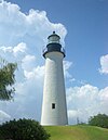
Port Isabel Lighthouse State Historic Site Port Isabel Texas Lighthouse.jpg
Commons-logo.svg More images
421 E. Queen Isabella Blvd. Port Isabel Cameron 26°4′41″N97°12′26″W / 26.07806°N 97.20722°W / 26.07806; -97.20722 (Port Isabel Lighthouse State Historic Site) THC
Sabine Pass Battleground State Historic Site Sabine Pass Battleground State Historic Site.jpg 6100 Dowling Rd. Port Arthur Jefferson 29°43′43″N93°52′30″W / 29.72861°N 93.87500°W / 29.72861; -93.87500 (Sabine Pass Battleground State Historic Site) THC
Sam Bell Maxey House State Historic Site ⁕⁑ Paris July 2015 56 (Sam Bell Maxey House).jpg
Commons-logo.svg More images
812 S. Church St. Paris Lamar 33°39′14″N95°33′17″W / 33.65389°N 95.55472°W / 33.65389; -95.55472 (Sam Bell Maxey House State Historic Site) THC
Sam Rayburn House State Historic Site # Sam Rayburn House Museum in 2009.jpg 890 W. SH 56 Bonham Fannin 33°34′10″N96°12′27″W / 33.56944°N 96.20750°W / 33.56944; -96.20750 (Sam Rayburn House State Historic Site) THC
San Felipe de Austin State Historic Site San felipe de austin shs 2007.jpg
Commons-logo.svg More images
15945 FM 1458 San Felipe Austin 29°48′25″N96°5′51″W / 29.80694°N 96.09750°W / 29.80694; -96.09750 (San Felipe de Austin State Historic Site) THC
San Jacinto Battleground State Historic Site # San Jacinto Battle Monument From the Texans Camp.jpg
Commons-logo.svg More images
3523 Independence Pkwy S. LaPorte Harris 29°44′18″N95°4′41″W / 29.73833°N 95.07806°W / 29.73833; -95.07806 (San Jacinto Battleground State Historic Site) THC
Seminole Canyon State Park and Historic Site Seminole Canyon Park6.JPG
Commons-logo.svg More images
US 90 Comstock Val Verde 29°42′0″N101°18′47″W / 29.70000°N 101.31306°W / 29.70000; -101.31306 (Seminole Canyon State Park and Historic Site) TPWD
Starr Family Home State Historic Site Marshall October 2016 17 (Starr Family Home).jpg
Commons-logo.svg More images
407 W. Travis St. Marshall Harrison 32°32′30″N94°22′15″W / 32.54167°N 94.37083°W / 32.54167; -94.37083 (Starr Family Home State Historic Site) THC
Varner–Hogg Plantation State Historic Site ⁕⁑ VarnerHoggHouse (1 of 1).jpg
Commons-logo.svg More images
1702 N. 13th St. West Columbia Brazoria 29°9′45″N95°38′28″W / 29.16250°N 95.64111°W / 29.16250; -95.64111 (Varner–Hogg Plantation State Historic Site) THC
Washington-on-the-Brazos State Historic Site Washington on the Brazos Monument.jpg
Commons-logo.svg More images
23400 Park Road 12 Washington Washington 30°19′25″N96°9′17″W / 30.32361°N 96.15472°W / 30.32361; -96.15472 (Washington-on-the-Brazos State Historic Site) THC
Zaragoza Birthplace State Historic Site House where General Zaragoza was born IMG 0998.JPG Calle Cinco de Mayo at Lopez Rd. Goliad Goliad 28°38′50″N97°22′59″W / 28.64722°N 97.38306°W / 28.64722; -97.38306 (Zaragoza Birthplace State Historic Site) TPWD

Related Research Articles

<span class="mw-page-title-main">National Historic Landmark</span> Designation by the US government

A National Historic Landmark (NHL) is a building, district, object, site, or structure that is officially recognized by the United States government for its outstanding historical significance. Only some 2,500, or roughly three percent, of over 90,000 places listed on the country's National Register of Historic Places are recognized as National Historic Landmarks.

<span class="mw-page-title-main">U.S. Route 80</span> Numbered Highway in the United States

U.S. Route 80 or U.S. Highway 80 (US 80) is a major east–west United States Numbered Highway in the Southern United States, much of which was once part of the early auto trail known as the Dixie Overland Highway. As the "0" in the route number indicates, it was originally a cross-country route, from the Pacific Ocean to the Atlantic Ocean. Its original western terminus was at Historic US 101 in San Diego, California. However, the entire segment west of Dallas, Texas, has been decommissioned in favor of various Interstate Highways and state highways. Currently, the highway's western terminus is at an interchange with Interstate 30 (I-30) on the Dallas–Mesquite city line. Its eastern terminus is in Tybee Island, Georgia near the Atlantic Ocean. Between Jonesville, Texas and Kewanee, Mississippi, US 80 runs parallel to or concurrently with Interstate 20. It also currently runs through Dallas, Texas; Shreveport, Louisiana; Jackson, Mississippi; Montgomery, Alabama; Columbus, Georgia; Macon, Georgia; and Savannah, Georgia.

<span class="mw-page-title-main">National Historic Sites of Canada</span> Heritage registers in Canada

National Historic Sites of Canada are places that have been designated by the federal Minister of the Environment on the advice of the Historic Sites and Monuments Board of Canada (HSMBC), as being of national historic significance. Parks Canada, a federal agency, manages the National Historic Sites program. As of November 2023, there were 1,005 National Historic Sites, 171 of which are administered by Parks Canada; the remainder are administered or owned by other levels of government or private entities. The sites are located across all ten provinces and three territories, with two sites located in France.

<span class="mw-page-title-main">Texas Historical Commission</span> Agency of the State of Texas, United States

The Texas Historical Commission is an agency dedicated to historic preservation within the U.S. state of Texas. It administers the National Register of Historic Places for sites in Texas.

<span class="mw-page-title-main">Old West Austin Historic District</span> Historic district in Texas, United States

The Old West Austin Historic District is a residential community in Austin, Texas, United States. It is composed of three neighborhoods located on a plateau just west of downtown Austin: Old Enfield, Pemberton Heights, and Bryker Woods. Developed between 1886 and 1953, the three historic neighborhoods stretch from Mopac Expressway east to Lamar Boulevard, and from 13th Street north to 35th Street. It borders Clarksville Historic District and the West Line Historic District to the south.

<span class="mw-page-title-main">Texas Park Road 27</span>

Park Road 27 or PR 27 is a Texas park road that runs from Fannin to the Fannin Battleground State Historic Site, which is the site of the Battle of Coleto. PR 27 was originally SH 162 and briefly Spur 91 before gaining its current designation in 1940.
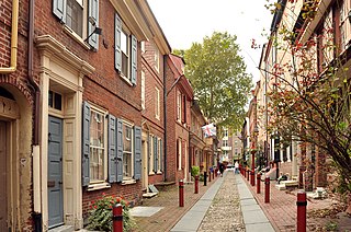
<span class="mw-page-title-main">Historic districts in the United States</span>

Historic districts in the United States are designated historic districts recognizing a group of buildings, archaeological resources, or other properties as historically or architecturally significant. Buildings, structures, objects, and sites within a historic district are normally divided into two categories, contributing and non-contributing. Districts vary greatly in size and composition: a historic district could comprise an entire neighborhood with hundreds of buildings, or a smaller area with just one or a few resources.

<span class="mw-page-title-main">Ranch Road 1</span> Highway in Texas

Ranch Road 1 is a Ranch Road located in Gillespie and Blanco counties, in the central region of the U.S. state of Texas. The highway is approximately 6.6 miles (10.6 km) long. It begins at U.S. Route 290 in Stonewall, running along the Pedernales River through Lyndon B. Johnson National Historical Park, the late President Lyndon Johnson's former ranch, and through Lyndon B. Johnson State Park and Historic Site, before terminating at US 290 near Hye. The road, designated in 1963, is the only road in the state that the Texas Department of Transportation (TxDOT) has designated as a "Ranch Road". In the earliest days of the state highway system, the route was a part of State Highway 20, and was later part of US 290 before that highway was relocated to the south.

Recorded Texas Historic Landmark (RTHL) is a designation awarded by the Texas Historical Commission for historically and architecturally significant properties in the U.S. state of Texas. RTHL is a legal designation and the highest honor the state can bestow on a historic structure. Purchase and display of a historical marker is a required component of the RTHL designation process. Because it is a legal designation, owners of RTHL-designated structures must give 60 days' notice before any alterations are made to the exterior of the structure. Changes that are unsympathetic may result in removal of the designation and historical marker. More than 3,600 RTHL structures are spread throughout the state.

A Smithsonian trinomial is a unique identifier assigned to archaeological sites in many states in the United States. They are composed of one or two digits coding for the state, typically two letters coding for the county or county-equivalent within the state, and one or more sequential digits representing the order in which the site was listed in that county. The Smithsonian Institution developed the site number system in the 1930s and 1940s, but it no longer maintains the system. Trinomials are now assigned by the individual states. The 48 states then in the union were assigned numbers in alphabetical order. Alaska was assigned number 49 and Hawaii was assigned number 50, after those states were admitted to the union. There is no Smithsonian trinomial number assigned for the District of Columbia or any United States territory.

<span class="mw-page-title-main">Texas Park Road 12</span>

Park Road 12 (PR 12) is a short Park Road located in Washington County, in the Gulf Coast region of the U.S. state of Texas. The highway is approximately 0.3 miles (0.48 km) long, and connects Washington-on-the-Brazos State Historic Site to Farm to Market Road 1155 (FM 1155) and the surrounding community of Washington-on-the-Brazos. The highway was designated in 1939, and was shortened in 1970. The designation originally contained all roads within the park.