List of United States Marine Corps installations

Last updated

This is a list of installations used by the United States Marine Corps, organized by type and state. Most US states do not have active Marine Corps bases; however, many do have reserve bases and centers. In addition, the Marine Corps Security Force Regiment maintains Marines permanently at numerous naval installations across the United States and abroad. The Corps also shares its headquarters with the rest of the United States armed forces at the Pentagon in Virginia.

Contents

United States

Marine Corps Bases and Air Stations

InsigniaInstallationLocationStateCoordinates
MCAS Yuma insignia.png
Arizona
32°39′24″N114°36′22″W / 32.65667°N 114.60611°W / 32.65667; -114.60611 (Marine Corps Air Station Yuma)
MCAS Miramar Insignia.png
California
32°52′04″N117°08′30″W / 32.86778°N 117.14167°W / 32.86778; -117.14167 (Marine Corps Air Station Miramar)
Seal of Marine Corps Base Camp Pendleton.png
California
33°20′00″N117°25′00″W / 33.33333°N 117.41667°W / 33.33333; -117.41667 (Camp Pendleton)
MCAS Pendleton insignia.gif
California
33°18′04″N117°21′19″W / 33.30111°N 117.35528°W / 33.30111; -117.35528 (Marine Corps Air Station Camp Pendleton)
MAGTFTC.png
California
34°13′54″N116°03′42″W / 34.23167°N 116.06167°W / 34.23167; -116.06167 (Marine Corps Air Ground Combat Center Twentynine Palms)
Mclb barstow insig.png
California
34°51′17″N116°56′24″W / 34.85472°N 116.94000°W / 34.85472; -116.94000 (Marine Corps Logistics Base Barstow)
MCRD WRR small.jpg
California
32°44′31″N117°11′50″W / 32.74194°N 117.19722°W / 32.74194; -117.19722 (Marine Corps Recruit Depot San Diego)
Mountain Warfare Training Center insignia.png
California
38°21′33″N119°30′45″W / 38.35917°N 119.51250°W / 38.35917; -119.51250 (Mountain Warfare Training Center)
Mclblogo.gif
Georgia
31°33′00″N84°03′15″W / 31.55000°N 84.05417°W / 31.55000; -84.05417 (Marine Corps Logistics Base Albany)
MCB Camp Blaz logo.jpg
Guam
13°34′11.38″N144°50′26″E / 13.5698278°N 144.84056°E / 13.5698278; 144.84056 (Marine Corps Base Camp Blaz)
MCB Hawaii.jpg
Hawaii
21°26′37″N157°44′56″W / 21.44361°N 157.74889°W / 21.44361; -157.74889 (Marine Corps Base Hawaii)
MCAF Kaneohe Bay logo.jpg
Hawaii
21°26′45″N157°46′11″W / 21.44583°N 157.76972°W / 21.44583; -157.76972 (Marine Corps Air Station Kaneohe Bay)
1st Marine Corps District
New York
40°43′47″N73°36′51″W / 40.72972°N 73.61417°W / 40.72972; -73.61417 (1st Marine Corps District)
MCAS CPoint.jpg
North Carolina
34°54′03″N076°52′51″W / 34.90083°N 76.88083°W / 34.90083; -76.88083 (Marine Corps Air Station Cherry Point)
Seal of MCB Camp Lejeune.png
North Carolina
34°35′00″N77°20′00″W / 34.58333°N 77.33333°W / 34.58333; -77.33333 (Camp Lejeune)
Air station new river.svg
North Carolina
34°42′26″N077°26′43″W / 34.70722°N 77.44528°W / 34.70722; -77.44528 (Marine Corps Air Station New River)
Mcasbeaufort.jpg
South Carolina
32°28′38″N080°43′23″W / 32.47722°N 80.72306°W / 32.47722; -80.72306 (Marine Corps Air Station Beaufort)
Marine Corps Recruit Depot, Parris Island logo.jpg
South Carolina
32°20′22″N80°41′24″W / 32.33944°N 80.69000°W / 32.33944; -80.69000 (Marine Corps Recruit Depot Parris Island)
Seal of Marine Corps Base Quantico.png
Virginia
38°33′4″N77°25′50″W / 38.55111°N 77.43056°W / 38.55111; -77.43056 (Marine Corps Base Quantico)
Henderson hall logo.jpg
Virginia
38°52′08″N77°04′21″W / 38.86889°N 77.07250°W / 38.86889; -77.07250 (Henderson Hall)
MBW logo.jpg
Washington, D.C.
Washington, D.C.
38°52′49″N76°59′38″W / 38.88028°N 76.99389°W / 38.88028; -76.99389 (Marine Barracks, Washington, D.C.)

Satellite Bases and Aviation Facilities

InsigniaInstallationHost FacilityLocationStateCoordinates
Blount Island Command Logo.png
Florida
30°24′22″N81°31′18″W / 30.40611°N 81.52167°W / 30.40611; -81.52167 (Blount Island Command)
No image.png
Hawaii
21°23′09″N157°54′23″W / 21.38583°N 157.90639°W / 21.38583; -157.90639 (Camp H. M. Smith)
No image.png
North Carolina
34°53′28″N76°20′58″W / 34.89111°N 76.34944°W / 34.89111; -76.34944 (Marine Corps Outlying Field Atlantic)
Boguerat3.gif
North Carolina
34°41′26″N077°01′47″W / 34.69056°N 77.02972°W / 34.69056; -77.02972 (Marine Corps Auxiliary Landing Field Bogue Field)
No image.png
North Carolina
34°31′00″N077°33′00″W / 34.51667°N 77.55000°W / 34.51667; -77.55000 (Marine Corps Outlying Field Camp Davis)
North Carolina
34°43′59″N77°27′16″W / 34.73306°N 77.45444°W / 34.73306; -77.45444 (Camp Geiger)
Logomccsss.jpg
Camp Gilbert H. Johnson
formerly known as "Montford Point"
North Carolina
34°44′09″N77°24′26″W / 34.73583°N 77.40722°W / 34.73583; -77.40722 (Camp Gilbert H. Johnson)
No image.png
North Carolina
34°34′49″N77°21′51″W / 34.58028°N 77.36417°W / 34.58028; -77.36417 (Courthouse Bay)
LogoWTBn.jpg
North Carolina
34°38′37″N77°24′45″W / 34.64361°N 77.41250°W / 34.64361; -77.41250 (Stone Bay)
No image.png
Virginia
36°55′42″N76°17′38″W / 36.92833°N 76.29389°W / 36.92833; -76.29389 (Camp Allen)
Mcas quantico.jpg
Virginia
38°30′13″N077°18′18″W / 38.50361°N 77.30500°W / 38.50361; -77.30500 (Marine Corps Air Facility Quantico)

Marine Corps Detachments

InsigniaDetachmentHost FacilityLocationStateCoordinates
MATSG-21 insignia.jpg
Florida
30°21′00″N87°17′24″W / 30.35000°N 87.29000°W / 30.35000; -87.29000 (Naval Air Station Pensacola)
MAG-22insignia.gif
Texas
27°41′33″N97°17′28″W / 27.69250°N 97.29111°W / 27.69250; -97.29111 (Naval Air Station Corpus Christi)
MATSG-23 insignia.gif
Florida
30°21′00″N87°17′24″W / 30.35000°N 87.29000°W / 30.35000; -87.29000 (Naval Air Station Pensacola)
MATSG-33insignia.jpg
Virginia
36°49′14″N76°02′00″W / 36.82056°N 76.03333°W / 36.82056; -76.03333 (Naval Air Station Oceana)
MATSG-53 insignia.jpg
Washington
48°21′07″N122°39′21″W / 48.35194°N 122.65583°W / 48.35194; -122.65583 (Naval Air Station Whidbey Island)
Mad cl logo.gif
California
35°41′08″N117°41′31″W / 35.68556°N 117.69194°W / 35.68556; -117.69194 (Naval Air Weapons Station China Lake)
MADPatch9.jpg
Maryland
38°17′10″N76°24′42″W / 38.28611°N 76.41167°W / 38.28611; -76.41167 (Naval Air Station Patuxent River)
No image.png
Oklahoma
34°40′16″N98°23′23″W / 34.67111°N 98.38972°W / 34.67111; -98.38972 (Fort Sill)
No image.png
Arizona
31°33′19″N110°20′59″W / 31.55528°N 110.34972°W / 31.55528; -110.34972 (Fort Huachuca)
No image.png
California
36°36′21″N121°54′37″W / 36.60583°N 121.91028°W / 36.60583; -121.91028 (Defense Language Institute)
MCD Corry Station.gif
Florida
30°24′18″N87°17′27″W / 30.40500°N 87.29083°W / 30.40500; -87.29083 (Corry Station Naval Technical Training Center)
MCD Fort Gordon.jpg
Georgia
33°24′48″N82°8′7″W / 33.41333°N 82.13528°W / 33.41333; -82.13528 (Fort Gordon)
No image.png
Georgia
32°21′58″N84°58′09″W / 32.36611°N 84.96917°W / 32.36611; -84.96917 (Fort Benning)
USMC Fort Knox detachmentlogo.PNG
Kentucky
37°55′12″N85°57′36″W / 37.92000°N 85.96000°W / 37.92000; -85.96000 (Fort Knox)
MCD APG.jpg
Maryland
39°28′24″N76°08′27″W / 39.47333°N 76.14083°W / 39.47333; -76.14083 (Aberdeen Proving Ground)
No image.png
Maryland
39°6′25″N76°44′35″W / 39.10694°N 76.74306°W / 39.10694; -76.74306 (Fort Meade)
MCD.PNG
Missouri
37°44′24.36″N92°07′34.59″W / 37.7401000°N 92.1262750°W / 37.7401000; -92.1262750 (Fort Leonard Wood)
No image.png
Rhode Island
41°31′20″N71°18′32″W / 41.52222°N 71.30889°W / 41.52222; -71.30889 (Naval Station Newport)
MCD GAFB.gif
Texas
31°25′46.6716″N100°23′56.54″W / 31.429631000°N 100.3990389°W / 31.429631000; -100.3990389 (Goodfellow Air Force Base)
No image.png
Virginia
37°14′06″N77°19′58″W / 37.23500°N 77.33278°W / 37.23500; -77.33278 (Fort Lee)

Marine Corps Reserve

InsigniaInstallationLocationStateCoordinates
MarforresLogo.jpg
Louisiana
29°57′00″N90°01′45″W / 29.95000°N 90.02917°W / 29.95000; -90.02917 (Naval Support Activity New Orleans)
MOBCOM.gif
Louisiana
38°51′00″N94°33′00″W / 38.85000°N 94.55000°W / 38.85000; -94.55000 (Marine Corps Individual Reserve Support Activity)
Naval Air Station Fort Worth (insignia).gif
Texas
32°46′09″N097°26′30″W / 32.76917°N 97.44167°W / 32.76917; -97.44167 (Naval Air Station Joint Reserve Base Fort Worth)

Overseas

InsigniaInstallationLocationCountryCoordinates
No image.png
Australia
12°26′42″S130°58′28″E / 12.44500°S 130.97444°E / -12.44500; 130.97444 (Robertson Barracks)
No image.png
Cuba
19°54′00″N75°9′00″W / 19.90000°N 75.15000°W / 19.90000; -75.15000 (Guantanamo Bay Naval Base)
No image.png
Djibouti
11°32′37″N43°08′55″E / 11.54361°N 43.14861°E / 11.54361; 43.14861 (Camp Lemonnier)
MARFOREUR-AF.png
Germany
48°40′55″N09°02′46″E / 48.68194°N 9.04611°E / 48.68194; 9.04611 (Panzer Kaserne)
Japan
34°08′42″N132°14′39″E / 34.14500°N 132.24417°E / 34.14500; 132.24417 (Marine Corps Air Station Iwakuni)
Camp smedley butler.png
Japan
26°17′51″N127°46′59″E / 26.29750°N 127.78306°E / 26.29750; 127.78306 (Camp Smedley D. Butler)
No image.png
Japan
26°23′31″N127°51′34″E / 26.39194°N 127.85944°E / 26.39194; 127.85944 (Camp Courtney)
No image.png
Japan
26°18′5″N127°46′47″E / 26.30139°N 127.77972°E / 26.30139; 127.77972 (Camp Foster)
MCJWTC.gif
Japan
26°41′20″N128°13′45″E / 26.68889°N 128.22917°E / 26.68889; 128.22917 (Camp Gonsalves)
No image.png
Japan
26°27′38″N127°54′54″E / 26.46056°N 127.91500°E / 26.46056; 127.91500 (Camp Hansen)
No image.png
Japan
26°15′09″N127°41′51″E / 26.25250°N 127.69750°E / 26.25250; 127.69750 (Camp Kinser)
No image.png
Japan
26°18′58″N127°45′46″E / 26.31611°N 127.76278°E / 26.31611; 127.76278 (Camp Lester)
No image.png
Japan
26°22′53″N127°50′47″E / 26.38139°N 127.84639°E / 26.38139; 127.84639 (Camp McTureous)
No image.png
Japan
26°31′29″N128°02′40″E / 26.52472°N 128.04444°E / 26.52472; 128.04444 (Camp Schwab)
MCAS Futenma insignia.svg
Japan
26°16′15″N127°44′53″E / 26.27083°N 127.74806°E / 26.27083; 127.74806 (Marine Corps Air Station Futenma)
MarineWingLiaisonKadena.gif
Japan
26°21′06″N127°46′10″E / 26.35167°N 127.76944°E / 26.35167; 127.76944 (Kadena Air Base)
No image.png
Japan
35°19′14″N138°52′07″E / 35.32056°N 138.86861°E / 35.32056; 138.86861 (Camp Fuji)
Camp Mujuk logo.png
South Korea
35°57′36″N129°25′34″E / 35.96000°N 129.42611°E / 35.96000; 129.42611 (Camp Mujuk)
No image.png
07°17′27″S72°23′09″E / 7.29083°S 72.38583°E / -7.29083; 72.38583 (Camp Thunder Cove)

Closed/Converted

United States

InsigniaInstallationDateCurrent FunctionLocationState
No image.png
2004
Alaska
No image.png
1945
Arkansas
No image.png
1964
California
No image.png
1946
California
1946
California
MCAS ElToro.jpg
1999
California
MCAS Mojave matchbook.jpg
1961
California
MCAS Santa Barbara Matchbook.jpg
1946
California
MCAS Tustin.jpg
1999
California
Naval Air Station Jacksonville (insignia).jpg
1986
Florida
No image.png
1959
Florida
No image.png
1952
Hawaii
No image.png
c.1960
North Carolina
MCAS Eagle Mountian Lake3.jpg
1946
private airport
Texas
No image.png
c.1946
North Carolina
No image.png
c.1946
North Carolina
No image.png
c.1946
North Carolina
No image.png
1944
Oregon
No image.png
1945
South Carolina

Overseas

InsigniaInstallationDateLocationCountry
No image.png
1969
Vietnam
No image.png
1970
Vietnam
No image.png
1971
Vietnam
No image.png
1972
Vietnam
No image.png
1972
Vietnam
No image.png
1973
Thailand
No image.png
1975
Vietnam
No image.png
Vietnam
No image.png
2007
Kosovo
No image.png
2012
Afghanistan
No image.png
2014
Afghanistan
No image.png
2014
Afghanistan
No image.png
2021
Afghanistan
No image.png
2021
Afghanistan
No image.png
2021
Afghanistan

See also

Citations

  1. Camp Allen/Elmore
  2. Marine Barracks Adak
  3. Brush, Peter. "Big Guns of Camp Carroll". Leatherneck.com. Retrieved 23 January 2018.

Related Research Articles

<span class="mw-page-title-main">Andrews Air Force Base</span> U.S. airbase

Andrews Air Force Base is the airfield portion of Joint Base Andrews, which is under the jurisdiction of the United States Air Force. In 2009, Andrews Air Force Base merged with Naval Air Facility Washington to form Joint Base Andrews. Andrews, located near Morningside, Maryland in suburban Washington, D.C., is the home base of two Boeing VC-25A aircraft with the call sign Air Force One when the president is on board, that serve the President of the United States, and the President is typically flown in and out of Andrews when travelling from Washington, D.C. by plane.

This list of military installations consists of a collection of military related lists worldwide:

<span class="mw-page-title-main">United States Forces Japan</span> American military command stationed in Japan

The United States Forces Japan (USFJ) is a subordinate unified command of the United States Indo-Pacific Command. It was activated at Fuchū Air Station in Tokyo, Japan, on 1 July 1957 to replace the Far East Command. USFJ is headquartered at Yokota Air Base in Tokyo and is commanded by the Commander, US Forces Japan who is also commander of the Fifth Air Force.

<span class="mw-page-title-main">Marine Corps Air Station Futenma</span> Airport

Marine Corps Air Station Futenma or MCAS FutenmaA is a United States Marine Corps base located in Ginowan, Okinawa, Japan, 5 NM northeastB of Naha, on the island of Okinawa. It is home to approximately 3,000 Marines of the 1st Marine Aircraft Wing and other units, and has been a U.S. military airbase since the defeat of the Japanese Imperial Army in the Battle of Okinawa in 1945. Marine Corps pilots and aircrew are assigned to the base for training and providing air support to other land and sea-based Marines in Okinawa and throughout the Asia-Pacific region. MCAS Futenma is part of the Marine Corps Installations Pacific command.

A military base is a facility directly owned and operated by or for the military or one of its branches that shelters military equipment and personnel, and facilitates training and operations. A military base always provides accommodations for one or more units, but it may also be used as a command center, training ground or proving ground. In most cases, military bases rely on outside help to operate. However, certain complex bases are able to endure on their own for long periods because they are able to provide food, water, and other necessities for their inhabitants while under siege. Bases for military aviation are called military air bases, or simply "air bases". Bases for military ships are called naval bases.

<span class="mw-page-title-main">Naval Air Station Jacksonville</span> United States Navy air base in Jacksonville, Florida, US

Naval Air Station Jacksonville is a large naval air station located approximately eight miles (13 km) south of the central business district of Jacksonville, Florida, United States.

<span class="mw-page-title-main">Mather Air Force Base</span> US Air Force base in California 1918–1993

Mather Air Force Base was a United States Air Force Base, which was closed in 1993 pursuant to a post-Cold War BRAC decision. It was located 12 miles (19 km) east of Sacramento, on the south side of U.S. Route 50 in Sacramento County, California. Mather Field was one of 32 Air Service training camps established after the United States entry into World War I in April 1917.

<span class="mw-page-title-main">Naval air station</span> Military airbase under naval command

A naval air station is a military air base, and consists of a permanent land-based operations locations for the military aviation division of the relevant branch of a navy. These bases are typically populated by squadrons, groups or wings, their various support commands, and other tenant commands.

<span class="mw-page-title-main">Fort Fisher Air Force Station</span> Radar station in North Carolina, US 1955–1988

Fort Fisher Air Force Station was a United States Air Force installation located on the Atlantic coast 0.8 miles (1.3 km) southwest of Kure Beach, North Carolina. Its primary mission was as a radar complex. It was closed on 30 June 1988 by the Air Force, and turned over to the Federal Aviation Administration (FAA).

<span class="mw-page-title-main">Naval Base Coronado</span> Group of US Navy installations around San Diego, California

Naval Base Coronado (NBC) is a consolidated Navy installation encompassing eight military facilities stretching from San Clemente Island, located seventy miles west of San Diego, California, in Los Angeles County, California, to the Mountain Warfare Training Camp Michael Monsoor and Camp Morena, located sixty miles east of San Diego.

During World War II, Kansas was a major United States Army Air Forces (USAAF) training center for pilots and aircrews of USAAF fighters and bombers. Kansas was favored because it has excellent, year-round flying conditions. The sparsely populated land made ideal locations for gunnery, bombing, and training ranges.

<span class="mw-page-title-main">United States Marine Corps</span> Maritime land force service branch of the U.S. military

The United States Marine Corps (USMC), also referred to as the United States Marines, is the maritime land force service branch of the United States Armed Forces responsible for conducting expeditionary and amphibious operations through combined arms, implementing its own infantry, artillery, aerial, and special operations forces. The U.S. Marine Corps is one of the eight uniformed services of the United States.

During World War II, the United States Army Air Forces (USAAF) established numerous airfields in Iowa for training pilots and aircrews of USAAF fighters and bombers.

<span class="mw-page-title-main">Marine Corps Air Station Cherry Point</span> US Marine Corps base in Havelock, North Carolina, United States

Marine Corps Air Station Cherry Point or MCAS Cherry Point is a United States Marine Corps airfield located in Havelock, North Carolina, United States, in the eastern part of the state. It was built in 1941, and was commissioned in 1942 and is currently home to the 2nd Marine Aircraft Wing.

<span class="mw-page-title-main">Oklahoma City Air Force Station</span> Historical Air Force station

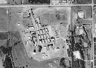
Oklahoma City Air Force Station is a closed Cold War United States Air Force air defense and communications-electronics headquarters and radar station. It was located 10 miles (16 km) east-southeast of Oklahoma City, Oklahoma, just to the southeast of Tinker Air Force Base. It ceased to be a separate Air Force installation on 1 October 1983, when it merged with Tinker.

<span class="mw-page-title-main">Joint Region Marianas</span> One of eleven naval regions of the U.S. Navy

Joint Region Marianas' mission is to provide installation management support to all Department of Defense components and tenants through assigned regional installations on Guam and the Northern Mariana Islands in support of training in the Marianas; to act as the interface between the Department of Defense and the civilian community; to ensure compliance with all environmental laws and regulations, safety procedures, and equal opportunity policy; and perform other functions and tasks as may be assigned.

<span class="mw-page-title-main">Energy usage of the United States military</span>

The United States Department of Defense is one of the largest single consumers of energy in the world, responsible for 93% of all US government fuel consumption in 2007 (Air Force: 52%; Navy: 33%; Army: 7%. Other DoD: 1%). In FY 2006, the DoD used almost 30,000 gigawatt hours (GWH) of electricity, at a cost of almost $2.2 billion. The DoD's electricity use would supply enough electricity to power more than 2.3 million average American homes. In electricity consumption, if it were a country, the DoD would rank 58th in the world, using slightly less than Denmark and slightly more than Syria (CIA World Factbook, 2006). The Department of Defense uses 4,600,000,000 US gallons (1.7×10¹⁰ L) of fuel annually, an average of 12,600,000 US gallons (48,000,000 L) of fuel per day. A large Army division may use about 6,000 US gallons (23,000 L) per day. According to the 2005 CIA World Factbook, if it were a country, the DoD would rank 34th in the world in average daily oil use, coming in just behind Iraq and just ahead of Sweden.

References

Bibliography
Web