 1. Kuala Lumpur, Federal Territories
 2. Kajang, Selangor
 3. Seberang Perai, Penang
 4. Petaling Jaya, Selangor
 5. Klang, Selangor
 6. Johor Bahru, Johor
 7. Shah Alam, Selangor
 8. George Town, Penang
 9. Subang Jaya, Selangor
 10. Selayang, Selangor
 11. Ipoh, Perak
 12. Seremban, Negeri Sembilan
 13. Iskandar Puteri, Johor
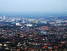 14. Kuantan, Pahang
 15. Sungai Petani, Kedah
Within defined boundaries
This table lists all cities, municipalities and districts in Malaysia whose population exceeds 250,000 people, according to statistics published in the 2020 Malaysian census by the Malaysian Department of Statistics (DOSM). There are 34 populated regions in Malaysia whose population exceeds 250,000 people. All 13 states and the Federal Territories have at least one city, municipality or district whose population exceeded 250,000 people.
This table displays:
- The settlement name;
- The state in which the settlement is located;
- The settlement's population as of 2020, as estimated in the 2020 census conducted by the DOSM;
- The settlement's population as of 2010, as estimated in the 2010 census conducted by the DOSM;
- The settlement's population difference between 2010 and 2020;
- The land area of the settlement's defined boundaries in square kilometres (km2);
- The population density of the settlement in people per square kilometres (/km2), as estimated by the settlement's 2020 population figures.
| Key (local governments) | |
|---|---|
| Regions administered by city halls and councils (Dewan/Majlis Bandaraya) | |
| Regions administered by municipal councils (Majlis Perbandaran) | |
| Regions administered by district councils (Majlis Daerah) | |
| † | National capital |
| # | State administrative capitals |
| * | State royal capitals |
| City, municipality or district | State | Government census figures | Land area | Density (2020) | Area ref. | |||
|---|---|---|---|---|---|---|---|---|
| 2020 | 2010 | Diff. | Pop. ref. | |||||
| Kuala Lumpur † | 1,982,112 | 1,588,750 | +24.76% | [1] | 243 km2 | 8,156/km2 | [2] | |
| Kajang | 1,047,356 | 795,522 | +31.66% | [3] | 788 km2 | 1,329/km2 | [4] | |
| Seberang Perai | 946,092 | 818,097 | +15.65% | [5] | 751 km2 | 1,265/km2 | [6] | |
| Petaling Jaya | 902,086 | 613,977 | +46.93% | [3] | 97 km2 | 9,300/km2 | [7] | |
| Klang * | 902,025 | 744,062 | +21.23% | [3] | 573 km2 | 1,574/km2 | [8] | |
| Johor Bahru # | 858,118 | 497,067 | +72.64% | [9] | 373 km2 | 2,300/km2 | [10] | |
| Shah Alam # | 812,327 | 541,306 | +50.07% | [3] | 290 km2 | 2,801/km2 | [11] | |
| George Town # | 794,313 | 708,127 | +12.17% | [5] | 306 km2 | 2,596/km2 | [12] | |
| Subang Jaya | 771,687 | 708,296 | +8.95% | [3] | 162 km2 | 4,764/km2 | [13] | |
| Selayang | 764,327 | 542,409 | +40.91% | [3] | 546 km2 | 1,400/km2 | [14] | |
| Ipoh # | 759,952 | 657,892 | +15.51% | [15] | 643 km2 | 1,182/km2 | [16] | |
| Seremban # [note 1] | 681,541 | 515,490 | +32.21% | [18] | 923 km2 | 738/km2 | [19] | |
| Iskandar Puteri [note 2] | 575,977 | 529,074 | +8.87% | [9] | 403 km2 | 1,429/km2 | [10] | |
| Kuantan # | 548,014 | 427,515 | +28.19% | [21] | 324 km2 | 1,691/km2 | [22] | |
| Sungai Petani | 545,053 | 443,488 | +22.90% | [23] | 913 km2 | 597/km2 | [24] | |
| Ampang Jaya | 531,904 | 468,961 | +13.42% | [3] | 144 km2 | 3,964/km2 | [8] | |
| Kota Kinabalu # | 500,425 | 452,058 | +10.70% | [25] | 352 km2 | 1,422/km2 | [26] | |
| Malacca City # [note 3] | 453,904 | – | – | [28] | 270 km2 | 1,681/km2 | [29] | |
| Sandakan | 439,050 | 396,290 | +10.79% | [25] | 2,275 km2 | 193/km2 | [26] | |
| Alor Setar # | 423,868 | 405,523 | +4.52% | [23] | 666 km2 | 636/km2 | [30] | |
| Tawau | 420,806 | 397,673 | +5.82% | [25] | 6,149 km2 | 68/km2 | [26] | |
| Batu Pahat | 401,210 | 209,461 | +91.54% | [9] | 1,873 km2 | 214/km2 | [31] | |
| Kota Bharu | 396,193 | 314,964 | +25.79% | [32] | 116 km2 | 3,415/km2 | [33] | |
| Kuala Terengganu # | 375,424 | 337,533 | +11.23% | [34] | 605 km2 | 621/km2 | [35] | |
| Kuching # | 349,147 | 325,132 | +7.39% | [36] | 431 km2 | 810/km2 | [37] [38] | |
| Sepang | 324,585 | 207,354 | +56.54% | [3] | 619 km2 | 524/km2 | [39] | |
| Kulim | 319,056 | 281,260 | +13.44% | [23] | 774 km2 | 412/km2 | [24] | |
| Muar * | 314,776 | 201,148 | +56.49% | [9] | 1,376 km2 | 229/km2 | [31] | |
| Pasir Gudang | 312,437 | 46,571 | +570.88% | [9] | 360 km2 | 868/km2 | [10] | |
| Kuala Langat | 307,418 | 220,214 | +39.60% | [3] | 858 km2 | 358/km2 | [40] | |
| Kulai | 294,156 | 234,532 | +25.42% | [9] | 747 km2 | 394/km2 | [10] | |
| Kangar # | 284,853 | 225,590 | +26.27% | [41] | 795 km2 | 358/km2 | [42] | |
| Kuala Selangor | 281,717 | 205,257 | +37.25% | [3] | 1,195 km2 | 236/km2 | [43] | |
| Padawan | 260,058 | 273,485 | −4.91% | [36] | 984 km2 | 264/km2 | [44] | |
Distribution

There are 34 settlements in Malaysia with a population of over 250,000 people. All 13 states and the Federal Territories have at least one settlement in the list. West Malaysia has more settlements that fit this criterion than East Malaysia, with 29 settlements against the East's five. The states with the least amount of settlements in this list are Kelantan, Melaka, Negeri Sembilan, Pahang, Perak, Perlis, Terengganu and the Federal Territories, with one locality each respectively, while the state with the highest amount of settlements with a population above 250,000 is Selangor, with 10 settlements in the list.
| Population | States | Regions | Total | ||||||||||||||
|---|---|---|---|---|---|---|---|---|---|---|---|---|---|---|---|---|---|
| JHR | KDH | KTN | MLK | NSN | PHG | PNG | PRK | PLS | SBH | SWK | SGR | TRG | FT | WM | EM | ||
| 1,000,000+ | – | – | – | – | – | – | – | – | – | – | – | 1 | – | 1 | 2 | – | 2 |
| 750,000–999,999 | 1 | – | – | – | – | – | 2 | 1 | – | – | – | 5 | – | – | 9 | – | 9 |
| 500,000–749,999 | 1 | 1 | – | – | 1 | 1 | – | – | – | 1 | – | 1 | – | – | 5 | 1 | 6 |
| 250,000–499,999 | 4 | 2 | 1 | 1 | – | – | – | – | 1 | 2 | 2 | 3 | 1 | – | 13 | 4 | 17 |
| Total | 6 | 3 | 1 | 1 | 1 | 1 | 2 | 1 | 1 | 3 | 2 | 10 | 1 | 1 | 29 | 5 | 34 |