List of counties of New Brunswick

Last updated
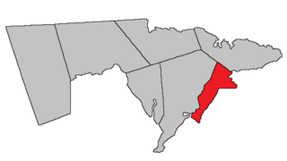
Counties of New Brunswick
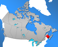
Location Province of New Brunswick
Number15
Populations10,998 (Queens) – 163,576 (Westmorland)
Areas1,461 km² (Saint John) – 12,843 km² (Northumberland)
Government
Subdivisions

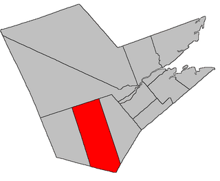
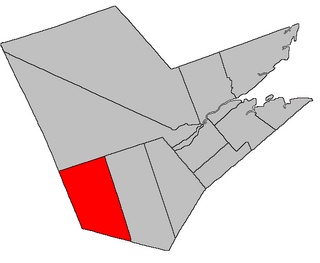
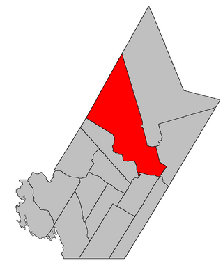
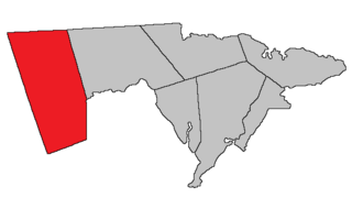
The Canadian province of New Brunswick has 15 counties according to the Territorial Divisions Act of New Brunswick. [1] While they are former counties, [2] they continue to define a regional community.

Contents

With the reorganization of local government legislation contained in the Robichaud government's reforms, collectively called the New Brunswick Equal Opportunity program, county municipalities ceased to function in 1966 and their councils were dissolved.

Another form of regional local government did not replace the county. Instead, many small village municipalities were created, with the surrounding predominantly rural areas remaining unincorporated.

Their use as census divisions continues, and are used along with their parishes, for registration of real estate among other things. They figure prominently in residents' sense of place and continue as significant threads in the Province's cultural fabric (i.e., most citizens always know which county they are in), and they still appear on some maps.

History

Origin

The territory of what is now New Brunswick was previously a part of the colony of Nova Scotia, which, in 1759, separated into counties for the first time. As part of this, all territory north of Kings County, including all of present-day New Brunswick, was erected as Cumberland County, [lower-alpha 2] until on April 30, 1765, when the Saint John River valley was erected as Sunbury County, although it would not be until 24 May 1770 that a boundary would be established between the two counties. Sunbury’s western boundary was described as starting at the head of the St. Croix River, following the north line to the Saint John River and then to the southern Canadian border. This description actually overlapped a part of Maine’s territory, as you would have needed to go far west, towards the area near the source of the Chaudière River. [3] No further changes would be made until 1785, when, now being a British colony, New Brunswick had new counties established for itself. [4]

Creation

In 1784, New Brunswick was separated from Nova Scotia to be established as its own colony. Within the next year, the new colony was divided into eight counties: Charlotte, Kings, Northumberland, Queens, Saint John, Sunbury, Westmorland and York. In January 1786, the first session of the New Brunswick Legislative Assembly was held in Saint John, at which the MLA’s passed An Act for the better ascertaining and confirming the Boundaries of Several Counties within this Province, and for subdividing them into Towns or Parishes. [5] As the council worked on developing the original county lines, they desperately needed maps of the province, which, at the time, they seemingly lacked. As a result, they relied on two maps by Joseph Frederick Wallet DesBarres from 1780, the best candidates for a map of New Brunswick at the time. [6] As the new boundaries were established, the former counties of Cumberland and Sunbury were disregarded, with the exception of the starting point of the boundary between Westmorland and Northumberland counties, which shared a resemblance to the old boundaries, though this might have been a coincidence. [7]

The county lines were strategically drawn to align with the watersheds, a logical decision given that New Brunswick's settlements were developed along waterways. [8] Additionally, the counties were able to be divided into three groups: the Bay of Fundy, the Saint John River and the North Shore. [9]

List

County [10] Shire town [10] Established [11] Origin [11] EtymologyPopulation (2021) [12] Population (2016) [12] Change [12] Land area (km2) [12] Population density (per km2) [12] Map
Albert County Hopewell Cape 1845Erected from Westmorland County Prince Albert, husband of Queen Victoria.30,74929,158+5.5%1,806.23 Map of New Brunswick highlighting Albert County.svg
Carleton County Woodstock 1831Erected from York County Thomas Carleton, the first Lieutenant Governor of New Brunswick.26,36026,178+0.7%3,309.06 Map of New Brunswick highlighting Carleton County.svg
Charlotte County St. Andrews 1785One of the original 8 counties. Queen Charlotte, wife of King George III.26,01525,428+2.3%3,418.24 Map of New Brunswick highlighting Charlotte County.svg
Gloucester County Bathurst 1826Erected from Northumberland County Princess Mary, Duchess of Gloucester, fourth daughter of King George III.78,25678,444−0.2%4,734.30 Map of New Brunswick highlighting Gloucester County.svg
Kent County Richibucto 1826Erected from Northumberland County Prince Edward, Duke of Kent and Strathearn, father of Queen Victoria.32,16930,475+5.6%4,550.38 Map of New Brunswick highlighting Kent County.svg
Kings County Hampton 1785One of the original 8 counties.To express loyalty to The Crown.71,18468,941+3.3%3,482.35 Map of New Brunswick highlighting Kings County.svg
Madawaska County Edmundston 1873Erected from Victoria County The Madawaska River, derived from a Maliseet word meaning unknown.32,60332,741−0.4%3,454.97 Map of New Brunswick highlighting Madawaska County.svg
Northumberland County Newcastle, now part of Miramichi 1785One of the original 8 counties.The Northumberland Strait 45,00544,952+0.1%12,843.39 Map of New Brunswick highlighting Northumberland County.svg
Queens County Gagetown 1785One of the original 8 counties.To express loyalty to The Crown and after early settlers from Queens, Long Island, New York.10,99810,472+5.0%3,681.05 Map of New Brunswick highlighting Queens County.svg
Restigouche County Dalhousie 1837Erected from Gloucester County The Restigouche River, derived from the Mi'kmaq name meaning five-fingered river.30,70030,955−0.8%8,566.82 Map of New Brunswick highlighting Restigouche County.svg
Saint John County Saint John 1785One of the original 8 counties.The Saint John River.76,55874,020+3.4%1,461.05 Map of New Brunswick highlighting Saint John County.svg
Sunbury County Burton 1785One of the original 8 counties. George Montagu-Dunk, 2nd Earl of Halifax, had been styled Viscount Sunbury prior to his Earl of Halifax title.27,86427,644+0.8%2,692.97 Map of New Brunswick highlighting Sunbury County.svg
Victoria County Andover, now part of Perth-Andover 1844Erected from Carleton County Queen Victoria 18,31218,617−1.6%5,492.85 Map of New Brunswick highlighting Victoria County.svg
Westmorland County Dorchester 1785One of the original 8 counties.The county of Westmorland in North West England.163,576149,623+9.3%3,659.74 Map of New Brunswick highlighting Westmorland County.svg
York County Fredericton 1785One of the original 8 counties. Prince Frederick, Duke of York and Albany, second son of George III.105,26199,453+5.8%8,095.10 Map of New Brunswick highlighting York County.svg

See also

Notes

  1. Parishes are the normal subdivision. Saint John, Fredericton, and the town of Grand Falls are also included in the Territorial Division Act, all with different boundaries than the municipalities have today. Fredericton was originally a parish, while Grand Falls Parish and the town are legally separate.
  2. Cumberland County still exists in modern-day Nova Scotia.

Related Research Articles

<span class="mw-page-title-main">Moncton Parish, New Brunswick</span> Parish in New Brunswick, Canada

Moncton is a geographic parish in Westmorland County, New Brunswick, Canada.

<span class="mw-page-title-main">Blissfield Parish, New Brunswick</span> Parish in New Brunswick, Canada

Blissfield is a geographic parish in Northumberland County, New Brunswick, Canada.

<span class="mw-page-title-main">Ludlow Parish, New Brunswick</span> Parish in New Brunswick, Canada

Ludlow is a geographic parish in Northumberland County, New Brunswick, Canada.

<span class="mw-page-title-main">Sackville Parish, New Brunswick</span> Parish in New Brunswick, Canada

Sackville is a geographic parish in Westmorland County, New Brunswick, Canada.

<span class="mw-page-title-main">Blackville Parish, New Brunswick</span> Parish in New Brunswick, Canada

Blackville is a geographic parish in Northumberland County, New Brunswick, Canada.

<span class="mw-page-title-main">Harcourt Parish, New Brunswick</span> Parish in New Brunswick, Canada

Harcourt is a geographic parish in Kent County, New Brunswick, Canada.

<span class="mw-page-title-main">Huskisson Parish, New Brunswick</span> Parish in New Brunswick, Canada

Huskisson is a geographic parish in Kent County, New Brunswick, Canada.

<span class="mw-page-title-main">Douglas Parish, New Brunswick</span> Parish in New Brunswick, Canada

Douglas is a geographic parish in York County, New Brunswick, Canada.

<span class="mw-page-title-main">Saint Marys Parish, New Brunswick</span> Parish in New Brunswick, Canada

Saint Marys is a geographic parish in York County, New Brunswick, Canada.

<span class="mw-page-title-main">Stanley Parish, New Brunswick</span> Parish in New Brunswick, Canada

Stanley is a geographic parish in York County, New Brunswick, Canada.

<span class="mw-page-title-main">Maugerville Parish, New Brunswick</span> Parish in New Brunswick, Canada

Maugerville is a geographic parish in Sunbury County, New Brunswick, Canada.

<span class="mw-page-title-main">Lincoln Parish, New Brunswick</span> Parish in New Brunswick, Canada

Lincoln is a geographic parish in Sunbury County, New Brunswick, Canada.

<span class="mw-page-title-main">Hopewell Parish, New Brunswick</span> Parish in New Brunswick, Canada

Hopewell is a geographic parish in eastern Albert County, New Brunswick, Canada.

<span class="mw-page-title-main">Alma Parish, New Brunswick</span> Parish in New Brunswick, Canada

Alma is a geographic parish on the Bay of Fundy in the southwestern corner of Albert County, New Brunswick, Canada.

<span class="mw-page-title-main">Salisbury Parish, New Brunswick</span> Parish in New Brunswick, Canada

Salisbury is a geographic parish in Westmorland County, New Brunswick, Canada.

<span class="mw-page-title-main">Botsford Parish, New Brunswick</span> Parish in New Brunswick, Canada

Botsford is a geographic parish in Westmorland County, New Brunswick, Canada.

<span class="mw-page-title-main">Westmorland Parish, New Brunswick</span> Parish in New Brunswick, Canada

Westmorland is a geographic parish in Westmorland County, New Brunswick, Canada.

<span class="mw-page-title-main">Brunswick Parish, New Brunswick</span> Parish in New Brunswick, Canada

Brunswick is a geographic parish in the northeastern corner of Queens County, New Brunswick, Canada.

<span class="mw-page-title-main">Burton Parish, New Brunswick</span> Parish in New Brunswick, Canada

Burton is a geographic parish in Sunbury County, New Brunswick, Canada.

<span class="mw-page-title-main">Gagetown Parish, New Brunswick</span> Parish in New Brunswick, Canada

Gagetown is a geographic parish in Queens County, New Brunswick, Canada.

References

  1. "NB Territorial Divisions Act, 1991".
  2. "Municipalities Act, SNB 1966(1), c 20, p.192" . Retrieved 3 February 2024.
  3. Ganong 1901, p. 226.
  4. Ganong 1901, p. 227.
  5. Ganong 1901, p. 413.
  6. Ganong 1901, pp. 413–414.
  7. Ganong 1901, p. 414.
  8. Ganong 1901, p. 415.
  9. Ganong 1901, pp. 416–417.
  10. 1 2 "Territorial Division Act". Government of New Brunswick. June 30, 1998. Retrieved December 28, 2021.
  11. 1 2 "Provincial Archives of New Brunswick". archives.gnb.ca.
  12. 1 2 3 4 5 Government of Canada, Statistics Canada (9 February 2022). "Population and dwelling counts: Canada and census divisions". www150.statcan.gc.ca.

Further reading

Ganong (1901). A monograph of the evolution of the boundaries of the province of New Brunswick.