Related Research Articles

Scilab is a free and open-source, cross-platform numerical computational package and a high-level, numerically oriented programming language. It can be used for signal processing, statistical analysis, image enhancement, fluid dynamics simulations, numerical optimization, and modeling, simulation of explicit and implicit dynamical systems and symbolic manipulations.

Open-source software (OSS) is computer software that is released under a license in which the copyright holder grants users the rights to use, study, change, and distribute the software and its source code to anyone and for any purpose. Open-source software may be developed in a collaborative, public manner. Open-source software is a prominent example of open collaboration, meaning any capable user is able to participate online in development, making the number of possible contributors indefinite. The ability to examine the code facilitates public trust in the software.
Source-available software is software released through a source code distribution model that includes arrangements where the source can be viewed, and in some cases modified, but without necessarily meeting the criteria to be called open-source. The licenses associated with the offerings range from allowing code to be viewed for reference to allowing code to be modified and redistributed for both commercial and non-commercial purposes.
GeoTIFF is a public domain metadata standard which allows georeferencing information to be embedded within a TIFF file. The potential additional information includes map projection, coordinate systems, ellipsoids, datums, and everything else necessary to establish the exact spatial reference for the file. The GeoTIFF format is fully compliant with TIFF 6.0, so software incapable of reading and interpreting the specialized metadata will still be able to open a GeoTIFF format file.
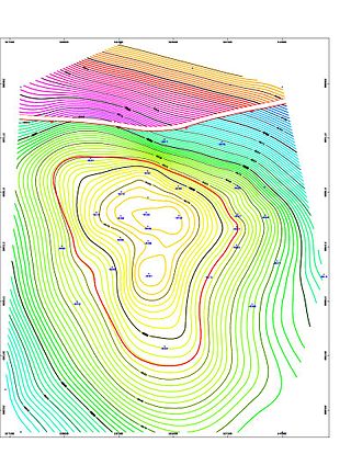
Geologic modelling,geological modelling or geomodelling is the applied science of creating computerized representations of portions of the Earth's crust based on geophysical and geological observations made on and below the Earth surface. A geomodel is the numerical equivalent of a three-dimensional geological map complemented by a description of physical quantities in the domain of interest. Geomodelling is related to the concept of Shared Earth Model; which is a multidisciplinary, interoperable and updatable knowledge base about the subsurface.
GeoTools is a free software (LGPL) GIS toolkit for developing standards compliant solutions. It provides an implementation of Open Geospatial Consortium (OGC) specifications as they are developed. GeoTools is a contributor to the GeoAPI project - a vendor-neutral set of Java interfaces derived from OGC specifications - and implements a subset of those.
PyMOL is an open source but proprietary molecular visualization system created by Warren Lyford DeLano. It was commercialized initially by DeLano Scientific LLC, which was a private software company dedicated to creating useful tools that become universally accessible to scientific and educational communities. It is currently commercialized by Schrödinger, Inc. As the original software license was a permissive licence, they were able to remove it; new versions are no longer released under the Python license, but under a custom license, and some of the source code is no longer released. PyMOL can produce high-quality 3D images of small molecules and biological macromolecules, such as proteins. According to the original author, by 2009, almost a quarter of all published images of 3D protein structures in the scientific literature were made using PyMOL.

GeoGebra is an interactive geometry, algebra, statistics and calculus application, intended for learning and teaching mathematics and science from primary school to university level. GeoGebra is available on multiple platforms, with apps for desktops, tablets and web. It is presently owned by Indian edutech firm Byju's.
ArcGIS is a family of client, server and online geographic information system (GIS) software developed and maintained by Esri.

MapWindow GIS is a lightweight open-source GIS (mapping) desktop application and set of programmable mapping components.
Integrated Land and Water Information System (ILWIS) is a geographic information system (GIS) and remote sensing software for both vector and raster processing. Its features include digitizing, editing, analysis and display of data, and production of quality maps. ILWIS was initially developed and distributed by ITC Enschede in the Netherlands for use by its researchers and students. Since 1 July 2007, it has been released as free software under the terms of the GPL-2.0-only license. Having been used by many students, teachers and researchers for more than two decades, ILWIS is one of the most user-friendly integrated vector and raster software programmes currently available. ILWIS has some very powerful raster analysis modules, a high-precision and flexible vector and point digitizing module, a variety of very practical tools, as well as a great variety of user guides and training modules all available for downloading. The current version is ILWIS 3.8.6. Similar to the GRASS GIS in many respects, ILWIS is currently available natively only on Microsoft Windows. However, a Linux Wine manual has been released.
Web-based simulation (WBS) is the invocation of computer simulation services over the World Wide Web, specifically through a web browser. Increasingly, the web is being looked upon as an environment for providing modeling and simulation applications, and as such, is an emerging area of investigation within the simulation community.

In computer science, Orfeo Toolbox (OTB) is a software library for processing images from Earth observation satellites.
GPlates is open-source application software offering a novel combination of interactive plate-tectonic reconstructions, geographic information system (GIS) functionality and raster data visualisation.
Dietmar Müller is a professor of geophysics at the school of geosciences, the University of Sydney.
References
- ↑ "Geological Software, 3D Modelling, QAQC and Resource Estimation | Genesis". 26 September 2023.
- ↑ "GeoTriple - Oil&Gas Exploration - About".
- ↑ Gstat website
- ↑ "Geostatistical Software Library". gslib.com. Retrieved 30 January 2024.
- ↑ "opengeostat/pygslib". GitHub. Retrieved 9 September 2016.
- ↑ "Virtual Geoscience Workbench". 13 March 2016.
- ↑ "CSIRO Data Access Portal".
- ↑ "Geoblock". geoblock.sourceforge.net. Retrieved 30 January 2024.
- ↑ GeoTrace website
- ↑ "Oslandia / Albion".
- ↑ "OSLANDIA" . Retrieved 30 January 2024.
- ↑ de la Varga, Miguel; Schaaf, Alexander; Wellmann, Florian (2019). "GemPy 1.0: open-source stochastic geological modeling and inversion". Geoscientific Model Development. 12 (1): 1–32. doi: 10.5194/gmd-12-1-2019 . hdl: 2164/11751 .
- ↑ Dapple website Archived 2006-08-13 at the Wayback Machine
- ↑ Estereografica Web
- ↑ Generic Mapping Tools hawaii.edu
- ↑ "GPlates". www.gplates.org. Retrieved 30 January 2024.
- ↑ "Welcome".
- ↑ "OpenStereo – an open source, cross-platform structural geology analysis software — OpenStereo 0.9.0 documentation".
- ↑ "dGB Earth Sciences - Innovative Seismic Interpretations Solutions". dgbes.com. Retrieved 30 January 2024.
- ↑ "HOME". modelgeo. Retrieved 30 January 2024.
- ↑ "ParaviewGeo". Archived from the original on 29 March 2018. Retrieved 9 March 2020.
- ↑ Lurcock, P. C. and G. S. Wilson (2012), PuffinPlot: A versatile, user-friendly program for paleomagnetic analysis, Geochemistry, Geophysics, Geosystems, 13, Q06Z45, doi:10.1029/2012GC004098
- ↑ "Noddy". Archived from the original on 20 January 2018. Retrieved 16 February 2011.
- ↑ "BasinVis 2.0".
- ↑ Lee E.Y., Novotny J., Wagreich M. (2016) BasinVis 1.0: A MATLAB®-based program for sedimentary basin subsidenceanalysis and visualization. Computers & Geosciences 91, 119–127. http://dx.doi.org/10.1016/j.cageo.2016.03.013
- ↑ Geomodelr website
- ↑ "Groundhog v2.8" . Retrieved 30 January 2024.
| General | |||
|---|---|---|---|
| Software packages | |||
| Community | |||
| Organisations | |||
| Licenses |
| ||
| Challenges | |||
| Related topics | |||