Maricopa County is in the south-central part of the U.S. state of Arizona. As of the 2020 census the population was 4,420,568, or about 62% of the state's total, making it the 4th most populous county in the United States, and the most populous county in Arizona, and the most populous capital county in the United States, and making Arizona one of the nation's most centralized states. The county seat is Phoenix, the state capital and 5th most populous city in the United States.
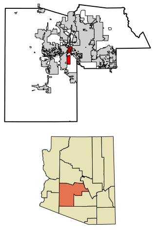
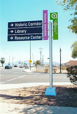
Avondale is a city in Maricopa County, Arizona, United States, adjacent to Phoenix. As of the 2020 census, the population of the city was 89,334, up from 76,238 in 2010 and 35,883 in 2000.

Gila Bend, founded in 1872, is a town in Maricopa County, Arizona, United States. The town is named for an approximately 90-degree bend in the Gila River, which is near the community's current location. As of the 2020 census, the population of the town was 1,892.

Litchfield Park is a city in Maricopa County, Arizona, United States. It is located 19 miles (31 km) west of Phoenix. As of the 2020 census, the population of the city was 6,847, up from 5,476 in 2010.

Sacaton is a census-designated place (CDP) in Pinal County, Arizona, United States. The population was 3,254 at the 2020 census. It is the capital of the Gila River Indian Community.

The Agua Fria River is a 120-mile (190 km) long intermittent stream which flows generally south from 20 miles (32 km) east-northeast of Prescott in the U.S. state of Arizona. Prescott draws much of its municipal water supply from the upper Agua Fria watershed. The Agua Fria runs through the Agua Fria National Monument. The river then flows through a small canyon called "Black Canyon" into Lake Pleasant, a popular recreation area near Peoria, Arizona. (There is a large "Black Canyon" on the Colorado River along the Arizona–Nevada border.)

Liberty is a small populated place in Maricopa County, Arizona, United States. It is located about 30 miles west of Phoenix and about 6 miles southeast of Buckeye. Liberty is located at the intersection of South Jackrabbit Trail and West Baseline Road. It is located entirely within Block 3017, Block Group 3, Census Tract 506.01, Maricopa County, Arizona, which had a population of 63 at the 2000 census.

Maricopa Association of Governments (MAG) is a Council of Governments (COG) that serves as the regional agency for the greater Maricopa region in Arizona, United States. This includes the Phoenix area and the neighboring urbanized area in Pinal County, containing the Town of Florence and City of Maricopa. When MAG was formed in 1967, the elected officials recognized the need for long-range planning and policy development on a regional scale. They realized that many issues such as transportation, air quality and human services affected residents beyond the borders of their individual jurisdictions.
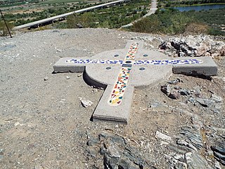
The Gila and Salt River Meridian intersects the initial point on the south side of the Gila River, opposite the mouth of Salt River, at latitude 33° 22′ 37.82733″ north, longitude 112° 18′ 21.99931″ west from Greenwich based on NAD 83, and governs the surveys in the territory of Arizona. The current declination for the initial point is 12° east. It is located on Monument Hill, an easily visible hill just south of the confluence of the Gila and Salt Rivers, in Avondale, Arizona, about 14 miles southwest of downtown Phoenix.
Many arterial roads in the Phoenix metropolitan area have the same name in multiple cities or towns. Some roads change names or route numbers across town borders, resulting in occasional confusion. For example, the road known as Apache Boulevard in Tempe continues east as Main Street in neighboring Mesa and then as Apache Trail in Apache Junction. Although Broadway Road maintains the same name through Goodyear, Avondale, Phoenix, Tempe, Mesa, and Apache Junction, each town uses a different reference point for address numbers.

Fort McDowell is an unincorporated community in Maricopa County, Arizona, United States. Fort McDowell is 23 miles northeast of Phoenix. Fort McDowell has a post office with ZIP code 85264.

The Double Butte Cemetery is the official name given to a historic cemetery in Tempe, Arizona. The cemetery was founded in 1888 on the baseline of the Double Butte Mountain for which it is named. It is the final resting place of various notable pioneers of the City of Tempe. The cemetery, which is located at 2505 W. Broadway Rd., is listed in the Tempe Historic Property Register Designation #46. The pioneer section of the cemetery was listed in the National Register of Historic Places on July 30, 2013, reference #13000020.

Greenwood Memory Lawn Mortuary & Cemetery is the official name given to a cemetery located at 2300 West Van Buren Street in Phoenix, Arizona owned by Dignity Memorial. The cemetery, which resulted as a merger of two historical cemeteries, Greenwood Memorial Park and Memory Lawn Memorial Park, is the final resting place of various notable former residents of Arizona. Pioneers, governors, congressman, government officials, journalists, race car drivers, soldiers, actors and actresses are among the many notable decedents who are interred in the cemetery.

Sacate is a populated place in the Middle Gila River Valley area, within Pinal County, Arizona, United States. Located 8 mi (13 km) north of Maricopa on the south side of the Gila River near Pima Butte, Sacate was an Pima village, a railroad station of the Southern Pacific Railroad, and a Catholic mission. It had originally been called Sacaton Station but the name was shortened to its current version in 1904.
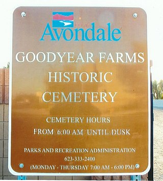
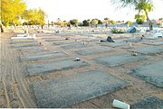
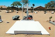
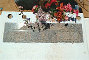
The Goodyear Farms Historic Cemetery is the official name given to a historic cemetery located at 3900 N Santa Fe Trail in the city of Avondale, Arizona. In the past the cemetery was known as the "Pioneer Cemetery" and also as the "Litchfield Cemetery". It is the final resting place of many Mexican migrants and Native-Americans who worked in the Goodyear Farms and the Wigwam Resort in Litchfield Park. The majority of the unmarked graves are of those who perished in the 1918 Spanish Influenza pandemic which spread throughout the entire globe. The Pioneers' Cemetery Association (PCA) defines an "historic cemetery" as one which has been in existence for more than fifty years.


 Different view of the initial point of the Gila and Salt River Meridan .
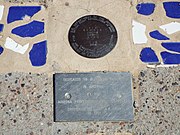 Gila and Salt River Meridan Marker.
 Monument Hill.
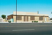 Old Commercial Building.
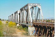 Union Pacific Railroad Bridge.
 Union Pacific Railroad Bridge.