Lopez, Quezon

Last updated
Lopez
Talolong
Municipality of Lopez
Hondagua December Sunset.jpg
Sunset at Hondagua Seaport
Flag of Lopez, Quezon.png
Bayan ng Lopez Opisyal na Sagisag.png
Ph locator quezon lopez.png
Map of Quezon with Lopez highlighted
OpenStreetMap
Lopez, Quezon
Philippines location map (square).svg
Red pog.svg
Lopez
Location within the Philippines
Coordinates: 13°53′02″N122°15′37″E / 13.884°N 122.2604°E / 13.884; 122.2604
Country Philippines
Region Calabarzon
Province Quezon
District 4th district
Founded April 30, 1856 [1]
Named for Candido López y Diaz
Barangays 95 (see Barangays)
Government
[2]
  Type Sangguniang Bayan
   Mayor Rachel A. Ubana
   Vice Mayor Maria Adeline A. Lee
   Representative Keith Micah DL. Tan
   Municipal Council
Members
   Electorate 60,990 voters (2022)
Area
[3]
  Total355.38 km2 (137.21 sq mi)
Elevation
43 m (141 ft)
Highest elevation
257 m (843 ft)
Lowest elevation
0 m (0 ft)
Population
 (2020 census) [4]
  Total94,657
  Density270/km2 (690/sq mi)
   Households
23,432
Demonym(s) Lopenze, Lopezeño
Economy
   Income class 1st municipal income class
   Poverty incidence
9.08
% (2018) [5]
   Revenue 317.6 million (2020)
   Assets 862.9 million (2020)
   Expenditure 266.9 million (2020)
   Liabilities 254.7 million (2020)
Service provider
  ElectricityQuezon 1 Electric Cooperative (QUEZELCO 1)
Time zone UTC+8 (PST)
ZIP code
4316
PSGC
IDD : area code +63(0)42
Native languages Tagalog
Website www.lopezquezon.gov.ph

Lopez, officially the Municipality of Lopez (Tagalog : Bayan ng Lopez), is a 1st class municipality in the province of Quezon, Philippines. According to the 2020 census, it has a population of 94,657 people. [4]

Contents

It is located in the southern part of the province, 216 kilometers (134 mi) from Manila, 86 kilometers (53 mi) east from Lucena, and 3 nautical kilometers to Alabat Island.

History

Aerial view of Lopez, circa 1930s Philippine Island - Luzon Island - NARA - 68156865.jpg
Aerial view of Lopez, circa 1930s

There was a flourishing coastal settlement somewhere in the southern part of the municipality of Gumaca called Talolong. The settlement's name was derived from the name of the river that traverses the place.

The original location of the settlement was in the marshy mouth of a sedate river, which was founded by the descendants of Datu Dumangsil and Datu Balinsusa of the Kalilayan kingdom. Due to the frequent plundering and terrorism of the pirates, the colony was transferred to the present town's location.

The settlement of Lakan Bugtali who founded the community of Gumaca was gone. Even a trace of its remains cannot be identified neither the vintages of the encomienda of Kalilayan nor a fraction of its 16th century glories. When it became a sitio through a papal bull, the village started to manage by her own.

In 1756, some people from the town of Mayoboc (present-day Pitogo) sought refuge in the sitio as they fled the Moro raid that burned the town to the ground. After sometime, some of them become discontented with the affairs of governing the sitio, went back to the original site of Mayoboc and again formed a settlement on an uphill portion, more suitable to guard against the Moro pirates. It later came to be known as Pitogo.

As the sitio became more organized and seen an increase in population, it formally became a full pledged town, separated from Gumaca, on April 30, 1856, during the Governorship of Alcalde Mayor Don Candido Lopez y Diaz. It later came to be known as the town of Lopez. The first gobernadorcillo was Don Antonio Olivarez.

Geography

Lopez is one of the largest municipalities in the province and has a total land area of 395.1 square kilometers representing 4.53% of the total land area of the province of Quezon.

The terrain generally ranges from 345 to 399 meters (1,132 to 1,309 ft) above sea level with rugged mountain areas. Coastal areas deviate from plain to hilly terrains. Rivers, streams and springs abound throughout the municipality, but the most prominent is the Talolong River.

It is bordered by the municipalities of Catanauan and General Luna on the south, Macalelon on the south-west, Calauag on the north-east, Gumaca on the west, Buenavista and Guinayangan on the east.

Barangays

Lopez is politically subdivided into 95 barangays. Each barangay consists of puroks and some have sitios.

Currently, there are 7 barangays which are classified as urban (highlighted in bold).

  • Bacungan
  • Bagacay
  • Banabahin Ibaba
  • Banabahin Ilaya
  • Bayabas
  • Bebito
  • Bigajo
  • Binahian A
  • Binahian B
  • Binahian C
  • Buenavista
  • Burgos (Poblacion)
  • Buyacanin
  • Cagacag
  • Calantipayan
  • Calumpang
  • Canda Ibaba
  • Canda Ilaya
  • Cawayan
  • Cawayanin
  • Cogorin Ibaba
  • Cogorin Ilaya
  • Concepcion
  • Danlagan (Poblacion)
  • De La Paz
  • Del Rosario
  • Esperanza Ibaba
  • Esperanza Ilaya
  • Gomez (Poblacion)
  • Guihay
  • Guinuangan
  • Guites
  • Hondagua
  • Ilayang Ilog A
  • Ilayang Ilog B
  • Inalusan
  • Jongo
  • Lalaguna
  • Lourdes
  • Mabanban
  • Mabini
  • Magallanes
  • Magsaysay (Poblacion)
  • Maguilayan
  • Mahayod-Hayod
  • Mal-ay
  • Mandoog
  • Manguisian
  • Matinik
  • Monteclaro
  • Pamampangin
  • Pansol
  • Peñafrancia
  • Pisipis
  • Rizal (Poblacion)
  • Rizal (Rural)
  • Roma
  • Rosario
  • Samat
  • San Andres
  • San Antonio
  • San Francisco A
  • San Francisco B
  • San Isidro
  • San Jose
  • San Lorenzo Ruiz (Poblacion)
  • San Miguel (Dao)
  • San Pedro
  • San Rafael
  • San Roque
  • Santa Catalina
  • Santa Elena
  • Santa Jacobe
  • Santa Lucia
  • Santa Maria
  • Santa Rosa
  • Santa Teresa
  • Santo Niño Ibaba
  • Santo Niño Ilaya
  • Silang
  • Sugod
  • Sumalang
  • Talolong (Poblacion)
  • Tan-ag Ibaba
  • Tan-ag Ilaya
  • Tocalin
  • Vegaflor
  • Vergaña
  • Veronica
  • Villa Aurora
  • Villa Espina
  • Villageda
  • Villahermosa
  • Villamonte
  • Villanacaob

Climate

Climate data for Lopez, Quezon
MonthJanFebMarAprMayJunJulAugSepOctNovDecYear
Mean daily maximum °C (°F)26
(79)
27
(81)
29
(84)
33
(91)
31
(88)
30
(86)
29
(84)
29
(84)
29
(84)
29
(84)
28
(82)
27
(81)
29
(84)
Mean daily minimum °C (°F)22
(72)
22
(72)
22
(72)
23
(73)
24
(75)
24
(75)
24
(75)
24
(75)
24
(75)
24
(75)
24
(75)
23
(73)
23
(74)
Average precipitation mm (inches)51
(2.0)
35
(1.4)
37
(1.5)
39
(1.5)
91
(3.6)
131
(5.2)
168
(6.6)
132
(5.2)
162
(6.4)
184
(7.2)
166
(6.5)
101
(4.0)
1,297
(51.1)
Average rainy days13.410.511.812.019.824.126.725.125.323.921.217.6231.4
Source: Meteoblue [6]

Demographics

Population census of Lopez
YearPop.±% p.a.
1903 8,549    
1918 13,327+3.00%
1939 19,948+1.94%
1948 22,935+1.56%
1960 31,558+2.69%
1970 49,021+4.50%
1975 55,849+2.65%
1980 58,422+0.90%
1990 66,037+1.23%
1995 75,344+2.50%
2000 78,694+0.94%
2007 86,660+1.34%
2010 91,074+1.82%
2015 95,167+0.84%
2020 94,657−0.11%
Source: Philippine Statistics Authority [7] [8] [9] [10]

Settlement areas in the municipality are highly scattered; population concentration is noticeable only within the poblacion, that is, the urban barangays of Burgos, Danlagan, Gomez, Magsaysay, Rizal, San Lorenzo Ruiz (Bocboc) and Talolong as well as the rural barangays of Mal-ay, Sugod, Pansol, Calantipayan, Manguisian, Del Pilar, Bebito, Canda Ibaba and Canda Ilaya which are traversed by the national highway. The rest of rural barangays are reached by other road networks which are accessible during dry and wet season. According to the 2007 census, it had a population of 86,660, [11] a quarter of which are in the urban areas and the rest are in the rural areas. Males outnumbered the females at a ratio of 105.34 to 100. The population grew to 95,167 in the 2015 census.

Aldrin Ludovice Salipande (2022) reports that Inagta Lopenze is spoken in Villa Espina and nearby barangays in Lopez. [12]

Religion

  • Roman Catholic
  • Seventh-Day Adventist
  • Jehovah's Witnesses
  • Baptist
  • Latter day saints
  • Church of God
  • Evangelical
  • Word for the World Christian Fellowship
  • Iglesia Ni Cristo

Economy

Pan-Philippine Highway traversing Lopez town proper National Road, Lopez Poblacion (Lopez, Quezon; 04-14-2023).jpg
Pan-Philippine Highway traversing Lopez town proper

Lopez had a labor force of 56.99% in 2000 or 44,849. About 9,474 of the employed labor force were engaged in primary industries such as farming and fishing. Its economy is basically engaged in agriculture, crops, poultry and livestock production. Around 17,778.57 hectares (43,931.8 acres) represent 45% of the total land area planted to coconut trees, 2,300 has. are established to rice production, 628 has. to corn harvest. Growing around are natural materials for handicraft such as wild vines, buri, anahaw, tikiw, bamboo, cogon and talahib. Several cottage industries exist in the locality such as bamboo furniture, bolo, baskets, rattan, anahaw and buri fan making, buntal and tikiw. It also has rich fishing grounds in the Lopez Bay area and a number of inland fishponds. Fish, shrimps, prawns, crabs and other sea products are abundant.

Rice is also a major staple crop, the municipality is also a major banana producer in the region. Other crops grown in the municipality are citrus, root crops, vegetables and industrial crops. Majority of the farmers are also raising livestock and poultry.

Public services

Tourism

Hondagua Bay Hondagua Bay Golden Sunset.jpg
Hondagua Bay

Sports

Lopez Sports Centre is noted for its cockfighting which is held every Sunday. In 2009 it was visited by Charley Boorman as part of By Any Means 2 .

Education

Lopez is dubbed as the educational center of southern Quezon. Several educational institutions operate in the town serving not only its citizens but also those coming from the Bondoc Peninsula and the Bicol Region. Very notable among these are the Polytechnic University of the Philippines - Lopez, Philippine Normal University - South Luzon, Eastern Tayabas College and the Lopez National Comprehensive High School. The Quezon Provincial Training Center of the Technical Education and Skills Development Authority (TESDA) is also located in the town. Lopez is also home to Laguna State Polytechnic University (LSPU) and Technological University of the Philippines (TUP) as the two state universities have started operating in the town starting in June 2012. Furthermore, preparatory, primary and secondary education are no longer a problem since several schools have already opened their doors in the far-flung areas to serve the rural youth as part of town's mission of bringing the schools closer to the people.

Related Research Articles

<span class="mw-page-title-main">Batangas City</span> Capital of Batangas, Philippines

Batangas City, officially the City of Batangas, is a 1st class component city and capital of the province of Batangas, Philippines. According to the 2020 census, it has a population of 351,437 people.

<span class="mw-page-title-main">Padre Burgos, Quezon</span> Municipality in Quezon, Philippines

Padre Burgos, officially the Municipality of Padre Burgos, is a 4th class municipality in the province of Quezon, Philippines. According to the 2020 census, it has a population of 23,488 people.

<span class="mw-page-title-main">Luisiana</span> Municipality in Laguna, Philippines

Luisiana, officially the Municipality of Luisiana, is a 4th class municipality in the province of Laguna, Philippines. According to the 2020 census, it has a population of 20,859 people.

<span class="mw-page-title-main">Paete</span> Municipality in Laguna, Philippines

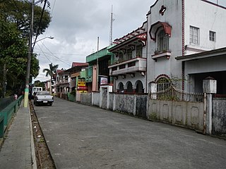
Paete, officially the Municipality of Paete, is a 4th class municipality in the province of Laguna, Philippines. According to the 2020 census, it has a population of 24,945 people.

<span class="mw-page-title-main">Gumaca</span> Municipality in Quezon, Philippines

Gumaca, officially the Municipality of Gumaca, is a 1st class municipality in the province of Quezon, Philippines. According to the 2020 census, it has a population of 71,942 people.

<span class="mw-page-title-main">Santa Elena, Camarines Norte</span> Municipality in Camarines Norte, Philippines

Santa Elena, officially the Municipality of Santa Elena, is a 3rd class municipality in the province of Camarines Norte, Philippines. According to the 2020 census, it has a population of 43,582 people.

<span class="mw-page-title-main">Agdangan</span> Municipality in Quezon, Philippines

Agdangan, officially the Municipality of Agdangan, is a 5th class municipality in the province of Quezon, Philippines. According to the 2020 census, it has a population of 12,764 people.

<span class="mw-page-title-main">Buenavista, Quezon</span> Municipality in Quezon, Philippines

Buenavista, officially the Municipality of Buenavista, is a 4th class municipality in the province of Quezon, Philippines. According to the 2020 census, it has a population of 31,160 people.

<span class="mw-page-title-main">Calauag</span> Municipality in Quezon, Philippines

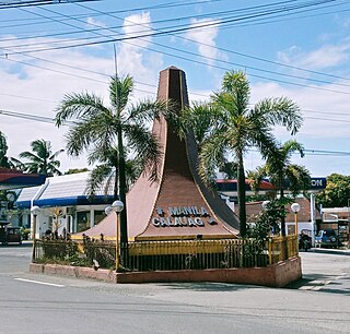
Calauag, officially the Municipality of Calauag, is a 1st class municipality in the province of Quezon, Philippines. According to the 2020 census, it has a population of 71,809 people.

<span class="mw-page-title-main">Dolores, Quezon</span> Municipality in Quezon, Philippines

Dolores, officially the Municipality of Dolores, is a 4th class municipality in the province of Quezon, Philippines. According to the 2020 census, it has a population of 32,514 people.

<span class="mw-page-title-main">Catanauan</span> Municipality in Quezon, Philippines

Catanauan, officially the Municipality of Catanauan, is a 1st class municipality in the province of Quezon, Philippines. According to the 2020 census, it has a population of 72,752 people.

<span class="mw-page-title-main">General Luna, Quezon</span> Municipality in Quezon, Philippines

General Luna, officially the Municipality of General Luna, is a 4th class municipality in the province of Quezon, Philippines. According to the 2020 census, it has a population of 24,804 people.

<span class="mw-page-title-main">Macalelon</span> Municipality in Quezon, Philippines

Macalelon, officially the Municipality of Macalelon, is a 4th class municipality in the province of Quezon, Philippines. According to the 2020 census, it has a population of 27,312 people.

<span class="mw-page-title-main">Pitogo, Quezon</span> Municipality in Quezon, Philippines

Pitogo, officially the Municipality of Pitogo, is a 4th class municipality in the province of Quezon, Philippines. According to the 2020 census, it has a population of 22,798 people.

<span class="mw-page-title-main">Plaridel, Quezon</span> Municipality in Quezon, Philippines

Plaridel, officially the Municipality of Plaridel, is a 5th class municipality in the province of Quezon, Philippines. According to the 2020 census, it has a population of 10,129 people.

<span class="mw-page-title-main">Quezon, Quezon</span> Municipality in Quezon, Philippines

Quezon, officially the Municipality of Quezon, is a 5th class municipality in the province of the same name. According to the 2020 census, it has a population of 15,886 people.

<span class="mw-page-title-main">San Andres, Quezon</span> Municipality in Quezon, Philippines

San Andres, officially the Municipality of San Andres, is a 4th class municipality in the province of Quezon, Philippines. According to the 2020 census, it has a population of 37,454 people.

<span class="mw-page-title-main">Tagkawayan</span> Municipality in Quezon, Philippines

Tagkawayan, officially the Municipality of Tagkawayan, is a 1st class municipality in the province of Quezon, Philippines. According to the 2020 census, it has a population of 54,003 people.

<span class="mw-page-title-main">Unisan, Quezon</span> Municipality in Quezon, Philippines

Unisan, officially the Municipality of Unisan, is a 4th class municipality in the province of Quezon, Philippines. According to the 2020 census, it has a population of 25,448 people.

<span class="mw-page-title-main">Atimonan</span> Municipality in Quezon, Philippines

Atimonan, officially the Municipality of Atimonan, is a 1st class municipality in the province of Quezon, Philippines. According to the 2020 census, it has a population of 64,260 people.

References

  1. "Wowquezon.com".
  2. Municipality of Lopez | (DILG)
  3. "2015 Census of Population, Report No. 3 – Population, Land Area, and Population Density" (PDF). Philippine Statistics Authority. Quezon City, Philippines. August 2016. ISSN   0117-1453. Archived (PDF) from the original on May 25, 2021. Retrieved July 16, 2021.
  4. 1 2 Census of Population (2020). "Region IV-A (Calabarzon)". Total Population by Province, City, Municipality and Barangay. Philippine Statistics Authority . Retrieved 8 July 2021.
  5. "PSA Releases the 2018 Municipal and City Level Poverty Estimates". Philippine Statistics Authority. 15 December 2021. Retrieved 22 January 2022.
  6. "Lopez: Average Temperatures and Rainfall". Meteoblue. Retrieved 27 January 2020.
  7. Census of Population (2015). "Region IV-A (Calabarzon)". Total Population by Province, City, Municipality and Barangay. Philippine Statistics Authority . Retrieved 20 June 2016.
  8. Census of Population and Housing (2010). "Region IV-A (Calabarzon)" (PDF). Total Population by Province, City, Municipality and Barangay. National Statistics Office . Retrieved 29 June 2016.
  9. Censuses of Population (1903–2007). "Region IV-A (Calabarzon)". Table 1. Population Enumerated in Various Censuses by Province/Highly Urbanized City: 1903 to 2007. National Statistics Office.{{cite encyclopedia}}: CS1 maint: numeric names: authors list (link)
  10. "Province of Quezon". Municipality Population Data. Local Water Utilities Administration Research Division. Retrieved 17 December 2016.
  11. "2007 Census of Population". Philippine Statistics Authority. Archived from the original on 2008-11-20. Retrieved 2008-10-04.
  12. Salipande, Aldrin Ludovice. 2022. Phonology of Agta Lopenze . Presentation given at the 31st Annual Meeting of the Southeast Asian Linguistics Society (SEALS 31), University of Hawaiʻi at Mānoa, May 18–20, 2022.
  13. "Poverty incidence (PI):". Philippine Statistics Authority. Retrieved December 28, 2020.
  14. "Estimation of Local Poverty in the Philippines" (PDF). Philippine Statistics Authority. 29 November 2005.
  15. "2003 City and Municipal Level Poverty Estimates" (PDF). Philippine Statistics Authority. 23 March 2009.
  16. "City and Municipal Level Poverty Estimates; 2006 and 2009" (PDF). Philippine Statistics Authority. 3 August 2012.
  17. "2012 Municipal and City Level Poverty Estimates" (PDF). Philippine Statistics Authority. 31 May 2016.
  18. "Municipal and City Level Small Area Poverty Estimates; 2009, 2012 and 2015". Philippine Statistics Authority. 10 July 2019.
  19. "PSA Releases the 2018 Municipal and City Level Poverty Estimates". Philippine Statistics Authority. 15 December 2021. Retrieved 22 January 2022.