Unisan, Quezon

Last updated
Unisan
Kalilayan
Municipality of Unisan
Burgos Street in Brgy.R.magsaysay, Unisan - panoramio.jpg
Barangay R. Magsaysay
Flag of Unisan, Quezon.png
Nickname: 
Old Capital of Kalilayan Province
Ph locator quezon unisan.png
Map of Quezon with Unisan highlighted
OpenStreetMap
Unisan, Quezon
Philippines location map (square).svg
Red pog.svg
Unisan
Location within the Philippines
Coordinates: 13°50′29″N121°58′31″E / 13.84132°N 121.97522°E / 13.84132; 121.97522
Country Philippines
Region Calabarzon
Province Quezon
District 3rd district
Founded 1521 or 1578
ReestablishedFebruary 18, 1876
Founded byMalay settlers (1521)
Juan de Plasencia and Diego de Oropesa (1578)
Barangays 36 (see Barangays)
Government
[1]
  Type Sangguniang Bayan
   Mayor Ferdinand P. Adulta
   Vice Mayor Meynardo D. Lat
   Representative Reynante U. Arrogancia
   Municipal Council
Members
   Electorate 18,147 voters (2022)
Area
[2]
  Total124.15 km2 (47.93 sq mi)
Elevation
21 m (69 ft)
Highest elevation
172 m (564 ft)
Lowest elevation
0 m (0 ft)
Population
 (2020 census) [3]
  Total25,448
  Density200/km2 (530/sq mi)
   Households
6,697
Demonym Unisanin
Economy
   Income class 4th municipal income class
   Poverty incidence
14.64
% (2018) [4]
   Revenue 119.2 million (2020)
   Assets 310.1 million (2020)
   Expenditure 110.4 million (2020)
   Liabilities 59.46 million (2020)
Service provider
  ElectricityQuezon 1 Electric Cooperative (QUEZELCO 1)
Time zone UTC+8 (PST)
ZIP code
4305
PSGC
IDD : area code +63(0)42
Native languages Tagalog

Unisan, officially the Municipality of Unisan (Tagalog : Bayan ng Unisan), is a 4th class municipality in the province of Quezon, Philippines. According to the 2020 census, it has a population of 25,448 people. [3]

Contents

Etymology

The name of Unisan may have been derived from the Spanish verb unir, meaning "unite". At that time inhabitants, which were composed of strangers from different parts of the island, were united and wanted to call the town Unisan, a corruption of the words union and unidos for the sake of euphony. [5]

There is another, more plausible version which related that the name was derived from the Latin words uni-sancti, meaning "one saint" or "in honor of a saint", possibly referring to Friar Pedro Bautista, once a missionary to Unisan when this town was still Kalilayan and later canonized saint following his martyrdom while a missionary in Japan. [5] Uni-Sancti was made Unisan for short and to suit the Visayan and Caviteño tongues.

History

Unisan, originally called Kalilayan, is perhaps one of the oldest towns in the Philippines. As early as 1521, the town of Kalilayan was founded by Malayan settlers. All other towns in the country were established not earlier than 1565, when Spain formally occupied the Philippines as a colony. During the latter part of the 19th century, traditions said that the real founder of the town was a Malayan queen called of Ladya. Hence her title was "Queen of Kalilayan".[ citation needed ]

It is believed that the founding occurred in the Middle Ages when immigration of the Malayans to this country was still predominant. That was before the advent of Islam in the East Indies. This proven by the fact that no traces of Mohamed's Creed were found in that part of the Philippines when the Europeans arrived.

The name Kalilayan derived from the Tagalog root word lilay, referring to a kind of palm similar to buri with the smaller leaves in the size of anahaw leaves that grew once in abundance.

The town was designated as the first capital of the province of Kalilayan from the province's creation in 1591 to 1749, when the capital was transferred to the town of Tayabas. [6] [7] In February 1876, the town was separated from Pitogo and became an independent municipality. At the same time, it was renamed to Unisan which was derived from the Latin word uni-sancti, meaning "holy saint". [5]

Geography

The municipality of Unisan is located on the central part of Quezon Province. It is bounded on the northern part by Atimonan, Quezon, on the south by the Tayabas Bay, on the western part by Agdangan and on the east by Gumaca and Pitogo. East of provincial Capital, the city of Lucena. It is accessible by land via Agdangan and Atimonan from Lucena City.

Barangays

Unisan is politically subdivided into 36 barangays. Each barangay consists of puroks and some have sitios.

San Roque was formerly a sitio of barrio Tagumpay. [8]

  • Almacén
  • Balagtás
  • Balanacan
  • Bonifacio
  • Bulo Ibabâ
  • Bulo Ilaya
  • Burgos
  • Cabulihan Ibabâ
  • Cabulihan Ilaya
  • Caigdál
  • F. De Jesús (Poblacion)
  • General Luna
  • Kalilayan Ibabâ
  • Kalilayan Ilaya
  • Mabini
  • Mairok Ibaba
  • Mairok Ilayang
  • Malvar
  • Maputat
  • Muliguin
  • Pagaguasan
  • Panaon Ibabâ
  • Panaon Ilaya
  • Pláridel
  • Poctol
  • Punta
  • R. Lapu-lapu (Poblacion)
  • R. Magsaysay (Poblacion)
  • Raja Solimán (Poblacion)
  • Rizal Ibabâ
  • Rizal Ilaya
  • San Roque
  • Socorro
  • Tagumpay
  • Tubas
  • Tubigan

Town proper

The town center (poblacion) consists of 4 barangays, R. Soliman, Ramon Magsaysay, Lapu-lapu and F. de Jesus. The heart of the town is the Catholic Church, comprising several blocks. The Unisan Central Elementary School is on the southeastern side of the church, while the Government Center is located at the back of the school which consists of Municipal Hall, Municipal Library, Fire Station, Police Station, Comelec Building and the Association of Barangay Captains (ABC) building. Remedios Etorma Suarez Memorial Auditorium (RESMA), a well used spot for programs and events is on the same government center, while just across the auditorium is the Unisan National High School. The Tamesis Park, named after a prominent Unisanin, Florencio Tamesis, the first Filipino director of the Bureau of Forestry and considered by experts as the father of Philippine Forestry, is likewise located at the center of the town, just across the Church Basketball Court. The old municipal building, now a proud heritage building of Unisan, is on the southwest corner of the poblacion, near the Kalilayan River.

Climate

Climate data for Unisan, Quezon
MonthJanFebMarAprMayJunJulAugSepOctNovDecYear
Average high °C (°F)26
(79)
27
(81)
29
(84)
31
(88)
31
(88)
30
(86)
29
(84)
29
(84)
29
(84)
29
(84)
28
(82)
26
(79)
29
(84)
Average low °C (°F)22
(72)
22
(72)
22
(72)
23
(73)
24
(75)
24
(75)
24
(75)
24
(75)
24
(75)
24
(75)
23
(73)
23
(73)
23
(74)
Average precipitation mm (inches)83
(3.3)
55
(2.2)
44
(1.7)
37
(1.5)
90
(3.5)
123
(4.8)
145
(5.7)
125
(4.9)
135
(5.3)
166
(6.5)
163
(6.4)
152
(6.0)
1,318
(51.8)
Average rainy days15.110.811.911.419.923.726.323.923.922.120.218.6227.8
Source: Meteoblue [9]

Demographics

Population census of Unisan
YearPop.±% p.a.
1903 2,692    
1918 5,431+4.79%
1939 11,464+3.62%
1948 9,290−2.31%
1960 12,285+2.36%
1970 15,550+2.38%
1975 17,318+2.18%
1980 18,230+1.03%
1990 19,851+0.86%
1995 21,509+1.51%
2000 21,252−0.26%
2007 23,911+1.64%
2010 25,186+1.91%
2015 26,884+1.25%
2020 25,448−1.07%
Source: Philippine Statistics Authority [10] [11] [12] [13]

Religion

The dominant religion in Unisan is Roman Catholic. Other religions present are:

Saint Peter the Apostle Parish

The foundation of Calilayan, the capital of the old province of Calilayan, by Friars Juan de Plasencia and Diego de Oropesa started in 1578. The first church was made of bamboo and nipa. In 1589, Friar Pedro Bautista obtained the permission to rebuild it with wood. Friar Alonso Bañon administered Calilayan after 1595. Friar Jode de la Concepcion was Guardian of the convent in 1597. Friar Pedro de Alcazar administered the pueblo in 1600 and 1601. Friar Juan Manso was the religious minister in 1602. Friar Diego de la Magdalena, a member of the 6th Mission that arrived in the Philippines in 1594, also administered Calilayan. In 1605, Calilayan was ravaged by the Moros. Of the 9,000 residents, barely 1,000 survived the attack. The survivors took refuge near the Palsabangon River, where the missionaries, among whom was Friar Pedro de san Buenaventura, built a church, a convent and school buildings with bamboo and nipa. Friar Juan de Mérida administered Palsabangon in 1609. In 1913, because of the crocodiles, the people relocated to the sitio of Cabuyao, where Friar de Mérida built a church and a convent with wood and school buildings with bamboo and nipa. The people lived peacefully in Cabuyao until 1635, when the Moro attacked again. Some 800 survivors took refuge in the sitios of Atimonan and Minanucan (now barrion Talaba in Atimonan). Hence, for many years the town of Calilayan was totally abandoned. From 1620 onwards, a certain Gregorio Vicente united various families from Cabuyao with wandering descendants of those who had lived in Calilayan and Palsabangon, and he and all these people fixed there residence in the site of old Calilayan---the delta east of the Calilayan River---without recognizing any civil or religious authority. They lived there until 1637 when the Government saw the need to burn the town. Finally in 1874 or 1875, the town was established in the outskirts of the old Calilayan. During its early years, Unisan was administered by Fr. Marcos Tolentino, a secular priest, who In 1945, during the World War II, the church was partially destroyed; it was reconstructed by the Philippine Historical Commission in 1966.

Saint Roche Parish (Barangay Panaon)

Established in 1962 by Father Ruben Profugo (later Bishop of the Diocese of Lucena), the Parokya ni San Roque was formerly a small church attached to the Parish of St. Peter in the town proper and served by the priest/chaplains of the Holy Child Jesus Institute (Dominican Academy). The parish comprises the barangays of Ibabang Bulo, Ilayang Bulo, Ibabang Mairok, Ilayang Mairok, Almacen, Bonifacio, Burgos, Ilayang Panaon, Ibabang Panaon, Tubigan, Plaridel, Ibabang Rizal, Ilayang Rizal, Socorro and Poctol. Most of the people are farmers. The church itself stands in the midst of rice fields. The priests who served Panaon either as parish priest or administrator include Fr. Antonio Salvo, Fr. Froilan Zalameda, Fr. Jose Dural, Fr. Dario Endiape, Fr. Quirino Macatangay, Fr. Jose Erlito Ebron, Fr. Alvin Cabungcal, Fr. Edwin Panergo,Fr. Isagani Reyes, Fr. Rolando Grecia, Fr. Benjamin Rhoda, Fr. Dennis Vargas and Fr. Claude Calvendra. Major Renovation of the church was done during the term of Fr. Roda.

Saint Peter the Apostle Parish and Saint Roche Parish are members of Roman Catholic Diocese of Lucena.

Economy

The economy of Unisan is sustained by fishing and agriculture, as well as commercial businesses and resorts.

Government

Mayors

List of former municipal mayors from 1941 onwards:

Appointed OIC:

Prominent Mayors in the pre-war era include, among others: Atty. Francisco Deveza De Jesus (whom Barangay F. De Jesus was named after), Dr. Teodorico V. Valerio, Dionisio V. Valerio, and Eulogio Fernandez

Several Mayors in the same era were surnamed Constantino and Isaac, two prominent names in the municipality

Vice Mayors

Municipal vice mayors: 1968 onwards

Congressional district

Unisan belongs to the Quezon's 3rd district since 1987. The said congressional district also includes Agdangan, Buenavista, Catanauan, General Luna, Macalelon, Mulanay, Padre Burgos, Pitogo, San Andres, San Francisco and San Narciso.

It was previously represented as part of Quezon's 2nd district, Quezon's at-large district, and Region IV-A.

Culture

Events and festivals

During the month of February is the annual celebration of CocoLilay Festival, wherein the coconut tree and the Lilay Tree is the main attraction of the festivities. The festival is highlighted by a street dancing competition participated by the residents of different barangays, as well as by elementary and high school students.

In the later part of 2011, the Dinilawang Manok Festival was held in the town. However, it was replaced again by CocoLilay Festival in the succeeding years to give importance to the town's history.

Tourism

Education

Elementary schools

  • Almacen Elementary School
  • Beredo Elementary School
  • Bienvinido S. Lat Elementary School
  • Bonifacio Elementary School
  • Cabulihan Elementary School
  • Caigdal Elementary School
  • Dominican Academy (Elementary Department)
  • Kalilayan Elementary School
  • Muliguin Elementary School
  • Mabini Elementary School
  • Panaon Elementary School
  • Poctol Elementary School
  • Punta Elementary School
  • Santayana Elementary School
  • San Roque Elementary School
  • Unisan Central Elementary School

Secondary

Tertiary

Notable personalities

Related Research Articles

<span class="mw-page-title-main">Pagbilao</span> Municipality in Quezon, Philippines

Pagbilao, officially the Municipality of Pagbilao, is a 1st class municipality in the province of Quezon, Philippines. According to the 2020 census, it has a population of 78,700 people.

<span class="mw-page-title-main">Padre Burgos, Quezon</span> Municipality in Quezon, Philippines

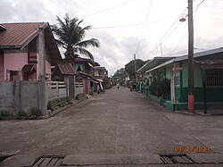
Padre Burgos, officially the Municipality of Padre Burgos, is a 4th class municipality in the province of Quezon, Philippines. According to the 2020 census, it has a population of 23,488 people.

<span class="mw-page-title-main">Liliw</span> Municipality in Laguna, Philippines

Liliw, officially the Municipality of Liliw, is a 4th class municipality in the province of Laguna, Philippines. According to the 2020 census, it has a population of 39,491 people.

<span class="mw-page-title-main">Paete</span> Municipality in Laguna, Philippines

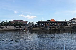
Paete, officially the Municipality of Paete, is a 4th class municipality in the province of Laguna, Philippines. According to the 2020 census, it has a population of 24,945 people.

<span class="mw-page-title-main">Gumaca</span> Municipality in Quezon, Philippines

Gumaca, officially the Municipality of Gumaca, is a 1st class municipality in the province of Quezon, Philippines. According to the 2020 census, it has a population of 71,942 people.

<span class="mw-page-title-main">Santa Elena, Camarines Norte</span> Municipality in Camarines Norte, Philippines

Santa Elena, officially the Municipality of Santa Elena, is a 3rd class municipality in the province of Camarines Norte, Philippines. According to the 2020 census, it has a population of 43,582 people.

<span class="mw-page-title-main">Gasan, Marinduque</span> Municipality in Marinduque, Philippines

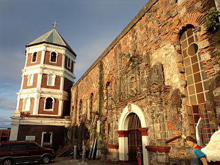
Gasan, officially the Municipality of Gasan, is a 3rd class municipality in the province of Marinduque, Philippines. According to the 2020 census, it has a population of 36,197 people.

<span class="mw-page-title-main">Mogpog</span> Municipality in Marinduque, Philippines

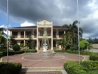
Mogpog, officially the Municipality of Mogpog is a 3rd class municipality in the province of Marinduque, Philippines. According to the 2020 census, it has a population of 34,516 people. The town is at the geographical center of the Philippines, attested by the site of the Luzon Datum of 1911 or Station Balanacan, a stone marker placed at a hill called Mt. Mataas, Barangay Hinanggayon. As the geographical center, it has been the primary geodetic reference station for triangulation in the country.

<span class="mw-page-title-main">Dolores, Eastern Samar</span> Municipality in Eastern Samar, Philippines

Dolores, officially the Municipality of Dolores, is a 3rd class municipality in the province of Eastern Samar, Philippines. According to the 2020 census, it has a population of 44,626 people.

<span class="mw-page-title-main">Agdangan</span> Municipality in Quezon, Philippines

Agdangan, officially the Municipality of Agdangan, is a 5th class municipality in the province of Quezon, Philippines. According to the 2020 census, it has a population of 12,764 people.

<span class="mw-page-title-main">Buenavista, Quezon</span> Municipality in Quezon, Philippines

Buenavista, officially the Municipality of Buenavista, is a 4th class municipality in the province of Quezon, Philippines. According to the 2020 census, it has a population of 31,160 people.

<span class="mw-page-title-main">Calauag</span> Municipality in Quezon, Philippines

Calauag, officially the Municipality of Calauag, is a 1st class municipality in the province of Quezon, Philippines. According to the 2020 census, it has a population of 71,809 people.

<span class="mw-page-title-main">Catanauan</span> Municipality in Quezon, Philippines

Catanauan, officially the Municipality of Catanauan, is a 1st class municipality in the province of Quezon, Philippines. According to the 2020 census, it has a population of 72,752 people.

<span class="mw-page-title-main">General Luna, Quezon</span> Municipality in Quezon, Philippines

General Luna, officially the Municipality of General Luna, is a 4th class municipality in the province of Quezon, Philippines. According to the 2020 census, it has a population of 24,804 people.

<span class="mw-page-title-main">Lopez, Quezon</span> Municipality in Quezon, Philippines

Lopez, officially the Municipality of Lopez, is a 1st class municipality in the province of Quezon, Philippines. According to the 2020 census, it has a population of 94,657 people.

<span class="mw-page-title-main">Macalelon</span> Municipality in Quezon, Philippines

Macalelon, officially the Municipality of Macalelon, is a 4th class municipality in the province of Quezon, Philippines. According to the 2020 census, it has a population of 27,312 people.

<span class="mw-page-title-main">Pitogo, Quezon</span> Municipality in Quezon, Philippines

Pitogo, officially the Municipality of Pitogo, is a 4th class municipality in the province of Quezon, Philippines. According to the 2020 census, it has a population of 22,798 people.

<span class="mw-page-title-main">Plaridel, Quezon</span> Municipality in Quezon, Philippines

Plaridel, officially the Municipality of Plaridel, is a 5th class municipality in the province of Quezon, Philippines. According to the 2020 census, it has a population of 10,129 people.

<span class="mw-page-title-main">Sampaloc, Quezon</span> Municipality in Quezon, Philippines

Sampaloc, officially the Municipality of Sampaloc, is a 5th class municipality in the province of Quezon, Philippines. According to the 2020 census, it has a population of 13,629 people.

<span class="mw-page-title-main">Atimonan</span> Municipality in Quezon, Philippines

Atimonan, officially the Municipality of Atimonan, is a 1st class municipality in the province of Quezon, Philippines. According to the 2020 census, it has a population of 64,260 people.

References

  1. Municipality of Unisan | (DILG)
  2. "2015 Census of Population, Report No. 3 – Population, Land Area, and Population Density" (PDF). Philippine Statistics Authority. Quezon City, Philippines. August 2016. ISSN   0117-1453. Archived (PDF) from the original on May 25, 2021. Retrieved July 16, 2021.
  3. 1 2 Census of Population (2020). "Region IV-A (Calabarzon)". Total Population by Province, City, Municipality and Barangay. Philippine Statistics Authority . Retrieved 8 July 2021.
  4. "PSA Releases the 2018 Municipal and City Level Poverty Estimates". Philippine Statistics Authority. 15 December 2021. Retrieved 22 January 2022.
  5. 1 2 3 "Municipality of Unisan". Quezon Province. Retrieved 2012-10-10.
  6. "History". www.quezon.gov.ph. Retrieved July 21, 2021.
  7. "Aurora, Philippines – History". www.aurora.ph. Archived from the original on February 8, 2017. Retrieved February 7, 2017.
  8. Republic Act No. 1283 (14 June 1955). An Act Creating the Barrio of San Roque in the Municipality of Unisan, Province of Quezon . Retrieved June 19, 2023.
  9. "Unisan: Average Temperatures and Rainfall". Meteoblue. Retrieved 27 January 2020.
  10. Census of Population (2015). "Region IV-A (Calabarzon)". Total Population by Province, City, Municipality and Barangay. Philippine Statistics Authority . Retrieved 20 June 2016.
  11. Census of Population and Housing (2010). "Region IV-A (Calabarzon)". Total Population by Province, City, Municipality and Barangay. National Statistics Office . Retrieved 29 June 2016.
  12. Censuses of Population (1903–2007). "Region IV-A (Calabarzon)". Table 1. Population Enumerated in Various Censuses by Province/Highly Urbanized City: 1903 to 2007. National Statistics Office.
  13. "Province of Quezon". Municipality Population Data. Local Water Utilities Administration Research Division. Retrieved 17 December 2016.
  14. "Poverty incidence (PI):". Philippine Statistics Authority. Retrieved December 28, 2020.
  15. "Estimation of Local Poverty in the Philippines" (PDF). Philippine Statistics Authority. 29 November 2005.
  16. "2003 City and Municipal Level Poverty Estimates" (PDF). Philippine Statistics Authority. 23 March 2009.
  17. "City and Municipal Level Poverty Estimates; 2006 and 2009" (PDF). Philippine Statistics Authority. 3 August 2012.
  18. "2012 Municipal and City Level Poverty Estimates" (PDF). Philippine Statistics Authority. 31 May 2016.
  19. "Municipal and City Level Small Area Poverty Estimates; 2009, 2012 and 2015". Philippine Statistics Authority. 10 July 2019.
  20. "PSA Releases the 2018 Municipal and City Level Poverty Estimates". Philippine Statistics Authority. 15 December 2021. Retrieved 22 January 2022.
First Capital of Kalilayan
1591–1749
Succeeded byas Capital of Tayabas