Related Research Articles
Wyandot County is a county located in the northwestern part of the U.S. state of Ohio. As of the 2020 census, the population was 21,900. Its county seat is Upper Sandusky. It was named for the Wyandot Indians, who lived here before and after European encounter. Their autonym is variously translated from their language as "around the plains" and "dwellers on the peninsula".
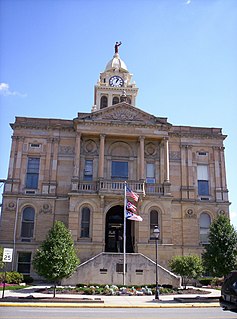
Marion County is a county located in the U.S. state of Ohio. As of the 2020 census, the population was 65,359. Its county seat is Marion. The county was created in 1820 and later organized in 1824. It is named for General Francis "The Swamp Fox" Marion, a South Carolinian officer in the Revolutionary War.

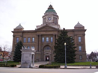
Crawford County is a county located in the north central portion of the U.S. state of Ohio. As of the 2020 census, the population was 42,025. Its county seat is Bucyrus. The county was created in 1820 and later organized in 1836. It was named for Colonel William Crawford, a soldier during the American Revolution.
The Little Scioto River is a tributary of the Scioto River, 27.2 miles (43.8 km) long, in central Ohio in the United States. Via the Scioto and Ohio Rivers, it is part of the watershed of the Mississippi River, draining an area of 111 square miles (290 km2).

Chatfield Township is one of the sixteen townships of Crawford County, Ohio, United States. As of the 2010 census there were 724 people living in the township, 535 of whom were in the unincorporated portions.
Lykens Township is one of the sixteen townships of Crawford County, Ohio, United States. As of the 2010 census the population was 660.

Texas Township is one of the sixteen townships of Crawford County, Ohio, United States. As of the 2010 census the population was 384.

Tod Township is one of the sixteen townships of Crawford County, Ohio, United States. As of the 2010 census the population was 677.
Holmes Township is one of the sixteen townships of Crawford County, Ohio, United States. As of the 2010 census the population was 1,339.

Brokensword is an unincorporated community on the border between the Holmes and Lykens townships of Crawford County, Ohio, United States. Located at the intersection of the concurrent State Routes 19 and 100 with Brokensword Road, it is six miles north and two miles west of the city of Bucyrus, the county seat. Broken Sword Creek flows a short distance to the south of the community.
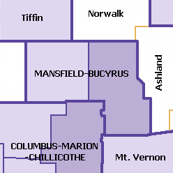
The Mansfield–Bucyrus, OH Combined Statistical Area is a CSA in the U.S. state of Ohio, as defined by the United States Census Bureau. It consists of the Mansfield Metropolitan Statistical Area ; and the Bucyrus Micropolitan Statistical Area. As of the 2000 Census, the Combined Statistical Area had a population of 175,818, but according to a US Census 2009 estimate, the CSA has a population of 167,893 residents.
Glendale is an unincorporated community in Humboldt County, California. It is located on the Mad River 4 miles (6 km) east-northeast of Arcata, at an elevation of 92 feet.
Monnett is an unincorporated community in Dallas Township, Crawford County, Ohio, United States. The zipcode assigned to Monnett by the United States Postal Service is 43302, a Marion county zipcode, although Monnett is located inside Crawford County.The population of Monnett as of 2017 is roughly between 40-45 residents.
Crawford is an unincorporated community in Wyandot County, in the U.S. state of Ohio.
Big Island is an unincorporated community in Marion County, in the U.S. state of Ohio.
Tobias is an unincorporated community in Scott Township, Marion County, Ohio, United States. It is located northeast of Marion at the intersection of Tobias Road and Morral-Kirkpatrick Road, at 40°41′18″N83°03′59″W.
Bellaire Gardens is an unincorporated community in Marion Township, Marion County, Ohio, United States. It is located north of Marion along Ohio State Route 4 at the northern end of the State Route 4/State Route 423 overlap, at 40°37′13″N83°07′56″W.
Brush Ridge is an unincorporated community in Grand Prairie Township, Marion County, Ohio, United States.
Centerville is an unincorporated community in Prospect Township, Marion County, Ohio, United States. It is located about 10 miles (16 km) southwest of Marion at the intersection of Centerville-Green Camp Road and Centerville-Newmans Road, at 40°29′41″N83°14′36″W.
Espyville is an unincorporated community in Big Island Township, Marion County, Ohio, United States. It is located between New Bloomington and Marion on Espyville Road north of its intersection with Ohio State Route 95, at 40°35′49″N83°15′19″W.
References
- ↑ U.S. Geological Survey Geographic Names Information System: Lykens
- ↑ History of Crawford County and Ohio. Baskin & Battey. 1881. pp. 703.
- ↑ "Native of Crawford County Retires After Distinguished Army Career". The Marion Star . Marion, OH. May 3, 1940. p. 1 – via Newspapers.com.
Municipalities and communities of Crawford County, Ohio, United States | ||
|---|---|---|
| Cities |  | |
| Villages | ||
| Townships | ||
| CDPs | ||
| Unincorporated communities | ||
| Footnotes | ‡This populated place also has portions in an adjacent county or counties | |
Coordinates: 40°57′54″N83°01′01″W / 40.96500°N 83.01694°W
| | This Crawford County, Ohio state location article is a stub. You can help Wikipedia by expanding it. |