Mananjary is the name of:

The Catholic Church in Madagascar is part of the worldwide Catholic Church, under the spiritual leadership of the Pope in Rome.

Farafangana is a city on the south-east coast of Madagascar and capital of the Atsimo-Atsinanana region.
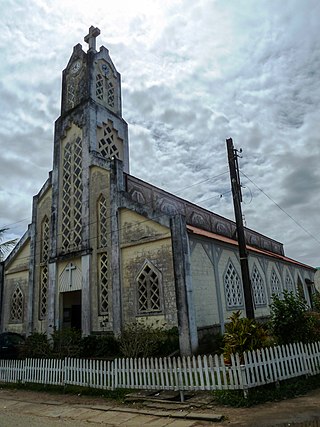
The Diocese of Mananjary is a Roman Catholic Diocese under the Archdiocese of Fianarantsoa in Madagascar. It is based in the town of Mananjary and was erected on 9 April 1968. It performs the Latin Rite. The Diocese covers approximately 14,270 km. As of 2004, the diocese population was about 700,000, with 14.8% Catholic. 35 priests were in the Diocese for a ratio of 2,962 Catholics for every 1 Priest. José Alfredo Caires de Nobrega, SCI has been the bishop of the Diocese since October 2000.
Mananjary Airport is an airport in Mananjary, Vatovavy-Fitovinany Region, Madagascar, located on the east coast on the island.
Tsaravary is a rural municipality in Madagascar. It belongs to the district of Mananjary, which is a part of Vatovavy. The population of the commune was estimated to be approximately 27,000 in 2001 commune census.
Tsiatosika is a rural municipality in Madagascar. It belongs to the district of Mananjary, which is a part of Vatovavy. The population of the commune was estimated to be approximately 24,000 in 2001 commune census.
Gérard Aristote Zaonarivelo is a Malagasy politician. A member of the National Assembly of Madagascar, he was elected as a member of the Tiako I Madagasikara party; he represents the constituency of Mananjary.
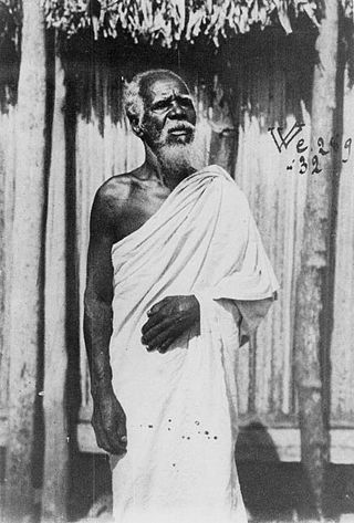
The Antambahoaka are the least numerous ethnic group in Madagascar, numbering around 50,000 in 2013. They inhabit a small region along the southeastern coast of Madagascar near Mananjary and share their origins with the partially Arab Antaimoro people, from whom the group split in the 15th century under a leader named Ravalarivo. Very little is known about the history of this group after its founding. The Antambahoaka speak a dialect of the Malagasy language, which is a branch of the Malayo-Polynesian language group derived from the Barito languages, spoken in southern Borneo.

Severe Tropical Storm Hubert was a destructive tropical cyclone that killed 85 people throughout Madagascar early March 2010. Forming out of a slow-moving area of low pressure on March 9, Hubert quickly developed within a region favoring tropical development. As the storm was situated off the coast of Madagascar on March 10, it would attain peak winds of 100 km/h (65 mph) hours before making landfall near Mananjary in Fianarantsoa Province. Rapid weakening took place once inland, with the storm losing gale-force winds late on March 11. The remnants of Hubert would persist for several days, eventually dissipating off the southern coast of Madagascar on March 15.

Mahanoro is a rural municipality located in the Atsinanana region of eastern Madagascar, along the coast.
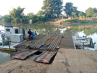
Irondro is a village in the region of Vatovavy in Madagascar. It belongs to the municipality of Antsenavolo and the district of Mananjary/ It is situated at the crossroad of the Route nationale 25 between Ranomafana, Ifanadiana and Mananjary and is the startpoint of the Route nationale 12 to Manakara (118km) and Farafangana.

Tropical Cyclone Alibera was the third longest-lasting tropical cyclone on record in the south-west Indian Ocean, with a duration of 22 days. It formed on December 16, 1989, well to the northeast of Madagascar. For several days, it meandered southwestward while gradually intensifying. On December 20, Alibera intensified to tropical cyclone status with 10‑minute maximum sustained winds of 120 km/h (75 mph), or the equivalent of a minimal hurricane. That day, the Météo-France office in Réunion (MFR) estimated 10‑minute winds of 140 km/h (87 mph), while the Joint Typhoon Warning Center (JTWC), an unofficial warning agency for the region, estimated peak 1‑minute winds of 250 km/h (160 mph). After drifting erratically for several days, the storm began a steady southwest motion on December 29 as a greatly weakened system. On January 1, Alibera struck southeastern Madagascar near Mananjary, having re-intensified to just below tropical cyclone status. It weakened over land but again restrengthened upon reaching open waters on January 3. The storm turned to the southeast, then to the southwest, and finally back to the southeast, dissipating on January 5.
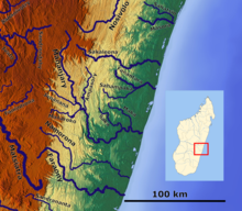
Mananjary is a district of Vatovavy in Madagascar. Its capital is the city of Mananjary.

Route nationale 25 is a primary highway in Madagascar of 161 km, running from Mananjary, Fianarantsoa to RN7. It crosses the regions of Vatovavy and Haute Matsiatra. It is only partly paved and often in bad condition.
Route nationale 11 is a secondary highway in Madagascar of 204 km, running from Mahanoro to Mananjary. It crosses the regions of Atsinanana and Vatovavy.

Vatovavy is a region of Madagascar. Its capital is Mananjary. It was created by dividing the former region of Vatovavy-Fitovinany on 16 June 2021.
Mananjary is a city on the East coast of Madagascar with a population of 25,222 inhabitants in 2018. It is the chief town of the Mananjary district and the Vatovavy region.