Masantol

Last updated
Masantol
San Miguel de Masantol
Municipality of Masantol
MasantolPampangajfa.JPG
Downtown area
09579jfRiverside Maps Masantol Hall Dalayap Roads Pampanga River Districts Villagesfvf 04.JPG
Masantol Pampanga.png
Etymology: Santol
Motto: 
Kayabe Kabang Bie
Ph locator pampanga masantol.png
Map of Pampanga with Masantol highlighted
OpenStreetMap
Masantol
Philippines location map (square).svg
Red pog.svg
Masantol
Location within the Philippines
Coordinates: 14°54′N120°43′E / 14.9°N 120.72°E / 14.9; 120.72
Country Philippines
Region Central Luzon
Province Pampanga
District 4th district
Founded 1878
Reinstated1907
Barangays 26 (see Barangays)
Government
[1]
  Type Sangguniang Bayan
   Mayor Jose Antonio C. Bustos
   Vice Mayor Danilo S. Guintu
   Representative Anna York P. Bondoc-Sagum
   Municipal Council
Members
   Electorate 40,000 voters (2022)
Area
[2]
  Total48.25 km2 (18.63 sq mi)
Elevation
5.0 m (16.4 ft)
Highest elevation
35 m (115 ft)
Lowest elevation
−5 m (−16 ft)
Population
 (2020 census) [3]
  Total57,990
  Density1,200/km2 (3,100/sq mi)
   Households
13,465
Economy
   Income class 2nd municipal income class
   Poverty incidence
10.24
% (2018) [4]
   Revenue 181.3 million (2020)
   Assets 159.5 million (2020)
   Expenditure 194.2 million (2020)
   Liabilities 46.76 million (2020)
Service provider
  ElectricityPampanga 3 Electric Cooperative (PELCO 3)
Time zone UTC+8 (PST)
ZIP code
2017
PSGC
IDD : area code +63(0)45
Native languages Kapampangan
Tagalog
Website www.masantolpampanga.gov.ph

Masantol, officially the Municipality of Masantol (Kapampangan : Balen ning Masantol; Tagalog : Bayan ng Masantol), is a 2nd class municipality in the province of Pampanga, Philippines. According to the 2020 census, it has a population of 57,990 people. [3]

Contents

Etymology

The municipality is named after the santol trees that used to grow abundantly in the area. [5]

The reason is either because there was a proliferation of santol trees in the area, or because the town was where santol fruits were heavily bartered (Kapampangans being fond of 'sinigang' dish).

A legend of how the town got its name goes like this: 'A Spanish missionary came to the town for the first time. Upon reaching a roadside corner store, he parked his horse-driven vehicle and inquired from the store keeper the name of the place. A middle-aged woman vendor, believing that the Spanish priest was asking for the name of the fruits she was selling, readily responded in broken Spanish language, Padre, todos dulce Masantol. The priest took from his pocket a pencil and a small diary and wrote down the word mas santol, referring to the name of the place he has visited. At the time, the locality abounded with santol trees, and santol fruits were in season when the priest visited the place.

History

San Miguel de Masantol May 1, 1878

Originally named San Miguel de Masantol and a part of the town of Macabebe, three of the town's leading patriarchs - Manuel Fajardo, Gregorio Bautista, and Juan Lacap - filed a motion on June 26, 1877, to separate the barrios of Bebe, Bulacus, Caingin and Nigui from Macabebe thereby creating a new Spanish pueblo called San Miguel. This new pueblo was approved by Spanish Governor General Domingo Moriones y Murillo and was inaugurated on May 1, 1878. On November 30, 1893, the Catholic Parish of San Miguel was formally acknowledged through a Royal Decree. [6] For a while it came to be known San Miguel Masantol, until popular usage reverted it to the original name.

Balen ning Masantol 1907

On July 26, 1904, Masantol once more became part of Macabebe. However, in 1907, Masantol was again reinstated as a separate independent municipality and this lasted up to the present. [6]

The Battle of Bangkusay Channel The Ruler of Macabebe

Tarik Sulayman Bambalino / Bankau or for some Historians the Unnamed ruler of Macabebe was the indigenous leader of Macabebe from the "Masantol area", who refused to ally with the Spaniards and therefore mounted an attack against the Spanish forces of Miguel López de Legazpi during the Battle of Bangkusay Channel on June 3, 1571. The Joint Force of Macabebe, Calumpit, Hagonoy and Maynila "Old Rajahnate of Maynila under Rajah Sulayman III / Rajah Mura/Muda of Manila" were defeated, by the Joint Force of Spanish Armada and Tagalog mercenaries and Tarik Sulayman himself was killed in the Battle, and Consequently, this victory enabled the Spaniards to establish themselves throughout the city "Territory of Kingdom of Tondo" and its neighboring Kingdoms and towns.

Tragedy

On January 7, 2008, one person drowned, another missing and 40 others were injured due to electric shocks, when a live cable hit the floating pagoda boat in the fluvial festival of Virgen La Purisima Concepcion at Barangay Alauli. [7]

Geography

Masantol is almost surrounded by the municipality of Macabebe (For it was once a former part of the town). It is known to be the southernmost town in the province of Pampanga. It is bounded to the north by the municipality of Macabebe; to the east by the municipalities of Calumpit and Hagonoy in Bulacan; to the west by Macabebe; and to the south by some parts of Macabebe and Manila Bay.

Climate

Climate data for Masantol, Pampanga
MonthJanFebMarAprMayJunJulAugSepOctNovDecYear
Mean daily maximum °C (°F)28
(82)
29
(84)
31
(88)
33
(91)
32
(90)
31
(88)
30
(86)
29
(84)
29
(84)
30
(86)
30
(86)
28
(82)
30
(86)
Mean daily minimum °C (°F)20
(68)
20
(68)
21
(70)
23
(73)
24
(75)
24
(75)
24
(75)
24
(75)
24
(75)
23
(73)
22
(72)
21
(70)
23
(72)
Average precipitation mm (inches)6
(0.2)
4
(0.2)
6
(0.2)
17
(0.7)
82
(3.2)
122
(4.8)
151
(5.9)
123
(4.8)
124
(4.9)
99
(3.9)
37
(1.5)
21
(0.8)
792
(31.1)
Average rainy days3.32.53.66.617.722.225.223.723.217.99.25.2160.3
Source: Meteoblue [8]

Barangays

Masantol is politically subdivided into 26 barangays. Each barangay consists of puroks and some have sitios.

  • Alauli
  • Bagang
  • Balibago
  • Bebe Anac
  • Bebe Matua
  • Bulacus
  • San Agustin (Caingin)
  • Santa Monica (Caingin)
  • Cambasi
  • Malauli
  • Nigui
  • Palimpe
  • Puti
  • Sagrada (Tibagin)
  • San Isidro Anac
  • San Isidro Matua (Poblacion)
  • San Nicolas (Poblacion)
  • San Pedro
  • Santa Cruz
  • Santa Lucia Matua
  • Santa Lucia Paguiaba
  • Santa Lucia Wakas
  • Santa Lucia Anac (Poblacion)
  • Sapang Kawayan
  • Sua
  • Santo Niño

Sitios

  • Bebe Arabia
  • Sagrada 2

Demographics

Population census of Masantol
YearPop.±% p.a.
1903 7,076    
1918 9,636+2.08%
1939 14,095+1.83%
1948 15,770+1.26%
1960 24,159+3.62%
1970 30,538+2.37%
1975 32,658+1.36%
1980 35,350+1.60%
YearPop.±% p.a.
1990 41,964+1.73%
1995 45,326+1.45%
2000 48,120+1.29%
2007 50,984+0.80%
2010 52,407+1.01%
2015 57,063+1.63%
2020 57,990+0.32%
Source: Philippine Statistics Authority [9] [10] [11] [12]

In the 2020 census, the population of Masantol, Pampanga, was 57,990 people, [3] with a density of 1,200 inhabitants per square kilometre or 3,100 inhabitants per square mile.

Religion

The majority of the population are members of the Catholic church and each village or barangay has its own fiesta. The main Roman Catholic parish church of the town is the San Miguel Parish Church in Barangay San Nicolas, established in the late 20th century.

Economy

Festivals

Education

Masantol is home to several primary, secondary, Vocational and Collage School among them are:

Related Research Articles

<span class="mw-page-title-main">Pampanga</span> Province in Central Luzon, Philippines

Pampanga, officially the Province of Pampanga, is a province in the Central Luzon region of the Philippines. Lying on the northern shore of Manila Bay, Pampanga is bordered by Tarlac to the north, Nueva Ecija to the northeast, Bulacan to the east, Manila Bay to the central-south, Bataan to the southwest and Zambales to the west. Its capital is the City of San Fernando. Angeles City is the largest LGU, but while geographically within Pampanga, it is classified as a first-class, highly urbanized city and has been governed independently of the province since it received its charter in 1964.

<span class="mw-page-title-main">Lubao</span> Municipality in Pampanga, Philippines

Lubao, officially the Municipality of Lubao, is a 1st class municipality in the province of Pampanga, Philippines. According to the 2020 census, it has a population of 173,502 people.

<span class="mw-page-title-main">Santa Rosa, Laguna</span> Component city in Laguna, Philippines

Santa Rosa, officially the City of Santa Rosa, is a 1st class component city in the province of Laguna, Philippines. According to the 2020 census, its population was 414,812 people.

<span class="mw-page-title-main">Candaba</span> Municipality in Pampanga, Philippines

Candaba, officially the Municipality of Candaba, is a 1st class municipality in the province of Pampanga, Philippines. According to the 2020 census, it has a population of 119,497 people.

<span class="mw-page-title-main">Apalit</span> Municipality in Pampanga, Philippines

Apalit, officially the Municipality of Apalit, is a 1st class municipality in the province of Pampanga, Philippines. According to the 2020 census, it has a population of 117,160 people.

<span class="mw-page-title-main">Mercedes, Camarines Norte</span> Municipality in Camarines Norte, Philippines

Mercedes, officially the Municipality of Mercedes, is a 2nd class municipality in the province of Camarines Norte, Philippines. According to the 2020 census, it has a population of 55,334 people.

<span class="mw-page-title-main">Boac, Marinduque</span> Capital of Marinduque, Philippines

Boac, officially the Municipality of Boac, is a 1st class municipality and capital of the province of Marinduque, Philippines. According to the 2020 census, it has a population of 57,283 people making the most populous town in Marinduque.

<span class="mw-page-title-main">San Fernando, Pampanga</span> Capital of Pampanga, Philippines

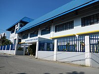
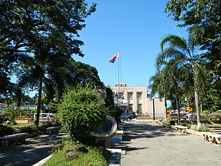
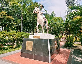
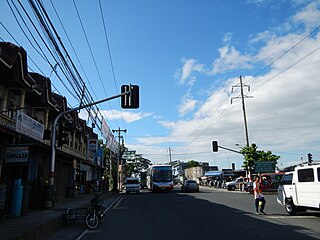
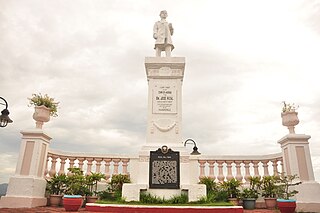
San Fernando, officially the City of San Fernando, is a 1st class component city and capital of the province of Pampanga, Philippines. According to the 2020 census, it has a population of 354,666 people.

<span class="mw-page-title-main">Arayat, Pampanga</span> City in Pampanga, Philippines

Arayat, officially the Municipality of Arayat, is a 1st class municipality in the province of Pampanga in the Philippines. According to the 2020 census, it has a population of 144,875 people.

<span class="mw-page-title-main">Guagua</span> Municipality in Pampanga, Philippines

Guagua, officially the Municipality of Guagua, is a 1st class municipality in the province of Pampanga, Philippines. According to the 2020 census, it has a population of 128,893 people.

<span class="mw-page-title-main">Macabebe</span> Municipality in Pampanga, Philippines

Macabebe, officially the Municipality of Macabebe, is a 1st class municipality in the province of Pampanga, Philippines. According to the 2020 census, it has a population of 78,151 people.

<span class="mw-page-title-main">Magalang</span> Municipality in Pampanga, Philippines

Magalang, officially the Municipality of Magalang, is a 1st class municipality in the province of Pampanga, Philippines. According to the 2020 census, it has a population of 124,188 people.

<span class="mw-page-title-main">Porac</span> Municipality in Pampanga, Philippines

Porac, officially the Municipality of Porac, is a 1st class municipality in the province of Pampanga, Philippines. According to the 2020 census, it has a population of 140,751 people.

<span class="mw-page-title-main">San Luis, Pampanga</span> Municipality in Pampanga, Philippines

San Luis, officially the Municipality of San Luis, is a 3rd class municipality in the province of Pampanga, Philippines. According to the 2020 census, it had a population of 58,551 people.

<span class="mw-page-title-main">Santa Ana, Pampanga</span> Municipality in Pampanga, Philippines

Santa Ana, officially the Municipality of Santa Ana, is a 3rd class municipality in the province of Pampanga, Philippines. According to the 2020 census, it has a population of 61,537 people.

<span class="mw-page-title-main">San Simon, Pampanga</span> Municipality in Pampanga, Philippines

San Simon, officially the Municipality of San Simon, is a 3rd class municipality in the province of Pampanga, Philippines. According to the 2020 census, it has a population of 59,182 people.

<span class="mw-page-title-main">Sasmuan</span> Municipality in Pampanga, Philippines

Sasmuan, officially the Municipality of Sasmuan, formerly known by its Spanish name Sexmoán, is a 4th class municipality in the province of Pampanga, Philippines. According to the 2020 census, it has a population of 29,076 people.

<span class="mw-page-title-main">Calumpit</span> Municipality in Bulacan, Philippines

Calumpit, officially the Municipality of Calumpit, is a 1st class municipality in the province of Bulacan, Philippines. According to the 2020 census, it has a population of 118,471 people.

<span class="mw-page-title-main">San Miguel, Bulacan</span> Municipality in Bulacan, Philippines

San Miguel, officially the Municipality of San Miguel, is a 1st class municipality in the province of Bulacan, Philippines. According to the 2020 census, it has a population of 172,073 people.

<span class="mw-page-title-main">Mauban</span> Municipality in Quezon, Philippines

Mauban, officially the Municipality of Mauban, is a 1st class municipality in the province of Quezon, Philippines. According to the 2020 census, it has a population of 71,081 people.

References

  1. Municipality of Masantol | (DILG)
  2. "2015 Census of Population, Report No. 3 – Population, Land Area, and Population Density" (PDF). Philippine Statistics Authority. Quezon City, Philippines. August 2016. ISSN   0117-1453. Archived (PDF) from the original on May 25, 2021. Retrieved July 16, 2021.
  3. 1 2 3 Census of Population (2020). "Region III (Central Luzon)". Total Population by Province, City, Municipality and Barangay. Philippine Statistics Authority . Retrieved 8 July 2021.
  4. "PSA Releases the 2018 Municipal and City Level Poverty Estimates". Philippine Statistics Authority. 15 December 2021. Retrieved 22 January 2022.
  5. Alejandro S. Camiling. "The Town of Masantol, Pampanga". Historical articles. andropampanga.com. Retrieved 13 December 2012.
  6. 1 2 "The Town of Masantol, Pampanga". Andropampanga. 2009. Retrieved 2009-08-05.{{cite web}}: External link in |publisher= (help)
  7. chinapost.com.tw, One drowns, 40 injured in Philippine boat mishap
  8. "Masantol: Average Temperatures and Rainfall". Meteoblue. Retrieved 5 May 2020.
  9. Census of Population (2015). "Region III (Central Luzon)". Total Population by Province, City, Municipality and Barangay. Philippine Statistics Authority . Retrieved 20 June 2016.
  10. Census of Population and Housing (2010). "Region III (Central Luzon)" (PDF). Total Population by Province, City, Municipality and Barangay. National Statistics Office . Retrieved 29 June 2016.
  11. Censuses of Population (1903–2007). "Region III (Central Luzon)". Table 1. Population Enumerated in Various Censuses by Province/Highly Urbanized City: 1903 to 2007. National Statistics Office.{{cite encyclopedia}}: CS1 maint: numeric names: authors list (link)
  12. "Province of Pampanga". Municipality Population Data. Local Water Utilities Administration Research Division. Retrieved 17 December 2016.
  13. "Poverty incidence (PI):". Philippine Statistics Authority. Retrieved December 28, 2020.
  14. "Estimation of Local Poverty in the Philippines" (PDF). Philippine Statistics Authority. 29 November 2005.
  15. "2003 City and Municipal Level Poverty Estimates" (PDF). Philippine Statistics Authority. 23 March 2009.
  16. "City and Municipal Level Poverty Estimates; 2006 and 2009" (PDF). Philippine Statistics Authority. 3 August 2012.
  17. "2012 Municipal and City Level Poverty Estimates" (PDF). Philippine Statistics Authority. 31 May 2016.
  18. "Municipal and City Level Small Area Poverty Estimates; 2009, 2012 and 2015". Philippine Statistics Authority. 10 July 2019.
  19. "PSA Releases the 2018 Municipal and City Level Poverty Estimates". Philippine Statistics Authority. 15 December 2021. Retrieved 22 January 2022.