Mattawa, Washington

Last updated

Mattawa
Mattawa City Hall IMG 1447.JPG
Mattawa City Hall (2008)
Grant County Washington Incorporated and Unincorporated areas Mattawa Highlighted.svg
Location of Mattawa, Washington
Coordinates: 46°44′10″N119°54′7″W / 46.73611°N 119.90194°W / 46.73611; -119.90194
CountryUnited States
State Washington
County Grant
Government
  Type Mayor–council [1]
   Mayor Maria M. Celaya [1]
Area
[2]
  Total0.92 sq mi (2.39 km2)
  Land0.92 sq mi (2.39 km2)
  Water0.00 sq mi (0.00 km2)
Elevation
768 ft (234 m)
Population
 (2020) [3]
  Total3,335
  Estimate 
(2021) [4]
3,627
  Density5,160.52/sq mi (1,992.03/km2)
Time zone UTC-8 (PST)
  Summer (DST) UTC-7 (PDT)
ZIP code
99349
Area code 509
FIPS code 53-44165
GNIS feature ID1506518 [5]
Website cityofmattawa.com

Mattawa is an incorporated city in Grant County, Washington, United States. The population was 3,335 at the 2020 census. [3]

Contents

History

Exterior view of straw bale library in Mattawa, Washington taken in 2008 (constructed 2002 by IronStraw Group). Matawa Straw Bale Library IMG 1443.JPG
Exterior view of straw bale library in Mattawa, Washington taken in 2008 (constructed 2002 by IronStraw Group).

The town of Mattawa was originally platted in 1909 by E. and Eva Campbell, but was not incorporated at that time. [6] With the construction of nearby Priest Rapids Dam and Wanapum Dam, the town boomed with construction workers. [7] Mattawa was officially incorporated on June 3, 1958. The Port of Mattawa was also established in 1958. [8] Mattawa is also home to the first straw bale library in the United States. [9] On December 3, 2009, the City of Mattawa became a non-charter code city.

Geography

Mattawa is located at 46°44′10″N119°54′7″W / 46.73611°N 119.90194°W / 46.73611; -119.90194 . [10]

According to the United States Census Bureau, the town has a total area of 0.74 square miles (1.92 km2), all of it land. [11]

Climate

According to the Köppen Climate Classification system, Mattawa has a semi-arid climate, abbreviated "BSk" on climate maps.

Demographics

Historical population
CensusPop.Note
1960 394
1970 180−54.3%
1980 29966.1%
1990 941214.7%
2000 2,609177.3%
2010 4,43770.1%
2020 3,335−24.8%
2021 (est.)3,627 [4] 8.8%
U.S. Decennial Census [12]
2020 Census [3]

The Mattawa Police Department (MAPD) currently consists of a police chief and four full-time, fully commissioned general-authority Washington police officers.

Mattawa is served by the Wahluke School District.

2010 census

As of the 2010 census, [13] there were 4,437 people, 791 households, and 725 families residing in the town. The population density was 5,995.9 inhabitants per square mile (2,315.0/km2). There were 843 housing units at an average density of 1,139.2 per square mile (439.8/km2). The racial makeup of the town was 45.0% White, 0.9% African American, 1.1% Native American, 0.1% Asian, 49.7% from other races, and 3.4% from two or more races. Hispanic or Latino of any race were 95.7% of the population.

There were 791 households, of which 82.8% had children under the age of 18 living with them, 70.7% were married couples living together, 10.6% had a female householder with no husband present, 10.4% had a male householder with no wife present, and 8.3% were non-families. 2.3% of all households were made up of individuals, and 0.6% had someone living alone who was 65 years of age or older. The average household size was 5.61 and the average family size was 5.28.

The median age in the town was 22 years. 42% of residents were under the age of 18; 14.3% were between the ages of 18 and 24; 33.1% were from 25 to 44; 8.7% were from 45 to 64; and 1.8% were 65 years of age or older. The gender makeup of the town was 55.7% male and 44.3% female.

2000 census

As of the 2000 census, there were 2,609 people, 495 households, and 438 families residing in the town. The population density was 5,281.7 people per square mile (2,055.8/km2). There were 576 housing units at an average density of 1,166.1 per square mile (453.9/km2). The racial makeup of the town was 29.59% White, 0.19% African American, 0.54% Native American, 0.92% Asian, 65.85% from other races, and 2.91% from two or more races. Hispanic or Latino of any race were 89.80% of the population.

There were 495 households, out of which 66.7% had children under the age of 18 living with them, 64.2% were married couples living together, 10.7% had a female householder with no husband present, and 11.5% were non-families. 5.5% of all households were made up of individuals, and 2.0% had someone living alone who was 65 years of age or older. The average household size was 5.27 and the average family size was 4.79.

In the city, the population was spread out, with 38.1% under the age of 18, 20.4% from 18 to 24, 32.4% from 25 to 44, 7.6% from 45 to 64, and 1.5% who were 65 years of age or older. The median age was 22 years. For every 100 females, there were 151.8 males. For every 100 females age 18 and over, there were 179.2 males.

The median income for a household in the town was $31,964, and the median income for a family was $25,921. Males had a median income of $13,669 versus $13,333 for females. The per capita income for the city was $7,510. About 30.6% of families and 34.4% of the population were below the poverty line, including 38.0% of those under age 18 and 42.6% of those age 65 or over.

Related Research Articles

<span class="mw-page-title-main">East Hemet, California</span> Census-designated place in California, United States

East Hemet is a census-designated place (CDP) in Riverside County, California, United States, located east of Hemet. East Hemet is in an unincorporated area outside the city limits of Hemet. The population was 17,418 at the 2010 census, up from 14,823 at the 2000 census.

<span class="mw-page-title-main">Darien, New York</span> Town in Genesee County, New York

Darien is a town in Genesee County, New York, United States. The population was 3,010 at the 2020 census. Darien lies in the southwestern part of Genesee County, southwest of Batavia.

<span class="mw-page-title-main">Lloyd, New York</span> Town in New York, United States

Lloyd is a town in Ulster County, New York, United States. The population was 11,133 at the 2020 census. It is part of the New York City combined statistical area.

<span class="mw-page-title-main">Elgin, Pennsylvania</span> Borough in Pennsylvania, United States

Elgin is a borough in Erie County, Pennsylvania, United States. The population was 204 at the 2020 census. It is part of the Erie Metropolitan Statistical Area. Places of recreation include Elgin Community Park. Elgin is home to the oldest borough building in Erie County.

<span class="mw-page-title-main">Royal City, Washington</span> City in Washington, United States

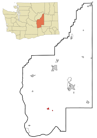
Royal City is a city in Grant County, Washington, United States. The population was 1,776 at the 2020 census.

<span class="mw-page-title-main">Worthington, West Virginia</span> Town in West Virginia, United States

Worthington is a town in Marion County, West Virginia, United States. The population was 158 at the 2010 census. Worthington was incorporated in 1893 and named for Colonel George Worthington, an early settler. U.S. Route 19 passes through the town.

<span class="mw-page-title-main">New Haven, West Virginia</span> Town in West Virginia, United States

New Haven is a town in Mason County, West Virginia, United States, along the Ohio River. The population was 1,485 at the 2020 census. It is part of the Point Pleasant, WV–OH Micropolitan Statistical Area.

<span class="mw-page-title-main">Gilbert Creek, West Virginia</span> CDP in West Virginia, United States

Gilbert Creek is a census-designated place (CDP) in Mingo County, West Virginia, United States. The population was 1,090 at the 2010 census. The community takes its name from nearby Gilbert Creek.

<span class="mw-page-title-main">Peterstown, West Virginia</span> Town in West Virginia, United States

Peterstown is a town in Monroe County, West Virginia, United States. The population was 456 at the 2020 census.

<span class="mw-page-title-main">Belmont, West Virginia</span> Town in West Virginia, United States

Belmont is a town in Pleasants County, West Virginia, United States. It is part of the Parkersburg–Vienna metropolitan area. The population was 872 at the 2020 census. Belmont was incorporated on April 19, 1946, by the Circuit Court of Pleasants County. The city was named for the beautiful hills in the area.

<span class="mw-page-title-main">Newburg, West Virginia</span> Town in West Virginia, United States

Newburg is a town in western Preston County, West Virginia, United States. The population was 275 at the 2020 census. It is part of the Morgantown metropolitan area.

<span class="mw-page-title-main">Bancroft, West Virginia</span> Town in West Virginia, United States

Bancroft is a town in Putnam County, West Virginia, United States, along the Kanawha River. The population was 389 at the 2020 census. It is part of the Huntington–Ashland metropolitan area.

<span class="mw-page-title-main">Lester, West Virginia</span> Town in West Virginia, United States

Lester is a town in Raleigh County, West Virginia, United States. The population was 337 at the 2020 census. The community was named after Champ Lester, a local pioneer.

<span class="mw-page-title-main">Sophia, West Virginia</span> Town in West Virginia, United States

Sophia is a town in Raleigh County, West Virginia, United States. It was incorporated in 1912. The population was 1,124 at the 2020 census.

<span class="mw-page-title-main">Harman, West Virginia</span> Town in West Virginia, United States

Harman is a town in Randolph County, West Virginia, United States. The population was 96 at the 2020 census.

<span class="mw-page-title-main">Auburn, West Virginia</span> Town in West Virginia, United States

Auburn is a town in Ritchie County, West Virginia, United States. The population was 80 at the 2020 census.

<span class="mw-page-title-main">Pullman, West Virginia</span> Town in West Virginia, United States

Pullman is a town in Ritchie County, West Virginia, United States. The population was 134 at the 2020 census.

<span class="mw-page-title-main">Camden-on-Gauley, West Virginia</span> Town in West Virginia, United States

Camden-on-Gauley is a town in Webster County, West Virginia, United States, along the Gauley River. The population was 126 at the 2020 census.

<span class="mw-page-title-main">Pine Grove, West Virginia</span> Town in West Virginia, United States

Pine Grove is a town in Wetzel County, West Virginia, United States. The population was 363 at the 2020 census. The community was named for a grove of pine trees near the original town site.

<span class="mw-page-title-main">Wien, Wisconsin</span> Town in Wisconsin, United States

Wien is a town in Marathon County, Wisconsin, United States. It is part of the Wausau, Wisconsin Metropolitan Statistical Area. The population was 825 at the 2010 census. The unincorporated community of Wien is located in the town.

References

  1. 1 2 "Mayor's Office / City Council". City of Mattawa. Retrieved April 9, 2022.
  2. "2019 U.S. Gazetteer Files". United States Census Bureau. Retrieved August 7, 2020.
  3. 1 2 3 "Explore Census Data". United States Census Bureau . Retrieved March 18, 2022.
  4. 1 2 "City and Town Population Totals: 2020-2021". United States Census Bureau. June 22, 2022. Retrieved June 22, 2022.
  5. "Mattawa". Geographic Names Information System . United States Geological Survey, United States Department of the Interior.
  6. "Mattawa, Washington". Archived from the original on June 25, 2009. Retrieved February 18, 2009.
  7. "Mattawa Area News". Washington Home Town News.
  8. "Grant County commissioners pass resolution on October 6, 1958, setting vote on creating Port of Mattawa". February 23, 2011. Retrieved August 7, 2023.
  9. Pioneering Achievements (PDF), IronStraw group, retrieved June 17, 2009
  10. "US Gazetteer files: 2010, 2000, and 1990". United States Census Bureau. February 12, 2011. Retrieved April 23, 2011.
  11. "US Gazetteer files 2010". United States Census Bureau. Archived from the original on January 25, 2012. Retrieved December 19, 2012.
  12. United States Census Bureau. "Census of Population and Housing" . Retrieved October 2, 2013.
  13. "U.S. Census website". United States Census Bureau . Retrieved December 19, 2012.