Related Research Articles

Mokane is a small city in southern Callaway County, Missouri, United States. The population was 185 at the 2010 census. It is part of the Jefferson City Metropolitan Statistical Area.

Norborne is a city in southwest Carroll County, Missouri, United States. The population was 634 at the 2020 census.

Revere is a city in Clark County, Missouri, United States. As of the 2020 census, its population was 76. It is part of the Fort Madison–Keokuk, IA-MO Micropolitan Statistical Area.

Wyaconda is a city in Clark County, Missouri, United States. As of the 2020 census, its population was 214. The city was organized in 1888 and is named after a Siouan name for God or the Great Spirit. The first land purchased from the Santa Fe and Land Co. was in 1888.
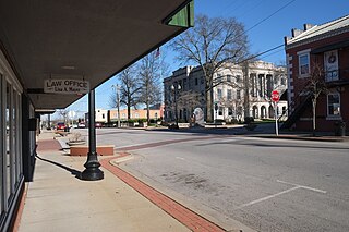
Union is a city in and the county seat of Franklin County, Missouri, United States. It is located on the Bourbeuse River, 50 miles (80 km) southwest of St. Louis. The population was 12,348 at the 2020 census.
Ridgeway is a city in Harrison County, Missouri, United States. The population was 372 at the 2020 census.

Bucklin is a city in southeast Linn County, Missouri, United States. The population was 413 at the 2020 census.

Powersville is a village in northwest Putnam County, Missouri, United States. The population was 42 at the 2020 census.

Seymour is a city in southeastern Webster County, Missouri, United States. The population was 1,921 at the 2010 census. It is part of the Springfield, Missouri Metropolitan Statistical Area.

De Soto is a city in Jefferson County, Missouri, United States. The population was 6,449 at the 2020 census and the city is part of the St. Louis metropolitan area. The Van Metre family were first to settle in 1803. The town was organized in 1857 and is named for the explorer Hernando De Soto, who claimed the Louisiana Territory for Spain. De Soto was the city closest to the mean center of U.S. population in 1980. The city celebrated its Bicentennial in 2003. The city made national news on and after May 6, 2003, when straight-line winds and a tornado struck.

Monett is the most-populous city in the Barry and Lawrence counties in the U.S. state of Missouri. The city is located in the Ozarks, just south of Interstate 44 between Joplin and Springfield. According to the 2020 census, the population of the town was estimated to be 9,576 individuals.

Browning is a city in Linn and Sullivan counties in the U.S. state of Missouri. The population was 219 at the 2020 census.
Golden is an unincorporated community and census-designated place in southeastern Barry County, Missouri, United States. It is approximately 20 miles (32 km) southeast of Cassville. It is located south of Table Rock Lake and one mile north of Missouri Route 86 on Highway J. At the 2020 census, Golden had a population of 275.
Montier is a census-designated place in southwestern Shannon County, Missouri, United States. As of the 2020 census, the population was 49.

Saint Catharine or St. Catharine is an unincorporated community and census-designated place in southeast Linn County, Missouri, United States. Saint Catharine is located approximately four miles east of Brookfield on Missouri Route 11. The Chicago, Burlington and Quincy Railroad passes the south side of the community.
Philadelphia is an unincorporated community and census-designated place in western Marion County, Missouri, United States. It is located 12 miles (19 km) west of Palmyra on Missouri Route 168. The community is part of the Hannibal Micropolitan Statistical Area.

Millersville is an unincorporated community in western Cape Girardeau County, Missouri, United States. It is located six miles (10 km) west of Jackson on Route 72.
Tebbetts is an unincorporated community in southern Callaway County, Missouri, United States. It is part of the Jefferson City, Missouri Metropolitan Statistical Area. Tebbetts is located on Route 94, approximately 8 miles (13 km) east of Jefferson City, on the north edge of the Missouri River floodplain.
Faucett is an unincorporated community and census-designated place in southern Buchanan County, Missouri, United States. It is located sixteen miles north of Platte City on Interstate 29 (Missouri)/U.S. Route 71. The community is part of the St. Joseph, MO–KS Metropolitan Statistical Area. The population was 248 at the 2020 census.
St. Francisville or Saint Francisville is an unincorporated community and census-designated place in northeast Clark County, Missouri, United States. As of the 2020 census, its population was 137.
References
- 1 2 3 4 U.S. Geological Survey Geographic Names Information System: Medill, Missouri
- ↑ "ArcGIS REST Services Directory". United States Census Bureau. Retrieved September 5, 2022.
- ↑ "Medill MO ZIP Code". zipdatamaps.com. 2023. Retrieved June 16, 2023.
- ↑ "2020: DEC Redistricting Data (PL 94-171)". United States Census Bureau . Retrieved November 17, 2021.
- ↑ Missouri Atlas & Gazetteer, DeLorme, First edition, 1998, p. 16 ISBN 0899332242
- ↑ Medill, MO, 7.5 Minute Topographic Quadrngle, USGS, 1951
- ↑ "Clark County Place Names, 1928–1945 (archived)". The State Historical Society of Missouri. Archived from the original on June 24, 2016. Retrieved September 18, 2016.
{{cite web}}: CS1 maint: bot: original URL status unknown (link) - ↑ "Post Offices". Jim Forte Postal History. Retrieved September 18, 2016.
- ↑ "Census of Population and Housing". Census.gov. Retrieved June 4, 2016.
Municipalities and communities of Clark County, Missouri, United States | ||
|---|---|---|
| Cities |  | |
| Villages | ||
| Townships | ||
| CDPs | ||
| Other communities | ||
| | This Clark County, Missouri state location article is a stub. You can help Wikipedia by expanding it. |