
Brighton is a town in Franklin County, New York, United States. The population was 1,435 at the 2010 census. It was named after Brighton, England, by early surveyors in the region.
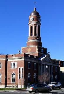
Harrietstown is a town in Franklin County, New York, United States. The total population was 5,709 at the 2010 census, of whom 3,879 lived in the village of Saranac Lake on the eastern side of the town.

Santa Clara is a town in Franklin County, New York, United States. The population was 345 at the 2010 census. The name was derived from the wife of an early town businessman, John Hurd.
The Adirondack Park is a part of New York's Forest Preserve in northeastern New York, United States. The park was established in 1892 for “the free use of all the people for their health and pleasure”, and for watershed protection. The park's boundary roughly corresponds with the Adirondack Mountains. Unlike most state parks, about 52 percent of the land is privately owned inholdings. State lands within the park are known as Forest Preserve. Land use on public and private lands in the park is regulated by the Adirondack Park Agency. This area contains 102 towns and villages, as well as numerous farms, businesses and an active timber-harvesting industry. The year-round population is 132,000, with 200,000 seasonal residents. The inclusion of human communities makes the park one of the great experiments in conservation in the industrialized world. The Forest Preserve was designated a National Historic Landmark in 1963.

The Raquette River, sometimes spelled Racquette, originates at Raquette Lake in the Adirondack Mountains in New York. 146 miles (235 km) long, it is the third longest river entirely in the state of New York.

Saranac River is an 81-mile-long (130 km) river in the U.S. state of New York. In its upper reaches is a region of mostly flat water and lakes. The river has more than three dozen source lakes and ponds north of Upper Saranac Lake; the highest is Mountain Pond on Long Pond Mountain. In the last third of its length it drops two-thirds of its total drop, and is known for having navigable rapids, which make it a popular site for whitewater kayaking and canoeing.
The Northern Forest Canoe Trail (NFCT) is a 740-mile (1,190 km) marked canoeing trail in the northeastern United States and Canada, extending from Old Forge in the Adirondacks of New York to Fort Kent, Maine. Along the way, the trail also passes through the states and provinces of Vermont, Quebec, and New Hampshire. The trail was opened on June 3, 2006.
Lake Clear is a hamlet and a lake in Franklin County, New York, United States. The area is named for 940-acre (3.8 km2) Lake Clear, part of the original Seven Carries canoe route. It is located in the town of Harrietstown.
The High Peaks Wilderness Area, the largest Forest Preserve unit in the U.S. state of New York, is located in three counties and six towns in the Adirondack Park: Harrietstown in Franklin County, North Elba, Keene, North Hudson and Newcomb in Essex County and Long Lake in Hamilton County.

Adirondack Hotel is a hotel in Long Lake, New York, located on New York State Route 30. It was built in the 1850s but it burnt down, and was rebuilt in 1900. The hotel has two verandas with a view of 14 miles of Long Lake.

Lower Saranac Lake is one of three connected lakes, part of the Saranac River, near the village of Saranac Lake in the Adirondacks in northern New York. With Middle Saranac Lake and Upper Saranac Lake, a 17-mile (27 km) paddle with only one portage is possible. The Saranac Lake Islands Public Campground provides 87 campsites on inlands in Lower and Middle Saranac Lake. In addition to the Saranac River, it is fed by nearby Lake Colby, Fish Creek, and Lilly Pad Pond. Lower Saranac Lake is located in the town of Harrietstown, New York. The lake, along with both Upper and Middle Saranac Lakes, is also part of the 740-mile Northern Forest Canoe Trail, which begins in Old Forge, NY and ends in Fort Kent, ME.

Upper Saranac Lake is one of three connected lakes, part of the Saranac River, in the towns of Santa Clara and Harrietstown, near the village of Saranac Lake in the Adirondacks in northern New York. Upper Saranac Lake is the sixth largest lake in the Adirondacks. With Middle Saranac Lake and Lower Saranac Lake, a 17-mile (27 km) paddle with only one carry is possible. There are 20 primitive campsites accessible by boat available on a first-come basis. Upper Saranac Lake is also known as Sin-ha-lo-nen-ne-pus.

Lake Flower is a 300 acres (120 ha) lake in Franklin County and Essex County in the Adirondack Mountains of Upstate New York in the United States. The lake was created by damming the Saranac River in 1827. It was originally called the Mill Pond, but was later named for New York Governor Roswell P. Flower. It is the only lake within the village of Saranac Lake. The village and the lake are divided between the towns of Harrietstown and North Elba. The lake shore is almost entirely in private hands.

Franklin Falls Pond is a 439-acre (178 ha), 2.7-mile (4.3 km) long pond created by damming the Saranac River three miles (5 km) northeast of Lower Saranac Lake in the Adirondack Mountains of northern New York State. The pond is also part of the 740-mile Northern Forest Canoe Trail, which begins in Old Forge, NY and ends in Fort Kent, ME.
The Saranac Lakes Wild Forest is a discontinuous 79,000-acre (320 km2) tract designated as Wild Forest by the New York State Department of Environmental Conservation in Franklin and Essex Counties near Saranac Lake, Tupper Lake, and Lake Placid. The area covers large portions of Harrietstown, Santa Clara, and North Elba; smaller portions are in Altamont, St. Armand, Brighton, and Franklin. The area is served by State Routes NY-3, NY-30, NY-86, and NY-73.

Ampersand Mountain is a 3,352 ft (1,021.7 m) mountain in Franklin County in the High Peaks Wilderness Area of the northeastern Adirondacks, west of the High Peaks proper in New York State. The trail up the mountain begins on New York State Route 3 8.1 miles (13.0 km) southwest of the village of Saranac Lake, near Middle Saranac Lake; it is a popular day hike. The mountain takes its name from nearby Ampersand Creek, so named because it twists and turns like the ampersand symbol. The summit is bare rock, with extensive views of the High Peaks to the east and the Saranac Lakes to the west. Stony Creek Mountain is located west-southwest of Ampersand Mountain. The mountain is notable as the land surrounding its hiking trail's initial ascent is generally acknowledged as unlogged old growth forest.

The Adirondack Canoe Classic, also known as the 90-miler, is a three-day, 90-mile (140 km) canoe race from Old Forge to Saranac Lake in the Adirondacks of New York, United States. The race has drawn as many as 500 competitors from California to Florida, New Zealand and Canada paddling 250 canoes, kayaks and guideboats. Included in the ninety mile length is 5.25 miles (8.45 km) of carries.
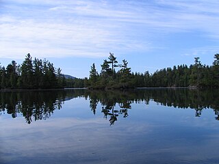
Weller Pond is a 177-acre (72 ha) wilderness pond 8 miles (13 km) southwest of the village of Saranac Lake in the Adirondacks in northern New York within Franklin County. The lake is found at an elevation of 1,539 feet (469 m). It is connected to Middle Saranac Lake and is entirely state-owned. It sits in the shadow of Boot Bay Mountain; there is a canoe carry to Upper Saranac Lake. It is a popular paddling and cross-country skiing destination.

Oseetah Lake is an 826-acre (3.34 km2) lake with a mean depth of three feet (0.91 m). It is in New York State's Adirondack Park, two and a half miles (4.0 km) south of the village of Saranac Lake on the Saranac River. It is located mostly in the town of Harrietstown, but its easternmost portion extends into the town of North Elba.

4,077-acre Long Lake is a 14-mile (23 km) lake in the town of Long Lake in Hamilton County, New York in the United States; the average width is half a mile. It is part of the Raquette River, which flows in a straight, northeast-trending valley. NY 30 crosses at a narrows 4 miles (6.4 km) from the south end where the hamlet of Long Lake is located. There are two public beaches and a state boat launch. More than half of the shoreline is part of the New York State Forest preserve. The northern end of the lake is undeveloped. The lake is also part of the 740-mile Northern Forest Canoe Trail, which begins in Old Forge, NY and ends in Fort Kent, ME. The Long Lake Camp for the Arts is based on the west side of the lake.


