Millsboro is a town in Sussex County, Delaware, United States. Millsboro is part of the Salisbury, Maryland-Delaware Metropolitan Statistical Area.
The Indian River is a river and estuary, approximately 15 mi (24 km) long, in Sussex County in southern Delaware in the United States. The river is named after a Native American reservation that was located on its upper reaches.
Millsboro or Millboro may refer to:

Fredericktown is a census-designated place located in East Bethlehem Township, Washington County in the state of Pennsylvania. The community was part of the Fredericktown-Millsboro CDP for the 2000 census, but was split into two separate CDPs for the 2010 census, the other community being Millsboro. Fredericktown is located in far southern Washington County, along Pennsylvania Route 88, which travels along the Monongahela River. As of the 2010 census the population was 403 residents.
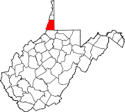
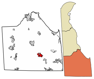
Millsboro is a census-designated place located in East Bethlehem Township, Washington County, Pennsylvania. The community was part of the Fredericktown-Millsboro CDP for the 2000 census but was split into two separate CDPs for the 2010 census, the other community being Fredericktown. Millsboro is located in far southern Washington County, along Pennsylvania Route 88, which travels along the Monongahela River. As of the 2010 census the population was 666 residents.

Delaware Route 20 (DE 20) is an east–west state highway in Sussex County, Delaware. Its western terminus is the Maryland state line in Reliance, where it continues as Maryland Route 392 (MD 392). Its eastern terminus is DE 54 west of Fenwick Island. The route runs through rural areas of Sussex County and passes through the towns of Seaford, Millsboro, and Dagsboro. DE 20 intersects U.S. Route 13 (US 13) in Seaford, US 9 in Hardscrabble, US 113 and DE 24/DE 30 in Millsboro, DE 26 in Dagsboro, and DE 17 in Roxana. DE 20 was originally created by 1936 to run from the Maryland border east to US 113 in Millsboro. By 1970, it was realigned to bypass Seaford. The route was extended east to DE 1 in Fenwick Island by 1994; however, the eastern terminus was cut back to DE 54 in 2005 to avoid the concurrency with that route.

Delaware Route 24 (DE 24) is a state highway located in Sussex County, Delaware. The route runs east from Maryland Route 348 (MD 348) at the Maryland border east of Sharptown, Maryland to an intersection with DE 1 in Midway, between Lewes and Rehoboth Beach. Along the way, DE 24 passes through Laurel, Millsboro, and Long Neck. DE 24 intersects U.S. Route 13 (US 13) in Laurel, US 113/DE 20 in Millsboro, and DE 5 and DE 23 in Long Neck. The route runs concurrent with DE 30 between Mission and Millsboro. DE 24 features an alternate alignment, DE 24 Alternate, that runs to the north of the route from US 113 in Stockley to DE 24 near Midway. DE 24 was built as a state highway throughout the 1920s, with completion of the entire route by 1931. DE 24 was assigned onto its current alignment by 1936. DE 24 Alt. was designated by 2006.

Delaware Route 30 (DE 30) is a state highway in Sussex County, Delaware. The route runs from an intersection with Bi-State Boulevard a short distance west of U.S. Route 13 (US 13) between Laurel and Delmar to DE 1 Business southeast of Milford in the area of Lincoln and Cedar Creek. The road runs east to Gumboro, where it turns north on the Millsboro Highway to Millsboro. Along this road, DE 30 shares concurrencies with DE 26, DE 54, and DE 24. From Millsboro, the route passes through Gravel Hill and to the west of Milton before reaching Milford. DE 30 is signed as an east-west road from the southern terminus to the east end of the DE 24 concurrency in Millsboro and as a north-south road from that point until the northern terminus.
The Indian River School District is a public school district in Sussex County, Delaware in the United States. The district is based in Selbyville and serves the southeastern portion of Sussex County.
The following radio stations broadcast on FM frequency 106.5 MHz:

Bryans Store is an unincorporated community in Sussex County, Delaware, United States. Bryans Store is located on Delaware Route 20 west of Millsboro.
Shortly is an unincorporated community in Sussex County, Delaware, United States. Shortly is located on Delaware Route 20 west of Millsboro.

Dagsboro Hundred is a hundred in Sussex County, Delaware, United States. Dagsboro Hundred was formed in 1773 from Worcester County, Maryland. Its primary community is Millsboro.
Blackwater Beach is an unincorporated community in Sussex County, Delaware, United States. Blackwater Beach is located on the south shore of the Indian River Bay east of Millsboro.
Trinity is an unincorporated community in Sussex County, Delaware, United States. Trinity is located on Delaware Route 5 and Delaware Route 24 northeast of Millsboro.
Pusey Crossroads is an unincorporated community in Sussex County, Delaware, United States. Pusey Crossroads is east of Laurel and west of Millsboro.
Westwoods is an unincorporated community in Sussex County, Delaware, United States. Westwoods is located along Delaware Route 26 and Delaware Route 30 southwest of Millsboro and north of the Maryland border.
The Greene River Trail is a non-motorized rail trail 60 miles south of Pittsburgh in Greene County, Pennsylvania. Greene River Trail runs along the banks of the Monongahela River as it winds through the former coal mining region of Greene County. The 5.2-mile trail begins in Millsboro at the Greene Cove Yacht Club, where the trail follows Ten Mile Creek for a quarter mile before turning upstream along the left (west) bank of the Monongahela River. The trail passes through Rices Landing and ends in Crucible. Plans call for the trail to be extended for 9 more miles to Nemacolin in the future.

The 1946 United States Senate election in Delaware took place on November 4, 1946. Incumbent Democratic U.S. Senator James M. Tunnell ran for re-election to a second term in office, but was defeated by Republican John J. Williams, a businessman and member of the Millsboro Town Council.
East Millsboro is an unincorporated community in Fayette County, Pennsylvania, United States. The community is located on the east bank of the Monongahela River across from Millsboro. East Millsboro has a post office with ZIP code 15433.