
Route 86 is a highway in southwest Missouri. The eastern terminus is at U.S. Route 65 just north of Ridgedale. From there, the road crosses the Long Creek arm of Table Rock Lake and continues to Blue Eye west between the Arkansas state line on the south and Table Rock Lake on the north. This section is also in the Mark Twain National Forest, and is recommended as a scenic drive by the Missouri Department of Transportation. From Eagle Rock the road turns north to join with Route 76 at Bates Corner with which it is runs concurrent through Cassville to just east of Rocky Comfort. The road continues north and west towards Neosho, then goes further west before turning north towards Joplin where the road ends at the interchange of Interstate 44 and Route 43. Except for a short section in Neosho, the road is a two-lane highway for its entire length.

Route 39 is a two-lane highway in southwestern Missouri. Its northern terminus is at U.S. Route 54 between Collins and El Dorado Springs at the community of Cedar Springs; its southern terminus is at the Arkansas state line where it continues as Highway 221.
Route 376 is a short highway in Branson, Missouri. Its southern terminus is at Route 265, and its northern terminus is at Route 76.

Route 83 is a state highway in western Missouri. Its northern terminus is at U.S. Route 65/Route 7 at Warsaw; its southern terminus is at Route 13 in Bolivar. It is a two-lane highway its entire length.
Route 19 is a long state highway in Missouri. Its northern terminus is at U.S. Route 61 in New London and its southern terminus is at U.S. Route 63 on the north side of Thayer. Route 19 is one of Missouri's original 1922 highways, though it initially had a northern terminus at Route 14 in Cuba and was later extended north.

Route 116 is a highway in northwestern Missouri. Its eastern terminus is at Route A in Braymer; its western terminus is at U.S. Route 59 in Rushville.

Route 248 is a highway in southwestern Missouri. Its eastern terminus is at U.S. Route 65 in Branson. Its western terminus is at Route 76/Route 86/Route 112 in Cassville.

Route 9 is a highway in the Kansas City, Missouri area. Its northern terminus is at Interstate 29/U.S. Route 71 in Kansas City North; its southern terminus is at Interstate 35/Interstate 70/U.S. Route 24/U.S. Route 40 in downtown Kansas City. Even though both termini are in Kansas City, it passes through other towns and cities. It is carried across the Missouri River by the Heart of America Bridge between downtown Kansas City, Missouri and North Kansas City, Missouri. In North Kansas City, the highway serves as a main thoroughfare, Burlington Street.
Route 133 is a highway in central Missouri. Its northern terminus is at U.S. Route 63 near Westphalia; its southern terminus is at Interstate 44 about fourteen miles (21 km) west of Waynesville.
Route 53 is a highway in southeastern Missouri. Its southern terminus is at Route 25 in Holcomb. Its northern terminus is at Business U.S. Route 67 Business in Poplar Bluff.

Route 34 is a highway in southeastern Missouri. Its eastern terminus is at the Illinois state line on the Mississippi River at Cape Girardeau where it overlaps Route 74. Its western terminus is at U.S. Route 60 near Van Buren. The road continues into Illinois as Illinois Route 146.

Route 58 is a highway in western Missouri. Its eastern terminus is at U.S. Route 50 west of Warrensburg; its western terminus is at Route D west of Belton, Missouri. It is one of only a very few highways to end at a state supplemental route.

Route 41 is a highway in central Missouri. Its northern terminus is at U.S. Route 24 in southern Carroll County; its southern terminus is at Interstate 70/U.S. Route 40 west of Boonville, where the road continues south as Route 135.

Route 135 is a highway in central Missouri. Its northern terminus is at Interstate 70/U.S. Route 40/Route 41 west of Boonville; its southern terminus is at Route 5 near the Lake of the Ozarks.

Route 33 is a highway in western Missouri. Its northern terminus is at Route 6 in Maysville; its southern terminus is at U.S. Route 69 in Liberty.

Route 47 is a highway in eastern Missouri. Its northern terminus is at Route 79 near Winfield; its southern terminus is at U.S. Route 67 in Bonne Terre.
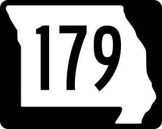
Route 179 is a highway in central Missouri. From its northern terminus at the interchange of Interstate 70 and Route 98, it winds its way Southeast over low rolling hills and through the flood plain along the Missouri River to Jefferson City, where it bypasses the city to the West via a four-lane divided highway between U.S. Route 50 and U.S. Route 54, its southern terminus. Towns on Route 179 are Overton, Wooldridge, Jamestown, Sandy Hook, Marion, and Jefferson City.

Route 176 is a highway in southwestern Missouri. The eastern terminus is at U.S. Route 160 north of Forsyth; its western terminus is at Route 248/Route 265/Route 413 in Galena.

Route 165 and County Road 165 (CR 165) form a loop around the west side of Branson, Missouri, in Taney and Stone counties. The highway's southern terminus is at U.S. Route 65 (US 65) south of Branson, in Hollister. Even though the county road designation belongs to Taney County, it briefly enters Stone County at Table Rock State Park. Upon re-entering Taney County, it crosses the Table Rock Lake Dam, along with Route 265, at Table Rock Lake. Its northern terminus is at US 65 along the Red Route in north Branson.
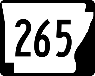
Highway 265 is a designation for three state highways in Northwest Arkansas. The southern segment of 19.70 miles (31.70 km) runs from Highway 170 near Strickler north to I-49/US 71/Highway 112 in south Fayetteville. A second segment begins in east Fayetteville at Highway 16 and runs north through Springdale to Highway 94 in Rogers. Further north, a third segment of 3.324 miles (5.349 km) runs from Highway 94 in Pea Ridge north to the Missouri state line. The highways are maintained by the Arkansas Department of Transportation (ARDOT).


