Kimberling City, Missouri

Last updated

Kimberling City, Missouri
UserKTrimble-Crappy AP of Kimberling City Mo.jpg
Stone County Missouri Incorporated and Unincorporated areas Kimberling City Highlighted.svg
Location within Stone County and Missouri
Coordinates: 36°38′31″N93°25′27″W / 36.64194°N 93.42417°W / 36.64194; -93.42417
Country United States
State Missouri
County Stone
Government
  MayorRobert Fritz [1]
Area
[2]
  Total3.86 sq mi (10.00 km2)
  Land3.50 sq mi (9.08 km2)
  Water0.36 sq mi (0.93 km2)
Elevation
951 ft (290 m)
Population
 (2020)
  Total2,344
  Density668.95/sq mi (258.27/km2)
Time zone UTC-6 (Central (CST))
  Summer (DST) UTC-5 (CDT)
ZIP code
65686
Area code 417
FIPS code 29-38612 [3]
GNIS ID 753024 [4]
Website ckcmo.com

Kimberling City is a city in Stone County, Missouri, United States. The population was 2,344 at the 2020 census. [5]

Contents

History

Kimberling City was founded on the shores of Table Rock Lake, a reservoir impounded in the late 1950s. Incorporated in 1973, Kimberling City was named after the Kimberling family, operators of a former nearby ferry. [6]

Geography

Kimberling City is located at 36°38′31″N93°25′27″W / 36.64194°N 93.42417°W / 36.64194; -93.42417 (36.641943, -93.424094). [7] According to the United States Census Bureau, the city has a total area of 3.78 square miles (9.79 km2), of which 3.42 square miles (8.86 km2) is land and 0.36 square miles (0.93 km2) is water. [8]

Demographics

Historical population
CensusPop.Note
1980 1,285
1990 1,59023.7%
2000 2,25341.7%
2010 2,4006.5%
2020 2,344−2.3%
U.S. Decennial Census [9]

Kimberling City is part of the Branson, Missouri Micropolitan Statistical Area.

2010 census

As of the census [10] of 2010, there were 2,400 people, 1,147 households, and 774 families living in the city. The population density was 701.8 inhabitants per square mile (271.0/km2). There were 1,431 housing units at an average density of 418.4 per square mile (161.5/km2). The racial makeup of the city was 98.1% White, 0.2% African American, 0.4% Native American, 0.5% Asian, 0.1% from other races, and 0.7% from two or more races. Hispanic or Latino of any race were 1.3% of the population.

There were 1,147 households, of which 16.7% had children under the age of 18 living with them, 58.4% were married couples living together, 6.3% had a female householder with no husband present, 2.8% had a male householder with no wife present, and 32.5% were non-families. 28.3% of all households were made up of individuals, and 17.2% had someone living alone who was 65 years of age or older. The average household size was 2.09 and the average family size was 2.53.

The median age in the city was 57.1 years. 14.4% of residents were under the age of 18; 4% were between the ages of 18 and 24; 15.1% were from 25 to 44; 31.2% were from 45 to 64; and 35.4% were 65 years of age or older. The gender makeup of the city was 46.8% male and 53.2% female.

2000 census

As of the census [3] of 2000, there were 2,253 people, 1,045 households, and 760 families living in the city. The population density was 673.6 inhabitants per square mile (260.1/km2). There were 1,236 housing units at an average density of 369.5 per square mile (142.7/km2). The racial makeup of the city was 97.91% White, 0.22% African American, 0.49% Native American, 0.13% Asian, 0.09% Pacific Islander, 0.27% from other races, and 0.89% from two or more races. Hispanic or Latino of any race were 1.11% of the population.

There were 1,045 households, out of which 17.0% had children under the age of 18 living with them, 65.8% were married couples living together, 4.9% had a female householder with no husband present, and 27.2% were non-families. 24.1% of all households were made up of individuals, and 15.1% had someone living alone who was 65 years of age or older. The average household size was 2.16 and the average family size was 2.50.

In the city, the population was spread out, with 15.1% under the age of 18, 4.1% from 18 to 24, 18.9% from 25 to 44, 29.0% from 45 to 64, and 32.9% who were 65 years of age or older. The median age was 54 years. For every 100 females, there were 91.9 males. For every 100 females age 18 and over, there were 88.5 males.

Kimberling City, Missouri bridge which carries highway 13 across Table Rock Lake. Kimberling City, Missouri Bridge.jpg
Kimberling City, Missouri bridge which carries highway 13 across Table Rock Lake.

The median income for a household in the city was $36,727, and the median income for a family was $40,508. Males had a median income of $30,774 versus $18,000 for females. The per capita income for the city was $19,715. About 4.5% of families and 6.2% of the population were below the poverty line, including 10.2% of those under age 18 and 3.6% of those age 65 or over.

Education

Kimberling City has a public library, the Kimberling Area Library. [11]

Notable people

Related Research Articles

<span class="mw-page-title-main">Stanley, Iowa</span> City in Iowa, United States

Stanley is a city in Buchanan and Fayette counties in the U.S. state of Iowa. The population was 81 at the time of the 2020 census.

<span class="mw-page-title-main">Geneva, Iowa</span> City in Iowa, United States

Geneva is a city in Franklin County, Iowa, United States. The population was 136 at the time of the 2020 census.

<span class="mw-page-title-main">Clemons, Iowa</span> City in Iowa, United States

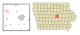
Clemons is a city in Marshall County, Iowa, United States. The population was 140 at the 2020 census.

<span class="mw-page-title-main">Woodland Hills, Kentucky</span> City in Kentucky, United States

Woodland Hills is a home rule-class city in Jefferson County, Kentucky, United States. The population was 696 at the 2010 census.

<span class="mw-page-title-main">Randolph, Minnesota</span> City in Minnesota, United States

Randolph is a city in Dakota County, Minnesota, United States. The population was 436 at the 2010 census.

<span class="mw-page-title-main">Greenwood, Minnesota</span> City in Minnesota, United States

Greenwood is a community on Saint Albans Bay on Lake Minnetonka in Hennepin County, Minnesota, United States just northeast of the community of Excelsior, Minnesota. The population was 688 at the 2010 census.

<span class="mw-page-title-main">Cohasset, Minnesota</span> City in Minnesota, United States

Cohasset is a city in Itasca County, Minnesota, United States. The population was 2,698 at the 2010 census.

<span class="mw-page-title-main">Kennedy, Minnesota</span> City in Minnesota, United States

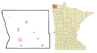
Kennedy is a city in Kittson County, Minnesota, United States. The population was 176 at the 2020 census.

<span class="mw-page-title-main">McKinley, St. Louis County, Minnesota</span> City in Minnesota, United States

McKinley is a city in Saint Louis County, Minnesota, United States; located within the Iron Range region of Minnesota. The population was 103 at the 2020 census.

<span class="mw-page-title-main">Fremont Hills, Missouri</span> City in Missouri, United States

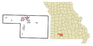
Fremont Hills is a city in Christian County, Missouri, United States. The population was 1,049 at the 2020 census. It is part of the Springfield, Missouri Metropolitan Statistical Area.

<span class="mw-page-title-main">Wade, Mississippi</span> Census-designated place in Mississippi, United States

Wade is an unincorporated community and census-designated place (CDP) in Jackson County, Mississippi, United States. It is part of the Pascagoula Metropolitan Statistical Area. The population was 1,074 at the 2010 census, up from 491 at the 2000 census.

<span class="mw-page-title-main">Reeds Spring, Missouri</span> City in Missouri, United States

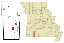
Reeds Spring is a city in Stone County, Missouri, United States. The population was 1,136 at the 2020 census.

<span class="mw-page-title-main">Sheffield, Ohio</span> Village in Ohio, United States

Sheffield is a village in Lorain County, Ohio, United States, along the Black River. The population was 4,135 at the 2020 census. It is part of the Cleveland metropolitan area.

<span class="mw-page-title-main">West Middletown, Pennsylvania</span> Borough in Pennsylvania, United States

West Middletown is a borough in Washington County, Pennsylvania, United States. The population was 109 at the 2020 census.

<span class="mw-page-title-main">Rural Retreat, Virginia</span> Town in Virginia, United States

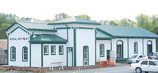
Rural Retreat is a town in Wythe County, Virginia, United States. The population was 1,483 at the 2010 census.

Fence is a town in Florence County, Wisconsin, United States. The population was 231 at the 2000 census. The origin of the name "Fence" is obscure.

<span class="mw-page-title-main">Lincoln, Kewaunee County, Wisconsin</span> Town in Wisconsin, United States

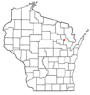
Lincoln is a town in Kewaunee County, Wisconsin, United States. The population was 948 at the 2010 census. The unincorporated communities of Lincoln, Gregorville, and Euren are in the town. The unincorporated communities of Rio Creek and Rosiere are also partially in the town.

<span class="mw-page-title-main">Breed, Wisconsin</span> Town in Wisconsin, United States

Breed is a town in Oconto County, Wisconsin, United States. The population was 657 at the 2000 census.

<span class="mw-page-title-main">Guernsey, Wyoming</span> Town in Wyoming, United States

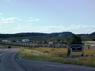
Guernsey is a town in Platte County, Wyoming, United States. The population was 1,147 at the 2010 census.

<span class="mw-page-title-main">Osage, Wyoming</span> CDP in Wyoming, United States

Osage is a census-designated place (CDP) in Weston County, Wyoming, United States. The population was 151 at the 2020 census. The CDP is named after the town of Osage, which is included within its boundaries. The CDP was established by the United States Census Bureau in time for the 2000 census.

References

  1. "Mayor and Board of Aldermen; Kimberling City".
  2. "ArcGIS REST Services Directory". United States Census Bureau. Retrieved August 28, 2022.
  3. 1 2 "U.S. Census website". United States Census Bureau . Retrieved January 31, 2008.
  4. "US Board on Geographic Names". United States Geological Survey. October 25, 2007. Retrieved January 31, 2008.
  5. "Explore Census Data". data.census.gov. Retrieved December 2, 2021.
  6. "Our Story". Kimberling City. Retrieved June 2, 2019.
  7. "US Gazetteer files: 2010, 2000, and 1990". United States Census Bureau. February 12, 2011. Retrieved April 23, 2011.
  8. "US Gazetteer files 2010". United States Census Bureau. Archived from the original on July 2, 2012. Retrieved July 8, 2012.
  9. "Census of Population and Housing". Census.gov. Retrieved June 4, 2015.
  10. "U.S. Census website". United States Census Bureau . Retrieved July 8, 2012.
  11. "Missouri Public Libraries". PublicLibraries.com. Archived from the original on June 10, 2017. Retrieved June 2, 2019.