The Whitewater River is a 101-mile-long (163 km) southerly flowing right tributary of the Great Miami River in southeastern Indiana and southwestern Ohio in the United States. It is formed by the confluence of two forks, the West Fork and East Fork. The name is a misnomer, as there is no true white water on the river. However, there are many rapids due to the steep gradient present - the river falls an average of six feet per mile (1.1 m/km). The gradient rendered upstream navigation impossible, and in the mid-nineteenth century resulted in the construction of the Whitewater Canal paralleling the river from north of Connersville, Indiana, to the Ohio River.

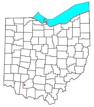
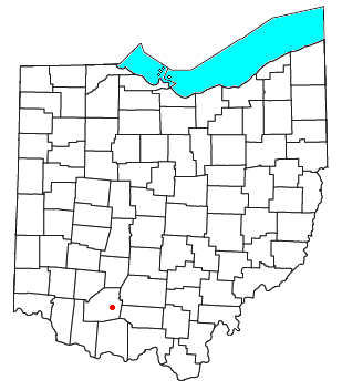
Lees Creek, also known as Centerville, is an unincorporated community in central Wayne Township, Clinton County, Ohio, United States. It lies at the intersection of State Route 729 with Cox Road, 6 miles south of Sabina and 12 miles (19 km) southeast of Wilmington, the county seat of Clinton County. It lies between the headwaters of the Middle Fork of Lees Creek, to the southeast, and the Anderson Fork of Caesar Creek. it had a post office, with the ZIP code 45138. The Post Office closed in 2012 and the town, including East Clinton High School, now carries a Sabina mailing address.
Pricetown is an unincorporated community in eastern Salem Township, Highland County, Ohio, United States.

Piney Fork is an unincorporated community in central Smithfield Township, Jefferson County, Ohio, United States. The stream of Piney Fork flows southeast past the community; it meets Short Creek in far western Warren Township, and Short Creek in turn meets the Ohio River at Rayland.

Barlow is an unincorporated community in western Barlow Township, Washington County, Ohio, United States. Although it is unincorporated, it has a ZIP code 45712. It lies at the intersection of State Routes 339 and 550 near the South Fork of Wolf Creek, which meets the Muskingum River at Waterford to the north.

Fairhaven is an unincorporated community in eastern Israel Township, Preble County, Ohio, United States. It lies along State Route 177 at its intersection with Israel-Somers Road. Four Mile Creek, which feeds into Acton Lake in southern Preble County, runs on the western edge of Fairhaven. It is located 10½ miles southwest of Eaton, the county seat of Preble County. The community is part of the Dayton Metropolitan Statistical Area. Fairhaven Church and Fairhaven Community Church are both located in Fairhaven along State Route 177. Fairhaven Community Church hosts a free annual Dinner Drama for the community. Fairhaven is home to the historic Bunker Hill house, a stop along the Underground Railroad.
Rose Farm is an unincorporated community and census-designated place (CDP) in southwestern York Township, Morgan County, and southeastern Harrison Township, Perry County, Ohio, United States. The population of the CPD was 111 at the 2020 census.

Pyrmont is an unincorporated community in northwestern Perry Township, Montgomery County, Ohio, United States. It centers at the intersection of Brookville–Pyrmont Pike and Sulphur Springs Road, extending to the intersection of Brookville–Pyrmont Pike and Providence Pike. Located in the far west of the county, it lies several miles from the city of Dayton; the nearest city is Brookville, three miles to the northeast. Pyrmont is a part of the Brookville Local School District. Pyrmont, which was on a stagecoach route, was a busy town before Interstate 70 was built near Brookville.

Royalton is an unincorporated community in northern Amanda Township, Fairfield County, Ohio, United States.

East Union is an unincorporated community in northwestern Stock Township, Noble County, Ohio, United States. It lies at the intersection of State Route 78 with County Road 6. The headwaters of Buffalo Creek, a tributary of the Muskingum River through Wills Creek, are located around East Union. It is located 7 miles east of Caldwell, the county seat of Noble County.
Marshall is an unincorporated community in central Marshall Township, Highland County, Ohio, United States. It lies at the intersection of State Routes 124 and 506. Rocky Fork Lake, the site of Rocky Fork State Park, is located 2 miles (3 km) to the north. It lies 7 miles (11 km) east-southeast of the city of Hillsboro, the county seat of Highland County. An early variant name was West Liberty.

Harriettsville is an unincorporated community in western Elk Township, Noble County, Ohio, United States. It lies along State Route 145 at its intersection with County Road 46. The East Fork of Duck Creek, a subsidiary of the Ohio River that meets the river near Marietta, runs along State Route 145 past the community. It lies 8 miles (13 km) northeast of Lower Salem by road, and 13 miles (21 km) directly southeast of Caldwell, the county seat of Noble County.

Bridgeport is an unincorporated community in far western Darby Township, Union County, Ohio, United States. It lies at the intersection of State Route 38 with Orchard Road, midway between the villages of Milford Center and Unionville Center. At Bridgeport, Buck Run meets the Big Darby Creek, which meets the Scioto River at Circleville. It is located 6 miles (9.7 km) south of Marysville, the county seat of Union County.

Byron is a small unincorporated community in southeastern Bath Township, Greene County, Ohio, United States. It sits at the intersection of Linebaugh and Dayton-Yellow Springs Roads, between Fairborn and Xenia. Byron is located at 39°47′10″N83°58′51″W, at an elevation of 915 feet (279 m).
Greentown is an unincorporated community in eastern Smithfield Township, Jefferson County, Ohio, United States. It lies approximately 2 miles (3.2 km) south of Smithfield, on a small road. Part of the Dry Fork of Short Creek, a stream that meets the Ohio River at Rayland, flows past the community. It is located 11+3⁄4 miles (18.9 km) southwest of Steubenville, the county seat of Jefferson County. The community is part of the Weirton–Steubenville, WV-OH Metropolitan Statistical Area.

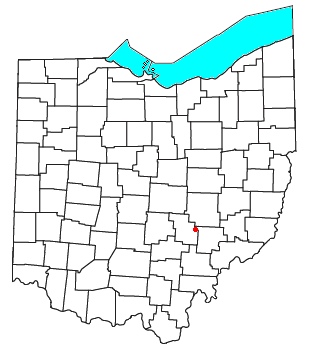
Roxabell is an unincorporated community in central Concord Township, Ross County, Ohio, United States. It lies at the intersection of Davis Hill and Jamison Roads, little more than 1 mile south of the village of Frankfort. Two parts of the North Fork of Paint Creek, a subsidiary of the Ohio River through the Scioto River, pass near Roxabel. It is located slightly more than 3 miles north of State Route 28, midway between the cities of Chillicothe—the county seat of Ross County—and Greenfield.

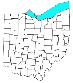
Birmingham is an unincorporated community in southeastern Monroe Township, Guernsey County, Ohio, United States. It lies at the intersection of Beal, Birmingham, and Peoli Roads, 3+3⁄4 miles (6.0 km) south of Peoli, 7 miles east-northeast of Kimbolton, and 13 miles (21 km) northeast of central Cambridge, the county seat of Guernsey County. Nearby streams flow southward into Salt Fork Lake, which is included in Salt Fork State Park.

Assumption is a small unincorporated community and also a historically Irish (Catholic) community in southern Amboy Township, Fulton County, Ohio, United States. A part of the Toledo Metropolitan Area, it lies seven miles from the northern edge of Swanton. It is located at roughly 41°40'N, 83°55'W.
Roundhill is an unincorporated community in Butler County, Kentucky, United States, situated on Butler County's eastern boundary with Edmonson County.
Jetson is an unincorporated community in Butler County, Kentucky, United States.


