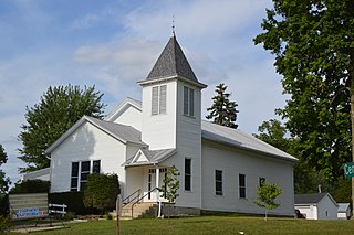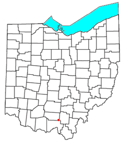
Iberia is a census-designated place in western Washington Township, Morrow County, Ohio, United States. The community is served by the Northmor Local School District which formerly operated Iberia Elementary School in the community. Iberia is near to Galion, and Martel. The ZIP code assigned to Iberia by the United States Postal Service is 43325. The population of Iberia was 431 at the 2020 census. Iberia is northwest of Mount Gilead, the county seat.
Buffalo is an unincorporated community and census-designated place in eastern Valley Township, Guernsey County, Ohio, United States. As of the 2020 census it had a population of 373. It has a post office with the ZIP code 43722. It lies along State Route 313.

Kilbourne is a census-designated place in eastern Brown Township, Delaware County, Ohio, United States. As of the 2020 census it had a population of 127. The community has a post office with the ZIP code of 43032. It lies along State Route 521.

Oceola is a census-designated place (CDP) in central Tod Township, Crawford County, Ohio, United States. As of the 2020 census its population was 156. It has a post office with the ZIP code 44860. It is located along the road that was U.S. Route 30 until being upgraded to a freeway.

Lafferty is a census-designated place in northeastern Union Township, Belmont County, Ohio, United States, along Wheeling Creek. As of the 2020 census it had a population of 255. It has a post office with the ZIP code 43951.

Collins is a census-designated place (CDP) in central Townsend Township, Huron County, Ohio, United States. As of the 2020 census the population of the CDP was 628. The CDP includes the unincorporated communities of Collins and East Townsend. Collins has a post office, with the ZIP code of 44826.

Damascus is an unincorporated community and census-designated place in southern Mahoning and northern Columbiana counties in the U.S. state of Ohio. As of the 2020 census, it had a population of 418. The community lies at the intersection of U.S. Route 62 and State Routes 173 and 534.

East Springfield is a census-designated place (CDP) in northwestern Salem Township, Jefferson County, Ohio, United States. It has a post office with the ZIP code 43925. It lies along State Route 43, 16 miles (26 km) northwest of the county seat of Steubenville and 17 miles (27 km) southeast of Carrollton. The community is part of the Weirton–Steubenville, WV-OH Metropolitan Statistical Area.

Haydenville is an unincorporated community and census-designated place (CDP) in southern Green Township, Hocking County, Ohio, United States. As of the 2020 census the population of the CDP was 337.

East Rochester is an unincorporated community and census-designated place (CDP) in southern West Township, Columbiana County, Ohio, United States. The population was 224 as of the 2020 census. It lies along U.S. Route 30, and has a post office with the ZIP code 44625. It is a part of the Salem micropolitan area, about 20 miles (32 km) east of Canton.

Kinsman is an unincorporated community and census-designated place in Kinsman Township, Trumbull County, Ohio, United States. The population was 574 at the 2020 census. It is part of the Youngstown–Warren metropolitan area. It lies at the intersection of State Route 5 and State Route 7 between Williamsfield and Burghill. Kinsman has a post office with the ZIP code 44428; as well as a library, the Kinsman Free Public Library.

Kansas is a census-designated place in northwestern Liberty Township, Seneca County, Ohio, United States. It has a post office with the ZIP code 44841. It is located along State Route 635.

East Fultonham is a census-designated place in central Newton Township, Muskingum County, Ohio, United States. It has a post office with the ZIP code 43735. It is located along U.S. Route 22 a short distance east of the village of Fultonham. The population was 290 at the 2020 census.

Eureka is an unincorporated community and census-designated place (CDP) in Clinton County in the U.S. state of Michigan. The population of the CDP was 233 at the 2020 census. The community is located within Greenbush Township.

Rio Rico is an unincorporated community and census-designated place (CDP) in Santa Cruz County, Arizona, United States. The population was 18,962 at the 2010 census. The Rio Rico CDP replaced the former CDPs of Rio Rico Northwest, Rio Rico Northeast, Rio Rico Southwest, and Rio Rico Southeast.

Lupton is an unincorporated community and census-designated place (CDP) in Ogemaw County in the U.S. state of Michigan. At the 2010 census, it had a population of 348. Lupton is located mostly within Rose Township with a small portion extending south into Cumming Township.
Filer City is an unincorporated community and census-designated place in Filer Charter Township, Manistee County, Michigan, United States. Its population was 116 as of the 2010 census. The community is located on Manistee Lake just south of Manistee. Filer City has a post office with ZIP code 49634. The post office opened March 10, 1868, was discontinued on April 12, 1871, and reopened on July 13, 1883.

White Mountain Lake is an unincorporated community and census-designated place in Navajo County, Arizona, United States. White Mountain Lake is 7.5 miles (12.1 km) north-northeast of Show Low. White Mountain Lake has a post office with ZIP code 85912.
Westport is an unincorporated community and census-designated place in Oldham County, Kentucky, United States. Its population was 268 as of the 2010 census. Westport has a post office with ZIP code 40077, which opened on November 29, 1815. The community is located along the Ohio River.
Garrison is an unincorporated community and census-designated place in Lewis County, Kentucky, United States. Its population was 866 as of the 2010 census. Garrison has a post office with ZIP code 41141, which opened on February 26, 1886. The community is located along the Ohio River and Kentucky Route 8.


