Beaver, Ohio

Last updated

Beaver, Ohio
OHMap-doton-Beaver.png
Location of Beaver, Ohio
Detailed map of Beaver, Ohio.png
Detailed map of Beaver
Coordinates: 39°01′55″N82°49′31″W / 39.03194°N 82.82528°W / 39.03194; -82.82528
Country United States
State Ohio
County Pike
Area
[1]
  Total0.39 sq mi (1.01 km2)
  Land0.39 sq mi (1.01 km2)
  Water0.00 sq mi (0.00 km2)
Elevation
[2]
696 ft (212 m)
Population
 (2020)
  Total442
  Estimate 
(2023) [3]
436
  Density1,133.33/sq mi (437.34/km2)
Time zone UTC-5 (Eastern (EST))
  Summer (DST) UTC-4 (EDT)
ZIP code
45613
Area code 740
FIPS code 39-04696 [4]
GNIS feature ID2398059 [2]

Beaver is a village in Pike County, Ohio, United States. The population was 442 at the 2020 census.

Contents

The village most likely was named after nearby Beaver Creek. [5]

Geography

According to the United States Census Bureau, the village has a total area of 0.39 square miles (1.01 km2), all land. [6]

Demographics

Historical population
CensusPop.Note
1900 262
1910 2869.2%
1920 278−2.8%
1930 2956.1%
1940 3053.4%
1950 285−6.6%
1960 34119.6%
1970 317−7.0%
1980 3304.1%
1990 3361.8%
2000 46438.1%
2010 449−3.2%
2020 442−1.6%
2023 (est.)436 [3] −1.4%
U.S. Decennial Census [7]

2010 census

As of the census [8] of 2010, there were 449 people, 182 households, and 109 families living in the village. The population density was 1,151.3 inhabitants per square mile (444.5/km2). There were 221 housing units at an average density of 566.7 per square mile (218.8/km2). The racial makeup of the village was 94.7% White, 0.4% from other races, and 4.9% from two or more races. Hispanic or Latino of any race were 2.2% of the population.

There were 182 households, of which 35.7% had children under the age of 18 living with them, 39.6% were married couples living together, 15.9% had a female householder with no husband present, 4.4% had a male householder with no wife present, and 40.1% were non-families. 34.6% of all households were made up of individuals, and 17% had someone living alone who was 65 years of age or older. The average household size was 2.47 and the average family size was 3.17.

The median age in the village was 31.8 years. 27.4% of residents were under the age of 18; 13.7% were between the ages of 18 and 24; 23.8% were from 25 to 44; 21.4% were from 45 to 64; and 13.6% were 65 years of age or older. The gender makeup of the village was 45.9% male and 54.1% female.

2000 census

As of the census [4] of 2000, there were 464 people, 195 households, and 124 families living in the village. The population density was 1,187.9 inhabitants per square mile (458.7/km2). There were 226 housing units at an average density of 578.6 per square mile (223.4/km2). The racial makeup of the village was 97.20% White, 0.65% Native American, 0.22% Asian, and 1.94% from two or more races. Hispanic or Latino of any race were 0.22% of the population.

There were 195 households, of which 34.4% had children under the age of 18 living with them, 45.1% were married couples living together, 16.4% had a female householder with no husband present, and 35.9% were non-families. 33.3% of all households were made up of individuals, and 13.8% had someone living alone who was 65 years of age or older. The average household size was 2.38 and the average family size was 3.04.

In the village, the population was spread out, with 30.4% under the age of 18, 8.2% from 18 to 24, 26.9% from 25 to 44, 19.8% from 45 to 64, and 14.7% who were 65 years of age or older. The median age was 34 years. For every 100 females, there were 81.3 males. For every 100 females age 18 and over, there were 78.5 males.

The median income for a household in the village was $22,632, and the median income for a family was $23,571. Males had a median income of $28,750 versus $20,000 for females. The per capita income for the village was $10,815. About 25.7% of families and 28.6% of the population were below the poverty line, including 46.4% of those under age 18 and 3.0% of those age 65 or over.

Attractions

Dogwood Pass, a living history museum that is a replica of an Old West town, is located in Beaver. [9]

Education

Beaver Eastern Pike serves as the local school district for surrounding areas. [10]

Beaver has a public library, a branch of the Garnet A. Wilson Public Library of Pike County. [11]

Related Research Articles

<span class="mw-page-title-main">Pike County, Ohio</span> County in Ohio, United States

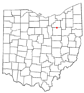
Pike County is a county located in the Appalachian (southern) region of the U.S. state of Ohio. As of the 2020 census, the population was 27,088. Its county seat is Waverly. The county is named for explorer Zebulon Pike.

<span class="mw-page-title-main">Fayetteville, Ohio</span> Village in Ohio, United States

Fayetteville is a village in Perry Township, Brown County, Ohio, United States. The population was 317 at the 2020 census.

<span class="mw-page-title-main">Rogers, Ohio</span> Village in Ohio, United States

Rogers is a village in eastern Columbiana County, Ohio, United States. The population was 194 at the 2020 census. It is part of the Salem micropolitan area, 21 miles (34 km) south of Youngstown.

<span class="mw-page-title-main">Orange, Ohio</span> Village in Ohio, United States

Orange is a village in eastern Cuyahoga County, Ohio, United States. The population was 3,421 at the 2020 census. An affluent eastern suburb of Cleveland, it is part of the Cleveland metropolitan area.

<span class="mw-page-title-main">Woodmere, Ohio</span> Village in Ohio, United States

Woodmere is a village in Cuyahoga County, Ohio, United States. As of the 2020 census, Woodmere had a population of 641 residents. An eastern suburb of Cleveland, it is part of the Cleveland metropolitan area.

<span class="mw-page-title-main">Yorkshire, Ohio</span> Village in Ohio, United States

Yorkshire is a village in Darke County, Ohio, United States. The population was 95 at the 2020 census.

<span class="mw-page-title-main">Delta, Ohio</span> Village in Ohio, United States

Delta is a village in Fulton County, Ohio, United States. The population was 3,316 at the 2020 census.

<span class="mw-page-title-main">Hanover, Ohio</span> Village in Ohio, United States

Hanover is a village in Licking County, Ohio, United States. The population was 1,270 at the 2020 census. The village lies along Ohio State Route 16.

<span class="mw-page-title-main">Hebron, Ohio</span> Village in Ohio, USA

Hebron is a village in Licking County, Ohio, United States. The population was 2,326 at the 2020 census.

<span class="mw-page-title-main">Miltonsburg, Ohio</span> Village in Ohio, United States

Miltonsburg is a village in Monroe County, Ohio, United States. The population was 42 at the 2020 census. Miltonsburg was named after Milton Pierson, son of Ohio pioneer David Pierson. David Pierson named Clarington, Ohio after his daughter Clarinda.

<span class="mw-page-title-main">Shawnee, Perry County, Ohio</span> Village in Ohio, United States

Shawnee is a village in Perry County, Ohio, United States. The population was 505 at the 2020 census. It is 9 miles (14 km) south of the county seat of New Lexington.

<span class="mw-page-title-main">Tarlton, Ohio</span> Village in Ohio, United States

Tarlton is a village in Fairfield and Pickaway counties in the U.S. state of Ohio. The population was 254 at the 2020 census.

<span class="mw-page-title-main">Piketon, Ohio</span> Village in Ohio, United States

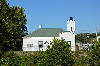
Piketon is a village in Pike County in the U.S. state of Ohio, along the Scioto River. The village is best known for the uranium enrichment plant located there, which is one of only three such plants in the United States. The population was 2,111 at the 2020 U.S. census.

<span class="mw-page-title-main">Bainbridge, Ross County, Ohio</span> Village in Ohio, United States

Bainbridge is a village in Ross County, Ohio, United States, along Paint Creek. The population was 765 at the 2020 census.

<span class="mw-page-title-main">Limaville, Ohio</span> Census-designated place in Ohio, United States

Limaville is a census-designated place (CDP) and former village in Stark County, Ohio, United States. The population was 151 at the 2020 census. It is part of the Canton–Massillon Metropolitan Statistical Area.

<span class="mw-page-title-main">Tuscarawas, Ohio</span> Village in Ohio, United States

Tuscarawas, originally Trenton, is a village in Tuscarawas County, Ohio, United States. The population was 1,035 at the 2020 census.

<span class="mw-page-title-main">Morrow, Ohio</span> Village in Ohio, United States

Morrow is a village in Salem Township, Warren County, Ohio, United States. The population was 2,049 at the 2020 census.

<span class="mw-page-title-main">Wilson, Ohio</span> Village in Ohio, United States

Wilson is a village in Belmont and Monroe counties in the U.S. state of Ohio. The population was 129 at the 2020 census. It is part of the Wheeling metropolitan area.

<span class="mw-page-title-main">Hunting Valley, Ohio</span> Village in Ohio, United States

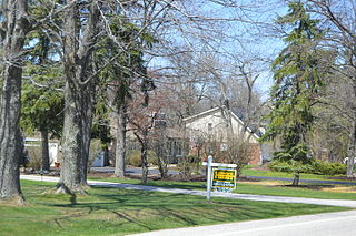
Hunting Valley is a village in Cuyahoga and Geauga counties in the U.S. state of Ohio. The population was 763 as of the 2020 census. An eastern suburb of Cleveland, it is part of the Cleveland metropolitan area. In 2000, Hunting Valley was ranked the 6th highest-income place in the United States. It was the 17th highest-income place in 2010, but still the wealthiest locale in Ohio.

<span class="mw-page-title-main">Creston, Ohio</span> Village in Ohio, United States

Creston is a village in Medina and Wayne counties in the U.S. state of Ohio. The population was 2,139 at the 2020 census.

References

  1. "ArcGIS REST Services Directory". United States Census Bureau. Retrieved September 20, 2022.
  2. 1 2 U.S. Geological Survey Geographic Names Information System: Beaver, Ohio
  3. 1 2 "Annual Estimates of the Resident Population for Incorporated Places in Ohio: April 1, 2020 to July 1, 2023". United States Census Bureau. Retrieved May 23, 2024.
  4. 1 2 "U.S. Census website". United States Census Bureau . Retrieved January 31, 2008.
  5. Overman, William Daniel (1958). Ohio Town Names. Akron, OH: Atlantic Press. p. 10.
  6. "US Gazetteer files 2010". United States Census Bureau. Archived from the original on January 25, 2012. Retrieved January 6, 2013.
  7. "Census of Population and Housing". Census.gov. Retrieved June 4, 2015.
  8. "U.S. Census website". United States Census Bureau . Retrieved January 6, 2013.
  9. "Dogwood Pass, Beaver".
  10. "Eastern Local Schools Home". www.ep.k12.oh.us.
  11. "Hours & Locations". Garnet A. Wilson Public Library of Pike County. Archived from the original on March 4, 2018. Retrieved March 3, 2018.