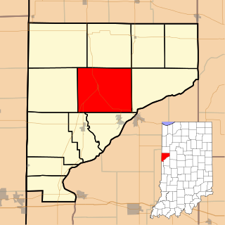
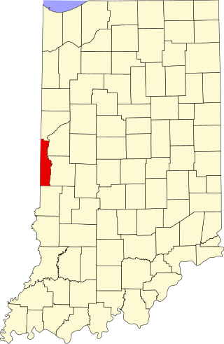
Liberty Township is one of twelve townships in Warren County, Indiana, United States. According to the 2010 census, its population was 896 and it contained 362 housing units.

North Crane is a small unincorporated community in Wea Township, Tippecanoe County, in the U.S. state of Indiana.

West Point is an unincorporated community and census-designated place in Wayne Township, Tippecanoe County, in the U.S. state of Indiana. The population was 594 at the 2010 census.

Flat Iron is a small, unincorporated community in Highland Township, Vermillion County, in the U.S. state of Indiana.

Royalton is an unincorporated community in Eagle Township, Boone County, in the U.S. state of Indiana.
Wesley is an unincorporated community in Wayne Township, Montgomery County, in the U.S. state of Indiana.
Bono is an unincorporated community in Helt Township, Vermillion County, in the U.S. state of Indiana.

Toad Hop is an unincorporated census-designated place in Sugar Creek Township, Vigo County, in the U.S. state of Indiana. It is officially part of West Terre Haute. In 2010, Toad Hop was a census designated place. It is part of the Terre Haute metropolitan area.

Gospel Grove is an unincorporated community in central Lost Creek Township, Vigo County, in the U.S. state of Indiana.

Pleasant Valley is an unincorporated community in Springfield Township, Bucks County, Pennsylvania, United States.
Denmark is an unincorporated community in the southwest portion of Marion Township, Owen County, in the U.S. state of Indiana. It lies near the intersection of County Road 1400 West and County Road 150 South, which is a community about fifteen miles west of the city of Spencer, the county seat of Owen County. Its elevation is 722 feet, and it is located at 39°16′11″N87°1′33″W.
Hickory Corner is an unincorporated community in the northwest corner of Marion Township, Owen County, in the U.S. state of Indiana. It lies near the intersection of County Road 1500 West and Orman Road, which is a community about twenty miles west of the city of Spencer, the county seat. Its elevation is 643 feet, and it is located at 39°18′18″N87°2′40″W.
Five Points is an extinct town that was located in Liberty Township in Warren County, Indiana, on U.S. Route 41.
Hooker Corner is an extinct town that was located in Pine Township in Warren County, Indiana, west of the town of Pine Village.
Banning Corner is an extinct town that was located in Warren Township in Warren County, Indiana, north of the town of Independence.
Glen Cliff is an extinct town that was located in Warren Township in Warren County, Indiana, north of the city of Attica in Fountain County.
Romine Corner is an extinct town that was located in Mound Township in Warren County, Indiana, west of the town of Covington.
Old Town is an extinct town located in Pike Township in Warren County, Indiana, and the original site of what is now the town of West Lebanon.
Crompton Hill is an unincorporated community in Clinton Township, Vermillion County, in the U.S. state of Indiana.
Ege is an unincorporated community in Swan Township, Noble County, in the U.S. state of Indiana.

