Murray, Iowa | |
---|---|
Motto: Murray Matters | |
Coordinates: 41°02′29″N93°56′56″W / 41.04139°N 93.94889°W | |
Country | United States |
State | Iowa |
County | Clarke |
Government | |
• Type | Mayor – Council |
• Mayor | Jeffrey Dale Robbins |
• City Administrator | Denise Arnold (née Denise Rae Palmer) |
Area | |
• Total | 0.8 sq mi (2 km2) |
• Land | 0.8 sq mi (2 km2) |
• Water | 0.0 sq mi (0.0 km2) |
Elevation | 1,217 ft (371 m) |
Population (2020) | |
• Total | 684 |
• Density | 855.00/sq mi (330.17/km2) |
Time zone | |
ZIP code | |
Area code | 641 |
FIPS code | 19-55065 |
GNIS feature ID | 2395142 [2] |
Website | www |
Murray is a city in Clarke County, Iowa, United States. The population was 684 at the time of the 2020 census. [3]
Murray was founded in 1868 as Oakland [4] following the construction of the Burlington & Missouri River Rail Road through the State. [5] The village was laid out in 1868 by Henry Clay Sigler (1830–1907) of Osceol and Smith Henderson Mallory (1835–1903) of Chariton. At that time, Oakland occupied a 120-acre (0.1875-square-mile) tract. The first U.S. Post Office in Oakland was established in the Fall of 1868 – In section 10, Troy Township. Albert ("Bert") Straub (1842–1897) was appointed postmaster November 27, 1868. [6] [7] [8] [9] Straub had been a member of Company E of the 50th Illinois Infantry Regiment and served in the Union Army during the American Civil War.
Murray was incorporated as a city Thursday, October 21, 1880 – thirty-four years after Clarke County had been established by the Territorial Legislature (January 13, 1846). Murray's first City Council meeting was held December 7, 1880. [10] [5] Alanson Bowers (1848–1922) served as founding mayor until March 1882. [11]
According to the United States Census Bureau, Murray has a total area of 0.8 square miles (2.1 km2), all land. [1] The city is in western Clarke County, along the historic Mormon Trail.
Driving distances from Murray:
Year | Pop. | ±% |
---|---|---|
1880 | 491 | — |
1890 | 666 | +35.6% |
1900 | 949 | +42.5% |
1910 | 796 | −16.1% |
1920 | 847 | +6.4% |
1930 | 828 | −2.2% |
1940 | 857 | +3.5% |
1950 | 767 | −10.5% |
1960 | 613 | −20.1% |
1970 | 620 | +1.1% |
1980 | 703 | +13.4% |
1990 | 731 | +4.0% |
2000 | 766 | +4.8% |
2010 | 756 | −1.3% |
2020 | 684 | −9.5% |
Source: 2020 U.S. Census [14] [15] |
As of the census [16] of 2010, there were 756 people, 310 households, and 200 families living in the city. The population density was 957.0 inhabitants per square mile (369.5/km2). There were 337 housing units at an average density of 426.6 per square mile (164.7/km2). The racial makeup of the city was 98.1% White, 0.5% African American, and 1.3% from other races. Hispanic or Latino of any race were 2.9% of the population.
There were 310 households, of which 31.3% had children under the age of 18 living with them, 48.4% were married couples living together, 9.4% had a female householder with no husband present, 6.8% had a male householder with no wife present, and 35.5% were non-families. 29.0% of all households were made up of individuals, and 13.9% had someone living alone who was 65 years of age or older. The average household size was 2.44 and the average family size was 2.97.
The median age in the city was 36.8 years. 26.5% of residents were under the age of 18; 7.6% were between the ages of 18 and 24; 25.8% were from 25 to 44; 25.2% were from 45 to 64; and 14.8% were 65 years of age or older. The gender makeup of the city was 49.7% male and 50.3% female.
As of the census [17] of 2000, there were 766 people, 308 households, and 218 families living in the city. The population density was 977.4 inhabitants per square mile (377.4/km2). There were 338 housing units at an average density of 431.3 per square mile (166.5/km2). The racial makeup of the city was 98.43% White, 0.65% African American, 0.26% Native American, 0.13% Asian, 0.13% from other races, and 0.39% from two or more races. Hispanic or Latino of any race were 1.31% of the population.
There were 305 households, out of which 37.0% had children under the age of 18 living with them, 53.6% were married couples living together, 12.0% had a female householder with no husband present, and 28.9% were non-families. 26.6% of all households were made up of individuals, and 14.3% had someone living alone who was 65 years of age or older. The average household size was 2.49 and the average family size was 2.97.
In the city, the population was spread out, with 28.2% under the age of 18, 9.0% from 18 to 24, 27.2% from 25 to 44, 20.6% from 45 to 64, and 15.0% who were 65 years of age or older. The median age was 36 years. For every 100 females, there were 93.9 males. For every 100 females age 18 and over, there were 88.4 males.
The median income for a household in the city was $29,879, and the median income for a family was $37,083. Males had a median income of $27,583 versus $20,577 for females. The per capita income for the city was $14,879. About 5.0% of families and 8.2% of the population were below the poverty line, including 7.8% of those under age 18 and 14.0% of those age 65 or over.
Queens is a borough of New York City, coextensive with Queens County, in the U.S. state of New York. Located at the western end of Long Island, it is the largest of the five New York City boroughs by area. It is bordered by the borough of Brooklyn and by Nassau County to its east, and shares maritime borders with the boroughs of Manhattan, the Bronx, and Staten Island, as well as with New Jersey. Queens is the most linguistically and ethnically diverse place on Earth.
Clay County is a county in the U.S. state of South Dakota. As of the 2020 census, the population was 14,967. The county seat is Vermillion, which is also home to the University of South Dakota. The county is named for Henry Clay, American statesman, US Senator from Kentucky, and United States Secretary of State in the 19th century.
Wayne County is a county located in the U.S. state of Iowa. As of the 2020 census, the population was 6,497, making it the sixth-least populous county in Iowa. The county seat is Corydon.
Jones County is a county in the U.S. state of Iowa. As of the 2020 census the population was 20,646. The county seat is Anamosa. The county was founded in 1837 and named after George Wallace Jones, a United States senator and member of Congress.
Jefferson County is a county located in the U.S. state of Iowa. As of the 2020 United States Census, the population was 15,663. The county seat is Fairfield. The county was formed in January 1839, and was named for U.S. President Thomas Jefferson.
Clarke County is a county located in the U.S. state of Iowa. As of the 2020 census, the population was 9,748. The county seat is Osceola. The county was formed in January 1846, one of twelve counties established by legislative action in a comprehensive act. It was named for James Clarke, a Governor of the Iowa Territory.
Boone County is a county in the U.S. state of Iowa. As of the 2020 census, the population was 26,715. Its county seat is Boone.
Allamakee County is the northeasternmost county in the U.S. state of Iowa. As of the 2020 census, the population was 14,061. Its county seat is Waukon.
Everly is a city in Clay County, Iowa, United States. The population was 575 in the 2020 census, a decline from 647 in 2000. The Ocheyedan River flows to the south and west of the city.
Grandview is a city in Louisa County, Iowa, United States. The population was 437 at the time of the 2020 census. It is part of the Muscatine Micropolitan Statistical Area.
Winterset is a city in and the county seat of Madison County, Iowa. The population was 5,353 at the time of the 2020 census.
Adams is a city in Adams Township, Mower County, Minnesota, United States. The population was 683 at the 2020 census, down from 787 in 2010.
Le Roy is a city in Mower County, Minnesota, United States, surrounded by Le Roy Township. The population was 957 at the 2020 census. Lake Louise State Park is just outside the town.
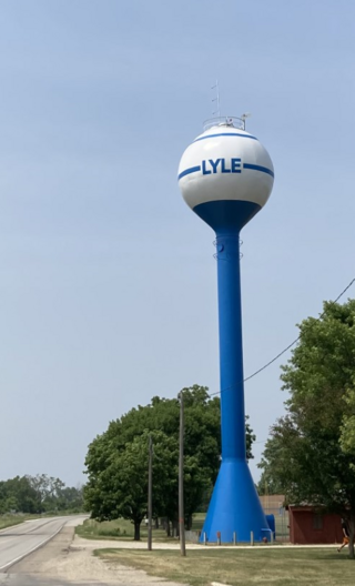
Lyle is a city in Mower County, Minnesota, United States. The city lies on the north side of the Iowa border. The population was 522 at the 2020 census.
Mapleview is a city in Lansing Township, Mower County, Minnesota, United States. It is a suburb of Austin, the county seat. The population was 144 at the 2020 census, down from 176 in 2010. It was named for a row of maple trees that once stood on the west side of town.
Rose Creek is a city in Mower County, Minnesota, United States. The population was 397 at the 2020 census.
Taopi is a city in Mower County, Minnesota, United States. The population was 61 at the 2020 census. It is located near the source of the Wapsipinicon River.
Waltham is a city in Mower County, Minnesota, United States. The population was 164 at the 2020 census.
Shenandoah is a city in Page and Fremont counties in Iowa, United States. The population was 4,925 at the time of the 2020 U.S. Census. Once referred to as the "seed and nursery center of the world," Shenandoah is the home to Earl May Seed Company and the radio station KMA, founded by Earl E. May. The early live radio stations gave many performers their start, including The Everly Brothers and Charlie Haden.
The Iowa Department of Education sets the standards for all public institutions of education in Iowa and accredits private as well as public schools. It is headquartered in Des Moines.
{{cite book}}
: CS1 maint: location missing publisher (link) OCLC 35564970(all editions).{{cite book}}
: CS1 maint: numeric names: authors list (link) LCCN 99-72525; ISBN 978-1-5903-8197-7, 1590-3-8197-1; OCLC 68906350, 1005479164.{{cite book}}
: CS1 maint: multiple names: authors list (link) CS1 maint: numeric names: authors list (link) LCCN 75-36295; ISBN 0-9161-7003-9, 978-0-9161-7003-5.{{cite book}}
: CS1 maint: numeric names: authors list (link) LCCN 2006-35801; ISBN 1-5872-9531-8, 978-1-5872-9531-7 (paperback); OCLC 297116395(all editions) {{cite news}}
: CS1 maint: numeric names: authors list (link) LCCN sn82-15551; OCLC 1566275(all editions).{{cite book}}
: CS1 maint: numeric names: authors list (link); doi:10.17077/0003-4827.5529 (article); OCLC 7790170116 (article index).Atlases