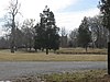
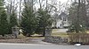
This is a list of properties and historic districts on the National Register of Historic Places in Anchorage, Kentucky. Latitude and longitude coordinates of the 35 sites listed on this page may be displayed in a map or exported in several formats by clicking on one of the links in the adjacent box. [1]
National Register sites elsewhere in Jefferson County are listed separately.
This National Park Service list is complete through NPS recent listings posted February 9, 2024. [2]
| [3] | Name on the Register | Image | Date listed | Date removed | Location | Description |
|---|---|---|---|---|---|---|
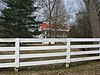
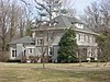
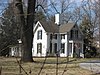
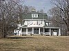
| 1 | Dorsey-O'Bannon'Hebel House | September 25, 1979 (#79000996) | February 5, 1991 | East of Anchorage at 13204 Factory Lane | Moved in 1987 |
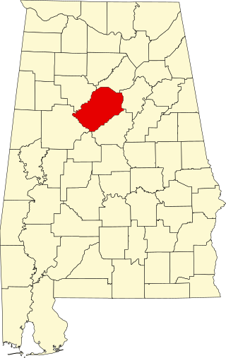
This is intended to be a complete list of the properties and districts on the National Register of Historic Places in Jefferson County, Alabama, United States. Latitude and longitude coordinates are provided for many National Register properties and districts; these locations may be seen together in an online map.

List of the National Register of Historic Places listings in Jefferson County, New York
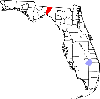
This is a list of the National Register of Historic Places listings in Jefferson County, Florida.
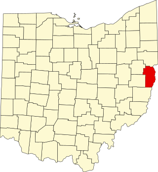
This is a list of the National Register of Historic Places listings in Jefferson County, Ohio.
This is a list of properties and historic districts on the National Register of Historic Places in downtown Louisville, Kentucky. Latitude and longitude coordinates of the 85 sites listed on this page may be displayed in a map or exported in several formats by clicking on one of the links in the adjacent box.

This is a list of the National Register of Historic Places listings in Jefferson County, Pennsylvania.
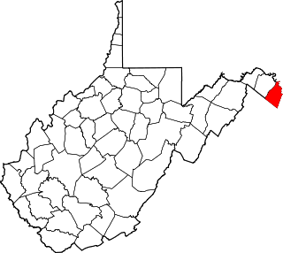
This is a list of the National Register of Historic Places listings in Jefferson County, West Virginia.
This is a list of properties and historic districts on the National Register of Historic Places in the Portland neighborhood of Louisville, Kentucky (roughly bounded by the Ohio River on the north; N. 10th St. to the east; W. Market St. to the south; and I-264 and the Shawnee Golf Course to the west. Latitude and longitude coordinates of the 35 sites listed on this page may be displayed in a map or exported in several formats by clicking on one of the links in the adjacent box.
This is a list of properties and historic districts on the National Register of Historic Places in the West End of Louisville, Kentucky. The table below includes 49 listings in the following neighborhoods:

This is a list of the National Register of Historic Places listings in Woodford County, Kentucky.

This is a list of the National Register of Historic Places listings in Franklin County, Kentucky.

This is a list of the National Register of Historic Places listings in Pulaski County, Kentucky.

This is a list of the National Register of Historic Places listings in Madison County, Kentucky.

This is a list of the National Register of Historic Places listings in Mercer County, Kentucky.

This is a list of the National Register of Historic Places listings in Floyd County, Kentucky.

This is intended to be a complete list of the properties and districts on the National Register of Historic Places in Kenton County, Kentucky, United States. The locations of National Register properties and districts for which the latitude and longitude coordinates are included below, may be seen in a map.

This is a list of the National Register of Historic Places listings in Clark County, Indiana.

This is a list of the National Register of Historic Places listings in Jefferson County, Indiana.
This is a list of properties and historic districts on the National Register of Historic Places in The Highlands, Louisville, Kentucky. The table below includes 30 listings in the following neighborhoods:
This is a list of properties and historic districts on the National Register of Historic Places in Old Louisville, Kentucky. Latitude and longitude coordinates of the 33 sites listed on this page may be displayed in a map or exported in several formats by clicking on one of the links in the adjacent box.
| Topics | |
|---|---|
| Lists by state |
|
| Lists by insular areas | |
| Lists by associated state | |
| Other areas | |
| Related | |