Forest Hills, Kentucky

Last updated
Forest Hills, Kentucky
Jefferson County Kentucky Incorporated and Unincorporated areas Forest Hills Highlighted 2128342.svg
Location of Forest Hills in Jefferson County, Kentucky
USA Kentucky location map.svg
Red pog.svg
Forest Hills
Location within the state of Kentucky
Usa edcp location map.svg
Red pog.svg
Forest Hills
Forest Hills (the United States)
Coordinates: 38°12′57″N85°35′00″W / 38.21583°N 85.58333°W / 38.21583; -85.58333
Country United States
State Kentucky
County Jefferson
Area
[1]
  Total0.29 sq mi (0.75 km2)
  Land0.29 sq mi (0.75 km2)
  Water0.00 sq mi (0.00 km2)
Elevation
[2]
659 ft (201 m)
Population
 (2020)
  Total438
  Density1,515.57/sq mi (585.02/km2)
Time zone UTC-5 (Eastern (EST))
  Summer (DST) UTC-4 (EDT)
ZIP Code
41527
FIPS code 21-28342
GNIS feature ID2403634 [2]
Website www.city-of-forest-hills.com

Forest Hills is a home rule-class city in Jefferson County, Kentucky, United States. It was formally incorporated by the state assembly in 1959. [3] The population was 444 at the 2010 census. [4]

Contents

Geography

Forest Hills is located in eastern Jefferson County at 38°12′47″N85°34′55″W / 38.21306°N 85.58194°W / 38.21306; -85.58194 (38.213169, -85.582062). [5] It is bordered to the northwest by Hurstbourne Acres and on all other sides by Jeffersontown. Interstate 64 passes just north of the city border, with access from Exit 15 (Hurstbourne Parkway). I-64 leads west 11 miles (18 km) to downtown Louisville and east 40 miles (64 km) to Frankfort.

According to the United States Census Bureau, Forest Hills has a total area of 0.29 square miles (0.75 km2), all land. [4]

Demographics

Historical population
CensusPop.Note
1960 180
1970 469160.6%
1980 5027.0%
1990 454−9.6%
2000 4948.8%
2010 444−10.1%
2020 438−1.4%
U.S. Decennial Census [6]

As of the census [7] of 2000, there were 494 people, 195 households, and 147 families residing in the city. The population density was 1,560.5 inhabitants per square mile (602.5/km2). There were 198 housing units at an average density of 625.5 per square mile (241.5/km2). The racial makeup of the city was 95.95% White, 1.42% Black or African American, 2.02% Native American, 0.20% Asian, 0.20% from other races, and 0.20% from two or more races. Hispanic or Latino of any race were 1.01% of the population.

There were 195 households, out of which 29.2% had children under the age of 18 living with them, 65.1% were married couples living together, 8.7% had a female householder with no husband present, and 24.6% were non-families. 22.1% of all households were made up of individuals, and 15.9% had someone living alone who was 65 years of age or older. The average household size was 2.53 and the average family size was 2.95.

In the city, the population was spread out, with 22.9% under the age of 18, 5.5% from 18 to 24, 26.9% from 25 to 44, 22.3% from 45 to 64, and 22.5% who were 65 years of age or older. The median age was 42 years. For every 100 females, there were 90.0 males. For every 100 females age 18 and over, there were 89.6 males.

The median income for a household in the city was $65,500, and the median income for a family was $73,750. Males had a median income of $46,500 versus $32,750 for females. The per capita income for the city was $24,024. About 1.5% of families and 2.9% of the population were below the poverty line, including 3.5% of those under age 18 and 7.8% of those age 65 or over.

Related Research Articles

<span class="mw-page-title-main">Jefferson County, Kentucky</span> County in Kentucky, United States

Jefferson County is located in the north central portion of the U.S. state of Kentucky. As of the 2020 census, the population was 782,969. It is the most populous county in the commonwealth.

<span class="mw-page-title-main">Hiseville, Kentucky</span> Unincorporated community in Kentucky, United States

Hiseville is an unincorporated community and census-designated place (CDP) in Barren County, Kentucky, United States. The population was 240 at the 2010 census. It is part of the Glasgow Micropolitan Statistical Area. Hiseville was a city until it disincorporated in 2004.

<span class="mw-page-title-main">Bellemeade, Kentucky</span> City in Kentucky, United States

Bellemeade is a home rule-class city in Jefferson County, Kentucky, United States. It was formally incorporated by the state assembly in 1956. The population was 865 at the 2010 census.

Broad Fields is a neighborhood of St. Matthews, Kentucky. Broad Fields was a Sixth Class city in Jefferson County, Kentucky, United States. Broad Fields was incorporated on May 24, 1957. Broad Fields was dissolved on July 1, 2000, and annexed by St. Matthews on January 8, 2001. The population was 250 at the 2000 census.

<span class="mw-page-title-main">Brownsboro Village, Kentucky</span> City in Kentucky, United States

Brownsboro Village is a home rule-class city in Jefferson County, Kentucky, United States. The population was 319 at the 2010 census.

Cherrywood Village is a neighborhood and former city in Jefferson County, Kentucky, United States. Cherrywood Village was annexed by the City of St. Matthews in 2001. The population was 327 at the 2000 census.

Fairmeade is a neighborhood of St. Matthews, Kentucky. The population was 264 at the 2000 census.

<span class="mw-page-title-main">Hurstbourne, Kentucky</span> City in Kentucky, United States

Hurstbourne is a home rule-class city in Jefferson County, Kentucky, United States. The population was 4,216 at the 2010 census, up from 3,884 at the time of the 2000 U.S. census. It is part of the Louisville Metro Government.

<span class="mw-page-title-main">Hurstbourne Acres, Kentucky</span> City in Kentucky, United States

Hurstbourne Acres is a home rule-class city in Jefferson County, Kentucky, United States. The population was 1,811 at the 2010 census, up from 1,504 at the 2000 census.

<span class="mw-page-title-main">Meadow Vale, Kentucky</span> City in Kentucky, United States

Meadow Vale is a home rule-class city in Jefferson County, Kentucky, United States. As of the 2010 census the population was 736.

<span class="mw-page-title-main">Moorland, Kentucky</span> City in Kentucky, United States

Moorland is a home rule-class city in Jefferson County, Kentucky, United States. The population was 431 as of the 2010 census.

Plymouth Village is a neighborhood of St. Matthews, Kentucky a city in Jefferson County, Kentucky, United States. The population was 201 at the 2000 census.

<span class="mw-page-title-main">Poplar Hills, Kentucky</span> City in Kentucky, United States

Poplar Hills is a home rule-class city in Jefferson County, Kentucky, United States. It is a part of the Louisville Metro government, but operates as a city under the Mayor to Commissioner form of government. Per the 2020 census, the population was 380, but the city administration has made several annexation ordinances that have passed and awaits updated information. The current city population is estimated to be 2380. It currently has the highest population density for any city in Kentucky.

Springlee is a neighborhood of St. Matthews, Kentucky, an area of Louisville. The population was 426 at the 2000 census. Until 2000 Springlee was an independent Sixth Class city in Jefferson County, Kentucky, United States. Springlee was incorporated on April 25, 1950. Springlee was dissolved on December 5, 2000 and annexed by the City of St. Matthews on January 8, 2001

Whipps Millgate is a former city in Jefferson County, Kentucky, United States. The population was 415 at the 2000 census. The City of Whipps Millgate was incorporated on April 26, 1969, it was dissolved and annexed by the City of Lyndon, Kentucky on July 1, 2001.

<span class="mw-page-title-main">Wildwood, Kentucky</span> City in Kentucky, United States

Wildwood is a home rule-class city in Jefferson County, Kentucky, United States. The population was 261 at the 2010 census.

<span class="mw-page-title-main">Woodland Hills, Kentucky</span> City in Kentucky, United States

Woodland Hills is a home rule-class city in Jefferson County, Kentucky, United States. The population was 696 at the 2010 census.

<span class="mw-page-title-main">Villa Hills, Kentucky</span> City in Kentucky, United States

Villa Hills is a home rule-class city in Kenton County, Kentucky along the Ohio River. The population was 7,489 at the 2010 census.

<span class="mw-page-title-main">Raywick, Kentucky</span> City in Kentucky, United States

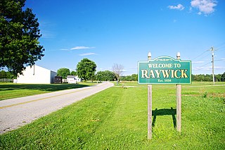
Raywick is a home rule-class city in Marion County, Kentucky, United States. The population was 155 at the 2020 census.

<span class="mw-page-title-main">Saranac, Michigan</span> Village in Michigan, United States

Saranac is a village in Boston Twp, Ionia County in the U.S. state of Michigan. The population was 1,325 at the 2010 census. Today, Saranac serves as a retail and services hub for agricultural areas surrounding the village.

References

  1. "2020 U.S. Gazetteer Files". United States Census Bureau. Retrieved March 18, 2022.
  2. 1 2 U.S. Geological Survey Geographic Names Information System: Forest Hills, Kentucky
  3. Commonwealth of Kentucky. Office of the Secretary of State. Land Office. "Forest Hills, Kentucky". Accessed 26 July 2013.
  4. 1 2 "Geographic Identifiers: 2010 Census Summary File 1 (G001): Forest Hills city, Kentucky". American Factfinder. U.S. Census Bureau. Archived from the original on February 13, 2020. Retrieved May 29, 2018.
  5. "US Gazetteer files: 2010, 2000, and 1990". United States Census Bureau. 2011-02-12. Retrieved 2011-04-23.
  6. "Census of Population and Housing". Census.gov. Retrieved June 4, 2015.
  7. "U.S. Census website". United States Census Bureau . Retrieved 2008-01-31.