National Register of Historic Places listings in Lee County, Mississippi

Last updated

Location of Lee County in Mississippi Map of Mississippi highlighting Lee County.svg
Location of Lee County in Mississippi

This is a list of the National Register of Historic Places listings in Lee County, Mississippi.

Contents

This is intended to be a complete list of the properties and districts on the National Register of Historic Places in Lee County, Mississippi, United States. Latitude and longitude coordinates are provided for many National Register properties and districts; these locations may be seen together in a map. [1]

There are 27 properties and districts listed on the National Register in the county.


    This National Park Service list is complete through NPS recent listings posted May 10, 2024. [2]

Current listings

[3] Name on the Register [4] ImageDate listed [5] Location City or townDescription
1 Baldwyn Historic District [6] July 20, 2011
(#11000471)
Roughly along E. & W. Main Sts. & N. & S. 2nd Ave.
34°30′33″N88°38′01″W / 34.509167°N 88.633611°W / 34.509167; -88.633611 (Baldwyn Historic District)
Baldwyn
2 Baldwyn Medical Group September 16, 2021
(#100006895)
300 Mill St.
34°30′31″N88°38′14″W / 34.508591°N 88.637179°W / 34.508591; -88.637179 (Baldwyn Medical Group)
Baldwyn
3 Benson Farm House February 12, 2024
(#100009039)
486 Cty. Rd. 520
34°09′17″N88°40′08″W / 34.1548°N 88.6689°W / 34.1548; -88.6689 (Benson Farm House)
Shannon vicinity
4 Brices Cross Roads National Battlefield Site
Brices Cross Roads National Battlefield Site Brices-cross-roads-NBS.jpg
Brices Cross Roads National Battlefield Site
October 15, 1966
(#66000067)
6 miles west of Baldwyn on Mississippi Highway 370
34°30′24″N88°43′44″W / 34.506667°N 88.728889°W / 34.506667; -88.728889 (Brices Cross Roads National Battlefield Site)
Baldwyn
5 Barlow Burrow House
Barlow Burrow House Barlow Burrow House, Lee County, Mississippi.jpg
Barlow Burrow House
March 1, 1984
(#84002251)
157 N. 2nd St.
34°22′45″N88°40′53″W / 34.379167°N 88.681389°W / 34.379167; -88.681389 (Barlow Burrow House)
Saltillo
6 Carnation Milk Factory
Carnation Milk Factory Carnation Milk Factory 1.JPG
Carnation Milk Factory
August 20, 2009
(#09000624)
520 Carnation St.
34°15′14″N88°42′34″W / 34.253889°N 88.709444°W / 34.253889; -88.709444 (Carnation Milk Factory)
Tupelo
7 R.C. Clark House
R.C. Clark House R.C. Clark House-Tupelo MS.jpg
R.C. Clark House
November 5, 2010
(#10000883)
215 N. Church St.
34°15′31″N88°42′31″W / 34.258611°N 88.708611°W / 34.258611; -88.708611 (R.C. Clark House)
Tupelo
8 Downtown Tupelo Historic District
Downtown Tupelo Historic District Downtown Tupelo 1.JPG
Downtown Tupelo Historic District
June 2, 2014
(#14000276)
Roughly bounded by Jefferson, Madison. N. Front, & Kansas City Southern RR.
34°15′27″N88°42′25″W / 34.257456°N 88.707005°W / 34.257456; -88.707005 (Downtown Tupelo Historic District)
Tupelo
9 First Methodist Church
First Methodist Church First Methodist Tupelo.jpg
First Methodist Church
March 15, 1990
(#90000348)
412 W. Main St.
34°15′28″N88°42′27″W / 34.257778°N 88.7075°W / 34.257778; -88.7075 (First Methodist Church)
Tupelo
10 R.F. Goodlett House
R.F. Goodlett House R.F. Goodlett House-Tupelo MS.jpg
R.F. Goodlett House
April 3, 1992
(#92000162)
219 Broadway
34°15′31″N88°42′20″W / 34.258611°N 88.705556°W / 34.258611; -88.705556 (R.F. Goodlett House)
Tupelo
11 Highland Circle Historic District March 20, 2006
(#06000196)
Highland Circle neighborhood, including parts of N. Madison St., Highland Circle, Oak Grove Rd., and W. Jackson St.
34°16′01″N88°42′43″W / 34.266944°N 88.711944°W / 34.266944; -88.711944 (Highland Circle Historic District)
Tupelo
12 Lee County Courthouse
Lee County Courthouse Lee County Courthouse.jpg
Lee County Courthouse
April 3, 1992
(#92000161)
Court St. between Spring and Broadway
34°15′31″N88°42′17″W / 34.258611°N 88.704722°W / 34.258611; -88.704722 (Lee County Courthouse)
Tupelo
13 Mill Village Historic District April 3, 1992
(#92000159)
Roughly bounded by the Illinois Central and St. Louis – San Francisco railroad tracks and Chestnut and Green Sts.
34°15′08″N88°42′19″W / 34.252222°N 88.705278°W / 34.252222; -88.705278 (Mill Village Historic District)
Tupelo
14 Mutt-Thomason Site August 31, 1978
(#78001611)
Address restricted [7]
Tupelo
15 North Broadway Historic District
North Broadway Historic District McCoy House (c. 1900).jpg
North Broadway Historic District
October 31, 1985
(#85003438)
300 block of N. Broadway St.
34°15′37″N88°42′20″W / 34.260278°N 88.705556°W / 34.260278; -88.705556 (North Broadway Historic District)
Tupelo
16 North Church Primary School
North Church Primary School NChurchStPrimarySchool.jpg
North Church Primary School
April 3, 1992
(#92000164)
Southwestern corner of the junction of Church and Jackson Sts.
34°15′48″N88°42′33″W / 34.263333°N 88.709167°W / 34.263333; -88.709167 (North Church Primary School)
Tupelo
17 Old Superintendent's House, Tupelo Fish Hatchery
Old Superintendent's House, Tupelo Fish Hatchery Tupelo MS Old Superintendent-s house Tupelo fish hatchery 02.JPG
Old Superintendent's House, Tupelo Fish Hatchery
July 14, 1992
(#92000837)
111 Elizabeth St.
34°14′55″N88°42′07″W / 34.248611°N 88.701944°W / 34.248611; -88.701944 (Old Superintendent's House, Tupelo Fish Hatchery)
Tupelo
18 Peoples Bank and Trust Company
Peoples Bank and Trust Company PeoplesBank&Trust.jpg
Peoples Bank and Trust Company
August 24, 1978
(#78001610)
211 Main St.
34°15′26″N88°42′17″W / 34.257222°N 88.704722°W / 34.257222; -88.704722 (Peoples Bank and Trust Company)
Tupelo
19 South Church Street Historic District April 3, 1992
(#92000160)
602-713 S. Church St.
34°15′05″N88°42′30″W / 34.251389°N 88.708333°W / 34.251389; -88.708333 (South Church Street Historic District)
Tupelo
20 Spain House
Spain House Spain House.jpg
Spain House
March 21, 2011
(#11000109)
553 W. Main St.
34°15′26″N88°42′37″W / 34.257222°N 88.710278°W / 34.257222; -88.710278 (Spain House)
Tupelo
21 F.L. Spight House
F.L. Spight House F L Spight House (1937).jpg
F.L. Spight House
April 3, 1992
(#92000163)
363 N. Broadway
34°15′41″N88°42′20″W / 34.261389°N 88.705556°W / 34.261389; -88.705556 (F.L. Spight House)
Tupelo
22 Spring Hill Missionary Baptist Church April 11, 2023
(#100008603)
589 North Green St.
34°16′06″N88°42′27″W / 34.2684°N 88.7075°W / 34.2684; -88.7075 (Spring Hill Missionary Baptist Church)
Tupelo
23 Stewart-Anderson House
Stewart-Anderson House Stewart-Anderson House (1867).jpg
Stewart-Anderson House
June 24, 1994
(#94000644)
433 N. Church St.
34°15′45″N88°42′34″W / 34.2625°N 88.709444°W / 34.2625; -88.709444 (Stewart-Anderson House)
Tupelo
24 Tombigbee State Park
Tombigbee State Park Tombigbee State Park-Tupelo MS.jpg
Tombigbee State Park
March 25, 1999
(#99000382)
264 Cabin Dr.
34°13′51″N88°37′24″W / 34.230833°N 88.623333°W / 34.230833; -88.623333 (Tombigbee State Park)
Tupelo
25 Tupelo Downtown Neighborhood Historic District September 28, 2021
(#100007053)
Roughly bounded by East Jackson, North Spring, Main, West Jefferson, and North Gloster Sts.
34°15′42″N88°42′32″W / 34.2616°N 88.7088°W / 34.2616; -88.7088 (Tupelo Downtown Neighborhood Historic District)
Tupelo
26 Tupelo Homesteads
Tupelo Homesteads Tupelo Homestead Quarters No 13 NPS.jpg
Tupelo Homesteads
February 7, 1997
(#97000035)
County Roads 657 and 665 and County Drive 647, south of its junction with the Natchez Trace Parkway
34°19′34″N88°42′27″W / 34.326111°N 88.7075°W / 34.326111; -88.7075 (Tupelo Homesteads)
Tupelo
27 Tupelo National Battlefield
Tupelo National Battlefield Tupelo NBS Monument.jpg
Tupelo National Battlefield
October 15, 1966
(#66000068)
On Mississippi Highway 6 about 1 mile west of its junction with U.S. Route 45
34°15′19″N88°44′14″W / 34.255278°N 88.737222°W / 34.255278; -88.737222 (Tupelo National Battlefield)
Tupelo

See also

Related Research Articles

<span class="mw-page-title-main">National Register of Historic Places listings in Adams County, Mississippi</span>

This is a list of the National Register of Historic Places listings in Adams County, Mississippi.

<span class="mw-page-title-main">National Register of Historic Places listings in Claiborne County, Mississippi</span>

This is a list of the National Register of Historic Places listings in Claiborne County, Mississippi.

<span class="mw-page-title-main">National Register of Historic Places listings in Harrison County, Mississippi</span>

This is a list of the National Register of Historic Places listings in Harrison County, Mississippi.

<span class="mw-page-title-main">National Register of Historic Places listings in Clay County, Mississippi</span>

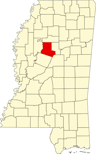
This is a list of the National Register of Historic Places listings in Clay County, Mississippi.

<span class="mw-page-title-main">National Register of Historic Places listings in Hinds County, Mississippi</span>

This is a list of the National Register of Historic Places listings in Hinds County, Mississippi.

<span class="mw-page-title-main">National Register of Historic Places listings in Jackson County, Mississippi</span>

This is a list of the National Register of Historic Places listings in Jackson County, Mississippi.

<span class="mw-page-title-main">National Register of Historic Places listings in Leflore County, Mississippi</span>

This is a list of the National Register of Historic Places listings in Leflore County, Mississippi.

<span class="mw-page-title-main">National Register of Historic Places listings in Coahoma County, Mississippi</span>

This is a list of the National Register of Historic Places listings in Coahoma County, Mississippi.

<span class="mw-page-title-main">National Register of Historic Places listings in Monroe County, Mississippi</span>

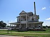
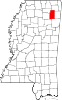
The following properties are listed on the National Register of Historic Places in Monroe County, Mississippi.

<span class="mw-page-title-main">National Register of Historic Places listings in Oktibbeha County, Mississippi</span>

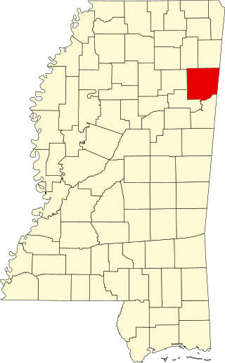
This is a list of the National Register of Historic Places listings in Oktibbeha County, Mississippi.

<span class="mw-page-title-main">National Register of Historic Places listings in Alcorn County, Mississippi</span>

This is a list of the National Register of Historic Places listings in Alcorn County, Mississippi.

<span class="mw-page-title-main">National Register of Historic Places listings in Lawrence County, Mississippi</span>

This is a list of the National Register of Historic Places listings in Lawrence County, Mississippi.

<span class="mw-page-title-main">National Register of Historic Places listings in Forrest County, Mississippi</span>

This is a list of the National Register of Historic Places listings in Forrest County, Mississippi.

<span class="mw-page-title-main">National Register of Historic Places listings in Holmes County, Mississippi</span>

This is a list of the National Register of Historic Places listings in Holmes County, Mississippi.

<span class="mw-page-title-main">National Register of Historic Places listings in Wilkinson County, Mississippi</span>

This is a list of the National Register of Historic Places listings in Wilkinson County, Mississippi.

<span class="mw-page-title-main">National Register of Historic Places listings in Carroll County, Mississippi</span>

This is a list of the National Register of Historic Places listings in Carroll County, Mississippi.

<span class="mw-page-title-main">National Register of Historic Places listings in Rankin County, Mississippi</span>

This is a list of the National Register of Historic Places listings in Rankin County, Mississippi.

<span class="mw-page-title-main">National Register of Historic Places listings in Yazoo County, Mississippi</span>

This is a list of the National Register of Historic Places listings in Yazoo County, Mississippi.

<span class="mw-page-title-main">National Register of Historic Places listings in Grenada County, Mississippi</span>

This is a list of the National Register of Historic Places listings in Grenada County, Mississippi.

<span class="mw-page-title-main">National Register of Historic Places listings in New Madrid County, Missouri</span>

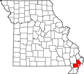
This is a list of the National Register of Historic Places listings in New Madrid County, Missouri.

References

  1. The latitude and longitude information provided in this table was derived originally from the National Register Information System, which has been found to be fairly accurate for about 99% of listings. Some locations in this table may have been corrected to current GPS standards.
  2. National Park Service, United States Department of the Interior, "National Register of Historic Places: Weekly List Actions", retrieved May 10, 2024.
  3. Numbers represent an alphabetical ordering by significant words. Various colorings, defined here, differentiate National Historic Landmarks and historic districts from other NRHP buildings, structures, sites or objects.
  4. "National Register Information System". National Register of Historic Places . National Park Service. March 13, 2009.
  5. The eight-digit number below each date is the number assigned to each location in the National Register Information System database, which can be viewed by clicking the number.
  6. "Weekly list of actions taken on properties: 7/18/11 through 7/22/11". National Park Service. July 29, 2011. Retrieved September 14, 2012.
  7. Federal and state laws and practices restrict general public access to information regarding the specific location of this resource. In some cases, this is to protect archeological sites from vandalism, while in other cases it is restricted at the request of the owner. See: Knoerl, John; Miller, Diane; Shrimpton, Rebecca H. (1990), Guidelines for Restricting Information about Historic and Prehistoric Resources, National Register Bulletin, National Park Service, U.S. Department of the Interior, OCLC   20706997 .