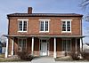
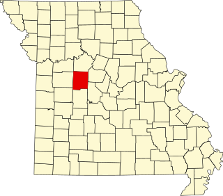
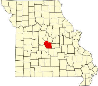
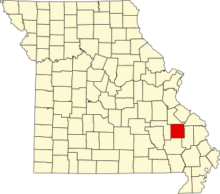
[3] Name on the Register Image Date listed [4] Location City or town Description 1 Levi Barkley House Upload image March 2, 1984 (# 84002583 West of Hannibal 39°44′04″N 91°29′51″W / 39.734444°N 91.4975°W / 39.734444; -91.4975 (Levi Barkley House ) Hannibal 2 Broadway District Broadway District August 1, 1986 (# 86002128 Roughly bounded by S. Main, Broadway, and S. 3rd Sts. 39°42′34″N 91°21′22″W / 39.709444°N 91.356111°W / 39.709444; -91.356111 (Broadway District ) Hannibal 3 Buildings at 207–209 South Main St. Buildings at 207–209 South Main St. August 1, 1986 (# 86002129 207–209 S. Main St. 39°42′30″N 91°21′17″W / 39.708333°N 91.354722°W / 39.708333; -91.354722 (Buildings at 207–209 South Main St. ) Hannibal 4 Central Park Historic District Central Park Historic District October 7, 1982 (# 82000586 Roughly bounded by 4th, 7th, North, and Lyon Sts. 39°42′32″N 91°21′36″W / 39.708889°N 91.36°W / 39.708889; -91.36 (Central Park Historic District ) Hannibal 5 Clemens Field Clemens Field August 26, 2008 (# 08000807 401 Collier St. 39°42′19″N 91°21′23″W / 39.705387°N 91.356277°W / 39.705387; -91.356277 (Clemens Field ) Hannibal 6 Culbertson-Head Farmstead Culbertson-Head Farmstead September 4, 2008 (# 08000838 7178 County Road 402 39°47′41″N 91°30′33″W / 39.794812°N 91.509302°W / 39.794812; -91.509302 (Culbertson-Head Farmstead ) Palmyra 7 Davidson Building Davidson Building August 1, 1986 (# 86002130 106 S. Main St. 39°42′34″N 91°21′18″W / 39.709444°N 91.355°W / 39.709444; -91.355 (Davidson Building ) Hannibal 8 Digel Block Digel Block August 1, 1986 (# 86002131 218-222 S. Main St. 39°42′30″N 91°21′15″W / 39.708333°N 91.354167°W / 39.708333; -91.354167 (Digel Block ) Hannibal 9 Dryden-Louthan House Dryden-Louthan House January 18, 1985 (# 85000104 402 E. Ross St. 39°47′40″N 91°31′09″W / 39.794444°N 91.519167°W / 39.794444; -91.519167 (Dryden-Louthan House ) Palmyra 10 Ebert-Dulany House Ebert-Dulany House February 17, 1983 (# 83001030 1000 Center St. 39°42′24″N 91°21′13″W / 39.706667°N 91.353611°W / 39.706667; -91.353611 (Ebert-Dulany House ) Hannibal 11 Eighth and Center Streets Baptist Church Eighth and Center Streets Baptist Church September 4, 1980 (# 80002376 722 Center St. 39°42′28″N 91°21′48″W / 39.707778°N 91.363333°W / 39.707778; -91.363333 (Eighth and Center Streets Baptist Church ) Hannibal 12 Robert Elliott's Wholesale Grocery Robert Elliott's Wholesale Grocery August 1, 1986 (# 86002132 116-120 S. 3rd St. 39°42′31″N 91°21′22″W / 39.708611°N 91.356111°W / 39.708611; -91.356111 (Robert Elliott's Wholesale Grocery ) Hannibal 13 Federal Building Federal Building October 15, 1980 (# 80002377 600 Broadway 39°42′29″N 91°21′33″W / 39.708056°N 91.359167°W / 39.708056; -91.359167 (Federal Building ) Hannibal 14 Gardner House Gardner House March 4, 1971 (# 71000470 421 Hamilton and Main Sts. 39°47′46″N 91°31′20″W / 39.796111°N 91.522222°W / 39.796111; -91.522222 (Gardner House ) Palmyra 15 Green Double House Green Double House August 1, 1986 (# 86002133 113-115 S. 3rd St. 39°42′31″N 91°21′24″W / 39.708611°N 91.356667°W / 39.708611; -91.356667 (Green Double House ) Hannibal 16 Hafner Grocery Warehouse Upload image August 1, 1986 (# 86002134 101 E. Church St. 39°42′34″N 91°21′12″W / 39.709444°N 91.353333°W / 39.709444; -91.353333 (Hafner Grocery Warehouse ) Hannibal 17 Hannibal Lime Company Office Upload image September 6, 1984 (# 84002585 623 Collier St. 39°42′18″N 91°21′34″W / 39.705°N 91.359444°W / 39.705; -91.359444 (Hannibal Lime Company Office ) Hannibal 18 Hannibal Old Police Station and Jail Hannibal Old Police Station and Jail July 17, 1979 (# 79001381 4th and Church Sts. 39°42′27″N 91°21′26″W / 39.7075°N 91.357222°W / 39.7075; -91.357222 (Hannibal Old Police Station and Jail ) Hannibal 19 Hendren Farm Upload image August 22, 1984 (# 84002587 Route 2 39°44′59″N 91°26′27″W / 39.749722°N 91.440833°W / 39.749722; -91.440833 (Hendren Farm ) Hannibal 20 Hock Building Hock Building December 2, 1986 (# 86003588 312 Center St. 39°42′35″N 91°21′29″W / 39.709861°N 91.358056°W / 39.709861; -91.358056 (Hock Building ) Hannibal 21 Holmes-Dakin Building Upload image August 1, 1986 (# 86002135 120-122 S. Main St. 39°42′33″N 91°21′17″W / 39.709167°N 91.354722°W / 39.709167; -91.354722 (Holmes-Dakin Building ) Hannibal 22 Benjamin Horr House Benjamin Horr House December 2, 1986 (# 86003587 308 Center St. 39°42′36″N 91°21′27″W / 39.71°N 91.3575°W / 39.71; -91.3575 (Benjamin Horr House ) Hannibal 23 Lock and Dam No. 21 Historic District Lock and Dam No. 21 Historic District March 10, 2004 (# 04000181 Mississippi River south of West Quincy 39°54′22″N 91°25′56″W / 39.906111°N 91.432194°W / 39.906111; -91.432194 (Lock and Dam No. 21 Historic District ) West Quincy Extends into Adams County, Illinois 24 Maple Avenue Historic District Maple Avenue Historic District November 21, 2002 (# 02001404 Roughly bounded by Broadway and Center St., the alley to North St., and Dulany to Section 39°42′30″N 91°21′59″W / 39.708333°N 91.366389°W / 39.708333; -91.366389 (Maple Avenue Historic District ) Hannibal 25 Marion County Courthouse Marion County Courthouse October 22, 2002 (# 02001194 906 Broadway 39°42′30″N 91°21′51″W / 39.708333°N 91.364167°W / 39.708333; -91.364167 (Marion County Courthouse ) Hannibal 26 Marion County Jail and Jailor's House Marion County Jail and Jailor's House October 4, 2002 (# 02001100 210 W. Lafayette St. 39°47′55″N 91°31′28″W / 39.798611°N 91.524444°W / 39.798611; -91.524444 (Marion County Jail and Jailor's House ) Palmyra 27 Mark Twain Historic District Mark Twain Historic District January 4, 1978 (# 78003398 Bird, Main, and Hill Sts. 39°42′43″N 91°21′25″W / 39.711944°N 91.356944°W / 39.711944; -91.356944 (Mark Twain Historic District ) Hannibal 28 Mark Twain Hotel Mark Twain Hotel August 1, 1986 (# 86002136 200 S. Main St. 39°42′33″N 91°21′17″W / 39.709167°N 91.354722°W / 39.709167; -91.354722 (Mark Twain Hotel ) Hannibal 29 Robert Masterson House Upload image April 5, 1984 (# 84002591 Northwest of Hannibal 39°46′02″N 91°28′20″W / 39.767222°N 91.472222°W / 39.767222; -91.472222 (Robert Masterson House ) Hannibal 30 North Main Street Historic District North Main Street Historic District August 1, 1986 (# 86002137 Roughly bounded by Bird, N. Main, and Hill Sts. 39°42′40″N 91°21′22″W / 39.711111°N 91.356111°W / 39.711111; -91.356111 (North Main Street Historic District ) Hannibal 31 Osterhout Mound Park Osterhout Mound Park April 11, 1973 (# 73001045 Wauneta Pl. 39°43′00″N 91°23′43″W / 39.71667°N 91.395201°W / 39.71667; -91.395201 (Osterhout Mound Park ) Hannibal 32 Riverview Park Riverview Park September 6, 2005 (# 05000998 2000 Harrison Hill 39°43′29″N 91°22′18″W / 39.724722°N 91.371667°W / 39.724722; -91.371667 (Riverview Park ) Hannibal 33 Rockcliffe Mansion Rockcliffe Mansion September 18, 1980 (# 80002378 1000 Bird St. 39°42′29″N 91°21′57″W / 39.708056°N 91.365833°W / 39.708056; -91.365833 (Rockcliffe Mansion ) Hannibal 34 St. Elizabeth Hospital St. Elizabeth Hospital August 14, 2012 (# 12000500 109 Virginia St. 39°42′14″N 91°22′51″W / 39.703992°N 91.380792°W / 39.703992; -91.380792 (St. Elizabeth Hospital ) Hannibal 35 Sharkey Mound Group Upload image December 18, 1973 (# 73001046 Address Restricted Hannibal 36 Peter J. Sowers House Peter J. Sowers House January 18, 1985 (# 85000105 221 Home St. 39°47′52″N 91°31′12″W / 39.797778°N 91.52°W / 39.797778; -91.52 (Peter J. Sowers House ) Palmyra 37 Speigle House Speigle House February 14, 1985 (# 85000283 406 S. Dickerson 39°47′48″N 91°31′28″W / 39.796667°N 91.524444°W / 39.796667; -91.524444 (Speigle House ) Palmyra 38 Standard Printing Company Standard Printing Company August 1, 1986 (# 86002138 201 N. 3rd St. 39°42′36″N 91°21′28″W / 39.710000°N 91.357778°W / 39.710000; -91.357778 (Standard Printing Company ) Hannibal 39 Mark Twain Boyhood Home Mark Twain Boyhood Home October 15, 1966 (# 66000419 206-208 Hill St. 39°42′44″N 91°21′28″W / 39.712222°N 91.357778°W / 39.712222; -91.357778 (Mark Twain Boyhood Home ) Hannibal 40 Walker-Woodward-Schaffer House Walker-Woodward-Schaffer House February 16, 1984 (# 84002592 1425 S. Main St. 39°47′13″N 91°31′23″W / 39.786944°N 91.523056°W / 39.786944; -91.523056 (Walker-Woodward-Schaffer House ) Palmyra 41 Ephraim J. Wilson Farm Complex Upload image December 28, 1982 (# 82000587 East of Palmyra off Route 168 39°45′45″N 91°29′16″W / 39.7625°N 91.487778°W / 39.7625; -91.487778 (Ephraim J. Wilson Farm Complex ) Palmyra