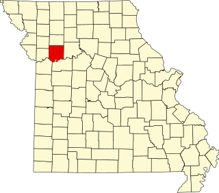
[3] Name on the Register Image Date listed [4] Location City or town Description 1 Aker Cemetery Aker Cemetery November 13, 1974 (# 74001071 Northeast of Smithville off MO W 39°24′40″N 94°32′44″W / 39.411111°N 94.545556°W / 39.411111; -94.545556 (Aker Cemetery ) Smithville 2 Antioch Christian Church Antioch Christian Church April 2, 1979 (# 79001358 4805 NE Antioch Rd. 39°10′53″N 94°32′52″W / 39.181389°N 94.547778°W / 39.181389; -94.547778 (Antioch Christian Church ) Kansas City 3 Armour Theatre Building Armour Theatre Building June 24, 2008 (# 08000560 400-410 Armour Rd. 39°08′33″N 94°34′32″W / 39.142572°N 94.575656°W / 39.142572; -94.575656 (Armour Theatre Building ) North Kansas City 4 Arthur-Leonard Historic District Arthur-Leonard Historic District January 4, 2001 (# 00001608 Roughly bounded by Ford Ave., Jewell St., Choctaw St., and Missouri St. 39°14′41″N 94°24′56″W / 39.244722°N 94.415556°W / 39.244722; -94.415556 (Arthur-Leonard Historic District ) Liberty 5 Atkins-Johnson Farmhouse Property Atkins-Johnson Farmhouse Property November 7, 2007 (# 07001154 6508 N Jackson Ave. 39°12′46″N 94°31′49″W / 39.212778°N 94.530278°W / 39.212778; -94.530278 (Atkins-Johnson Farmhouse Property ) Gladstone 6 Boarding House District Upload image August 24, 2018 (# 100002791 401-608 Benton, 339-436 E Broadway, 201-223 S Francis, 105 Haynes, 309-526 Isley, 101 Linden, 110-112 Perry, 103-305 Saratoga, 000-213 Temple 39°20′28″N 94°13′04″W / 39.3412°N 94.2179°W / 39.3412; -94.2179 (Boarding House District ) Excelsior Springs 7 Clay County Savings Association Building Clay County Savings Association Building December 28, 1992 (# 92001675 104 E. Franklin St. 39°14′50″N 94°25′08″W / 39.247222°N 94.418889°W / 39.247222; -94.418889 (Clay County Savings Association Building ) Liberty 8 Claybrook House Claybrook House December 21, 1981 (# 81000332 Northeast of Kearney 39°23′17″N 94°20′09″W / 39.388056°N 94.335833°W / 39.388056; -94.335833 (Claybrook House ) Kearney 9 Clinton House Clinton House November 22, 1978 (# 78001641 404 S. Leonard St. 39°14′23″N 94°25′00″W / 39.239722°N 94.416667°W / 39.239722; -94.416667 (Clinton House ) Liberty 10 Colonial Hotel Colonial Hotel June 24, 2010 (# 10000392 328 E. Broadway 39°20′33″N 94°13′13″W / 39.3425°N 94.220278°W / 39.3425; -94.220278 (Colonial Hotel ) Excelsior Springs 11 Dr. James Compton House Dr. James Compton House July 10, 1979 (# 79003677 5410 NE Oak Ridge Rd. 39°11′47″N 94°30′43″W / 39.196389°N 94.511944°W / 39.196389; -94.511944 (Dr. James Compton House ) Kansas City 12 Dougherty-Prospect Heights Historic District Dougherty-Prospect Heights Historic District January 4, 2001 (# 00001605 Roughly bounded by Mississippi St., Gallatin St., Schrader St., and Fairview Ave. 39°14′52″N 94°25′32″W / 39.247778°N 94.425556°W / 39.247778; -94.425556 (Dougherty-Prospect Heights Historic District ) Liberty 13 Downtown Smithville Historic District Downtown Smithville Historic District April 21, 2014 (# 14000159 Roughly bounded by Bridge, Church, Commercial & Meadow Sts. 39°23′14″N 94°34′49″W / 39.387103°N 94.580359°W / 39.387103; -94.580359 (Downtown Smithville Historic District ) Smithville 14 The Elms Historic District The Elms Historic District March 31, 2014 (# 14000091 Roughly 400 blk. Regent Ave., 500 blk. Elms Blvd., 500-600 blocks Kansas City Ave. 39°20′15″N 94°13′34″W / 39.337393°N 94.226196°W / 39.337393; -94.226196 (The Elms Historic District ) Excelsior Springs 15 Elms Hotel Elms Hotel March 29, 1985 (# 85000648 Regent and Elms Blvd. 39°20′14″N 94°13′32″W / 39.337222°N 94.225556°W / 39.337222; -94.225556 (Elms Hotel ) Excelsior Springs 16 Excelsior Springs Hall of Waters Commercial East Historic District Excelsior Springs Hall of Waters Commercial East Historic District May 27, 1999 (# 99000638 Roughly along portions of East and West Broadway and Main St. 39°20′39″N 94°13′19″W / 39.344167°N 94.221944°W / 39.344167; -94.221944 (Excelsior Springs Hall of Waters Commercial East Historic District ) Excelsior Springs 17 Excelsior Springs Hall of Waters Commercial West Historic District Excelsior Springs Hall of Waters Commercial West Historic District May 27, 1999 (# 99000637 Roughly along portions of Thompson, and St. Louis Aves.; South, Main, Marietta, and Spring Sts.; and Elms Blvd. 39°20′33″N 94°14′13″W / 39.3425°N 94.236944°W / 39.3425; -94.236944 (Excelsior Springs Hall of Waters Commercial West Historic District ) Excelsior Springs 18 First Methodist Church First Methodist Church October 28, 2009 (# 09000856 114 N. Marietta St. 39°20′34″N 94°13′28″W / 39.342733°N 94.224356°W / 39.342733; -94.224356 (First Methodist Church ) Excelsior Springs 19 Garrison School Historic District Garrison School Historic District January 4, 2001 (# 00001607 Roughly along N. Main St. and N. Water St. 39°15′14″N 94°25′14″W / 39.253889°N 94.420556°W / 39.253889; -94.420556 (Garrison School Historic District ) Liberty 20 Hall of Waters Hall of Waters June 9, 1983 (# 83000977 201 E. Broadway 39°20′30″N 94°13′20″W / 39.341667°N 94.222222°W / 39.341667; -94.222222 (Hall of Waters ) Excelsior Springs 21 Frank Hughes Memorial Library Frank Hughes Memorial Library December 28, 1992 (# 92001676 210 E. Franklin St. 39°14′50″N 94°25′03″W / 39.247222°N 94.4175°W / 39.247222; -94.4175 (Frank Hughes Memorial Library ) Liberty 22 IOOF Liberty Lodge No. 49 IOOF Liberty Lodge No. 49 December 28, 1992 (# 92001677 16-18 E. Franklin St. 39°14′49″N 94°25′11″W / 39.2470°N 94.4197°W / 39.2470; -94.4197 (IOOF Liberty Lodge No. 49 ) Liberty 23 James Brothers' House and Farm James Brothers' House and Farm March 16, 1972 (# 72000709 2.25 miles (3.62 km) east of Kearney; also northeast of Kearney 39°23′36″N 94°19′18″W / 39.393333°N 94.321667°W / 39.393333; -94.321667 (James Brothers' House and Farm ) Kearney Northeast of Kearney represents a boundary increase of September 27, 1978 24 Jewell Hall Jewell Hall September 6, 1978 (# 78001642 Jewell St. between Kansas and Mississippi Sts. 39°14′49″N 94°24′44″W / 39.246944°N 94.412222°W / 39.246944; -94.412222 (Jewell Hall ) Liberty 25 Jewell-Lightburne Historic District Jewell-Lightburne Historic District January 4, 2001 (# 00001606 Roughly bounded by N. Jewell St., E. Mill St., Main St. and Gordon St. 39°14′53″N 94°24′54″W / 39.248056°N 94.415°W / 39.248056; -94.415 (Jewell-Lightburne Historic District ) Liberty 26 Ligon Apartments Ligon Apartments May 17, 2010 (# 10000265 211 E Excelsior St. 39°20′34″N 94°13′18″W / 39.342730°N 94.221678°W / 39.342730; -94.221678 (Ligon Apartments ) Excelsior Springs 27 Major Hotel Major Hotel December 28, 1992 (# 92001678 112 E. Franklin St. 39°14′50″N 94°25′06″W / 39.247222°N 94.418333°W / 39.247222; -94.418333 (Major Hotel ) Liberty 28 Miller Building Miller Building December 28, 1992 (# 92001679 2 E. Franklin St. 39°14′50″N 94°25′12″W / 39.247222°N 94.42°W / 39.247222; -94.42 (Miller Building ) Liberty 29 Missouri City Savings Bank Building and Meeting Hall Missouri City Savings Bank Building and Meeting Hall July 30, 2010 (# 10000507 417-419 Main St. 39°14′18″N 94°17′39″W / 39.238333°N 94.294167°W / 39.238333; -94.294167 (Missouri City Savings Bank Building and Meeting Hall ) Missouri City 30 Mt. Memorial Cemetery Mt. Memorial Cemetery April 24, 2012 (# 12000231 500 block E. Mississippi St. 39°14′56″N 94°24′45″W / 39.249003°N 94.412363°W / 39.249003; -94.412363 (Mt. Memorial Cemetery ) Liberty 31 Nebo Hill Archeological Site Upload image March 4, 1971 (# 71000465 Summit of Nebo Hill [5] 39°12′40″N 94°21′22″W / 39.211111°N 94.356111°W / 39.211111; -94.356111 (Nebo Hill Archeological Site ) Liberty 32 Odd Fellows Home District Odd Fellows Home District September 15, 1987 (# 87001595 MO 291 39°13′47″N 94°24′30″W / 39.229722°N 94.408333°W / 39.229722; -94.408333 (Odd Fellows Home District ) Liberty 33 Sears, Roebuck and Company Warehouse Building Sears, Roebuck and Company Warehouse Building May 9, 1997 (# 97000411 715 Armour Rd. 39°08′32″N 94°34′17″W / 39.142222°N 94.571389°W / 39.142222; -94.571389 (Sears, Roebuck and Company Warehouse Building ) North Kansas City 34 South Liberty Courthouse Square Historic District South Liberty Courthouse Square Historic District December 28, 1992 (# 92001680 2 S. Main St., 10 E. Kansas St., 1-17 E. Kansas St. 39°14′45″N 94°25′11″W / 39.245833°N 94.419722°W / 39.245833; -94.419722 (South Liberty Courthouse Square Historic District ) Liberty 35 Watkins Mill Watkins Mill November 13, 1966 (# 66000416 6 miles (9.7 km) northwest of Excelsior 39°24′36″N 94°15′45″W / 39.41°N 94.2625°W / 39.41; -94.2625 (Watkins Mill ) Excelsior Springs 36 West Liberty Courthouse Square Historic District Upload image December 28, 1992 (# 92001681 12-16 N. Main St. 39°14′47″N 94°25′14″W / 39.246389°N 94.420556°W / 39.246389; -94.420556 (West Liberty Courthouse Square Historic District ) Liberty 37 Wheeling Corrugating Company Building Wheeling Corrugating Company Building October 21, 1994 (# 94001220 820 E. 14th Ave. 39°08′04″N 94°34′14″W / 39.134444°N 94.570556°W / 39.134444; -94.570556 (Wheeling Corrugating Company Building ) North Kansas City 38 Woodneath Woodneath February 17, 1978 (# 78001640 8900 NE Flintlock Rd. 39°15′12″N 94°28′03″W / 39.253333°N 94.4675°W / 39.253333; -94.4675 (Woodneath ) Kansas City 39 Wyman School Wyman School July 24, 2008 (# 08000695 100 Dunbar St. 39°20′23″N 94°13′41″W / 39.339664°N 94.228169°W / 39.339664; -94.228169 (Wyman School ) Excelsior Springs