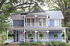
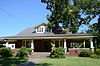
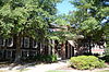
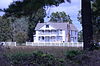
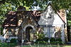
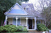
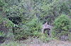
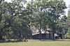
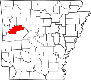
[3] Name on the Register [4] Image Date listed [5] Location City or town Description 1 William Thomas Abington House William Thomas Abington House July 11, 1992 (# 91001350 Center St., southwest of its junction with Highway 367 35°04′28″N 91°52′30″W / 35.074444°N 91.875°W / 35.074444; -91.875 (William Thomas Abington House ) Beebe 2 Ackins House Upload image July 11, 1992 (# 91001322 Junction of Highways 31 and 305 35°11′31″N 91°58′01″W / 35.191944°N 91.966944°W / 35.191944; -91.966944 (Ackins House ) Floyd No longer standing. 3 American Legion Hall American Legion Hall September 13, 1991 (# 91001186 Junction of Race and Spruce Sts. 35°15′04″N 91°44′17″W / 35.251111°N 91.738056°W / 35.251111; -91.738056 (American Legion Hall ) Searcy 4 Col. Ralph Andrews House Col. Ralph Andrews House September 5, 1991 (# 91001253 517 W. Center St. 35°04′05″N 91°53′09″W / 35.068056°N 91.885833°W / 35.068056; -91.885833 (Col. Ralph Andrews House ) Beebe 5 Baldock House Baldock House September 5, 1991 (# 91001239 Junction of S. Elm St. and W. Woodruff Ave. 35°14′45″N 91°44′25″W / 35.245833°N 91.740278°W / 35.245833; -91.740278 (Baldock House ) Searcy 6 Bank of Searcy Bank of Searcy September 5, 1991 (# 91001228 301 N. Spruce St. 35°15′01″N 91°44′19″W / 35.250278°N 91.738611°W / 35.250278; -91.738611 (Bank of Searcy ) Searcy 7 Beebe Jail Beebe Jail September 13, 1991 (# 91001251 East of the junction of N. Main and Illinois Sts. 35°04′17″N 91°52′48″W / 35.071272°N 91.879882°W / 35.071272; -91.879882 (Beebe Jail ) Beebe 8 Beebe Railroad Station Beebe Railroad Station December 11, 1979 (# 79000465 Center St. 35°04′11″N 91°52′49″W / 35.069722°N 91.880278°W / 35.069722; -91.880278 (Beebe Railroad Station ) Beebe 9 Beebe Theater Upload image September 5, 1991 (# 91001265 Center St. 35°04′15″N 91°52′46″W / 35.070833°N 91.879444°W / 35.070833; -91.879444 (Beebe Theater ) Beebe Demolished. 10 Bell House Bell House September 5, 1991 (# 91001201 302 W. Woodruff Ave. 35°14′47″N 91°44′24″W / 35.246389°N 91.74°W / 35.246389; -91.74 (Bell House ) Searcy 11 Berry House Berry House September 5, 1991 (# 91001262 208 Hickory 35°04′22″N 91°53′14″W / 35.072778°N 91.887222°W / 35.072778; -91.887222 (Berry House ) Beebe 12 Big Four School Big Four School July 10, 1992 (# 91001192 County Road 383 south of its junction with Highway 258 35°20′44″N 91°38′34″W / 35.345556°N 91.642778°W / 35.345556; -91.642778 (Big Four School ) Providence Demolished. 13 Benjamin Clayton Black House Benjamin Clayton Black House November 20, 1974 (# 74000505 300 E. Race St. 35°15′36″N 91°44′01″W / 35.26°N 91.733611°W / 35.26; -91.733611 (Benjamin Clayton Black House ) Searcy 14 Bloom House Bloom House September 5, 1991 (# 91001176 Junction of N. Maple and Academy Sts. 35°15′10″N 91°44′41″W / 35.252778°N 91.744722°W / 35.252778; -91.744722 (Bloom House ) Searcy 15 Blunt House Livestock Barn Upload image July 10, 1992 (# 91001363 County Road 357, east of its junction with Highway 157 35°31′00″N 91°38′13″W / 35.516667°N 91.636944°W / 35.516667; -91.636944 (Blunt House Livestock Barn ) Midway 16 James William Boggs House James William Boggs House September 5, 1991 (# 91001298 Austin St. between South and Torrence Sts. 35°25′29″N 91°50′11″W / 35.424722°N 91.836389°W / 35.424722; -91.836389 (James William Boggs House ) Pangburn 17 Luke Bone Grocery-Boarding House Luke Bone Grocery-Boarding House September 13, 1991 (# 91001275 Junction of Main and Market Sts. 35°18′35″N 91°34′00″W / 35.309722°N 91.566667°W / 35.309722; -91.566667 (Luke Bone Grocery-Boarding House ) Bald Knob 18 Green Booth House Green Booth House September 5, 1991 (# 91001202 Junction of S. Pecan St. and W. Center Ave. 35°14′56″N 91°44′39″W / 35.248889°N 91.744167°W / 35.248889; -91.744167 (Green Booth House ) Searcy 19 Booth-Weir House Booth-Weir House September 5, 1991 (# 91001345 W. 1st St. 35°07′11″N 91°48′54″W / 35.119722°N 91.815°W / 35.119722; -91.815 (Booth-Weir House ) McRae 20 Bradford City Hall-Byers Masonic Lodge Bradford City Hall-Byers Masonic Lodge October 21, 1999 (# 99001260 302 W. Walnut St. 35°25′27″N 91°27′19″W / 35.424167°N 91.455278°W / 35.424167; -91.455278 (Bradford City Hall-Byers Masonic Lodge ) Bradford 21 Brooks House Brooks House July 10, 1992 (# 91001217 704 E. Market St. 35°14′59″N 91°43′48″W / 35.249722°N 91.73°W / 35.249722; -91.73 (Brooks House ) Searcy 22 Brown House Brown House September 13, 1991 (# 91001268 Elm St. 35°18′39″N 91°34′07″W / 35.310833°N 91.568611°W / 35.310833; -91.568611 (Brown House ) Bald Knob 23 Joe Brown House and Farmstead Upload image September 13, 1991 (# 91001338 County Road 529 northwest of Little Red 35°28′34″N 91°43′20″W / 35.476111°N 91.722222°W / 35.476111; -91.722222 (Joe Brown House and Farmstead ) Little Red 24 Burnett House Upload image July 11, 1992 (# 91001337 County Road 766 northwest of Searcy 35°15′55″N 91°47′04″W / 35.265278°N 91.784444°W / 35.265278; -91.784444 (Burnett House ) Searcy Demolished. 25 Caldwell House Caldwell House September 5, 1991 (# 91001347 Junction of E. 2nd and Smith Sts. 35°06′43″N 91°49′19″W / 35.111944°N 91.821944°W / 35.111944; -91.821944 (Caldwell House ) McRae 26 Campbell-Chrisp House Campbell-Chrisp House September 5, 1991 (# 91001280 102 Elm St. 35°18′38″N 91°34′09″W / 35.310556°N 91.569167°W / 35.310556; -91.569167 (Campbell-Chrisp House ) Bald Knob 27 Leslie and Anamiece Carmichael House Upload image September 14, 2022 (# 100008145 712 Randall Dr. 35°15′15″N 91°43′30″W / 35.2542°N 91.72489°W / 35.2542; -91.72489 (Leslie and Anamiece Carmichael House ) Searcy 27 Cary House Cary House July 10, 1992 (# 91001293 Junction of Searcy and Short Sts. 35°25′41″N 91°50′14″W / 35.428056°N 91.837222°W / 35.428056; -91.837222 (Cary House ) Pangburn 28 Chandler House Upload image July 10, 1992 (# 91001310 Junction of County Roads 327 and 379 35°22′41″N 91°37′19″W / 35.378056°N 91.621944°W / 35.378056; -91.621944 (Chandler House ) Stevens Creek 29 Childers Farmstead Childers Farmstead July 11, 1992 (# 91001349 East of Highway 367 and south of McRae 35°05′38″N 91°49′39″W / 35.093889°N 91.8275°W / 35.093889; -91.8275 (Childers Farmstead ) McRae 30 Churchill-Hilger House Churchill-Hilger House September 5, 1991 (# 91001301 Junction of Main and Searcy Sts. 35°25′35″N 91°50′10″W / 35.426389°N 91.836111°W / 35.426389; -91.836111 (Churchill-Hilger House ) Pangburn 31 Pattie Cobb Hall Pattie Cobb Hall September 5, 1991 (# 91001209 900 E. Center at Harding University 35°14′50″N 91°43′40″W / 35.247222°N 91.727778°W / 35.247222; -91.727778 (Pattie Cobb Hall ) Searcy 32 Collison House Collison House May 29, 2008 (# 08000489 206 N. Main St. 35°18′43″N 91°34′03″W / 35.311944°N 91.5675°W / 35.311944; -91.5675 (Collison House ) Bald Knob 33 Sam Cooley Barn Upload image July 11, 1992 (# 91001282 County Road 96 southeast of Bald Knob 35°17′41″N 91°32′53″W / 35.294722°N 91.548056°W / 35.294722; -91.548056 (Sam Cooley Barn ) Bald Knob 34 Cremane House Cremane House July 10, 1992 (# 91001320 County Road 95 west of Bradford Lake 35°25′01″N 91°26′19″W / 35.416944°N 91.438611°W / 35.416944; -91.438611 (Cremane House ) Bradford 35 Col. John Critz Farm, Springhouse Upload image July 10, 1992 (# 91001333 County Road 818 west of its junction with County Road 41 35°17′14″N 91°52′10″W / 35.287222°N 91.869444°W / 35.287222; -91.869444 (Col. John Critz Farm, Springhouse ) Center Hill Demolished. 36 Cumberland Presbyterian Church Cumberland Presbyterian Church July 10, 1992 (# 91001225 Junction of Race and Spring Sts. 35°15′03″N 91°44′14″W / 35.250833°N 91.737222°W / 35.250833; -91.737222 (Cumberland Presbyterian Church ) Searcy 37 Jesse N. Cypert Law Office Jesse N. Cypert Law Office July 12, 1992 (# 91001179 104 E. Race St. 35°15′04″N 91°44′13″W / 35.251111°N 91.736944°W / 35.251111; -91.736944 (Jesse N. Cypert Law Office ) Searcy 38 Darden-Gifford House Darden-Gifford House January 1, 1976 (# 76000474 North of Rose Bud off Highway 5 35°20′15″N 92°04′44″W / 35.3375°N 92.078889°W / 35.3375; -92.078889 (Darden-Gifford House ) Rose Bud 39 Deener House Deener House December 22, 1982 (# 82000957 310 E. Center Ave. 35°14′54″N 91°43′57″W / 35.248333°N 91.7325°W / 35.248333; -91.7325 (Deener House ) Searcy 40 Department of Labor Employment Security Division Office Department of Labor Employment Security Division Office September 13, 1991 (# 100008146 501 West Arch Ave. 35°15′00″N 91°44′32″W / 35.2500°N 91.7422°W / 35.2500; -91.7422 (Department of Labor Employment Security Division Office ) Searcy 40 Doniphan Lumber Mill Historic District Upload image September 13, 1991 (# 91001196 Around Doniphan Lake off Highway 367 35°15′02″N 91°40′31″W / 35.250556°N 91.675278°W / 35.250556; -91.675278 (Doniphan Lumber Mill Historic District ) Doniphan 41 David Doyle House No. 2 Upload image September 5, 1991 (# 91001302 Junction of Highway 5 and County Road 953 35°07′27″N 92°05′40″W / 35.124167°N 92.094444°W / 35.124167; -92.094444 (David Doyle House No. 2 ) El Paso Demolished 11/2003. 42 James W. Edie House James W. Edie House September 5, 1991 (# 91001189 Junction of Jackson and Washington Sts. 35°16′07″N 91°38′18″W / 35.268611°N 91.638333°W / 35.268611; -91.638333 (James W. Edie House ) Judsonia 43 El Paso Bank El Paso Bank September 5, 1991 (# 91001303 County Road 3 east of its junction with Highway 5 35°07′34″N 92°05′45″W / 35.126111°N 92.095833°W / 35.126111; -92.095833 (El Paso Bank ) El Paso 44 Elm Street House Elm Street House September 13, 1991 (# 91001269 Elm St. 35°18′37″N 91°34′07″W / 35.310278°N 91.568611°W / 35.310278; -91.568611 (Elm Street House ) Bald Knob 45 Joe Emmer House Upload image July 12, 1992 (# 91001327 County Road 47 35°21′36″N 91°45′29″W / 35.36°N 91.758056°W / 35.36; -91.758056 (Joe Emmer House ) Holly Springs Demolished. 46 First United Methodist Church First United Methodist Church July 12, 1992 (# 91001206 Junction of Main and Market Sts. 35°15′00″N 91°44′09″W / 35.25°N 91.735833°W / 35.25; -91.735833 (First United Methodist Church ) Searcy 47 Floyd Cotton Gin Floyd Cotton Gin July 12, 1992 (# 91001324 Junction of Highways 31 and 305 35°11′29″N 91°58′04″W / 35.191389°N 91.967778°W / 35.191389; -91.967778 (Floyd Cotton Gin ) Floyd 48 Fox Motel House Upload image July 12, 1992 (# 91001267 Highway 367 35°18′51″N 91°33′55″W / 35.314167°N 91.565278°W / 35.314167; -91.565278 (Fox Motel House ) Bald Knob No longer standing. 49 Fredonia Cemetery Historic Section Fredonia Cemetery Historic Section January 29, 2007 (# 06001312 Roughly 0.5 miles (0.80 km) down Fredonia Rd., past its junction with Honeysuckle Rd. 35°23′12″N 91°37′34″W / 35.386667°N 91.626111°W / 35.386667; -91.626111 (Fredonia Cemetery Historic Section ) Stevens Creek 50 Wood Freeman House No. 1 Wood Freeman House No. 1 September 5, 1991 (# 91001185 702 Arch St. 35°15′01″N 91°44′40″W / 35.250278°N 91.744444°W / 35.250278; -91.744444 (Wood Freeman House No. 1 ) Searcy 51 Wood Freeman House No. 2 Upload image September 5, 1991 (# 91001181 703 W. Race St. 35°15′02″N 91°44′40″W / 35.250556°N 91.744444°W / 35.250556; -91.744444 (Wood Freeman House No. 2 ) Searcy No longer standing. 52 Dr. Frizell House Dr. Frizell House July 12, 1992 (# 91001318 Junction of U.S. Highway 67 and Elm St. 35°25′20″N 91°27′23″W / 35.422222°N 91.456389°W / 35.422222; -91.456389 (Dr. Frizell House ) Bradford 53 Lizzie Garrard House Lizzie Garrard House September 5, 1991 (# 91001263 N. Cypress St. 35°04′17″N 91°52′59″W / 35.071389°N 91.883056°W / 35.071389; -91.883056 (Lizzie Garrard House ) Beebe 54 Milt Gooden House Upload image July 13, 1992 (# 91001281 County Road 83 southeast of Bald Knob 35°15′15″N 91°32′10″W / 35.254167°N 91.536111°W / 35.254167; -91.536111 (Milt Gooden House ) Bald Knob No longer standing. 55 Grand Army of the Republic Memorial Grand Army of the Republic Memorial May 3, 1996 (# 96000502 Evergreen Cemetery, approximately 0.25 miles (0.40 km) south of the junction of Highways 367 and 13 35°16′41″N 91°38′25″W / 35.278056°N 91.640278°W / 35.278056; -91.640278 (Grand Army of the Republic Memorial ) Judsonia 56 Gravel Hill Baptist Church Gravel Hill Baptist Church July 21, 1992 (# 91001323 Gravel Hill Rd. 35°14′56″N 91°58′40″W / 35.248889°N 91.977778°W / 35.248889; -91.977778 (Gravel Hill Baptist Church ) Gravel Hill Demolished. 57 Gray House Gray House July 21, 1992 (# 91001334 Junction of County Roads 46 and 758 35°18′27″N 91°48′48″W / 35.3075°N 91.813333°W / 35.3075; -91.813333 (Gray House ) Crosby Demolished. 58 Louis Gray Homestead, Barn Louis Gray Homestead, Barn July 21, 1992 (# 91001194 Highway 157 east of Plainview 35°18′48″N 91°39′18″W / 35.313333°N 91.655°W / 35.313333; -91.655 (Louis Gray Homestead, Barn ) Plainview Demolished. 59 Rufus Gray House Rufus Gray House September 5, 1991 (# 91001294 Junction of Austin and South Sts. 35°25′27″N 91°50′10″W / 35.424167°N 91.836111°W / 35.424167; -91.836111 (Rufus Gray House ) Pangburn 60 Gray-Kincaid House Gray-Kincaid House July 21, 1992 (# 91001335 Junction of County Roads 46 and 759 35°19′01″N 91°49′17″W / 35.316944°N 91.821389°W / 35.316944; -91.821389 (Gray-Kincaid House ) Crosby 61 Griffithville School Upload image July 13, 1992 (# 91001357 Highway 11 west of its junction with Highway 385 35°07′14″N 91°38′54″W / 35.120556°N 91.648333°W / 35.120556; -91.648333 (Griffithville School ) Griffithville Building listed on the NRHP has been demolished, but the gym and another building dating to the same period still stand. 62 Thomas Jefferson Hale General Merchandise Store Thomas Jefferson Hale General Merchandise Store July 21, 1992 (# 91001358 Junction of County Roads 62 and 433 35°04′46″N 91°44′37″W / 35.079444°N 91.743611°W / 35.079444; -91.743611 (Thomas Jefferson Hale General Merchandise Store ) Vinity Corner 63 Fred Hall House Fred Hall House September 5, 1991 (# 91001222 Junction of 2nd and W. Searcy Sts. 35°13′58″N 91°40′07″W / 35.232778°N 91.668611°W / 35.232778; -91.668611 (Fred Hall House ) Kensett 64 Mary Alice Hammond House Mary Alice Hammond House July 21, 1992 (# 91001204 County Road 839 west of its junction with Highway 367 35°11′41″N 91°44′04″W / 35.194722°N 91.734444°W / 35.194722; -91.734444 (Mary Alice Hammond House ) Searcy 65 Roy Harper House Upload image July 21, 1992 (# 91001304 County Road 16 east of its junction with Highway 5 35°11′26″N 92°02′53″W / 35.190556°N 92.048056°W / 35.190556; -92.048056 (Roy Harper House ) Romance 66 Morris Hartsell Farmstead Upload image September 13, 1991 (# 91001340 Highway 157 35°25′48″N 91°41′09″W / 35.43°N 91.685833°W / 35.43; -91.685833 (Morris Hartsell Farmstead ) Steprock 67 Hassell House Hassell House September 5, 1991 (# 91001205 Junction of S. Elm St. and W. Woodruff Ave. 35°14′45″N 91°44′27″W / 35.245833°N 91.740833°W / 35.245833; -91.740833 (Hassell House ) Searcy 68 Brady Hays Homestead Upload image September 13, 1991 (# 91001312 U.S. Highway 167 south of Denmark 35°28′12″N 91°35′17″W / 35.47°N 91.588056°W / 35.47; -91.588056 (Brady Hays Homestead ) Denmark Burned 7/15/2007. 69 Alfred W. Henson House Alfred W. Henson House October 23, 1986 (# 86002938 111 Main St. 35°16′14″N 91°38′27″W / 35.270556°N 91.640833°W / 35.270556; -91.640833 (Alfred W. Henson House ) Judsonia Burned and demolished. 70 Marshall Hickmon Homestead Marshall Hickmon Homestead July 21, 1992 (# 91001317 Highway 87 35°25′28″N 91°27′55″W / 35.424444°N 91.465278°W / 35.424444; -91.465278 (Marshall Hickmon Homestead ) Bradford 71 U.L. Hickmon Hardware Store U.L. Hickmon Hardware Store September 5, 1991 (# 91001316 Junction of Main and 2nd Sts. 35°25′25″N 91°27′20″W / 35.423611°N 91.455556°W / 35.423611; -91.455556 (U.L. Hickmon Hardware Store ) Bradford 72 Hicks-Dugan-Deener House Hicks-Dugan-Deener House April 18, 1985 (# 85000835 306 E. Center St. 35°14′54″N 91°43′51″W / 35.248333°N 91.730833°W / 35.248333; -91.730833 (Hicks-Dugan-Deener House ) Searcy 73 Louis N. Hilger Homestead, Livestock Barn Louis N. Hilger Homestead, Livestock Barn July 21, 1992 (# 91001191 County Road 374 west of its junction with Highway 157 35°22′10″N 91°41′31″W / 35.369444°N 91.691944°W / 35.369444; -91.691944 (Louis N. Hilger Homestead, Livestock Barn ) Providence 74 Hill Farm Hill Farm July 21, 1992 (# 91001258 North of U.S. Highway 67 southwest of Beebe 35°03′37″N 91°56′42″W / 35.060278°N 91.945°W / 35.060278; -91.945 (Hill Farm ) Beebe 75 Hoag House Upload image July 21, 1992 (# 91001236 Junction of Highways 157 and 367 35°17′07″N 91°37′49″W / 35.285278°N 91.630278°W / 35.285278; -91.630278 (Hoag House ) Judsonia Demolished. 76 Holly Grove School Upload image July 13, 1992 (# 91001309 County Road 379 north of its junction with County Road 327 35°22′41″N 91°37′20″W / 35.378056°N 91.622222°W / 35.378056; -91.622222 (Holly Grove School ) Stevens Creek Burned in early 2014. 77 Hoofman Farmstead Barn Hoofman Farmstead Barn July 22, 1992 (# 91001188 Between Plainview and the Little Red River 35°18′30″N 91°41′52″W / 35.308333°N 91.697778°W / 35.308333; -91.697778 (Hoofman Farmstead Barn ) Searcy 78 Arthur W. Hoofman House Arthur W. Hoofman House July 22, 1992 (# 91001184 Junction of E. Race and N. Cross Sts. 35°15′01″N 91°43′24″W / 35.250278°N 91.723333°W / 35.250278; -91.723333 (Arthur W. Hoofman House ) Searcy 79 Tobe Hoofman Farmstead Tobe Hoofman Farmstead July 22, 1992 (# 91001238 Highway 13 north of its junction with Highway 157 35°19′18″N 91°39′43″W / 35.321667°N 91.661944°W / 35.321667; -91.661944 (Tobe Hoofman Farmstead ) Providence 80 Hopewell District No. 45 School Upload image July 13, 1992 (# 91001283 Highway 258 west of Lake Bald Knob 35°20′12″N 91°36′05″W / 35.336667°N 91.601389°W / 35.336667; -91.601389 (Hopewell District No. 45 School ) Hopewell Demolished. 81 Hunt House Hunt House September 13, 1991 (# 91001207 707 W. Center St. 35°14′54″N 91°44′41″W / 35.248333°N 91.744722°W / 35.248333; -91.744722 (Hunt House ) Searcy 82 Thomas Hunt House Upload image July 22, 1992 (# 91001193 Highway 157 north of Plainview 35°20′01″N 91°40′35″W / 35.333611°N 91.676389°W / 35.333611; -91.676389 (Thomas Hunt House ) Plainview Burned to the ground 9-24-2015. 83 L.D. Hutchinson House L.D. Hutchinson House July 22, 1992 (# 91001325 Highway 31 north of its junction with Highway 305 35°11′47″N 91°58′02″W / 35.196389°N 91.967222°W / 35.196389; -91.967222 (L.D. Hutchinson House ) Floyd 84 Dr. James House Upload image September 13, 1991 (# 91001241 Junction of W. Center and S. Gum Sts. 35°14′55″N 91°44′22″W / 35.248611°N 91.739444°W / 35.248611; -91.739444 (Dr. James House ) Searcy ; probably demolished85 Jameson-Richards Cafe Jameson-Richards Cafe September 5, 1991 (# 91001266 Highway 367 east of its junction with Vine St. 35°18′35″N 91°34′07″W / 35.309722°N 91.568611°W / 35.309722; -91.568611 (Jameson-Richards Cafe ) Bald Knob 86 Jameson-Richards Gas Station Jameson-Richards Gas Station September 5, 1991 (# 91001279 Junction of Highway 367 and Vine St. 35°18′34″N 91°34′08″W / 35.309444°N 91.568889°W / 35.309444; -91.568889 (Jameson-Richards Gas Station ) Bald Knob 87 Joiner House Joiner House July 22, 1992 (# 91001214 708 Market St. 35°14′59″N 91°43′45″W / 35.249722°N 91.729167°W / 35.249722; -91.729167 (Joiner House ) Searcy 88 Mark P. Jones House Mark P. Jones House September 5, 1991 (# 91001197 Junction of Center and Fir Sts. 35°14′55″N 91°44′33″W / 35.248611°N 91.7425°W / 35.248611; -91.7425 (Mark P. Jones House ) Searcy 89 Judsonia Bridge Judsonia Bridge April 9, 1990 (# 90000535 County Road 66 over the Little Red River 35°16′03″N 91°38′23″W / 35.2675°N 91.639722°W / 35.2675; -91.639722 (Judsonia Bridge ) Judsonia 90 Judsonia Community Building Historic District Judsonia Community Building Historic District September 5, 1991 (# 91001234 Junction of Judson Ave. and 6th St. 35°16′22″N 91°38′20″W / 35.272778°N 91.638889°W / 35.272778; -91.638889 (Judsonia Community Building Historic District ) Judsonia 91 C.D. Kelly House C.D. Kelly House September 5, 1991 (# 91001190 Junction of Main and Adams Sts. 35°16′12″N 91°38′27″W / 35.27°N 91.640833°W / 35.27; -91.640833 (C.D. Kelly House ) Judsonia 92 Kerr-Booth House Kerr-Booth House March 2, 2006 (# 06000076 611 W. Center Ave. 35°15′01″N 91°44′34″W / 35.250278°N 91.742778°W / 35.250278; -91.742778 (Kerr-Booth House ) Searcy 93 S.A. Kimbrough House S.A. Kimbrough House September 5, 1991 (# 91001252 302 E. Illinois St. 35°04′21″N 91°52′43″W / 35.0725°N 91.878611°W / 35.0725; -91.878611 (S.A. Kimbrough House ) Beebe 94 Henry W. Klotz Sr. Service Station Henry W. Klotz Sr. Service Station September 13, 1991 (# 91001273 W. 1st St. 35°21′51″N 91°30′27″W / 35.364167°N 91.5075°W / 35.364167; -91.5075 (Henry W. Klotz Sr. Service Station ) Russell 95 Henry Klotz Sr. House Henry Klotz Sr. House July 22, 1992 (# 91001285 1st St. 35°21′52″N 91°30′26″W / 35.364444°N 91.507222°W / 35.364444; -91.507222 (Henry Klotz Sr. House ) Russell 96 Capt. Larned House Capt. Larned House July 22, 1992 (# 91001235 Highway 157 north of U.S. Highway 64 35°18′14″N 91°38′37″W / 35.303889°N 91.643611°W / 35.303889; -91.643611 (Capt. Larned House ) Judsonia 97 Lattimer House Lattimer House September 5, 1991 (# 91001215 Junction of Oak and Market Sts. 35°14′59″N 91°44′03″W / 35.249722°N 91.734167°W / 35.249722; -91.734167 (Lattimer House ) Searcy 98 Laws-Jarvis House Laws-Jarvis House July 22, 1992 (# 91001256 409 N. Main St. 35°04′22″N 91°52′55″W / 35.072778°N 91.881944°W / 35.072778; -91.881944 (Laws-Jarvis House ) Beebe 99 Harvey Lea House Upload image July 13, 1992 (# 91001270 County Road 70 35°21′53″N 91°30′40″W / 35.364722°N 91.511111°W / 35.364722; -91.511111 (Harvey Lea House ) Russell Burned down. 100 Leggett House Upload image July 13, 1992 (# 91001339 Highway 124 east of Little Red 35°26′56″N 91°43′50″W / 35.448889°N 91.730556°W / 35.448889; -91.730556 (Leggett House ) Little Red 101 Letona Hotel Letona Hotel September 13, 1991 (# 91001329 Off Highway 310 35°21′44″N 91°49′45″W / 35.362222°N 91.829167°W / 35.362222; -91.829167 (Letona Hotel ) Letona 102 Lightle House Lightle House December 22, 1982 (# 82000958 605 Race Ave. 35°15′01″N 91°43′50″W / 35.250278°N 91.730556°W / 35.250278; -91.730556 (Lightle House ) Searcy 103 Lightle House Upload image July 20, 1992 (# 91001224 County Road 76 35°15′20″N 91°42′40″W / 35.255556°N 91.711111°W / 35.255556; -91.711111 (Lightle House ) Searcy 104 Ben Lightle House Ben Lightle House September 5, 1991 (# 91001216 Junction of N. Locust and E. Market Sts. 35°14′58″N 91°44′06″W / 35.249444°N 91.735°W / 35.249444; -91.735 (Ben Lightle House ) Searcy 105 William H. Lightle House William H. Lightle House September 5, 1991 (# 91001226 601 E. Race St. 35°15′02″N 91°43′55″W / 35.250556°N 91.731944°W / 35.250556; -91.731944 (William H. Lightle House ) Searcy 106 Jim Little House Upload image September 5, 1991 (# 91001315 Walnut St. east of its junction with Front St. 35°25′24″N 91°27′11″W / 35.423333°N 91.453056°W / 35.423333; -91.453056 (Jim Little House ) Bradford No longer standing. 107 Livestock and Equipment Barn, Glenn Homestead Livestock and Equipment Barn, Glenn Homestead July 20, 1992 (# 91001287 Highway 124 northeast of Pangburn 35°25′51″N 91°48′00″W / 35.430833°N 91.8°W / 35.430833; -91.8 (Livestock and Equipment Barn, Glenn Homestead ) Pangburn 108 Lone Star School Upload image July 20, 1992 (# 91001355 East of Big Mingo Creek 35°13′20″N 91°30′05″W / 35.222222°N 91.501389°W / 35.222222; -91.501389 (Lone Star School ) Lone Star Demolished. 109 Dr. Lovell House Dr. Lovell House July 20, 1992 (# 91001314 Walnut St. east of its junction with Main St. 35°25′28″N 91°27′25″W / 35.424444°N 91.456944°W / 35.424444; -91.456944 (Dr. Lovell House ) Bradford 110 E.D. Maddox Farm Chicken House Upload image July 20, 1992 (# 91001359 County Road 36 east of its junction with Highway 5 35°19′57″N 92°04′25″W / 35.3325°N 92.073611°W / 35.3325; -92.073611 (E.D. Maddox Farm Chicken House ) Rose Bud ; possibly moved or demolished.111 Walter Marsh House Walter Marsh House September 5, 1991 (# 91001288 Junction of Maple and Torrence Sts. 35°25′24″N 91°50′30″W / 35.423333°N 91.841667°W / 35.423333; -91.841667 (Walter Marsh House ) Pangburn 112 Wesley Marsh House Wesley Marsh House July 20, 1992 (# 91001328 Junction of Highways 16 and 305 35°22′19″N 91°48′33″W / 35.371944°N 91.809167°W / 35.371944; -91.809167 (Wesley Marsh House ) Letona 113 Martindale Corn Crib Martindale Corn Crib July 20, 1992 (# 91001330 Highway 310 35°21′43″N 91°50′28″W / 35.361944°N 91.841111°W / 35.361944; -91.841111 (Martindale Corn Crib ) Letona 114 Mason House Upload image July 20, 1992 (# 91001319 W. Main St. west of its junction with Walnut St. 35°25′30″N 91°27′37″W / 35.425°N 91.460278°W / 35.425; -91.460278 (Mason House ) Bradford No longer standing. 115 Mayfair Hotel Mayfair Hotel September 5, 1991 (# 91001242 Junction of Spring and Center Sts. 35°14′56″N 91°44′16″W / 35.248889°N 91.737778°W / 35.248889; -91.737778 (Mayfair Hotel ) Searcy 116 McAdams House McAdams House September 5, 1991 (# 91001289 Junction of Maple and South Sts. 35°25′21″N 91°50′25″W / 35.4225°N 91.840278°W / 35.4225; -91.840278 (McAdams House ) Pangburn 117 Dr. McAdams House Upload image September 13, 1991 (# 91001300 Junction of Maple and Searcy Sts. 35°25′29″N 91°50′08″W / 35.424722°N 91.835556°W / 35.424722; -91.835556 (Dr. McAdams House ) Pangburn Demolished prior to 2010. 118 Emmett McDonald House Emmett McDonald House July 20, 1992 (# 91001368 County Road 443 southeast of McRae 35°05′40″N 91°48′27″W / 35.094444°N 91.8075°W / 35.094444; -91.8075 (Emmett McDonald House ) McRae 119 McRae Jail McRae Jail July 20, 1992 (# 91001344 E. 1st St. 35°06′48″N 91°49′16″W / 35.113333°N 91.821111°W / 35.113333; -91.821111 (McRae Jail ) McRae 120 Methodist Episcopal Church, South Methodist Episcopal Church, South July 20, 1992 (# 91001278 Junction of Main and Center Sts. 35°18′40″N 91°34′04″W / 35.311111°N 91.567778°W / 35.311111; -91.567778 (Methodist Episcopal Church, South ) Bald Knob 121 Emmett Miller House Upload image July 20, 1992 (# 91001237 Highway 13 east of Plainview 35°18′38″N 91°39′38″W / 35.310556°N 91.660556°W / 35.310556; -91.660556 (Emmett Miller House ) Plainview Demolished. 122 Mills House Mills House September 5, 1991 (# 91001220 200 W. Searcy St. 35°13′59″N 91°40′09″W / 35.233056°N 91.669167°W / 35.233056; -91.669167 (Mills House ) Kensett 123 Missouri Pacific Depot Missouri Pacific Depot July 20, 1992 (# 91001276 Junction of Market and Ramey Sts. 35°18′28″N 91°34′09″W / 35.307778°N 91.569167°W / 35.307778; -91.569167 (Missouri Pacific Depot ) Bald Knob 124 Missouri Pacific Railway Caboose No. 928 Missouri Pacific Railway Caboose No. 928 May 16, 2011 (# 11000303 Next to UPRR on Market St., southwest of Vine St. 35°18′28″N 91°34′09″W / 35.307778°N 91.569167°W / 35.307778; -91.569167 (Missouri Pacific Railway Caboose No. 928 ) Bald Knob 125 Moody House Moody House July 20, 1992 (# 91001277 104 Market St. 35°18′24″N 91°34′16″W / 35.306667°N 91.571111°W / 35.306667; -91.571111 (Moody House ) Bald Knob 126 Morris House Morris House December 4, 1978 (# 78000641 Route 1 35°29′03″N 91°37′31″W / 35.484167°N 91.625278°W / 35.484167; -91.625278 (Morris House ) Bradford 127 Morris Institute Dairy Barn Upload image July 20, 1992 (# 91001332 County Road 41 south of its junction with County Road 818 35°16′31″N 91°52′01″W / 35.275278°N 91.866944°W / 35.275278; -91.866944 (Morris Institute Dairy Barn ) Crosby Demolished. 128 Mount Olive-Bedford Chapel Cemetery Mount Olive-Bedford Chapel Cemetery May 30, 2019 (# 100003997 SW of the intersection of Nix & Manning Rds. 35°15′07″N 92°06′03″W / 35.2520°N 92.1008°W / 35.2520; -92.1008 (Mount Olive-Bedford Chapel Cemetery ) Mount Vernon vicinity 129 J.A. Neaville House J.A. Neaville House July 22, 1992 (# 91001356 Highway 385 north of its junction with Highway 11 35°07′26″N 91°38′40″W / 35.123889°N 91.644444°W / 35.123889; -91.644444 (J.A. Neaville House ) Griffithville 130 New Mt. Pisgah School New Mt. Pisgah School July 20, 1992 (# 91001331 Between Mt. Pisgah and Little Creek 35°19′45″N 91°49′48″W / 35.329167°N 91.83°W / 35.329167; -91.83 (New Mt. Pisgah School ) New Mt. Pisgah 131 Nimmo Clubhouse Nimmo Clubhouse July 22, 1992 (# 91001360 County Road 65 at the Little Red River 35°11′03″N 91°28′34″W / 35.184167°N 91.476111°W / 35.184167; -91.476111 (Nimmo Clubhouse ) Nimmo 132 Howard O'Neal Barn Upload image July 20, 1992 (# 91001286 County Road 73 south of Russell 35°21′19″N 91°30′21″W / 35.355278°N 91.505833°W / 35.355278; -91.505833 (Howard O'Neal Barn ) Russell Demolished. 133 Austin Pangburn House Austin Pangburn House September 5, 1991 (# 91001290 Junction of Main and Austin Sts. 35°25′34″N 91°50′16″W / 35.426111°N 91.837778°W / 35.426111; -91.837778 (Austin Pangburn House ) Pangburn 134 Paschall House Paschall House September 5, 1991 (# 91001203 Junction of N. Oak and E. Center Sts. 35°14′56″N 91°44′02″W / 35.248889°N 91.733889°W / 35.248889; -91.733889 (Paschall House ) Searcy 135 Patman House Upload image September 5, 1991 (# 91001292 Junction of Mountain and Jackson Sts. 35°25′17″N 91°50′30″W / 35.421389°N 91.841667°W / 35.421389; -91.841667 (Patman House ) Pangburn Demolished prior to 2010. 136 Pence-Carmichael Farm, Barn and Root Cellar Pence-Carmichael Farm, Barn and Root Cellar July 20, 1992 (# 91001305 Off Highway 31 east of Romance 35°14′29″N 92°02′25″W / 35.241389°N 92.040278°W / 35.241389; -92.040278 (Pence-Carmichael Farm, Barn and Root Cellar ) Romance 137 Plummer House Plummer House July 22, 1992 (# 91001247 314 Alabama St. 35°03′39″N 91°52′37″W / 35.060833°N 91.876944°W / 35.060833; -91.876944 (Plummer House ) Beebe 138 Powell Clothing Store Powell Clothing Store September 5, 1991 (# 91001249 201 N. Main St. 35°04′16″N 91°52′51″W / 35.071111°N 91.880833°W / 35.071111; -91.880833 (Powell Clothing Store ) Beebe 139 Prince House Upload image July 22, 1992 (# 91001307 County Road 68 northwest of Velvet Ridge 35°26′19″N 91°35′50″W / 35.438611°N 91.597222°W / 35.438611; -91.597222 (Prince House ) Velvet Ridge 140 Edward Ransom Farmstead, Livestock and Equipment Barn Upload image July 22, 1992 (# 91001361 County Road 359 west of its junction with U.S. Highway 167 35°30′11″N 91°36′46″W / 35.503056°N 91.612778°W / 35.503056; -91.612778 (Edward Ransom Farmstead, Livestock and Equipment Barn ) Midway Demolished. 141 Sam Ray House Sam Ray House July 23, 1992 (# 91001296 Highway 305 northeast of its junction with County Road 47 35°24′02″N 91°46′58″W / 35.400556°N 91.782778°W / 35.400556; -91.782778 (Sam Ray House ) Clay 142 J.C. Rhew Co. Packing Shed Upload image July 23, 1992 (# 91001343 County Road 376 northeast of Providence 35°23′57″N 91°38′53″W / 35.399167°N 91.648056°W / 35.399167; -91.648056 (J.C. Rhew Co. Packing Shed ) Providence No longer standing. 143 Rialto Theater Rialto Theater September 13, 1991 (# 91001231 Junction of Race and Spring Sts. 35°15′03″N 91°44′16″W / 35.250833°N 91.737778°W / 35.250833; -91.737778 (Rialto Theater ) Searcy 144 Robertson Drugstore Robertson Drugstore September 13, 1991 (# 91001245 Junction of Spring and Arch Sts. 35°15′00″N 91°44′16″W / 35.25°N 91.737778°W / 35.25; -91.737778 (Robertson Drugstore ) Searcy 145 Robertson House Robertson House September 5, 1991 (# 91001221 Junction of 2nd and Dandridge Sts. 35°13′55″N 91°40′13″W / 35.231944°N 91.670278°W / 35.231944; -91.670278 (Robertson House ) Kensett 146 Rock Building Rock Building July 23, 1992 (# 91001195 County Road 370 south of its junction with Highway 157 35°18′00″N 91°40′09″W / 35.3°N 91.669167°W / 35.3; -91.669167 (Rock Building ) Plainview 147 Russell Jail Russell Jail July 23, 1992 (# 91001271 Off Elm St. 35°21′46″N 91°30′33″W / 35.362778°N 91.509167°W / 35.362778; -91.509167 (Russell Jail ) Russell 148 St. Richard's Catholic Church St. Richard's Catholic Church July 20, 1992 (# 91001274 Junction of Hickory and Cleveland Sts. 35°18′42″N 91°34′14″W / 35.311667°N 91.570556°W / 35.311667; -91.570556 (St. Richard's Catholic Church ) Bald Knob 149 Scott-Davis House Upload image July 20, 1992 (# 91001306 County Road 15 southwest of Romance 35°13′41″N 92°03′29″W / 35.228056°N 92.058056°W / 35.228056; -92.058056 (Scott-Davis House ) Romance 150 Searcy Confederate Monument Searcy Confederate Monument April 26, 1996 (# 96000458 Courthouse lawn near the junction of W. Arch Ave. and Spring St. 35°15′03″N 91°44′18″W / 35.250833°N 91.738333°W / 35.250833; -91.738333 (Searcy Confederate Monument ) Searcy 151 Searcy Post Office Searcy Post Office July 20, 1992 (# 91001200 Southwestern corner of the junction of Gum and Arch Sts. 35°14′59″N 91°44′24″W / 35.249722°N 91.74°W / 35.249722; -91.74 (Searcy Post Office ) Searcy ; now the municipal courthouse152 Sellers House Sellers House September 5, 1991 (# 91001261 702 W. Center St. 35°04′06″N 91°53′16″W / 35.068333°N 91.887778°W / 35.068333; -91.887778 (Sellers House ) Beebe 153 Shue House Shue House September 5, 1991 (# 91001257 108 Holly St. 35°04′08″N 91°53′18″W / 35.068889°N 91.888333°W / 35.068889; -91.888333 (Shue House ) Beebe 154 John Shutter House John Shutter House September 5, 1991 (# 91001299 Junction of Austin and Main Sts. 35°25′32″N 91°50′15″W / 35.425556°N 91.8375°W / 35.425556; -91.8375 (John Shutter House ) Pangburn 155 Stanley Simpson Farmstead Picking Shed Upload image September 13, 1991 (# 91001342 County Road 390 west of its junction with Highway 157 35°22′44″N 91°41′25″W / 35.378889°N 91.690278°W / 35.378889; -91.690278 (Stanley Simpson Farmstead Picking Shed ) Providence 156 Smith House Smith House September 5, 1991 (# 91001218 607 W. Arch Ave. 35°15′00″N 91°44′36″W / 35.25°N 91.743333°W / 35.25; -91.743333 (Smith House ) Searcy 157 A.J. Smith House Upload image September 5, 1991 (# 91001223 Highway 385 35°07′35″N 91°38′41″W / 35.126389°N 91.644722°W / 35.126389; -91.644722 (A.J. Smith House ) Griffithville No longer standing. 158 Smyrna Methodist Church Smyrna Methodist Church July 20, 1992 (# 91001336 Highway 36 east of Center Hill 35°15′08″N 91°51′11″W / 35.252222°N 91.853056°W / 35.252222; -91.853056 (Smyrna Methodist Church ) Center Hill 159 Dr. Emmett Snipes House Upload image September 5, 1991 (# 91001243 Junction of E. Market and N. Locust Sts. 35°14′59″N 91°44′05″W / 35.249722°N 91.734722°W / 35.249722; -91.734722 (Dr. Emmett Snipes House ) Searcy No longer standing. 160 Staggs-Huffaker Building Staggs-Huffaker Building September 5, 1991 (# 91001250 Junction of N. Main and W. Illinois Sts. 35°04′15″N 91°52′50″W / 35.070833°N 91.880556°W / 35.070833; -91.880556 (Staggs-Huffaker Building ) Beebe 161 Stipe Cotton Gin Stipe Cotton Gin July 20, 1992 (# 91001248 Junction of Florida and Cypress Sts. 35°04′04″N 91°52′42″W / 35.067778°N 91.878333°W / 35.067778; -91.878333 (Stipe Cotton Gin ) Beebe 162 William Howell House, Storm Cellar William Howell House, Storm Cellar July 20, 1992 (# 91001295 County Road 47 east of its junction with Highway 305 35°23′47″N 91°47′06″W / 35.396389°N 91.785°W / 35.396389; -91.785 (William Howell House, Storm Cellar ) Clay 163 Thomas House Upload image July 23, 1992 (# 91001326 County Road 751 northwest of Fourmile Hill 35°18′23″N 91°47′17″W / 35.306422°N 91.788083°W / 35.306422; -91.788083 (Thomas House ) Fourmile Hill 164 Thompson House Upload image July 23, 1992 (# 91001341 County Road 328 behind Holly Grove Cemetery 35°23′08″N 91°37′52″W / 35.385556°N 91.631111°W / 35.385556; -91.631111 (Thompson House ) Stevens Creek 165 John Thrasher Homestead Upload image July 23, 1992 (# 91001362 Off County Road 359 west of its junction with U.S. Highway 167 35°30′05″N 91°36′50″W / 35.501389°N 91.613889°W / 35.501389; -91.613889 (John Thrasher Homestead ) Midway Demolished. 166 Titan II ICBM Launch Complex 373-5 Site Titan II ICBM Launch Complex 373-5 Site March 6, 2000 (# 00000100 Approximately 0.5 miles (0.80 km) northeast of Highway 36 35°15′34″N 91°51′26″W / 35.259444°N 91.857222°W / 35.259444; -91.857222 (Titan II ICBM Launch Complex 373-5 Site ) Center Hill 167 Titus House Titus House September 5, 1991 (# 91001240 406 E. Center St. 35°14′56″N 91°44′00″W / 35.248889°N 91.733333°W / 35.248889; -91.733333 (Titus House ) Searcy 168 Trinity Episcopal Church Trinity Episcopal Church July 23, 1992 (# 91001199 Junction of N. Elm and Market Sts. 35°14′59″N 91°44′25″W / 35.249722°N 91.740278°W / 35.249722; -91.740278 (Trinity Episcopal Church ) Searcy 169 Walker Homestead Historic District Walker Homestead Historic District July 20, 1992 (# 91001351 County Road 56 east of its junction with Highway 267 35°11′16″N 91°46′35″W / 35.187778°N 91.776389°W / 35.187778; -91.776389 (Walker Homestead Historic District ) Garner 170 Otha Walker Homestead Otha Walker Homestead July 23, 1992 (# 91001354 Highway 36 35°12′12″N 91°36′27″W / 35.203230°N 91.607464°W / 35.203230; -91.607464 (Otha Walker Homestead ) West Point 171 Ward-Stout House Ward-Stout House September 5, 1991 (# 91001313 Junction of Front and Walnut Sts. 35°25′23″N 91°27′15″W / 35.423056°N 91.454167°W / 35.423056; -91.454167 (Ward-Stout House ) Bradford 172 Watkins House Watkins House September 5, 1991 (# 91001182 1208 E. Race St. 35°15′03″N 91°43′25″W / 35.250833°N 91.723611°W / 35.250833; -91.723611 (Watkins House ) Searcy 173 Tom Watkins House Tom Watkins House September 5, 1991 (# 91001183 Junction of Oak and Race Sts. 35°15′03″N 91°44′01″W / 35.250833°N 91.733611°W / 35.250833; -91.733611 (Tom Watkins House ) Searcy 174 William Henry Watson Homestead William Henry Watson Homestead July 20, 1992 (# 91001308 County Road 68 south of Denmark 35°26′32″N 91°35′23″W / 35.442222°N 91.589722°W / 35.442222; -91.589722 (William Henry Watson Homestead ) Denmark Demolished. 175 Weber House Upload image September 5, 1991 (# 91001272 Elm St. 35°21′46″N 91°30′36″W / 35.362778°N 91.51°W / 35.362778; -91.51 (Weber House ) Russell Burned down. 176 Albert Whisinant House Upload image July 23, 1992 (# 91001297 Highway 16 north of Mountain Home 35°24′02″N 91°49′08″W / 35.400556°N 91.818889°W / 35.400556; -91.818889 (Albert Whisinant House ) Mountain Home 177 White County Courthouse White County Courthouse August 3, 1977 (# 77000279 Court Sq. 35°15′17″N 91°44′16″W / 35.254722°N 91.737778°W / 35.254722; -91.737778 (White County Courthouse ) Searcy 178 Wilburn House Wilburn House September 5, 1991 (# 91001177 707 E. Race St. 35°15′02″N 91°43′48″W / 35.250556°N 91.73°W / 35.250556; -91.73 (Wilburn House ) Searcy 179 Williams House Upload image July 23, 1992 (# 91001353 Junction of Highway 267 and County Road 54 35°13′44″N 91°45′00″W / 35.228889°N 91.75°W / 35.228889; -91.75 (Williams House ) Searcy No longer standing. 180 Arthur Williams Homestead, Feed Storage Shed Upload image July 23, 1992 (# 91001321 Falwell Rd. 35°25′15″N 91°27′50″W / 35.420833°N 91.463889°W / 35.420833; -91.463889 (Arthur Williams Homestead, Feed Storage Shed ) Bradford 181 Jack Wood House Jack Wood House November 2, 1989 (# 89001939 Judson Ave. 35°16′49″N 91°38′14″W / 35.280278°N 91.637222°W / 35.280278; -91.637222 (Jack Wood House ) Judsonia 182 Arthur W. Woodson House Arthur W. Woodson House September 5, 1991 (# 91001211 1005 W. Arch Ave. 35°15′00″N 91°44′51″W / 35.25°N 91.7475°W / 35.25; -91.7475 (Arthur W. Woodson House ) Searcy 183 Dalton Woodson House Dalton Woodson House September 5, 1991 (# 91001212 1007 W. Arch Ave. 35°15′00″N 91°44′54″W / 35.25°N 91.748333°W / 35.25; -91.748333 (Dalton Woodson House ) Searcy 184 Avanell Wright House Avanell Wright House September 5, 1991 (# 91001291 Junction of Main and Pine Sts. 35°25′38″N 91°50′07″W / 35.427222°N 91.835278°W / 35.427222; -91.835278 (Avanell Wright House ) Pangburn 185 Jim Wright Farmstead Historic District Jim Wright Farmstead Historic District September 5, 1991 (# 91001284 Highway 258 east of its junction with Highway 323 35°21′14″N 91°37′10″W / 35.353889°N 91.619444°W / 35.353889; -91.619444 (Jim Wright Farmstead Historic District ) Bald Knob