Neutral Ground (Louisiana)

Last updated
The Neutral Ground Sabinefreestate.png
The Neutral Ground

The Neutral Ground (also known as the Neutral Strip, the Neutral Territory, and the No Man's Land of Louisiana; sometimes anachronistically referred to as the Sabine Free State) was a disputed area between Spanish Texas and the United States' newly acquired Louisiana Purchase. Local officers of Spain and the United States agreed to leave the Neutral Ground temporarily outside the jurisdiction of either country. The area, now in western Louisiana, had neutral status from 1806 to 1821.

Contents

Background

Spain had been concerned for many years with what it viewed as the encroachment of the French from Louisiana into Texas. About 1734, the French moved their post at Natchitoches from the east to the west side of the Red River. The Spanish governor of Texas, Manuel de Sandoval, was reprimanded for not protesting this violation of what Spain believed was its sovereign territory. In 1740, Governor Prudencio de Orobio y Basterra was ordered to investigate French intrusion in the Natchitoches area. Other investigations were ordered in 1744 and 1751. [1]

In 1753, Texas Governor Jacinto de Barrios y Jáuregui determined that the French had encroached on Texas by occupying territory to the west of Arroyo Hondo, a small creek in western Natchitoches Parish that had previously been used by the French as their western boundary with Texas.[ citation needed ] In 1764, the boundary dispute became temporarily moot when France ceded its Louisiana colony to Spain. This colony was the large area west of the Mississippi River but drained by the same, plus New Orleans and its immediate vicinity. [2] The transfer was made without resolving the earlier border dispute, which did not seem significant under the circumstances. Spain administered the area from Havana, contracting out governing to people from many nationalities as long as they swore allegiance to Spain and promised to publicly worship in Catholic churches. Many Americans took advantage of these grants that would eventually become known as Rio Hondo claims. [3]

By the secret Third Treaty of San Ildefonso of October 1, 1800, Louisiana was formally transferred back to France, although the Spanish continued to administer it. The terms of the treaty did not specify the boundaries of the territory being returned. Rumors of the treaty reached U.S. President Thomas Jefferson, who sought to purchase land at the mouth of the Mississippi to ensure American access to the Gulf of Mexico. Jefferson discovered that Napoleon was willing to sell the entire territory to help fund his wars in Europe. France took formal control of Louisiana from Spain on November 30, 1803, and turned over New Orleans to the United States on December 20, 1803. The U.S. took over the rest of the territory on March 10, 1804. The Louisiana Purchase doubled the size of the United States and opened U.S. expansion west to the Pacific Ocean and the Gulf Coast.[ citation needed ]

The boundary dispute between Spain and the United States

The precise boundaries of the area had still not been determined. The United States, having purchased the territory from France, claimed the same boundaries France had claimed before the transfer to Spain. In fact, the U.S. asserted a claim to the Rio Grande as the western border, based on the temporary settlement by René-Robert Cavelier, Sieur de La Salle in Texas in 1684. The more serious U.S. claim, however, was to the Sabine River, today's boundary between the U.S. states of Louisiana and Texas. Spanish claims were the same as before — to the Arroyo Hondo in Natchitoches Parish and, south of the Kisatchie Hills, to the Calcasieu River. [4]

Negotiations to resolve the dispute broke down in 1805 when Spain severed diplomatic relations with the United States.[ citation needed ] From October 1805 until October 1806, there was continual skirmishing, both verbal and military, around the Sabine River. There were rumors that both sides were amassing troops near the disputed area. [5]

Establishment of the Neutral Ground

Neither side, however, wanted to go to war over the dispute. In order to avert further armed clashes, U.S. General James Wilkinson and Spanish Lt. Col. Simón de Herrera, the two military commanders in the region, signed an agreement declaring the disputed territory Neutral Ground (November 5, 1806), [6] until the boundary could be determined by the respective governments. The agreement was not a treaty and was not ratified by either government, although it was largely respected. Even with this agreement, the boundaries of the Neutral Ground were not entirely specified.

The Arroyo Hondo and (unconnected) Calcasieu River were the eastern boundary, with the Sabine River serving as the western boundary. [7] The southern boundary was undoubtedly the Gulf of Mexico, and it can be assumed that the northern boundary was the thirty-second parallel, approximately. [8] It included portions of the present-day Louisiana parishes of De Soto, Sabine, Natchitoches, Vernon, Rapides, Beauregard, Allen, Calcasieu, Jefferson Davis, and Cameron. [9]

The area covered by the agreement was declared off-limits to soldiers of both countries. The agreement also stipulated that no settlers would be permitted in the Neutral Ground. Nevertheless, settlers from New Spain and the United States territory began to move in. After the area was recognized as a part of the United States, these settlers were granted third class homestead claims. [3] (Those with Spanish land grants predating the sale of the Louisiana Purchase to the United States were granted first class claims. [3] ) Some of the settlers from the United States would form the nucleus of the Louisiana Redbone community. This lawless area also attracted exiles, deserters, political refugees, fortune hunters, and a variety of criminals. Eventually, the highwaymen organized to the degree that they manned outposts and organized spies in order to better fleece travelers and avoid the American and Spanish military. [10] In 1810 and again in 1812 the two governments sent joint military expeditions into the area to expel outlaws.

Resolution and afterward

The Adams–Onís Treaty, [11] signed in 1819 and ratified in 1821, recognized the U.S. claim, setting the border at the Sabine River. Spain surrendered any claim to the area. (Two years after the treaty was negotiated, New Spain won its independence as the Mexican Empire.) After the treaty, however, the Neutral Ground and the adjacent part of East Texas remained in the hands of the Spanish.[ citation needed ] The Regulator–Moderator War in East Texas in 1839–44 had its roots in the earlier anarchy of the Neutral Ground. [12]

See also

Related Research Articles

<span class="mw-page-title-main">Sabine River (Texas–Louisiana)</span> River in the United States

The Sabine River is a 360-mile (580 km) long river in the Southern U.S. states of Texas and Louisiana, From the 32nd parallel north and downstream, it serves as part of the boundary between the two states and empties into Sabine Lake, an estuary of the Gulf of Mexico.

<span class="mw-page-title-main">Sabine Parish, Louisiana</span> Parish in the United States

Sabine Parish is a parish located in the U.S. state of Louisiana. As of the 2020 census, the population was 22,155. The seat of the parish is Many.

<span class="mw-page-title-main">Cameron Parish, Louisiana</span> Parish in Louisiana, United States

Cameron Parish is a parish in the southwest corner of the U.S. state of Louisiana. As of the 2020 census, the population was 5,617. The parish seat is Cameron. Although it is the largest parish by area in Louisiana, it has the second-smallest population in the state, ahead of only Tensas. Cameron Parish is part of the Lake Charles metropolitan statistical area.

<span class="mw-page-title-main">Calcasieu Parish, Louisiana</span> Parish in Louisiana, United States

Calcasieu Parish is a parish located on the southwestern border of the U.S. state of Louisiana. As of the 2020 census, the population was 216,785. The parish seat is Lake Charles.

<span class="mw-page-title-main">Beauregard Parish, Louisiana</span> Parish in Louisiana, United States

Beauregard Parish is a parish located in the U.S. state of Louisiana. As of the 2020 census, the population was 36,549. The parish seat is DeRidder. The parish was formed on January 1, 1913.

<span class="mw-page-title-main">Vinton, Louisiana</span> Town in Louisiana, United States

Vinton is a town in Calcasieu Parish, Louisiana, United States. The population was 3,400 in 2020. It is part of the Lake Charles metropolitan statistical area.

<span class="mw-page-title-main">Adams–Onís Treaty</span> Treaty ceding Spanish Florida to the U.S. (1819)

The Adams–Onís Treaty of 1819, also known as the Transcontinental Treaty, the Spanish Cession, the Florida Purchase Treaty, or the Florida Treaty, was a treaty between the United States and Spain in 1819 that ceded Florida to the U.S. and defined the boundary between the U.S. and Mexico. It settled a standing border dispute between the two countries and was considered a triumph of American diplomacy. It came during the successful Latin American wars of independence against Spain.

<span class="mw-page-title-main">Pinckney's Treaty</span> 1795 treaty between the US and Spain

Pinckney's Treaty, also known as the Treaty of San Lorenzo or the Treaty of Madrid, was signed on October 27, 1795, by the United States and Spain.

Redbone is a term historically used in much of the southern United States to denote a multiracial individual or culture. Among African Americans the term has been slang for a fairer-skinned Black person. In Louisiana, it also refers to a specific, geographically and ethnically distinct group.

<span class="mw-page-title-main">Territory of Orleans</span> Territory of the U.S. between 1804–1812

The Territory of Orleans or Orleans Territory was an organized incorporated territory of the United States that existed from October 1, 1804, until April 30, 1812, when it was admitted to the Union as the State of Louisiana.

<span class="mw-page-title-main">Calcasieu River</span> River in Louisiana, United States

The Calcasieu River is a river on the Gulf Coast in southwestern Louisiana. Approximately 200 miles (320 km) long, it drains a largely rural area of forests and bayou country, meandering southward to the Gulf of Mexico. The name "Calcasieu" comes from the Indian Atakapa language katkosh, for "eagle", and yok, "to cry".

<span class="mw-page-title-main">Los Adaes</span> United States historic place

Los Adaes was the capital of Tejas on the northeastern frontier of New Spain from 1721 to 1773. It included a Franciscan mission, San Miguel de Cuellar de los Adaes, and a presidio, Nuestra Señora del Pilar de Los Adaes. The name Adaes derives from the indigenous Adai people, members of the Caddoan confederacy of Indians who were the people the missionaries aimed to convert to Christianity. The presidio and mission were established to counter French influence in Louisiana territory and defend New Spain from possible invasion or encroachment by the French. In 1763 Louisiana came under the control of Spain and the Los Adaes outpost was no longer necessary for defense. In 1773 the Spanish closed the mission and presidio and forced the population to move to San Antonio.

<span class="mw-page-title-main">Spanish Texas</span> Province of New Spain

Spanish Texas was one of the interior provinces of the colonial Viceroyalty of New Spain from 1519 until 1821. Spain claimed ownership of the region in 1519. Slave raids by Spaniards into what became Texas began in the 16th century and created an atmosphere of antagonism with Native Americans (Indians) which would cause endless difficulties for the Spanish in the future. Spain did not attempt to establish a permanent presence until after France established the colony of Fort Saint Louis in 1685. In 1688, the French colony failed due to internal dissention and attacks by the Karankawa Indians. In 1690, responding to fear of French encroachment, Spanish explorer Alonso de León escorted several Catholic missionaries to east Texas, where they established the first mission in Texas. That attempt to establish a Spanish colony failed due to the hostility of the Caddo Indians.

<span class="mw-page-title-main">Fort Jesup</span> United States historic place

Fort Jesup, also known as Fort Jesup State Historic Site or Fort Jesup or Fort Jesup State Monument, was built in 1822, 22 miles (35 km) west of Natchitoches, Louisiana, to protect the United States border with New Spain and to return order to the Neutral Strip. Originally named Cantonment Jesup, the fort operated from 1822 until 1846. After the abandonment of the fort in 1846, the United States federal government continued to own the abandoned fort site until the privatization of the site in 1869.

<span class="mw-page-title-main">Louisiana (New Spain)</span> Former Spanish province in North America

Louisiana, or the Province of Louisiana, was a province of New Spain from 1762 to 1801 primarily located in the center of North America encompassing the western basin of the Mississippi River plus New Orleans. The area had originally been claimed and controlled by France, which had named it La Louisiane in honor of King Louis XIV in 1682. Spain secretly acquired the territory from France near the end of the Seven Years' War by the terms of the Treaty of Fontainebleau (1762). The actual transfer of authority was a slow process, and after Spain finally attempted to fully replace French authorities in New Orleans in 1767, French residents staged an uprising which the new Spanish colonial governor did not suppress until 1769. Spain also took possession of the trading post of St. Louis and all of Upper Louisiana in the late 1760s, though there was little Spanish presence in the wide expanses of what they called the "Illinois Country".

<span class="mw-page-title-main">New Philippines</span> Old name for Spanish-occupied central Texas and Louisiana (1722–1821)

The New Philippines was the abbreviated name of a territory in New Spain. Its full and official name was Nuevo Reino de Filipinas.

Augustus William Magee ; was a U.S. Army lieutenant and later a military filibuster who led the Gutiérrez–Magee Expedition into Spanish Texas in 1812.

<span class="mw-page-title-main">Caddo Lake State Park</span> Lakeside state park in eastern Texas

Caddo Lake State Park is a state park located in the piney woods ecoregion of East Texas. The park consists of 484 acres (196 ha) on Big Cypress Bayou, west of Caddo Lake itself, in Harrison County, near Karnack, Texas. The park opened in 1934 and is managed by the Texas Parks and Wildlife Department. There are two separate units, Caddo Wildlife Management Area and Caddo Lake National Wildlife Refuge, nearby.

<span class="mw-page-title-main">Burr Ferry, Louisiana</span> Unincorporated community in Louisiana, United States

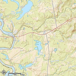
Burr Ferry is an unincorporated community at the junction of LA 8 and LA 111 south, in Vernon Parish, Louisiana, United States. The community is two miles from the site of the old Burr's Ferry on the Sabine River, at the Texas line. The Sabine River, at this location, is the site of two listings on the National Register of Historic Places: Burr's Ferry Bridge and Burr's Ferry Earthworks.

Gaines Ferry was a ferry on the Sabine River, between what is now Sabine Parish, Louisiana and Sabine County, Texas, at the eastern terminus of Texas State Highway 21, and the western terminus of LA 6. Much of the early history of New Spain, France, Mexico, the Republic of Texas, the United States, including the American Civil War, and the U.S. states of Texas and Louisiana, involve some aspect of Gaines Ferry. It was a major highway to the west and cattle trail east, a port of entry for the Republic of Texas, and a transportation road for military supplies and soldiers during the American Civil War that included transporting cotton to Mexico. Gaines Ferry was the northern entry for many colonists heading to Texas, and it was named after James Gaines who purchased it in 1819. The ferry saw continuous service until 1937.

References

  1. "The Neutral Ground" chronology Archived March 15, 2007, at the Wayback Machine , at Louisiana Places
  2. See Louisiana (New Spain)
  3. 1 2 3 Claims to Land Between the Rio Hondo and Sabine Rivers in Louisiana. Communicated to the Senate January 31, 1825
  4. "The Story of Texas Under Six Flags". 1897.
  5. "The Cabildo", at the Louisiana State Museum web site
  6. Neutral Ground agreement -retrieved 2010-12-24
  7. LeJeune, Keagan. "Western Louisiana's Neutral Strip: Its History, People, And Legends". Folklife in Louisiana. Retrieved 2022-04-11.
  8. John V. Haggard, "Neutral Ground", Handbook of Texas Online
  9. "Louisiana Documents: The Territorial Legislature Defines Counties in 1805" Archived 2007-06-29 at the Wayback Machine , at Louisiana Places
  10. "Texas 1806" Archived 2007-06-10 at the Wayback Machine , Texas Archeological Society
  11. Adams-Onis Treaty -Retrieved 2010-12-24
  12. "The Worst Feud" by Bob Bowman, at TexasEscapes.com

Bibliography