Related Research Articles

Millersville is an unincorporated community in western Cape Girardeau County, Missouri, United States. It is located six miles (10 km) west of Jackson on Route 72.

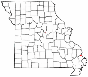
Perkins is an unincorporated community and census-designated place in western Scott County, Missouri, United States. It is located sixteen miles northwest of Sikeston.
Illmo is a former community and neighborhood of Scott City, Missouri.
Tanner is an unincorporated community in Scott County, in the U.S. state of Missouri.
Crowder is a place in Scott County, Missouri, United States. The town site is located on State Highway Z between Tanner and Vanduser.
McMullin is an unincorporated community in Scott County, in the U.S. state of Missouri. The town site is located north of Sikeston on the El Camino Real, known today as U.S. Route 61.
Arnsberg is an unincorporated community in Cape Girardeau County, Missouri, United States.
Blomeyer is an unincorporated community in Cape Girardeau County, in the U.S. state of Missouri.
Leemon is an unincorporated community in Cape Girardeau County, in the U.S. state of Missouri.
Dundee is an unincorporated community in northern Franklin County, in the U.S. state of Missouri. The community is above the Missouri River floodplain on Missouri Route 100 approximately six miles northwest of Washington and five miles east of New Haven.
Prosperity is an unincorporated community in Jasper County, in the U.S. state of Missouri. It is northeast of Joplin and just southeast of Webb City, sitting east of Missouri State Highway 249.
Ancell is an extinct town in the northeast corner of Kelso Township, Scott County, in the U.S. state of Missouri. It was named for Pashal Ancell, a pioneer citizen, but was first known as Glenn. It is now part of Scott City. Scott City is a consolidation of the formerly separate towns of Fornfelt, Ancell and Illmo, Missouri. These towns arose in association with the building and operation of railroads that passed through the area and all incorporated around the same time. Fornfelt, then known as Edna, incorporated in 1905. Illmo, on the Missouri side of a bridge linking Illinois and Missouri, incorporated in 1906. Ancell, just to the west of Illmo, incorporated in 1907. In 1960, Ancell merged with Fornfelt and formed Scott City. Illmo merged into Scott City in 1980. A post office called Ancell was established in 1912 and remained in operation until this merger. Ancell Cemetery is 5 miles south of Scott City.
Bleda is an unincorporated community in Scott County, in the U.S. state of Missouri.
Caney Creek is a stream in Scott County in southeast Missouri. The stream headwaters arise northwest of Benton at 37°06′16″N89°34′51″W. The stream flows east then turns to the northwest passing under U.S. Route 61 twice north of Benton. The stream flows west passing north of New Hamburg, under Missouri Route 77 and north of the community of Bleda and ends at 37°06′30″N89°43′31″W in the Old Caney Basin at Drainage ditch #1.
Grays Point is an extinct town in Scott County, in the U.S. state of Missouri.
Parker is an unincorporated community in Scott County, in the U.S. state of Missouri.
Ardeola is an unincorporated community in Stoddard County, in the U.S. state of Missouri.
Heagy is an unincorporated community in Stoddard County, in the U.S. state of Missouri.
Swinton is an unincorporated community in Stoddard County, in the U.S. state of Missouri.
Edanville is an extinct town in northern Texas County, in the U.S. state of Missouri. The GNIS classifies it as a populated place.
References
- ↑ "ArcGIS REST Services Directory". United States Census Bureau. Retrieved September 5, 2022.
- 1 2 3 U.S. Geological Survey Geographic Names Information System: New Hamburg, Missouri
- ↑ "Census of Population and Housing". Census.gov. Retrieved June 4, 2016.
- ↑ "Scott County Place Names, 1928–1945". The State Historical Society of Missouri. Archived from the original on June 24, 2016. Retrieved December 24, 2016.
- ↑ Eaton, David Wolfe (1918). How Missouri Counties, Towns and Streams Were Named. The State Historical Society of Missouri. p. 363.
- ↑ "Post Offices". Jim Forte Postal History. Retrieved December 24, 2016.
Municipalities and communities of Scott County, Missouri, United States | ||
|---|---|---|
| Cities |  | |
| Villages | ||
| Townships | ||
| CDPs | ||
| Other communities | ||
| Ghost towns | ||
| Footnotes | ‡This populated place also has portions in an adjacent county or counties | |
37°07′35″N89°35′36″W / 37.12639°N 89.59333°W
| | This Scott County, Missouri state location article is a stub. You can help Wikipedia by expanding it. |