
McLennan County is a county located on the Edwards Plateau in Central Texas. As of the 2010 census, its population was 234,906. Its county seat and largest city is Waco. The U.S. census 2019 county population estimate is 256,623. The county is named for Neil McLennan, an early settler.
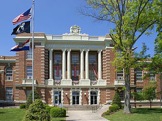
Scott County is a county located in the southeastern portion of the U.S. state of Missouri. As of the 2010 census, the population was 39,191. Its county seat is Benton. The county was organized in 1821 and named for U.S. Representative John Scott, the first federal representative from Missouri.

Sikeston is a city located both in southern Scott County and northern New Madrid County, in the state of Missouri, United States. It is situated just north of the "Missouri Bootheel", although many locals consider Sikeston a part of it. By way of Interstate 55, Interstate 57, and U.S. Route 60, Sikeston is close to the halfway point between St. Louis and Memphis and three hours from Nashville. The city is named after John Sikes, who founded it in 1860. It is the principal city of the Sikeston Micropolitan Statistical Area, which consists of all of Scott County, and has a total population of 41,143.

Arizona State Route 51 (SR 51), also known as the Piestewa Freeway, is a numbered state highway in Phoenix, Arizona. It connects Interstate 10 just outside Downtown Phoenix with Loop 101 on the north side of Phoenix, making it one of the area's major freeways. It is a largely north–south route and is known for traversing the Piestewa Peak Recreation Area. The peak was named after Lori Piestewa, the first Native American woman to die in combat in the U.S. Military. Prior to this time, the freeway was known as the Squaw Peak Parkway, a name considered offensive by many Native Americans. Rapid growth and increased traffic demand on the east side of Metro Phoenix made the Piestewa Freeway necessary.

A diverging diamond interchange (DDI), also called a double crossover diamond interchange (DCD), is a type of diamond interchange in which the two directions of traffic on the non-freeway road cross to the opposite side on both sides of the bridge at the freeway. It is unusual in that it requires traffic on the freeway overpass to briefly drive on the opposite side of the road from what is customary for the jurisdiction. The crossover "X" sections can either be traffic-light intersections or one-side overpasses to travel above the opposite lanes without stopping, to allow nonstop traffic flow when relatively sparse traffic.

Forgottonia, also spelled Forgotonia, is the name given to a 16-county region in Western Illinois in the late 1960s and early 1970s. This geographic region forms the distinctive western bulge of Illinois that is roughly equivalent to "The Tract", the Illinois portion of the Military Tract of 1812, along and west of the Fourth Principal Meridian. Since this wedge-shaped region lies between the Illinois and Mississippi rivers, it has historically been isolated from the eastern portion of Central Illinois.

Akers is an unincorporated community in northwestern Shannon County, Missouri, United States. It is located approximately eighteen miles northwest of Eminence in the Ozark National Scenic Riverways. Akers houses a campground and access to the Current River. Since there is no bridge within the community, there is a small ferry that allows vehicles traveling on Highway K to cross the Current River.

Perkins is an unincorporated community in western Scott County, Missouri, United States. It is located sixteen miles northwest of Sikeston.
State Route 531 (SR 531) is a short state highway in Snohomish County, Washington, United States. It runs from west to east along 172nd Street between Wenberg County Park on Lake Goodwin to a junction with SR 9 in southern Arlington, with an intermediate interchange with Interstate 5 (I-5) in Smokey Point. The highway is the primary access point for the Arlington Municipal Airport and the Smokey Point retail corridor.
Interstate 55 (I-55) is a major north–south Interstate Highway in the U.S. state of Illinois that connects the St. Louis, Missouri, and Chicago metropolitan areas. It enters the state from Missouri on the Poplar Street Bridge near East St. Louis and runs to U.S. Route 41 near downtown Chicago where the highway ends, a distance of 294.38 miles (473.76 km). The Road also runs through the cities of Springfield, Bloomington, and Joliet. The section in DuPage County is officially named Joliet Freeway or Will Rogers Freeway and in Cook County is officially named the Stevenson Expressway.
Interstate 75 (I-75) runs from Cincinnati to Toledo by way of Dayton in the U.S. state of Ohio. The highway enters the state running concurrently with I-71 from Kentucky on the Brent Spence Bridge over the Ohio River and into the Bluegrass region. I-75 continues north into the Miami Valley and then passes through the Great Black Swamp before crossing into Michigan.
Tanner is an unincorporated community in Scott County, in the U.S. state of Missouri.
Crowder is a place in Scott County, Missouri, United States. The town site is located on State Highway Z between Tanner and Vanduser.
McMullin is an unincorporated community in Scott County, in the U.S. state of Missouri. The town site is located north of Sikeston on the El Camino Real, known today as U.S. Route 61.
New Hamburg is an unincorporated community in Scott County, in the U.S. state of Missouri.
Bleda is an unincorporated community in Scott County, in the U.S. state of Missouri.
Grays Point is an extinct town in Scott County, in the U.S. state of Missouri.
Parker is an unincorporated community in Scott County, in the U.S. state of Missouri.

