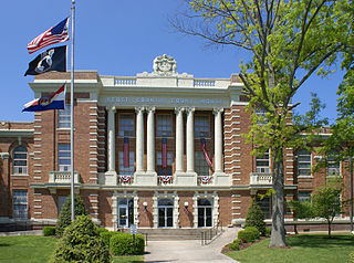
Scott County is a county located in the southeastern portion of the U.S. state of Missouri. As of the 2020 census, the population was 38,059. Its county seat is Benton. The county was organized in 1821 and named for U.S. Representative John Scott, the first federal representative from Missouri. Scott County comprises the Sikeston, MO Micropolitan Statistical Area, which is also included in the Cape Girardeau-Sikeston, MO-IL Combined Statistical Area. The county is home to Scott County Central High School, which has won 18 state championships in boys basketball—the most of any high school in the state.

Mascoutah is a city in St. Clair County, Illinois, United States, named for the Mascoutens, a tribe of the Michigan Natives. The population was 7,483 at the 2010 census. According to the US Census Bureau, the population was estimated at 7,994 in 2019.

Monett is the most-populous city in the Barry and Lawrence counties in the U.S. state of Missouri. The city is located in the Ozarks, just south of Interstate 44 between Joplin and Springfield. According to the 2020 census, the population of the town was estimated to be 9,576 individuals.

BNSF Railway is the largest freight railroad in the United States. One of six North American Class I railroads, BNSF has 36,000 employees, 33,400 miles (53,800 km) of track in 28 states, and over 8,000 locomotives. It has three transcontinental routes that provide rail connections between the western and eastern United States. BNSF trains traveled over 169 million miles in 2010, more than any other North American railroad.

The Chicago, Burlington and Quincy Railroad was a railroad that operated in the Midwestern United States. Commonly referred to as the Burlington Route, the Burlington, or as the Q, it operated extensive trackage in the states of Colorado, Illinois, Iowa, Missouri, Nebraska, Wisconsin, Wyoming, and also in Texas through subsidiaries Colorado and Southern Railway, Fort Worth and Denver Railway, and Burlington-Rock Island Railroad. Its primary connections included Chicago, Minneapolis–Saint Paul, St. Louis, Kansas City, and Denver. Because of this extensive trackage in the midwest and mountain states, the railroad used the advertising slogans "Everywhere West", "Way of the Zephyrs", and "The Way West".
The Missouri–Kansas–Texas Railroad was a Class I railroad company in the United States, with its last headquarters in Dallas, Texas. Established in 1865 under the name Union Pacific Railroad (UP), Southern Branch, it came to serve an extensive rail network in Texas, Oklahoma, Kansas, and Missouri. In 1988, it merged with the Missouri Pacific Railroad; today, it is part of UP.
The Cartier Railway is a privately owned railway that operates 260 miles (418 km) of track in the Canadian province of Québec.

The St. Louis–San Francisco Railway, commonly known as the "Frisco", was a railroad that operated in the Midwest and South Central United States from 1876 to April 17, 1980. At the end of 1970, it operated 4,547 miles (7,318 km) of road on 6,574 miles (10,580 km) of track, not including subsidiaries Quanah, Acme and Pacific Railway and the Alabama, Tennessee and Northern Railroad; that year, it reported 12,795 million ton-miles of revenue freight and no passengers. It was purchased and absorbed into the Burlington Northern Railroad in 1980. Despite its name, it never came close to San Francisco.

The St. Louis Southwestern Railway Company, known by its nickname of "The Cotton Belt Route" or simply "Cotton Belt", is a former Class I railroad that operated between St. Louis, Missouri, and various points in the U.S. states of Arkansas, Tennessee, Louisiana, and Texas from 1891 to 1980, when the system added the Rock Island's Golden State Route and operations in Kansas, Oklahoma, and New Mexico. The Cotton Belt operated as a Southern Pacific subsidiary from 1932 until 1992, when its operation was assumed by Southern Pacific Transportation Company.

The Mark Twain Zephyr was an early diesel four-unit articulated zephyr train that was similar to the Pioneer Zephyr in style. The train was built by the Budd Company and was powered by a diesel engine produced by the Winton Engine Company. The train was named after the renowned author Mark Twain because it was scheduled to provide service from St. Louis, Missouri to Burlington, Iowa via his hometown Hannibal, Missouri. The train's exterior structure used stainless steel, and had a "shovel nose" front.
Bird's Point is an unincorporated community in Mississippi County, Missouri, United States. It lies on an island or former island in the Mississippi River, near the confluence of the Ohio and Mississippi Rivers and is situated directly across from Cairo, Illinois. This is the point where the U.S. Route 60 bridge connects with Cairo.

Idalia is an unincorporated community in Stoddard County, Missouri, United States. It is located six miles northeast of Dexter.

Little Rock Union Station, also known as Mopac Station, is a train station in Little Rock, Arkansas, United States served by Amtrak, the national railroad passenger system.
The Arkansas Valley Interurban Railway (AVI) was an interurban railway that operated in Kansas, United States, from 1910 to 1938 for passengers and to 1942 for freight, running between Wichita, Newton, and Hutchinson. It operated a small fleet of electrically powered passenger and freight equipment. Service was suspended during World War II and never resumed, except on a small portion owned the Hutchinson and Northern Railroad which is still in operation. (2020)
The Lone Star was a passenger train operated by St. Louis Southwestern Railway between Memphis, and Dallas, with through connections via Cotton Belt parent, Southern Pacific, for San Antonio, El Paso, and ultimately Los Angeles. There were also through cars operating between Memphis, Lewisville and Shreveport. At various times during the train's operation, connecting services were also provided from Brinkley to St. Louis. The train was discontinued on November 1, 1952, as a part of extensive passenger train restructuring by St. Louis Southwestern. The Lone Star was replaced by trains number 107 and 108 which connected with the Cotton Belt mainline at Mount Pleasant, Texas.

The Eureka Springs & North Arkansas Railway is a for-profit passenger tourist railway established by the late Robert Dortch, Jr. and his wife Mary Jane in 1981 in Eureka Springs, Arkansas. The railway offers one-hour excursion tours, a catered luncheon train and a catered dinner train - each lasting a little more than one hour, from April through October. It operates along 2.5 miles (4.0 km) of restored track right-of-way formerly belonging to the defunct Arkansas & Ozarks Railway Co - the last incarnation of the North Arkansas Line.
Conklin is a hamlet in northern Alberta, Canada within the Regional Municipality (RM) of Wood Buffalo. It is located on Highway 881 between Fort McMurray and Lac La Biche. It lies near the west end of Christina Lake at an elevation of 575 metres (1,886 ft), and was named for John Conklin, a railroad employee.
Keevil is an unincorporated community in Monroe County, Arkansas, United States. Keevil is located on Arkansas Highway 17, 7.4 miles (11.9 km) south-southwest of Brinkley.
The Southwestern Limited was a night train, as #205 of the Illinois Central Railroad in the Southeastern United States. Running on the IC subsidiary Yazoo and Mississippi Valley Railroad Vicksburg Division, from Meridian, Mississippi's Union Station to Shreveport, Louisiana's own Union Station, it was one of the few trains spanning the Mississippi River south of St. Louis, Missouri and north of New Orleans, Louisiana.

