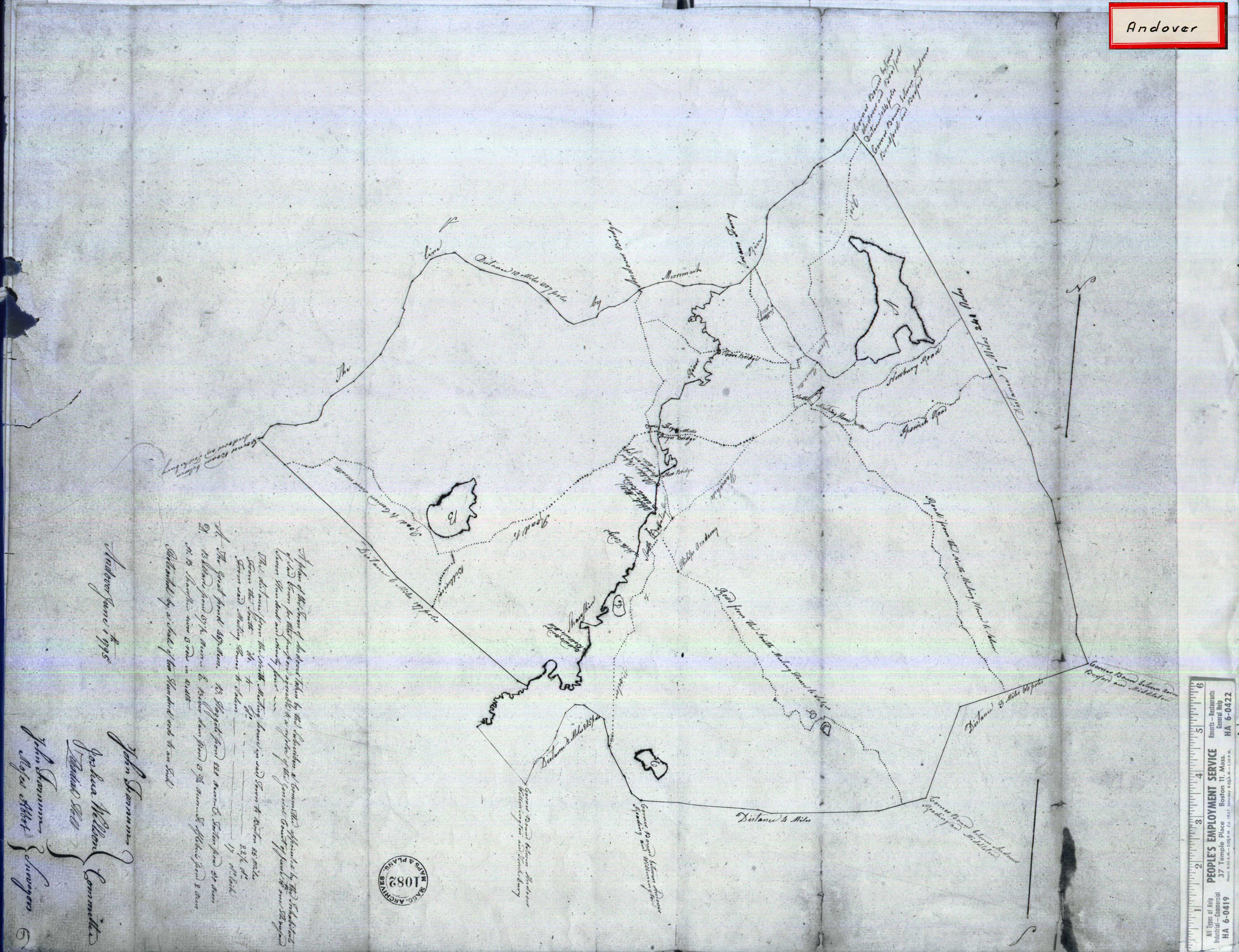
The lands south of the Merrimack River around Lake Cochichewick and the Shawsheen River were set aside by the Massachusetts General Court in 1634 for the purpose of creating an inland plantation. The Cochichewick Plantation, as it was called, was purchased on May 6, 1646 when Reverend John Woodbridge, who had settled the land for the English, paid MassachusettsachemCutshamekin six pounds and a coat for the lands.[6] The plantation was then incorporated as Andover, most likely in honor of the hometown of many early residents, Andover, Hampshire, England. The town was centered in what is now North Andover, but the spread of settlement south and west of the old town center created much conflict in the early years about the location of the parish church. In 1709, the matter was brought to the General Court, which set aside two parish churches, north and south.[7] The parishes grew apart as the years went on and on April 7, 1855, the North parish separated from the south and was incorporated as North Andover.
There are several first period (pre-1720) houses still standing in town. The oldest house is probably the Bridges House, relocated from Marbleridge Road to Court Street in 2001; the original portion of this house probably dates to about 1690. Other first period houses include the Stevens House on Great Pond Road; the Faulkner House on Appleton Street; the Abiel Stevens House on Salem Street; the Parson Barnard House, which is a museum; a house on Andover Street near the intersection with Chickering Road; and the Carlton-Frie-Tucker House[8] at 140 Mill Road. No house in North Andover has been scientifically dated by dendrochronology, so dates are based solely on stylistic elements, original deeds, and tradition.
The North Parish Church on the North Andover Green is a historic church building built in 1836.[9] It was the 5th meetinghouse of the Puritan church congregation founded in 1645 in North Andover. In about 1836 the congregation chose to become a Unitarian church and commissioned this Gothic building.[10]
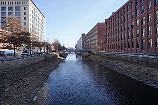
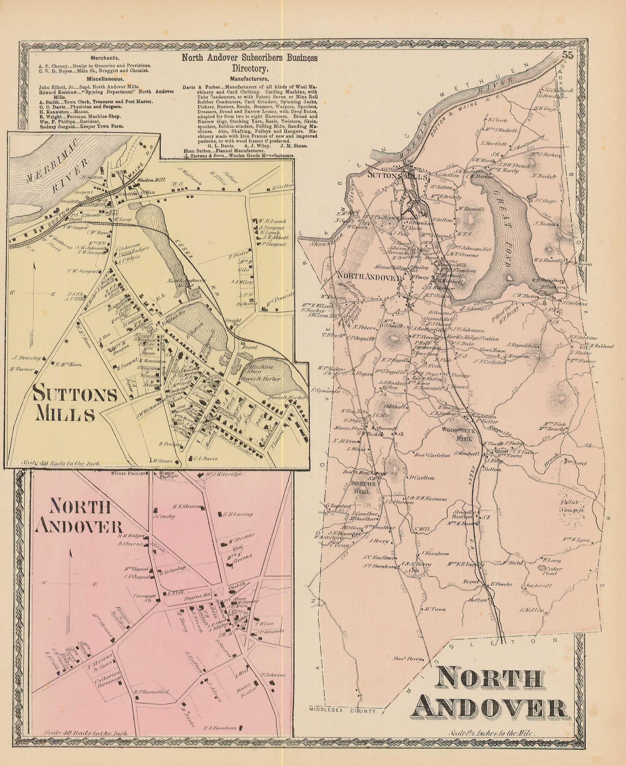
North Andover's development was varied, with much of the land along the Shawsheen and Merrimack being concerned with industry, and the lands southwest being more agricultural. Several mills were located in the town, as well as the Western Electric Company, AT&T's manufacturing division, which supplied telephone machinery for many years before it was split up by AT&T into the new company, Lucent Technologies. Today, North Andover is considered a bedroom community of the Greater Boston area.
In January 2018, voters turned down a proposal for a cannabis-growing and research facility in the former Lucent Technologies building, along the Merrimack River. The town meeting vote was 1,430 against having recreational marijuana facilities and 1,155 voted in favor. The growing and research facility was expected to bring in to the town $100 million over a 20-year period.[11]
Geography
According to the United States Census Bureau, the town has a total area of 27.8 square miles (71.9km2), of which 26.3 square miles (68.1km2) is land and 1.4 square miles (3.7km2), or 5.18%, is water.[12] The town lies to the south of the Merrimack River, which makes up part of its northwestern boundary, along with the Shawsheen River. The northeastern quadrant of town is dominated by Lake Cochichewick, which is also bordered by the Osgood Hill Reservation, Weir Hill Reservation and the Reas Pond Conservation Area. The town also is home to portions of Harold Parker State Forest, Boxford State Forest and the Charles W. Ward Reservation. There are many brooks, streams and ponds dotting the town.
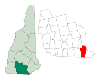
North Andover lies in the northwestern portion of Essex County along the Merrimack and Shawsheen Rivers. It is bordered by Andover to the southwest, Lawrence and Methuen to the northwest, Haverhill to the northeast, Boxford to the east and Middleton to the southeast. North Andover's Old Center, which is closer to the geographic center of town than its newer town center, is located 3.5 miles (5.6km) southeast of Lawrence's city center, and is 25 miles (40km) north of Boston and 30 miles (48km) southeast of Manchester, New Hampshire.
As of the census[23] of 2010, there were 28,352 people, 10,516 households, and 7,324 families residing in the town. The population density was 1,078.0 inhabitants per square mile (416.2/km2). There were 10,964 housing units at an average density of 416.9 per square mile (161.0/km2). The racial makeup of the town was 88.7% White, 1.78% African American, 0.09% Native American, 6.31% Asian, 0.01% Pacific Islander, 1.62% from other races, and 1.50% from two or more races. Hispanic or Latino of any race were 4.93% of the population.
There were 10,516 households, out of which 36.1% had children under the age of 18 living with them, 57.0% were married couples living together, 9.6% had a female householder with no husband present, 3.0% had a male householder with no wife present, and 30.4% were non-families. 25.6% of all households were made up of individuals, and 11.6% had someone living alone who was 65 years of age or older. The average household size was 2.62 and the average family size was 3.19.
In the town, the population was spread out, with 26.2% under the age of 18, 7.6% from 18 to 24, 23.9% from 25 to 44, 28.9% from 45 to 64, and 13.4% who were 65 years of age or older. The median age was 40 years. For every 100 females, there were 91.2 males. For every 100 females age 18 and over, there were 92.8 males.
As of the 2017 American Community Survey, the median income for a household in the town was $105,661, and the median income for a family was $132,674. Males had a median income of $68,411 versus $42,270 for females. The per capita income for the town was $51,658. 5.1% of the population and 2.9% of families were below the poverty line. 5.2% of those under the age of 18 and 4.0% of those 65 and older were living below the poverty line.
Government and infrastructure
North Andover employs the open town meeting form of government, and is led by a five-member Select Board and a town manager, Melissa Rodrigues.[24] The town has its own police and fire departments, EMS, public works, and a senior center. North Andover has no hospital, the nearest being Lawrence General Hospital.
On the state level, the town is served by Essex County services, and is patrolled by the First Barracks of Troop A of the Massachusetts State Police, based in Andover. North Andover lies in two districts, the Fourteenth Essex and Eighteenth Essex, in the Massachusetts House of Representatives, and the First Essex and First Essex and Middlesex in the Massachusetts Senate.[25] North Andover is located within Massachusetts's 6th congressional district, and has been served by Representative Seth Moulton (D) since 2015. Massachusetts' senior Senator is Elizabeth Warren (D), and its junior Senator is Ed Markey (D), both in office since 2013. North Andover has no mayor, but, until his death in 2006, William P McEvoy, the director of recreation, was known as the "unofficial mayor".[26]
An aerial view of the North Andover Old Center showing the North Parish of North Andover Unitarian Universalist Church.
Media
North Andover is located within the Boston media market, and is served by the Eagle-Tribune newspaper.
Education
North Andover is home to its own school system. It has an early childhood center, five elementary schools (Atkinson Elementary, Franklin Elementary, Kittredge Elementary, Annie L. Sargent Elementary, Thomson Elementary), North Andover Middle School and North Andover High School. On May 16, 2017, the citizens of North Andover approved the expansion of the early childhood center, which opened for the 2018–2019 school year. The primary reason behind this expansion was to reduce elementary class size, which it failed to realize.[27]
In 2004, a brand new high school and complete sporting complex including a football field, a soccer field, field hockey greens, and a lacrosse field was added. There is a complete track and field area and numerous tennis courts. North Andover's mascot is the Scarlet Knight and its colors are scarlet and black. It competes in the Merrimack Valley Conference and Division II of the MIAA.[28] Its main rival is Andover, who it plays in the annual Thanksgiving Day football game. High school students from North Andover are also allowed to attend Greater Lawrence Technical School in Andover. There are two private schools in North Andover: Brooks School, and Saint Michael's Elementary School. The nearest private high schools include: Phillips Academy Andover (9–12), Austin Preparatory School (6–12), Central Catholic High School (9–12), which are located in the nearby towns of Andover and Reading, and the city of Lawrence.
Barker's Farm, which started in 1643, is the oldest continually operated business in Massachusetts and among the oldest in the United States.[29]
Converse, the popular sneaker company, was headquartered in North Andover from 2002 to 2015.[30]
Entertainment
Residents of North Andover can purchase a summer pass to Steven's Pond where they can go swimming.[31] Nearby Weir Hill offers trails for hiking, walking, biking, and views of the surrounding area and beyond.
Many events are held at the old town center, including the sheep shearing festival in late spring and various summer activities for children and adults. The North Andover Youth Center is also located in the old town center and offers a variety of activities to the town's youth. These services are offered to kids in grades 6 through 12 and yearly passes can be purchased to have full access to their facilities.
Harold Parker State Forest offers 25 miles (40km) of trails, a campground, and a freshwater swimming beach. Other activities include horseback riding, camping, fishing, hunting, mountain biking, and hiking. In September there is also an annual fishing tournament.
On September 13, 2018, several gas lines suffered leakage due to high pressure in the tubes of Columbia Gas of Massachusetts, a subsidiary of NiSource. As a result, several fires and explosions occurred, homes were evacuated.[32]
Essex County is a county in the northeastern part of the U.S. state of Massachusetts. At the 2020 census, the total population was 809,829, making it the third-most populous county in the state, and the seventy-eighth-most populous in the country. It is part of the Greater Boston area. The largest city in Essex County is Lynn. The county was named after the English county of Essex. It has two traditional county seats: Salem and Lawrence. Prior to the dissolution of the county government in 1999, Salem had jurisdiction over the Southern Essex District, and Lawrence had jurisdiction over the Northern Essex District, but currently these cities do not function as seats of government. However, the county and the districts remain as administrative regions recognized by various governmental agencies, which gathered vital statistics or disposed of judicial case loads under these geographic subdivisions, and are required to keep the records based on them. The county has been designated the Essex National Heritage Area by the National Park Service.
Georgetown is a town in Essex County, Massachusetts, United States. The population was 8,470 at the 2020 census. It was incorporated in 1838 from part of Rowley.
Groveland is a town in Essex County, Massachusetts, United States. It is thirty-four miles north of Boston. At the 2020 census, it had a population of 6,752. The town is divided into two precincts, Groveland and South Groveland.
Haverhill is a city in Essex County, Massachusetts, United States. Haverhill is located 35 miles north of Boston on the New Hampshire border and about 17 miles from the Atlantic Ocean. The population was 67,787 at the 2020 United States census.
Lawrence is a city located in Essex County, Massachusetts, United States, on the Merrimack River. At the 2020 census, the city had a population of 89,143. Surrounding communities include Methuen to the north, Andover to the southwest, and North Andover to the east. Lawrence and Salem were the county seats of Essex County, until the state abolished county government in 1999. Lawrence is part of the Merrimack Valley.
Merrimac is a small town in Essex County, Massachusetts, United States, located on the southeastern border of New Hampshire, approximately 34 miles (55 km) northeast of Boston and 10 miles (16 km) west of the Atlantic Ocean. It was incorporated on April 11, 1876. It is situated along the north bank of the Merrimack River in the Merrimack Valley. The population was 6,723 at the 2020 census. Historically a mill town, it has long since become a largely residential community. It is part of the Greater Boston metropolitan area.
Methuen is a 23-square-mile city in Essex County, Massachusetts, United States. The population was 53,059 at the 2020 census. Methuen lies along the northwestern edge of Essex County, just east of Middlesex County and just south of Rockingham County, New Hampshire. The city is bordered by Haverhill to the northeast, North Andover to the southeast, Lawrence and Andover to the south, Dracut to the west, Pelham, New Hampshire to the northwest, and Salem, New Hampshire to the north. Methuen is located 17 miles (27 km) southwest from Newburyport, 30 miles (48 km) north-northwest of Boston and 25 miles (40 km) south-southeast of Manchester, New Hampshire.
Middleton is a town in Essex County, Massachusetts, United States. The population was 9,779 at the 2020 census.
Newbury is a town in Essex County, Massachusetts, United States. The population was 6,716 at the 2020 census. Newbury includes the villages of Old Town, Plum Island and Byfield. Each village is a precinct with its own voting district, various town offices, and business center.
West Newbury is a town in Essex County, Massachusetts, United States. Situated on the Merrimack River, its population was 4,500 at the 2020 census.
Billerica is a town in Middlesex County, Massachusetts, United States. The population was 42,119 according to the 2020 census. It takes its name from the town of Billericay in Essex, England.
Dracut is a town in Middlesex County, Massachusetts, United States. At the 2020 census, the town's population was 32,617, making it the second most populous town in Massachusetts with an open town meeting system of governance. The town covers a total area of 21.36 square miles, 0.5 square miles of which are water.
Tewksbury is a town in Middlesex County, Massachusetts, United States. Its population was 26,342 as of the 2020 United States Census.
Burlington is a town in Middlesex County, Massachusetts, United States. The population was 26,377 at the 2020 census.
Andover is a town in Essex County, Massachusetts, United States. It was settled in 1642 and incorporated in 1646. At the 2020 census, the population was 36,569. It is located 20 miles (32 km) north of Boston and 4 miles (6.4 km) south of Lawrence. Part of the town comprises the census-designated place of Andover. It is twinned with its namesake: Andover, Hampshire, England.
Boxford is a town in Essex County, Massachusetts, United States. According to the U.S. Census Bureau, the town's population was 8,203 in 2020.
Rowley is a town in Essex County, Massachusetts, United States. The population was 6,161 at the 2020 census.
Hudson is a town in Hillsborough County, New Hampshire, United States. It is located along the Massachusetts state line. The population was 25,394 at the 2020 census. It is the tenth-largest municipality in the state, by population.
The Cochichewick River, also known as Cochichewick Brook, is a 1.6-mile-long (2.6 km) stream in North Andover, Massachusetts, that drains water from Lake Cochichewick into the Merrimack River.
Route 133 is a 40.87-mile-long (65.77 km) east–west Massachusetts state route that runs from Route 38 and Route 110 in Lowell to Route 127 in Gloucester.
↑ "1950 Census of Population"(PDF). 1: Number of Inhabitants. Bureau of the Census. 1952. Section 6, Pages 21-10 and 21-11, Massachusetts Table 6. Population of Counties by Minor Civil Divisions: 1930 to 1950. Retrieved July 12, 2011.{{cite journal}}: Cite journal requires |journal= (help)
↑ "1920 Census of Population"(PDF). Bureau of the Census. Number of Inhabitants, by Counties and Minor Civil Divisions. Pages 21-5 through 21-7. Massachusetts Table 2. Population of Counties by Minor Civil Divisions: 1900, 1910, and 1920. Retrieved July 12, 2011.
↑ "1890 Census of the Population"(PDF). Department of the Interior, Census Office. Pages 179 through 182. Massachusetts Table 5. Population of States and Territories by Minor Civil Divisions: 1880 and 1890. Retrieved July 12, 2011.
↑ "1870 Census of the Population"(PDF). Department of the Interior, Census Office. 1872. Pages 217 through 220. Table IX. Population of Minor Civil Divisions, &c. Massachusetts. Retrieved July 12, 2011.
↑ "1860 Census"(PDF). Department of the Interior, Census Office. 1864. Pages 220 through 226. State of Massachusetts Table No. 3. Populations of Cities, Towns, &c. Retrieved July 12, 2011.
This page is based on this Wikipedia article Text is available under the CC BY-SA 4.0 license; additional terms may apply. Images, videos and audio are available under their respective licenses.


