North Hampton, Ohio | |
---|---|
Coordinates: 39°59′22″N83°56′38″W / 39.98944°N 83.94389°W | |
Country | United States |
State | Ohio |
County | Clark |
Township | Pike |
Area | |
• Total | 0.39 sq mi (1.00 km2) |
• Land | 0.39 sq mi (1.00 km2) |
• Water | 0.00 sq mi (0.00 km2) |
Elevation | 1,070 ft (330 m) |
Population (2020) | |
• Total | 457 |
• Density | 1,187.01/sq mi (458.50/km2) |
Time zone | UTC-5 (Eastern (EST)) |
• Summer (DST) | UTC-4 (EDT) |
ZIP code | 45349 |
Area code(s) | 937, 326 |
FIPS code | 39-56588 [3] |
GNIS feature ID | 2399515 [2] |
North Hampton is a village in Clark County, Ohio, United States. The population was 457 at the 2020 census. It is part of the Springfield, Ohio Metropolitan Statistical Area.
North Hampton was platted in 1829. [4] A post office called North Hampton has been in operation since 1839. [5]
In 1969, North Hampton earned a place in rock and roll lore when confusion of the town's name with that of Northampton Township, Ohio caused the rock group Vanilla Fudge to arrive at North Hampton for a rock concert instead of the Blossom Amphitheater. After learning that they were nearly 200 miles from the concert venue (near Cleveland), the band then charted a plane to fly them to the gig and arrived four hours late. [6] Vocalist Mark Stein told a reporter later, "You understand, man, that the promoter kept telling our agent about Blossom Center in Northampton Township. Only we were up in Montreal, and looking at a map to find the place and sure enough — there's this town, North Hampton, near Dayton somewhere. We figured, that's a weird place for a concert, but if that's where peoples' heads are at in Ohio, fine — that's where we'll wail." [7]
North Hampton is a well-known speed trap throughout Ohio. [8] The village was one of the municipalities with the highest speeding citation numbers in the state in 2019. [9]
North Hampton is located at 39°59′26″N83°56′30″W / 39.99056°N 83.94167°W (39.990592, -83.941676). [10]
According to the United States Census Bureau, the village has a total area of 0.43 square miles (1.11 km2), all of it land. [11]
Census | Pop. | Note | %± |
---|---|---|---|
1850 | 147 | — | |
1860 | 140 | −4.8% | |
1870 | 205 | 46.4% | |
1880 | 173 | −15.6% | |
1930 | 369 | — | |
1940 | 383 | 3.8% | |
1950 | 424 | 10.7% | |
1960 | 495 | 16.7% | |
1970 | 489 | −1.2% | |
1980 | 421 | −13.9% | |
1990 | 417 | −1.0% | |
2000 | 370 | −11.3% | |
2010 | 478 | 29.2% | |
2020 | 457 | −4.4% | |
U.S. Decennial Census [12] |
As of the census [13] of 2010, there were 478 people, 173 households, and 123 families living in the village. The population density was 1,111.6 inhabitants per square mile (429.2/km2). There were 178 housing units at an average density of 414.0 per square mile (159.8/km2). The racial makeup of the village was 96.9% White, 0.2% Native American, 0.2% Asian, 0.2% from other races, and 2.5% from two or more races. Hispanic or Latino of any race were 1.0% of the population.
There were 173 households, of which 44.5% had children under the age of 18 living with them, 53.8% were married couples living together, 12.7% had a female householder with no husband present, 4.6% had a male householder with no wife present, and 28.9% were non-families. 22.0% of all households were made up of individuals, and 11% had someone living alone who was 65 years of age or older. The average household size was 2.76 and the average family size was 3.17.
The median age in the village was 37.4 years. 28.9% of residents were under the age of 18; 8.7% were between the ages of 18 and 24; 26.1% were from 25 to 44; 24.9% were from 45 to 64; and 11.3% were 65 years of age or older. The gender makeup of the village was 48.3% male and 51.7% female.
As of the census [3] of 2000, there were 370 people, 135 households, and 103 families living in the village. The population density was 1,440.7 inhabitants per square mile (556.3/km2). There were 136 housing units at an average density of 529.6 per square mile (204.5/km2). The racial makeup of the village was 97.03% White, 0.81% Asian, and 2.16% from two or more races.
There were 135 households, out of which 38.5% had children under the age of 18 living with them, 70.4% were married couples living together, 4.4% had a female householder with no husband present, and 23.7% were non-families. 21.5% of all households were made up of individuals, and 12.6% had someone living alone who was 65 years of age or older. The average household size was 2.74 and the average family size was 3.18.
In the village, the population was spread out, with 28.9% under the age of 18, 7.3% from 18 to 24, 30.0% from 25 to 44, 22.2% from 45 to 64, and 11.6% who were 65 years of age or older. The median age was 35 years. For every 100 females there were 102.2 males. For every 100 females age 18 and over, there were 97.7 males.
The median income for a household in the village was $37,083, and the median income for a family was $55,341. Males had a median income of $32,000 versus $100,000 for females. The per capita income for the village was $12,961. None of the population or families were below the poverty line.
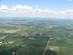
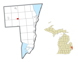
Emmett is a village in St. Clair County of the U.S. state of Michigan. The population was 269 at the 2010 census. The village is located within Emmett Township.
Kelliher is a city in Beltrami County, Minnesota, United States. The population was 258 at the 2020 census. Minnesota State Highway 72 is the primary route through Kelliher.
Buchanan is a village located in the town of Cortlandt in Westchester County, New York, United States. The population was 2,230 as of the 2010 census.
Aberdeen is a village in Huntington Township, Brown County, Ohio, United States, along the Ohio River 50 miles (80 km) southeast of Cincinnati. The population was 1,515 at the 2020 census.
Warsaw is a village in Coshocton County, Ohio, United States, along the Walhonding River. The population was 624 at the 2020 census.
North Star is a village in Darke County, Ohio, United States. The population was 224 at the 2020 census.
Baltimore is a village in Fairfield County, Ohio, United States. The population was 2,981 at the 2020 census.
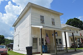
Brice is a village in Franklin County, Ohio, United States, on the southeast side of the Columbus metropolitan area. The population was 93 at the 2020 census.
Riverlea is a village in Franklin County, Ohio, United States, surrounded by Worthington on its north, south, and east sides, and bordered on the west by the Olentangy River, across which is Columbus. Riverlea was incorporated in 1939, a small community that formed on former farmland. The population was 599 at the 2020 census.
Addyston is a village in Miami Township, Hamilton County, Ohio, United States. Located along the Ohio River, it is a western suburb of the neighboring city of Cincinnati. The population was 927 at the 2020 census.
Cleves is a village in Miami Township, Hamilton County, Ohio, United States. Located along the Ohio River, it is a western suburb of Cincinnati. The population was 3,414 at the 2020 census.
Monroeville is a village in Huron County, Ohio, United States. The population was 1,300 at the 2020 census.
North Fairfield is a village in Huron County, Ohio, United States. The population was 465 at the 2020 census.
North Perry is a village in Lake County, Ohio, United States. The population was 915 at the 2020 census.
St. Louisville or Saint Louisville is a village in Licking County, Ohio, United States, along the North Fork of the Licking River. The population was 352 at the 2020 census.
West Jefferson is a village in Madison County, Ohio, United States. The population was 4,137 at the 2020 census. Located along U.S. Route 40, the village has a fairly close relationship with the surrounding township, which include various out-of-corporation-limit neighborhoods.
Limaville is a census-designated place (CDP) and former village in Stark County, Ohio, United States. The population was 151 at the 2020 census. It is part of the Canton–Massillon Metropolitan Statistical Area.
Macksburg is a village in Washington County, Ohio, United States, along the West Fork of Duck Creek. The population was 120 at the 2020 census. The village is about 28 miles (45 km) south of Cambridge, Ohio.
Gratiot is a village in Licking and Muskingum counties in the U.S. state of Ohio. The population was 215 at the 2020 census.
Mogadore is a village in Portage and Summit counties in the U.S. state of Ohio. The population was 3,811 at the 2020 census. A suburb of Akron, it is part of the Akron metropolitan area.