
Bidwell is a small unincorporated community in northwestern Springfield Township, Gallia County, Ohio, United States, and is often associated with the nearby community of Porter. Although unincorporated, it has its own ZIP Code of 45614. Bidwell is located eleven miles from the county seat, Gallipolis, at an elevation of 682 feet (208 m).

Patriot is an unincorporated community in southern Perry Township, Gallia County, Ohio, United States. Although it is unincorporated, it has a post office, with the ZIP code of 45658.
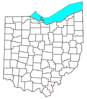
Kerr is an unincorporated community in southeastern Springfield Township, Gallia County, Ohio, United States. Although it is unincorporated, it has a post office, with the ZIP code of 45643.
Smyrna is an unincorporated community in Jefferson County, Indiana, in the United States. It is also called Creswell.
Mercerville is an unincorporated community in Gallia County in southern Ohio, approximately seven miles (11 km) north of Crown City and 25 miles (40 km) northeast of Huntington, West Virginia, near the easternmost corner of Wayne National Forest and roughly five miles (8.0 km) west of the Ohio River, where Ohio borders West Virginia. Mercerville sits along State Route 218 (SR 218) near its intersection with SR 790. It is home to South Gallia High School, one of only three high schools in the entire county, and nearby Hannan Trace Elementary School.
Bloom Junction is an unincorporated community in Scioto County, in the U.S. state of Ohio.
Hales Creek is an unincorporated community in Scioto County, in the U.S. state of Ohio.
Lyra is an unincorporated community in Scioto County, in the U.S. state of Ohio.
Slocum is an unincorporated community in Scioto County, in the U.S. state of Ohio.
Wallace Mills is an unincorporated community in Scioto County, in the U.S. state of Ohio.

Markland is an unincorporated community in York Township, Switzerland County, in the U.S. state of Indiana.
Kyger is an unincorporated community in Gallia County, in the U.S. state of Ohio.
Rodney is an unincorporated community in Gallia County, in the U.S. state of Ohio.
Centerpoint is an unincorporated community in Gallia County, in the U.S. state of Ohio.
Gallia is an unincorporated community in Gallia County, in the U.S. state of Ohio.
Porter is an unincorporated community in Gallia County, in the U.S. state of Ohio.
Evergreen is an unincorporated community in Gallia County, in the U.S. state of Ohio.
Adamsville is an unincorporated community in Gallia County, in the U.S. state of Ohio.
Harrisburg is an unincorporated community in Gallia County, in the U.S. state of Ohio.
Ewington is an unincorporated community in Gallia County, in the U.S. state of Ohio.


