Vinton, Ohio

Last updated

Vinton, Ohio
Main from Jackson, Vinton.jpg
Main Street
OHMap-doton-Vinton.png
Location of Vinton, Ohio
Map of Gallia County Ohio Highlighting Vinton Village.png
Location of Vinton in Gallia County
Coordinates: 38°58′39″N82°20′15″W / 38.97750°N 82.33750°W / 38.97750; -82.33750
Country United States
State Ohio
County Gallia
Township Huntington
Area
[1]
  Total1.21 sq mi (3.14 km2)
  Land1.18 sq mi (3.05 km2)
  Water0.03 sq mi (0.09 km2)
Elevation
[2]
604 ft (184 m)
Population
 (2020)
  Total224
  Density190.31/sq mi (73.45/km2)
Time zone UTC-5 (Eastern (EST))
  Summer (DST) UTC-4 (EDT)
ZIP code
45686
Area code 740
FIPS code 39-80178
GNIS feature ID2400072 [2]

Vinton is a village in Gallia County, Ohio, United States. The population was 224 at the 2020 census. It is part of the rural Point Pleasant micropolitan area.

Contents

History

Vinton was platted in 1832. [3] A post office called Vinton has been in operation since 1834. [4]

Geography

According to the United States Census Bureau, the village has a total area of 1.21 square miles (3.13 km2), of which 1.18 square miles (3.06 km2) is land and 0.03 square miles (0.08 km2) is water. [5]

Vinton is located on Raccoon Creek, a tributary of the Ohio River. [6]

Demographics

Historical population
CensusPop.Note
1870 137
1880 19643.1%
1890 31862.2%
1900 304−4.4%
1910 3246.6%
1920 40725.6%
1930 344−15.5%
1940 38712.5%
1950 378−2.3%
1960 374−1.1%
1970 352−5.9%
1980 3756.5%
1990 293−21.9%
2000 32410.6%
2010 222−31.5%
2020 2240.9%
U.S. Decennial Census [7]

2010 census

As of the census [8] of 2010, there were 222 people, 95 households, and 65 families living in the village. The population density was 188.1 inhabitants per square mile (72.6/km2). There were 125 housing units at an average density of 105.9 per square mile (40.9/km2). The racial makeup of the village was 99.1% White and 0.9% African American. Hispanic or Latino of any race were 0.5% of the population.

There were 95 households, of which 24.2% had children under the age of 18 living with them, 58.9% were married couples living together, 8.4% had a female householder with no husband present, 1.1% had a male householder with no wife present, and 31.6% were non-families. 30.5% of all households were made up of individuals, and 9.5% had someone living alone who was 65 years of age or older. The average household size was 2.34 and the average family size was 2.89.

The median age in the village was 46.7 years. 20.3% of residents were under the age of 18; 5.9% were between the ages of 18 and 24; 21.8% were from 25 to 44; 35.6% were from 45 to 64; and 16.7% were 65 years of age or older. The gender makeup of the village was 47.3% male and 52.7% female.

2000 census

As of the census [9] of 2000, there were 324 people, 123 households, and 91 families living in the village. The population density was 290.5 inhabitants per square mile (112.2/km2). There were 143 housing units at an average density of 128.2 per square mile (49.5/km2). The racial makeup of the village was 97.84% White, 0.62% African American, 0.31% Asian, 1.23% from other races. Hispanic or Latino of any race were 0.31% of the population.

There were 123 households, out of which 35.0% had children under the age of 18 living with them, 61.8% were married couples living together, 10.6% had a female householder with no husband present, and 26.0% were non-families. 22.8% of all households were made up of individuals, and 13.8% had someone living alone who was 65 years of age or older. The average household size was 2.63 and the average family size was 3.11.

In the village, the population was spread out, with 26.9% under the age of 18, 8.6% from 18 to 24, 25.9% from 25 to 44, 25.0% from 45 to 64, and 13.6% who were 65 years of age or older. The median age was 39 years. For every 100 females there were 100.0 males. For every 100 females age 18 and over, there were 97.5 males.

The median income for a household in the village was $25,417, and the median income for a family was $33,250. Males had a median income of $37,250 versus $20,833 for females. The per capita income for the village was $13,836. About 17.9% of families and 16.4% of the population were below the poverty line, including 19.0% of those under age 18 and 20.5% of those age 65 or over.

Education

Public education in the village of Vinton is provided by the Gallia County Local School District.

Related Research Articles

<span class="mw-page-title-main">Gallia County, Ohio</span> County in Ohio, United States

Gallia County is a county located in the U.S. state of Ohio. As of the 2020 census, the population was 29,220. Its county seat and largest village is Gallipolis.

<span class="mw-page-title-main">Aberdeen, Ohio</span> Village in Ohio, United States

Aberdeen is a village in Huntington Township, Brown County, Ohio, United States, along the Ohio River 50 miles (80 km) southeast of Cincinnati. The population was 1,515 at the 2020 census.

<span class="mw-page-title-main">Warsaw, Ohio</span> Village in Ohio, United States

Warsaw is a village in Coshocton County, Ohio, United States, along the Walhonding River. The population was 624 at the 2020 census.

<span class="mw-page-title-main">Brice, Ohio</span> Village in Ohio, United States

Brice is a village in Franklin County, Ohio, United States, on the southeast side of the Columbus metropolitan area. The population was 93 at the 2020 census.

<span class="mw-page-title-main">Centerville, Gallia County, Ohio</span> Village in Ohio, United States

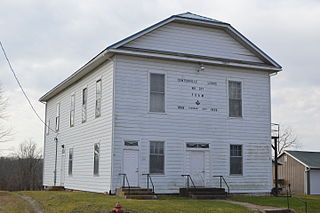
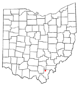
Centerville, also known as Thurman, is a city in western Gallia County, Ohio, United States. The city lies adjacent to the Gallia - Jackson county line. It is located adjacent to U.S. Route 35 at the eastern terminus of State Route 279.

<span class="mw-page-title-main">Cheshire, Ohio</span> Village in Ohio, United States

Cheshire is a village in Gallia County, Ohio, United States, along the Ohio River. The population was 123 at the 2020 census. It is part of the rural Point Pleasant micropolitan area.

<span class="mw-page-title-main">Crown City, Ohio</span> Village in Ohio, United States

Crown City is a village in Gallia County, Ohio, United States, along the Ohio River. The population was 424 at the 2020 census.

<span class="mw-page-title-main">Gallipolis, Ohio</span> Village in Ohio, United States

Gallipolis is a chartered village in and the county seat of Gallia County, Ohio, United States. The municipality is located in Southeast Ohio along the Ohio River about 55 miles (89 km) southeast of Chillicothe and 44 miles (71 km) northwest of Charleston, West Virginia. The population was 3,313 at the 2020 census. Gallipolis is the second-largest community in the rural Point Pleasant micropolitan area, which includes all of Gallia County, Ohio, and Mason County, West Virginia.

<span class="mw-page-title-main">Rio Grande, Ohio</span> Village in Ohio, United States

Rio Grande is a village in Gallia County, Ohio, United States. The population was 724 at the 2020 census. It is part of the rural Point Pleasant micropolitan area. Although the town is named after the river in the southern United States, its name is pronounced "Rye-O Grand" rather than the traditional Spanish pronunciation.

<span class="mw-page-title-main">Addyston, Ohio</span> Village in Ohio, United States

Addyston is a village in Miami Township, Hamilton County, Ohio, United States. Located along the Ohio River, it is a western suburb of the neighboring city of Cincinnati. The population was 927 at the 2020 census.

<span class="mw-page-title-main">Cleves, Ohio</span> City in Ohio, United States

Cleves is a village in Miami Township, Hamilton County, Ohio, United States. Located along the Ohio River, it is a western suburb of Cincinnati. The population was 3,414 at the 2020 census.

<span class="mw-page-title-main">Mowrystown, Ohio</span> Village in Ohio, United States

Mowrystown is a village in Highland County, Ohio, United States. The population was 385 at the 2020 census.

<span class="mw-page-title-main">Hanover, Ohio</span> Village in Ohio, United States

Hanover is a village in Licking County, Ohio, United States. The population was 1,270 at the 2020 census. The village lies along Ohio State Route 16.

<span class="mw-page-title-main">Montezuma, Ohio</span> Village in Ohio, United States

Montezuma is a village in Mercer County, Ohio, United States. The population was 152 at the 2020 census.

<span class="mw-page-title-main">Hamden, Ohio</span> Village in Ohio, United States

Hamden is a village in Vinton County, Ohio, United States. The population was 727 at the 2020 census.

<span class="mw-page-title-main">McArthur, Ohio</span> Village in Ohio, United States

McArthur is a village in and the county seat of Vinton County, Ohio, United States. It is located 27 miles (43 km) southeast of Chillicothe. The population was 1,783 at the 2020 census.

<span class="mw-page-title-main">Wilkesville, Ohio</span> Village in Ohio, United States

Wilkesville is a village in Vinton County, Ohio, United States. The population was 116 at the 2020 census.

<span class="mw-page-title-main">Zaleski, Ohio</span> Village in Ohio, United States

Zaleski is a village in Vinton County, Ohio, United States. The population was 230 at the 2020 census.

<span class="mw-page-title-main">Macksburg, Ohio</span> Village in Ohio, United States

Macksburg is a village in Washington County, Ohio, United States, along the West Fork of Duck Creek. The population was 120 at the 2020 census. The village is about 28 miles (45 km) south of Cambridge, Ohio.

<span class="mw-page-title-main">Gratiot, Ohio</span> Village in Ohio, United States

Gratiot is a village in Licking and Muskingum counties in the U.S. state of Ohio. The population was 215 at the 2020 census.

References

  1. "ArcGIS REST Services Directory". United States Census Bureau. Retrieved September 20, 2022.
  2. 1 2 U.S. Geological Survey Geographic Names Information System: Vinton, Ohio
  3. History of Gallia County: Containing a Condensed History of the County; Biographical Sketches; General Statistics; Miscellaneous Matters &c. St. Peter's Episcopal Church. 1882. p. 28.
  4. "Post offices". Jim Forte Postal History. Retrieved July 16, 2016.
  5. "US Gazetteer files 2010". United States Census Bureau. Archived from the original on January 25, 2012. Retrieved January 6, 2013.
  6. "State of Ohio GIS Databases". Archived from the original on August 21, 2011. Retrieved March 6, 2011.
  7. "Census of Population and Housing". Census.gov. Retrieved June 4, 2015.
  8. "U.S. Census website". United States Census Bureau . Retrieved January 6, 2013.
  9. "U.S. Census website". United States Census Bureau . Retrieved January 31, 2008.