Oglesby, Illinois

Last updated

Oglesby
City of Oglesby
Oglesby updated water tower.jpg
LaSalle County Illinois Incorporated and Unincorporated areas Oglesby Highlighted.svg
Location of Oglesby in LaSalle County, Illinois.
Illinois in United States (US48).svg
Location of Illinois in the United States
Coordinates: 41°17′36″N89°04′16″W / 41.29333°N 89.07111°W / 41.29333; -89.07111 [1]
CountryUnited States
StateIllinois
County LaSalle
Township LaSalle
Government
  Type City commission government
  MayorJason Curran
  CommissionersRichard Baldridge, Terry Eutis, Greg "Mac" McDermott and Tony Stefanelli
Area
[2]
  Total4.99 sq mi (12.93 km2)
  Land4.99 sq mi (12.93 km2)
  Water0.00 sq mi (0.00 km2)
Elevation
[1]
637 ft (194 m)
Population
 (2020)
  Total3,712
  Density743.59/sq mi (287.11/km2)
Time zone UTC−6 (CST)
  Summer (DST) UTC−5 (CDT)
ZIP code
61348 [3]
Area code 815
FIPS code 17-55353
GNIS feature ID2395310 [1]
Website www.oglesby.il.us

Oglesby is a city in LaSalle County, Illinois, United States. The population was 3,712 at the 2020 census, down from 3,791 at the 2010 census. It is part of the Ottawa Micropolitan Statistical Area.

Contents

History

Oglesby was a center for mining coal, limestone, and silica, located near the confluence of the Illinois River and the north-flowing Vermilion River. Oglesby grew from an amalgamation of several mining villages, such as Kenosha, Portland, and Black Hollow. It was originally called Portland, due to the cement mined and manufactured in the area that was similar to Portland Cement from England. It was renamed in 1913 after the coal company and in honor of Richard J. Oglesby (1824–1899), a former U.S. Senator and three-time Governor of Illinois. [4] [5]

During the Civil War, the Kenosha Coal Company sank a coal mining shaft at Oglesby in 1865. Thatcher Tucker Bent purchased the mine and mineral rights as the Oglesby Coal Company. The mine was innovative and the Bents were very involved in the development of the community. Mrs. Josephine Bent even organized English classes for the immigrant miner's wives. The Marquette Cement Manufacturing Company mined limestone and claimed that the Bent's mine was causing collapses. The conflict eventually liquidated the Oglesby Coal Company, with the Bent selling the machinery to Marquette and auctioning off the farm animals. The Black Hollow Mine was dug in the 1890s as a slope mine along the Vermilion River. It provided coal to its owners, the Illinois Zinc Company in Peru, Illinois. [6]

The surface ground layers around Oglesby had excellent exposed limestone and coal; Oglesby also had adequate riverine transport. It soon became an important center for cement manufacture. Before open-pit mining there were several subsurface cement mines: [7]

As well as several coal mines:

State parks

Matthiessen State Park and Starved Rock State Park are located a few miles east on Illinois State Route 178. [8] [9] With over two million visitors a year, Starved Rock is the most visited of any Illinois state park.

Geography

According to the 2010 census, Oglesby has a total area of 4.11 square miles (10.64 km2), all land. [10]

Demographics

Historical population
CensusPop.Note
1910 3,194
1920 4,13529.5%
1930 3,910−5.4%
1940 3,9380.7%
1950 3,922−0.4%
1960 4,2157.5%
1970 4,175−0.9%
1980 3,979−4.7%
1990 3,619−9.0%
2000 3,6470.8%
2010 3,7913.9%
2020 3,712−2.1%
U.S. Decennial Census [11]

As of the 2020 census [12] there were 3,712 people, 1,522 households, and 1,035 families residing in the city. The population density was 743.59 inhabitants per square mile (287.10/km2). There were 1,780 housing units at an average density of 356.57 per square mile (137.67/km2). The racial makeup of the city was 90.25% White, 0.46% African American, 0.38% Native American, 0.67% Asian, 0.00% Pacific Islander, 1.62% from other races, and 6.63% from two or more races. Hispanic or Latino of any race were 8.19% of the population.

There were 1,522 households, out of which 33.0% had children under the age of 18 living with them, 48.88% were married couples living together, 12.16% had a female householder with no husband present, and 32.00% were non-families. 25.62% of all households were made up of individuals, and 10.91% had someone living alone who was 65 years of age or older. The average household size was 2.90 and the average family size was 2.40.

The city's age distribution consisted of 24.1% under the age of 18, 4.4% from 18 to 24, 26.3% from 25 to 44, 26.1% from 45 to 64, and 19.1% who were 65 years of age or older. The median age was 40.7 years. For every 100 females, there were 106.2 males. For every 100 females age 18 and over, there were 95.3 males.

The median income for a household in the city was $61,250, and the median income for a family was $70,260. Males had a median income of $51,642 versus $28,393 for females. The per capita income for the city was $29,569. About 4.7% of families and 6.3% of the population were below the poverty line, including 8.3% of those under age 18 and 5.3% of those age 65 or over.

Education

Oglesby Lincoln School, Oglesby Washington School, Holy Family parochial School, and Illinois Valley Community College are located in Oglesby.

Arts and culture

1942 WPA mural The Illini and Potawatomies Struggle at Starved Rock The Illini and Potawatomies Struggle at Starved Rock.jpg
1942 WPA mural The Illini and Potawatomies Struggle at Starved Rock

Murals were produced in the United States through the Section of Painting and Sculpture, later called the Section of Fine Arts, of the Treasury Department from 1934 to 1943. They were intended to boost the morale of the American people suffering from the effects of the Depression by depicting uplifting subjects. In 1942 artist Fay E. Davis painted an oil on canvas mural titled The Illini and Potawatomes Struggles at Starved Rock in the town's post office. The mural's muted earth tones faded badly over time and it was restored in 1988. In 1993 a post office janitor complained about the nudity of the features of the Native Americans depicted in the mural. The painting was covered by a venetian blind and only revealed upon request. [13] A successful petition drive to remove the blinds was begun soon after.

Transportation

While there is no fixed-route transit service in Oglesby, intercity bus service is provided by Burlington Trailways in nearby Peru. [14]

Notable people

Related Research Articles

<span class="mw-page-title-main">Arlington, Illinois</span> Village in Illinois, United States

Arlington is a village in Bureau County, Illinois, United States. The population was 169 at the 2020 census. It is part of the Ottawa Micropolitan Statistical Area, located east of the Quad Cities, north of Peoria and Galesburg, west of LaSalle and Peru, and southwest of Rockford and Chicago.

<span class="mw-page-title-main">Cherry, Illinois</span> Village in Illinois, United States

Cherry is a village in Bureau County, Illinois, United States. The population was 435 at the 2020 census. It is part of the Ottawa Micropolitan Statistical Area. It is located northwest of LaSalle-Peru, just a few miles north of Interstate 80, and is about 75 miles (121 km) east of the Quad Cities.

<span class="mw-page-title-main">Dalzell, Illinois</span> Village in Illinois, United States

Dalzell is a village in Bureau and LaSalle counties in the U.S. state of Illinois. The population was 663 at the 2020 census, down from 717 at the 2010 census. It is part of the Ottawa Micropolitan Statistical Area. Dalzell was founded on November 24, 1903 and certified on February 11, 1904.

<span class="mw-page-title-main">Ladd, Illinois</span> Village in Illinois, United States

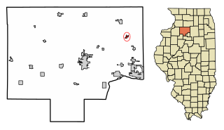
Ladd is a village in Bureau County, Illinois, United States. The population was 1,236 at the 2020 census. It is part of the Ottawa Micropolitan Statistical Area. Ladd is perhaps most known for a Vietnam War tank located in the center of its park.

<span class="mw-page-title-main">Seatonville, Illinois</span> Village in Illinois, United States

Seatonville is a village in Bureau County, Illinois, United States. The population was 321 at the 2020 census. It is part of the Ottawa Micropolitan Statistical Area.

<span class="mw-page-title-main">Moweaqua, Illinois</span> Village in Illinois, United States

Moweaqua is a village in Shelby and Christian counties, Illinois, United States. The population was 1,764 at the 2020 census.

<span class="mw-page-title-main">Buckner, Illinois</span> Village in Illinois, United States

Buckner is a village in Franklin County, Illinois, United States. The population was 409 at the 2020 census. The current mayor is Aaron Eubanks.

<span class="mw-page-title-main">Christopher, Illinois</span> City in Illinois, United States

Christopher is a city in Franklin County, Illinois, United States. The population was 2,697 at the time of the 2020 census.

<span class="mw-page-title-main">Sesser, Illinois</span> City in Illinois, United States

Sesser is a city in Franklin County, Illinois, United States. The population was 1,931 at the 2010 census. The current mayor is C. Jason Ashmore.

<span class="mw-page-title-main">LaSalle, Illinois</span> City in Illinois, United States

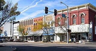
LaSalle or La Salle is a city in LaSalle County, Illinois, United States, located at the intersection of Interstates 39 and 80. It is part of the Ottawa, IL Micropolitan Statistical Area. Originally platted in 1837 over one square mile, the city's boundaries have grown to 12 sq mi (31 km2). City boundaries extend from the Illinois River and Illinois and Michigan Canal to a mile north of Interstate 80 and from the city of Peru on the west to the village of North Utica on the east. Starved Rock State Park is located approximately 5 mi (8 km) to the east. The population was 9,582 as of the 2020 census, down from 9,609 at the 2010 census. LaSalle and its twin city, Peru, make up the core of the Illinois Valley. Due to their combined dominance of the zinc processing industry in the early 1900s, they were collectively nicknamed "Zinc City."

<span class="mw-page-title-main">Peru, Illinois</span> City in Illinois, United States

Peru is a city in LaSalle County, Illinois, United States. The population was 9,896 at the 2020 census, down from 10,295 at the 2010 census. It is part of the Ottawa, IL Micropolitan Statistical Area. Peru and its twin city, LaSalle, make up the core of Illinois Valley.

<span class="mw-page-title-main">Virden, Illinois</span> City in Illinois, United States

Virden is a city in Macoupin and Sangamon counties in the U.S. state of Illinois. The population was 3,231 at the 2020 census.

<span class="mw-page-title-main">Colfax, Illinois</span> Village in Illinois, United States

Colfax is a village in McLean County, Illinois, United States. The population was 996 at the 2020 census. It is part of the Bloomington–Normal Metropolitan Statistical Area.

<span class="mw-page-title-main">Standard, Illinois</span> Place in Illinois, United States

Standard is a village in Putnam County, Illinois, United States. The population was 220 at the 2010 census, down from 256 in 2000. It is part of the Ottawa Micropolitan Statistical Area.

<span class="mw-page-title-main">Carbon Cliff, Illinois</span> Village in Illinois, United States

Carbon Cliff is a village in Rock Island County, Illinois, United States. The population was 2,134 at the 2010 census. It lies in the south part of Hampton Township.

<span class="mw-page-title-main">Johnston City, Illinois</span> City in Illinois, United States

Johnston City is a city in Williamson County, Illinois, United States. The population was 3,348 at the 2020 census. This was a center of coal mining in the early 20th century, having a peak of population in the 1920s. The mining jobs attracted many immigrants from Europe.

<span class="mw-page-title-main">Minonk, Illinois</span> City in Illinois, United States

Minonk is a city in Minonk Township, Woodford County, Illinois. The population was 2,078 at the 2010 census, down from 2,168 in 2000. The city is part of the Peoria, Illinois, metropolitan area.

<span class="mw-page-title-main">Coalville, Iowa</span> CDP in Iowa, United States

Coalville is a census-designated place (CDP) in Webster County, Iowa, United States. The population was 610 at the 2010 census. The community is located on U.S. Route 20 near Fort Dodge's large gypsum mines.

<span class="mw-page-title-main">Gary, West Virginia</span> City in West Virginia, United States

Gary is a city located along the Tug Fork River in McDowell County, West Virginia, United States. According to the 2020 census, the city had a population of 762. It was named for Elbert Henry Gary, one of the founders of U.S. Steel. The former coal towns of Elbert, Filbert, Thorpe, and Wilcoe became part of Gary at the time of its incorporation in 1971.

Van Lear is an unincorporated community and coal town in Johnson County, Kentucky, United States.

References

  1. 1 2 3 U.S. Geological Survey Geographic Names Information System: Oglesby, Illinois
  2. "2020 U.S. Gazetteer Files". United States Census Bureau. Retrieved March 15, 2022.
  3. "Oglesby IL ZIP Code". zipdatamaps.com. 2023. Retrieved May 12, 2023.
  4. Oglesby-Our Home Town (1902–2002). Oglesby, Illinois: Oglesby Historical Society. 2002. p. 5.
  5. Illinois Central Magazine. Illinois Central Railroad Company. 1922. p. 43.
  6. Bluemer, R.G. (2001). Black Diamond Mines. Granville, Illinois: Grand Village Press.
  7. "Archived copy" (PDF). Archived from the original (PDF) on June 14, 2010. Retrieved September 4, 2011.{{cite web}}: CS1 maint: archived copy as title (link)
  8. "Matthiessen - State Park". Illinois Department of Natural Resources . Archived from the original on September 21, 2013. Retrieved September 20, 2013.
  9. "Fun Facts about Illinois Tourism". illinois issues.uis.edu. University of Illinois at Springfield. Archived from the original on June 15, 2011. Retrieved November 16, 2015.
  10. "G001 - Geographic Identifiers - 2010 Census Summary File 1". United States Census Bureau. Archived from the original on February 13, 2020. Retrieved December 27, 2015.
  11. "Census of Population and Housing". Census.gov. Retrieved June 4, 2015.
  12. "Explore Census Data". data.census.gov. Retrieved June 28, 2022.
  13. "Indians at the Post Office". postalmuseum.si.edu. Smithsonian Postal Museum. Retrieved December 9, 2014.
  14. "Illinois Bus Stops" . Retrieved September 28, 2023.
  15. "Jim Bottomley". National Baseball Hall of Fame. Retrieved February 18, 2018.