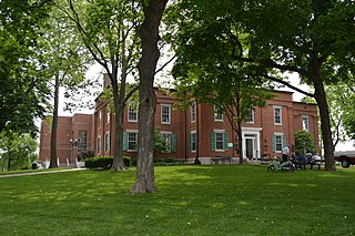
Monroe County is a county in the U.S. state of West Virginia. As of the 2010 census, the population was 13,502. Its county seat is Union.

LaSalle County is located in the North Central region of the U.S. state of Illinois; it has an estimated population of 109,430 as of 2018 and its county seat and largest city is Ottawa.

Waterloo is a city in Monroe County, Illinois, United States. The population was 9,811 at the 2010 census. It is the county seat of Monroe County.

Rich Creek is a town in Giles County, Virginia, United States. The population was 774 at the 2010 census, up from 665 at the 2000 census. It is part of the Blacksburg–Christiansburg Metropolitan Statistical Area.

Peterstown is a town in Monroe County, West Virginia, United States. The population was 653 at the 2010 census.
West Virginia Route 12 is a north–south route located in the southern portion of the U.S. state of West Virginia. The southern terminus of the route is at U.S. Route 219 in Peterstown, Monroe County, less than 300 yards (270 m) from the Virginia state line. It compromises a portion of the Farm Heritage Road byway between Peterstown and West Virginia Route 122. The northern terminus of the route is at U.S. Route 60 in Alta, Greenbrier County, near Interstate 64 exit 161.
The “Jones Diamond,” also known as the “Punch Jones Diamond,” "The Grover Jones Diamond," or "The Horseshoe Diamond," was a 34.48 carat alluvial diamond found in Peterstown, West Virginia by members of the Jones family. It remains the largest alluvial diamond ever discovered in North America.
U.S. Route 219 (US 219) is a part of the U.S. Highway System that travels from Rich Creek, Virginia to West Seneca, New York. In the U.S. state of West Virginia, the U.S. Highway travels from the Virginia state line near Peterstown to the Maryland state line near Silver Lake.

The Peterstown House is a historic building located at 275 N. Main St. in Waterloo, Illinois. The saltbox building was constructed in the mid-1830s; an addition was placed on its north side around the 1860s. Emory Peter Rogers, for whom the house and surrounding neighborhood were named, was the first owner of the building. The building served as an inn and stagecoach stop along the Kaskaskia-Cahokia Trail, which was the first road in Illinois. The stagecoach route connected the French settlements at Kaskaskia and Cahokia. The Peterstown House is the only intact inn which still stands along the trail; while another building in Waterloo once served as an inn on the trail, it has been extensively remodeled. In the late nineteenth century, the Peterstown House became a local social hall.

The Ottawa, IL Micropolitan Statistical Area, as defined by the United States Census Bureau, is an area consisting of three counties in north central Illinois, anchored by the city of Ottawa. Peru and Streator are former primary cities.

Neponset is an unincorporated community in Summers County, West Virginia, United States. Neponset is located near the east bank of the New River, south of Hinton and north of Peterstown.

Ballard is an unincorporated community in Monroe County, West Virginia, United States. Ballard is located on West Virginia Route 12 north of Peterstown. Ballard has a post office with ZIP code 24918.

Bozoo is an unincorporated community in Monroe County, West Virginia, United States. Bozoo is north of Peterstown.

Cashmere is an unincorporated community in Monroe County, West Virginia, United States. Cashmere is located on West Virginia Route 12 north of Peterstown.

Cloverdale is an unincorporated community in Monroe County, West Virginia, United States. Cloverdale is north of Peterstown.

Lindside is an unincorporated community in Monroe County, West Virginia, United States. Lindside is located on U.S. Route 219 northwest of Peterstown. Lindside has a post office with ZIP code 24951.

Rock Camp is an unincorporated community in Monroe County, West Virginia, United States. Rock Camp is located on U.S. Route 219 northeast of Peterstown and southwest of Union.
Monroe County Schools is the operating school district within Monroe County, West Virginia. It is governed by the Monroe County Board of Education.
'Joseph P. Stremlau was an American farmer, businessman, and politician.


