Olifantshoek

Last updated

Olifantshoek
South Africa Northern Cape location map.svg
Red pog.svg
Olifantshoek
South Africa adm location map.svg
Red pog.svg
Olifantshoek
Coordinates: 27°56′S22°44′E / 27.933°S 22.733°E / -27.933; 22.733
Country South Africa
Province Northern Cape
District John Taolo Gaetsewe
Municipality Gamagara
Area
[1]
  Total66.58 km2 (25.71 sq mi)
Population
 (2011) [1]
  Total10,233
  Density150/km2 (400/sq mi)
Racial makeup (2011)
[1]
   Black African 42.5%
   Coloured 47.7%
   Indian/Asian 0.6%
   White 5.5%
  Other3.8%
First languages (2011)
[1]
   Afrikaans 78.9%
   Tswana 10.2%
   English 2.1%
   Sotho 1.3%
  Other7.4%
Time zone UTC+2 (SAST)
Postal code (street)
8450
PO box
8450
Area code 053

Olifantshoek is a town in John Taolo Gaetsewe District Municipality in the Northern Cape Province of South Africa.

Contents

The village is 60 km northwest of Postmasburg and 80 km southwest of Kuruman. It developed from a police post and is administered by a village management board. The name is of Afrikaans origin and means "elephants' corner" or "elephants' glen", referring to the many elephant skeletons that Dutch settlers found in the area. It may also be translated from Tswana "ditlou".

History

The town was officially founded in 1912. The town was allegedly named after the tusk of an elephant that was used to purchase the farm on which the town was built. Many other elephant bones were found in the area.

Geography

Olifantshoek lies at the foot of the Lange Mountains on the Namakwari Route in the Northern Cape Province of South Africa. For millions of years, a natural reservoir beneath the dunes has washed the red oxide out of the sand leaving white dunes which remain. These white dunes contrast against the rust-red sand of the rest of the Kalahari. During hot and dry conditions, the grains of sand rub together to create a deep hum. These sounds are best heard in close proximity to the dunes during the summer months between September and April. Rain silences the sounds of the dunes. [2] [3] The town is also known as the ‘Gateway to the White and Roaring Sands’. [4]

Climate

The red and white dunes of the Kalahari desert Northern Cape Red and White Dunes.jpeg
The red and white dunes of the Kalahari desert

Olifantshoek is situated within both the Savanna and Nama-Karoo biomes, and is a semi-arid region. Average yearly rainfall is 242mm per annum with the majority of the rain falling in summer. [5] Day temperatures often reach over 35 degrees Celsius in mid-summer. Winters are clear and dry, and, while daytime temperatures average 21 degrees Celsius, temperatures often drop below zero at night.

Attractions

Witsand Nature Reserve

The Witsand Nature Reserve has white sand dunes which are surrounded by contrasting red sand dunes. The reserve spans over 2,500 hectares of land with dunes up to 100 metres high and 10 kilometres in length. These white dunes are also known as the Kalahari Roaring Sands due to the sounds they make under certain weather conditions. The colouring of the dunes is believed to have been formed by numerous hills beneath the sand. Wildlife that can be observed in the nature reserve include meerkats, pangolins and aardvarks. Larger antelope such as the red hartebeest, springbok, gemsbok and kudu can also be seen. [3] Nocturnal wildlife includes the porcupine, aardwolf, bat-eared fox, Cape fox, genet, springhare and owl. [2]

The road leading to Olifantshoek Road to Olifantshoek - panoramio.jpg
The road leading to Olifantshoek

Hiking trails

The Neylan and the Pudu hiking trails are available for exploration in Olifantshoek.

San Rock Paintings

There are numerous engravings and San rock art paintings in the Olifantshoek area. Some of these can be viewed on Meerlust and Pan Heuwel farms.

War Grave

The war graves cemetery in Olifantshoek dates back to 1879. The graves are of the deceased during the Galeshewe wars fought between the inhabitants of the old Transvaal and the Tswana people on the western perimeter of the old Transvaal Republic. [3] These graves are on the Fuller farm. [6]

See also

Related Research Articles

<span class="mw-page-title-main">Kalahari Desert</span> Semi-arid sandy savanna in Southern Africa

The Kalahari Desert is a large semi-arid sandy savanna in Southern Africa extending for 900,000 square kilometres (350,000 sq mi), covering much of Botswana, as well as parts of Namibia and South Africa.

<span class="mw-page-title-main">Mafikeng</span> Capital city of the North-West Province, South Africa

Mahikeng, formerly known as Mafikeng and alternatively known as Mafeking, is the capital city of the North West province of South Africa.

<span class="mw-page-title-main">Northern Cape</span> Province in South Africa

The Northern Cape is the largest and most sparsely populated province of South Africa. It was created in 1994 when the Cape Province was split up. Its capital is Kimberley. It includes the Kalahari Gemsbok National Park, part of the Kgalagadi Transfrontier Park and an international park shared with Botswana. It also includes the Augrabies Falls and the diamond mining regions in Kimberley and Alexander Bay.

<span class="mw-page-title-main">North West (South African province)</span> Province in South Africa

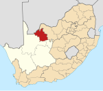
North West is a province of South Africa. Its capital is Mahikeng. The province is located to the west of the major population centre of Gauteng and south of Botswana.

<span class="mw-page-title-main">Kuruman</span> Place in Northern Cape, South Africa

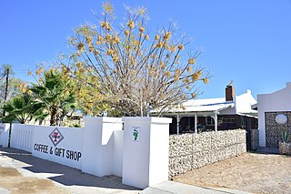
Kuruman is a small town in the Northern Cape province of South Africa. It is known for its scenery and the Eye of Kuruman, a geological feature that brings water from deep underground. The abundance of water produces an unexpected swathe of green amidst the barren plains and is known as the "Oasis of the Kalahari". It was at first a mission station of the London Missionary Society founded by Robert Moffat in 1821. It was also the place where David Livingstone arrived for his first position as a missionary in 1841. The Kuruman River, which is dry except for flash floods after heavy rain, is named after the town.

<span class="mw-page-title-main">Kgalagadi Transfrontier Park</span> Transfrontier conservation area in Botswana and South Africa

Kgalagadi Transfrontier Park is a large wildlife preserve and conservation area in southern Africa.

<span class="mw-page-title-main">Magaliesberg</span> Mountain range in South Africa

The Magaliesberg of northern South Africa, is a modest but well-defined mountain range composed mainly of quartzites. It rises at a point south of the Pilanesberg to form a curved prominence that intersects suburban Pretoria before it peters out some 50 km (31 mi) to the east, just south of Bronkhorstspruit. The highest point of the Magaliesberg is reached at Nooitgedacht, about 1,852 metres (6,076 ft) above sea level. A cableway reaching to the top of the mountain range is located at Hartbeespoort Dam, providing sweeping views of the Magaliesberg and surrounding area.

<span class="mw-page-title-main">Pedi people</span> Sotho-Tswana ethnic group of northeast South Africa

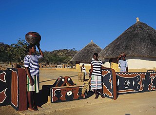
The Pedi or Bapedi, also known as the Sotho, Basotho, Northern Sotho, Basotho ba Lebowa, Transvaal Sotho, Marota, or Bamaroteng are a Sotho-Tswana ethnic group that speak Pedi or Sepedi, which is one of the 12 official languages in South Africa. They are primarily situated in Limpopo, Gauteng and northern Mpumalanga.

Atherstone Collaborative Nature Reserve, also known as the Atherstone Nature Reserve, is a 23,500 hectare reserve situated close to Dwaalboom, in the Limpopo, province in South Africa. The reserve consists mainly of vast savannah plains with bushveld and Kalahari grasslands ecosystems. Besides antelopes, zebras and giraffes, the south-central black rhinoceros and African bush elephants are one of the highlights of Atherstone.

The Milnerton Racecourse Nature Reserve is a lowland conservation area located in the City of Cape Town, South Africa.

<span class="mw-page-title-main">Cape Flats Sand Fynbos</span> Vegetation type endemic to the City of Cape Town

Cape Flats Sand Fynbos (CFSF), previously known as Sand Plain Fynbos, is a critically endangered vegetation type that occurs only within the city of Cape Town. Less than 1% of this unique lowland fynbos vegetation is conserved.

Witzands Aquifer Nature Reserve is a 3,000-hectare (7,400-acre) protected natural area in Cape Town, South Africa, located on the city's northern outskirts. This reserve protects an important part of Cape Town's natural and cultural heritage, including the Atlantis Aquifer. It is adjacent to the Koeberg Nature Reserve.

Blaauwberg Nature Reserve was proclaimed a local and provincial nature reserve in 2007. The reserve has views down fynbos slopes, across the city, to seven kilometres of rocky and sandy coastline and the ocean and beyond. The reserve presents itself as one of the few viewpoints in the world from where you can see two proclaimed world heritage sites, namely Table Mountain and Robben Island.

<span class="mw-page-title-main">Macassar Dunes Conservation Area</span> Coastal nature reserve in Macassar, Cape Town, South Africa

Macassar Dunes Conservation Area is a 1,116-hectare (2,760-acre) coastal nature reserve in Macassar, within the City of Cape Town, South Africa.

<span class="mw-page-title-main">Lusikisiki</span> Place in Eastern Cape, South Africa

Lusikisiki is a town in the Ingquza Hill Local Municipality in the Eastern Cape Province, South Africa. The name is onomatopoeic, derived from the rustling sound of reeds in the wind, named by the local Xhosa people. Lusikisiki is 45 kilometres (28 mi) inland from and north of Port St Johns. The town is positioned along the R61 leading to Mthatha to the west and Port Shepstone to the north-east.

<span class="mw-page-title-main">Askham, South Africa</span> Place in Northern Cape, South Africa

Askham is a village in the Dawid Kruiper Local Municipality in the ZF Mgcawu District Municipality in the Northern Cape province of South Africa. Askham lies not far from the confluence of the mostly dry Molopo and Kuruman Rivers in the Red Kalahari Desert, about 200 km north of Upington at the junction of the R31 and the R360 roads.

The Helderberg Marine Protected Area is a small marine conservation area on the north-eastern side of False Bay in the Western Cape province of South Africa, It lies between the mouths of the Lourens River in the Strand, and the Eerste River in Macassar.

Witsand Nature Reserve is located in Northern Cape, South Africa, and covers 3,500 hectares. The reserve is 80 km southwest of Postmasburg and 59 km northeast of Groblershoop. The reserve is dominated by sand dunes on a plateau around 1,200 m above sea level. Singing sand can be found here, a phenomenon in which during the dry summer months, a roar can be heard while walking over the sands.

<span class="mw-page-title-main">Koeberg Nature Reserve</span> Nature reserve surrounding Koeberg Nuclear Power Station, South Africa

The Koeberg Nature Reserve is located in the Western Cape province of South Africa, about 30 kilometres north of Cape Town. The reserve was proclaimed in 1991 to create a buffer zone around the Koeberg Nuclear Power Station and protect the surrounding natural habitat. It is adjacent to the Witzands Aquifer Nature Reserve.

References

  1. 1 2 3 4 "Main Place Olifantshoek". Census 2011.
  2. 1 2 "Witsand Nature Reserve, Northern Cape". www.sa-venues.com. Retrieved 12 January 2018.
  3. 1 2 3 "Olifantshoek Accommodation, Kalahari & Diamond Fields". www.wheretostay.co.za. Retrieved 12 January 2018.
  4. "Experience the Northern Cape, South Africa". experiencenortherncape.com. Retrieved 12 January 2018.[ title missing ]
  5. "Olifantshoek climate". www.saexplorer.co.za. Retrieved 9 February 2018.
  6. "Olifantshoek Travel Information". www.northern-cape-info.co.za. Retrieved 13 January 2018.