Ortley, South Dakota

Last updated

Ortley, South Dakota
Roberts County South Dakota Incorporated and Unincorporated areas Ortley Highlighted.svg
Location in Roberts County and the state of South Dakota
Coordinates: 45°20′06″N97°12′18″W / 45.33500°N 97.20500°W / 45.33500; -97.20500
Country United States
State South Dakota
County Roberts
Incorporated1906 [1]
Area
[2]
  Total2.24 sq mi (5.81 km2)
  Land2.24 sq mi (5.81 km2)
  Water0.00 sq mi (0.00 km2)
Elevation
[3]
1,844 ft (562 m)
Population
 (2020) [4]
  Total50
  Density22.28/sq mi (8.60/km2)
Time zone UTC-6 (Central (CST))
  Summer (DST) UTC-5 (CDT)
ZIP code
57256
Area code 605
FIPS code 46-47660 [5]
GNIS feature ID1267526 [3]

Ortley is a town in Roberts County, South Dakota, United States. The population was 50 according to the 2020 census. [6]

Contents

History

Ortley was laid out in 1906; an early variant name was Anderson. [7]

Geography

According to the United States Census Bureau, the town has a total area of 2.24 square miles (5.80 km2), all land. [8]

Demographics

Historical population
CensusPop.Note
1910 192
1920 187−2.6%
1930 157−16.0%
1940 18417.2%
1950 144−21.7%
1960 127−11.8%
1970 111−12.6%
1980 80−27.9%
1990 63−21.2%
2000 54−14.3%
2010 6520.4%
2020 50−23.1%
U.S. Decennial Census [9] [4]

2010 census

As of the census [10] of 2010, there were 65 people, 28 households, and 20 families residing in the town. The population density was 29.0 inhabitants per square mile (11.2/km2). There were 42 housing units at an average density of 18.7 per square mile (7.2/km2). The racial makeup of the town was 84.6% White, 12.3% Native American, and 3.1% from two or more races.

There were 28 households, of which 21.4% had children under the age of 18 living with them, 53.6% were married couples living together, 17.9% had a female householder with no husband present, and 28.6% were non-families. 25.0% of all households were made up of individuals, and 10.7% had someone living alone who was 65 years of age or older. The average household size was 2.32 and the average family size was 2.60.

The median age in the town was 48.6 years. 16.9% of residents were under the age of 18; 4.6% were between the ages of 18 and 24; 20.1% were from 25 to 44; 26.2% were from 45 to 64; and 32.3% were 65 years of age or older. The gender makeup of the town was 55.4% male and 44.6% female.

2000 census

As of the census [5] of 2000, there were 54 people, 25 households, and 16 families residing in the town. The population density was 24.1 people per square mile (9.3/km2). There were 32 housing units at an average density of 14.3 per square mile (5.5/km2). The racial makeup of the town was 85.19% White and 14.81% Native American.

There were 25 households, out of which 28.0% had children under the age of 18 living with them, 56.0% were married couples living together, 4.0% had a female householder with no husband present, and 36.0% were non-families. 36.0% of all households were made up of individuals, and 16.0% had someone living alone who was 65 years of age or older. The average household size was 2.16 and the average family size was 2.81.

In the town, the population was spread out, with 20.4% under the age of 18, 11.1% from 18 to 24, 18.5% from 25 to 44, 27.8% from 45 to 64, and 22.2% who were 65 years of age or older. The median age was 45 years. For every 100 females, there were 100.0 males. For every 100 females age 18 and over, there were 95.5 males.

The median income for a household in the town was $23,438, and the median income for a family was $24,063. Males had a median income of $21,875 versus $21,250 for females. The per capita income for the town was $11,327. There were 10.5% of families and 12.9% of the population living below the poverty line, including 8.3% of under eighteens and 20.0% of those over 64.

Related Research Articles

<span class="mw-page-title-main">Brinsmade, North Dakota</span> City in North Dakota, United States

For people with the surname, see Brinsmade (surname).

<span class="mw-page-title-main">Loma, North Dakota</span> City in North Dakota, United States

Loma is a city in Cavalier County, North Dakota, United States. The population was 10 at the 2020 census. Loma was founded in 1905.

<span class="mw-page-title-main">Brocket, North Dakota</span> City in North Dakota, United States

Brocket is a city in Ramsey County, North Dakota, United States. The population was 34 at the 2020 census. Brocket was founded in 1901.

<span class="mw-page-title-main">Pisek, North Dakota</span> City in North Dakota, United States

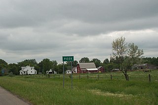
Pisek is a city in Walsh County, North Dakota, United States. The population was 89 at the 2020 census.

<span class="mw-page-title-main">Artas, South Dakota</span> Town in South Dakota, United States

Artas is a town in Campbell County, South Dakota, United States. The population was 7 at the 2020 census.

<span class="mw-page-title-main">Raymond, South Dakota</span> Town in South Dakota, United States

Raymond is a rural small village in western Clark County, South Dakota, United States. The population was 53 at the 2020 census. There is a post office at Raymond, also a fire station, a church, and a bar.

<span class="mw-page-title-main">Pringle, South Dakota</span> Town in South Dakota, United States

Pringle is a town in Custer County, South Dakota, United States. The population was 109 at the 2020 census.

<span class="mw-page-title-main">Marvin, South Dakota</span> Town in South Dakota, United States

Marvin is a town in Grant County, South Dakota, United States. The population was 19 at the 2020 census.

<span class="mw-page-title-main">Farmer, South Dakota</span> Town in South Dakota, United States

Farmer is a town in Hanson County, South Dakota, United States. It is part of the Mitchell, South Dakota Micropolitan Statistical Area. The population was 15 at the 2020 census.

<span class="mw-page-title-main">Harrold, South Dakota</span> Town in South Dakota, United States

Harrold is a town in Hughes County, South Dakota, United States. It is part of the Pierre, South Dakota Micropolitan Statistical Area. The population was 101 at the 2020 census.

<span class="mw-page-title-main">Central City, South Dakota</span> City in South Dakota, United States

Central City is a city in Lawrence County, South Dakota, United States. The population was 93 at the 2020 census.

<span class="mw-page-title-main">Lennox, South Dakota</span> City in South Dakota, United States

Lennox is a city in Lincoln County, South Dakota, United States, located 20 miles (32 km) southwest of Sioux Falls. The population was 2,423 at the 2020 census.

<span class="mw-page-title-main">Presho, South Dakota</span> City in South Dakota, United States

Presho is a small city in Lyman County, South Dakota, United States. The population was 472 at the 2020 census.

<span class="mw-page-title-main">Vilas, South Dakota</span> Town in South Dakota, United States

Vilas is a town in Miner County, South Dakota, United States. The population was 29 at the 2020 census.

<span class="mw-page-title-main">Trent, South Dakota</span> Town in South Dakota, United States

Trent is a town in Moody County, South Dakota, United States. The population was 206 at the 2020 census.

<span class="mw-page-title-main">Lebanon, South Dakota</span> Town in South Dakota, United States

Lebanon is a town in Potter County, South Dakota, United States. The population was 33 at the 2020 census.

<span class="mw-page-title-main">Tolstoy, South Dakota</span> Town in South Dakota, United States

Tolstoy is a town in Potter County, South Dakota, United States. The population was 35 at the 2020 census.

<span class="mw-page-title-main">White Rock, South Dakota</span> Town in South Dakota, United States

White Rock is a town in Roberts County, South Dakota, United States, along the Bois de Sioux River. The population was 6 at the 2020 census. White Rock is the most northeastern community in South Dakota, being along the Minnesota border and one mile south of North Dakota.

<span class="mw-page-title-main">Northville, South Dakota</span> Town in South Dakota, United States

Northville is a town in Spink County, South Dakota, United States. The population was 139 at the 2020 census.

<span class="mw-page-title-main">Turton, South Dakota</span> Town in South Dakota, United States

Turton is a town in Spink County, South Dakota, United States. The population was 55 at the 2020 census. The town was served by Turton High School from 1915 to 1956; students attended Doland High School thereafter.

References

  1. "SD Towns" (PDF). South Dakota State Historical Society . Retrieved February 14, 2010.
  2. "ArcGIS REST Services Directory". United States Census Bureau. Retrieved October 15, 2022.
  3. 1 2 U.S. Geological Survey Geographic Names Information System: Ortley, South Dakota
  4. 1 2 "Census Population API". United States Census Bureau. Retrieved October 15, 2022.
  5. 1 2 "U.S. Census website". United States Census Bureau . Retrieved January 31, 2008.
  6. "U.S. Census Bureau: Ortley town, South Dakota". www.census.gov. United States Census Bureau. Retrieved January 28, 2022.
  7. Federal Writers' Project (1940). South Dakota place-names, v.1-3. University of South Dakota. p. 52.
  8. "US Gazetteer files 2010". United States Census Bureau. Archived from the original on January 25, 2012. Retrieved June 21, 2012.
  9. "Census of Population and Housing". Census.gov. Retrieved June 4, 2015.
  10. "U.S. Census website". United States Census Bureau . Retrieved June 21, 2012.