White Rock, South Dakota

Last updated

White Rock, South Dakota
Roberts County South Dakota Incorporated and Unincorporated areas White Rock Highlighted.svg
Location in Roberts County and the state of South Dakota
Coordinates: 45°55′29″N96°34′34″W / 45.92472°N 96.57611°W / 45.92472; -96.57611
Country United States
State South Dakota
County Roberts
Area
[1]
  Total1.57 sq mi (4.07 km2)
  Land1.57 sq mi (4.07 km2)
  Water0.00 sq mi (0.00 km2)
Elevation
[2]
974 ft (297 m)
Population
 (2020) [3]
  Total6
  Density3.82/sq mi (1.47/km2)
Time zone UTC-6 (Central (CST))
  Summer (DST) UTC-5 (CDT)
Area code 605
FIPS code 46-71380
GNIS feature ID1267654 [2]

White Rock is a town in Roberts County, South Dakota, United States, along the Bois de Sioux River. The population was 6 at the 2020 census. [4] White Rock is the most northeastern community in South Dakota, being along the Minnesota border and one mile south of North Dakota.

Contents

History

A post office called White Rock was established in 1885, and remained in operation until 1965. [5] White Rock took its name from a white granite boulder near the original town site. [6] The namesake boulder was destroyed and a grain elevator was built at the spot. [7] A historical marker stands at the corner of Haggert Ave. (the main east/west road along the north side of town) and 2nd St. (one of the two main north /south streets).

Geography

According to the United States Census Bureau, the town has a total area of 1.57 square miles (4.07 km2), all land. [8]

Demographics

Historical population
CensusPop.Note
1900 170
1910 368116.5%
1920 353−4.1%
1930 281−20.4%
1940 220−21.7%
1950 113−48.6%
1960 76−32.7%
1970 35−53.9%
1980 10−71.4%
1990 7−30.0%
2000 18157.1%
2010 3−83.3%
2020 6100.0%
U.S. Decennial Census [9]
2013 Estimate [10] [3]

2010 census

As of the census [11] of 2010, there were 3 people, 3 households, and 0 families residing in the town. The population density was 1.9 inhabitants per square mile (0.7/km2). There were 8 housing units at an average density of 5.1 per square mile (2.0/km2). The racial makeup of the town was 33.3% White, 33.3% Native American, and 33.3% from other races. Hispanic or Latino of any race were 33.3% of the population.

There were 3 households, of which 100.0% were non-families. 100.0% of all households were made up of individuals, and 33.3% had someone living alone who was 65 years of age or older. The average household size was 1.00 and the average family size was 0.00.

The median age in the town was 60.5 years. 0.0% of residents were under the age of 18; 0.0% were between the ages of 18 and 24; 0.0% were from 25 to 44; 66.6% were from 45 to 64; and 33.3% were 65 years of age or older. The gender makeup of the town was 100.0% male and 0.0% female.

2000 census

As of the census of 2000, there were 18 people, 2 households, and 0 families residing in the town. The population density was 11.4 people per square mile (4.4/km2). There were 6 housing units at an average density of 3.8 per square mile (1.5/km2). The racial makeup of the town was 100.00% White.

There were 2 households, out of which none had children under the age of 18 living with them, none were married couples living together, and 100.0% were non-families. 100.0% of all households were made up of individuals, and none had someone living alone who was 65 years of age or older. The average household size was 1.00 and the average family size was 0.00.

In the town, the population was spread out, with 5.6% from 25 to 44, 5.6% from 45 to 64, and 88.9% who were 65 years of age or older. The median age was 90 years. For every 100 females, there were 38.5 males. For every 100 females age 18 and over, there were 38.5 males.

The median income for a household in the town was $3,750, and the median income for a family was $0. Males had a median income of $0 versus $0 for females. The per capita income for the town was $22,883. There were no families and 100.0% of the population living below the poverty line, including no under eighteens and none of those over 64.

Related Research Articles

<span class="mw-page-title-main">Rawson, North Dakota</span> Unincorporated community in North Dakota, United States

Rawson is a now-unincorporated farm community in McKenzie County, North Dakota, United States. It has two streets: Main Street, one mile north of the combined state highways 85 and 200, at Main's intersection with First Avenue. The population was 6 at the 2000 census. Rawson was founded in 1913 and incorporated, and attained the status of a small rural town. The government of Rawson was dissolved in 2002, Mail was then sent to Alexander.

<span class="mw-page-title-main">Ruso, North Dakota</span> City in North Dakota, United States

Ruso is a city in McLean County, North Dakota, in the USA. The population was 1 at the 2020 census, making Ruso the least populous incorporated place in North Dakota.

<span class="mw-page-title-main">Grano, North Dakota</span> City in North Dakota, United States

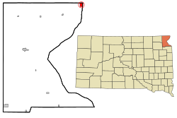
Grano is a tiny City in Renville County, North Dakota, United States. The population was 10 at the 2020 Census. It consists of a bar and three homes.

<span class="mw-page-title-main">Aurora Center, South Dakota</span> CDP in South Dakota, United States

Aurora Center is a census-designated place (CDP) in Aurora County, South Dakota, United States. The population was 22 at the 2020 census.

<span class="mw-page-title-main">Virgil, South Dakota</span> Town in South Dakota, United States

Virgil is a town in Beadle County in the U.S. state of South Dakota. The population was 26 at the 2020 census.

<span class="mw-page-title-main">Bushnell, South Dakota</span> Town in South Dakota, United States

Bushnell is a town in Brookings County, South Dakota, United States. The population was 71 at the 2020 census.

<span class="mw-page-title-main">Butler, South Dakota</span> Town in South Dakota, United States

Butler is a town in Day County, South Dakota, United States. The population was 4 at the 2020 census.

<span class="mw-page-title-main">Chelsea, South Dakota</span> Town in South Dakota, United States

Chelsea is a town in Faulk County, South Dakota, United States. The population was 19 at the 2020 census.

<span class="mw-page-title-main">Albee, South Dakota</span> Unincorporated community in South Dakota, United States

Albee is a town in Grant County, South Dakota, United States. The population was 7 at the 2020 census.

<span class="mw-page-title-main">Revillo, South Dakota</span> Town in South Dakota, United States

Revillo is a town in southeastern Grant County, South Dakota, United States. The population was 99 at the 2020 census.

<span class="mw-page-title-main">Farmer, South Dakota</span> Town in South Dakota, United States

Farmer is a town in Hanson County, South Dakota, United States. It is part of the Mitchell, South Dakota Micropolitan Statistical Area. The population was 15 at the 2020 census.

<span class="mw-page-title-main">Milltown, South Dakota</span> CDP in South Dakota, United States

Milltown is a census-designated place (CDP) in Hutchinson County, South Dakota, United States. The population was 8 at the 2020 census.

<span class="mw-page-title-main">Belvidere, South Dakota</span> Town in South Dakota, United States

Belvidere is a town in Jackson County, South Dakota, United States. The population was 46 at the 2020 census.

<span class="mw-page-title-main">Cottonwood, South Dakota</span> Town in the United States

Cottonwood is a small rural hamlet in Jackson County, South Dakota, United States. The population was 12 at the 2020 census. There are no businesses or services at Cottonwood.

<span class="mw-page-title-main">Wetonka, South Dakota</span> Town in South Dakota, United States

Wetonka is a town in McPherson County, South Dakota, United States. The population was 16 at the 2020 census.

<span class="mw-page-title-main">Roswell, South Dakota</span> Census-designated place in South Dakota, United States

Roswell is a CDP in Miner County, South Dakota, United States. The population was 8 at the 2020 census. It disincorporated as a town in 2012.

<span class="mw-page-title-main">Vilas, South Dakota</span> Town in South Dakota, United States

Vilas is a town in Miner County, South Dakota, United States. The population was 29 at the 2020 census.

<span class="mw-page-title-main">Brentford, South Dakota</span> Town in South Dakota, United States

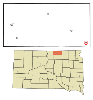
Brentford is a town in Spink County, South Dakota, United States. The population was 88 at the 2020 census.

<span class="mw-page-title-main">Dolton, South Dakota</span> Town in South Dakota, United States

Dolton is a town in Turner County, South Dakota, United States. The population was 34 at the 2020 census.

<span class="mw-page-title-main">Lowry, South Dakota</span> Town in South Dakota, United States

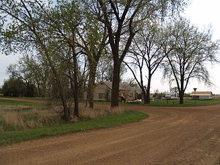
Lowry is a town in Walworth County, South Dakota, United States. The population was 10 at the 2020 census. The town is home to Lowry Pilgrim Community Church, Swan Creek Harness Shop, J & C Repair, Karst Service and a fire station. Lowry also has an abandoned school, and a post office, which closed to service in the early 1970s.

References

  1. "ArcGIS REST Services Directory". United States Census Bureau. Retrieved October 15, 2022.
  2. 1 2 U.S. Geological Survey Geographic Names Information System: White Rock, South Dakota
  3. 1 2 "Census Population API". United States Census Bureau. Retrieved October 15, 2022.
  4. "U.S. Census Bureau: White Rock town, South Dakota". www.census.gov. United States Census Bureau. Retrieved January 28, 2022.
  5. "Roberts County". Jim Forte Postal History. Retrieved August 12, 2015.
  6. Upham, Warren (1920). Minnesota Geographic Names: Their Origin and Historic Significance. Minnesota Historical Society. p.  551.
  7. Federal Writers' Project (1940). South Dakota place-names, v.1-3. University of South Dakota. p. 68.
  8. "US Gazetteer files 2010". United States Census Bureau . Retrieved June 21, 2012.
  9. "U.S. Decennial Census". Census.gov. Retrieved May 29, 2013.
  10. "Annual Estimates of the Resident Population: April 1, 2010 to July 1, 2013" . Retrieved July 11, 2014.
  11. "U.S. Census website". United States Census Bureau . Retrieved June 21, 2012.