
The Palouse Scenic Byway is a Washington State Scenic and Recreational Highway in Whitman County, Washington that follows seven different highways in the Palouse region: [1]
The Palouse Scenic Byway is a Washington State Scenic and Recreational Highway in Whitman County, Washington that follows seven different highways in the Palouse region: [1]
The Palouse Scenic Byway was designated on April 17, 2003 on sections of SR 26, SR 27, US 195 and SR 271 in Whitman County. [2] SR 278 was added to the byway in 2011. [3]
Whitman County is a county located in the U.S. state of Washington. As of the 2020 census, the population was 47,973. The county seat is Colfax, and its largest city is Pullman.

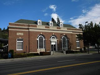
Colfax is the county seat of Whitman County, Washington, United States. The population was 2,805 at the 2010 census. The population is estimated at 2,911 per the State of Washington Office of Financial Management in 2018 making Colfax the second largest city in Whitman County behind Pullman. It is situated amidst wheat-covered hills in a valley at the confluence of the north and south forks of the Palouse River. U.S. Route 195, which forms the town's main street, intersects with State Route 26 at the north end of town; in the past, Colfax also lay at the junction of three major railway lines. It was named after Schuyler Colfax, the vice president from 1869–73.

U.S. Route 195 (US 195) is a north–south United States Highway, of which all but 0.65 miles of its 94.02 miles are within the state of Washington. The highway starts in rural Idaho north of the city of Lewiston as a state highway in an interchange with US 95. As the road crosses into Washington it becomes a state highway that connects communities in the Palouse region of Eastern Washington. US 195 travels north, serving the cities of Pullman, Colfax and Rosalia in Whitman County before continuing into Spokane County to its terminus in the city of Spokane at an interchange with Interstate 90 (I-90).

State Route 410 is a 107.44-mile (172.91 km) long state highway that traverses Pierce, King, and Yakima counties in the US state of Washington. It begins at an interchange with SR 167 in Sumner and travels southeast across the Cascade Range to a junction with U.S. Route 12 (US 12) in Naches. While the western part of SR 410 is a freeway that serves built-up, urban areas, the remainder of the route is a surface road that traverses mostly rural areas as it passes through the mountains.

State Route 27 (SR 27) is a 90-mile-long (145 km) state highway serving Whitman and Spokane counties, located in the eastern region of the U.S. state of Washington. The highway travels generally north from U.S. Route 195 (US 195) through Pullman, Palouse, Tekoa, and Spokane Valley to SR 290 north of an interchange with Interstate 90 (I-90). SR 27 serves the Palouse region as part of the Palouse Scenic Byway and travels between US 195 to the west and US 95 to the east in Idaho, with several auxiliary routes connecting to the two other highways.

State Route 23 (SR 23) is a state highway traversing Whitman and Lincoln counties in the U.S. state of Washington. The 66-mile (106.22 km) highway extends northwest from U.S. Route 195 (US 195) in Steptoe through Sprague to an intersection with SR 28 in Harrington. It serves as a route from Interstate 90 and US 395 in Sprague towards Pullman via US 195, and has a longer child route, SR 231 that travels north from SR 23 near Sprague to Reardan and Chewelah.

State Route 26 (SR 26) is a state highway in central Washington in the United States. It travels east–west for 114 miles (183 km) from Interstate 90 (I-90) near Vantage to U.S. Route 195 (US 195) in Colfax. The highway intersects several major north–south highways, including SR 24, SR 17, US 395, and SR 261 before ending in Colfax. The route serves as a connector between Vantage, Royal City, Othello, Washtucna, La Crosse, and Colfax.

State Route 270 (SR 270) is a state highway in Whitman County, Washington, United States. It connects the city of Pullman to U.S. Route 195 (US 195) at its west end and Idaho State Highway 8 near Moscow, Idaho, at its east end. The 10-mile-long (16 km) highway is one of the main roads in Pullman and connects the campuses of Washington State University and the University of Idaho.

State Route 127 (SR 127) is a 27.05-mile-long (43.53 km) state highway serving the eastern region of the U.S. state of Washington. The highway, listed on the National Highway System, begins in rural Garfield County at U.S. Route 12 (US 12) and travels north across the Snake River on the Elmer Huntley Bridge. The roadway continues into Whitman County before it ends at SR 26 in Dusty. SR 127 formed a section of the Inland Empire Highway and Primary State Highway 3 (PSH 3) prior to becoming US 295 in 1926. US 295 was decommissioned in 1968 and replaced by a longer SR 127, traveling its full length from Dodge to Colfax from its establishment in 1970 until an extension of SR 26 to Colfax in 1979.
State Route 276 (SR 276) was a legislated, but not constructed, state highway located in the U.S. state of Washington. The highway was meant to serve as a northern bypass of Pullman in Whitman County, traveling east from U.S. Route 195 (US 195) west of the city to SR 270 east of the city. Proposals were first drawn in 1969 for a complete ring road around Pullman, with the west side built and signed as US 195 in 1975. The northern segment of the ring road was codified in law in 1973 as SR 276, but was never constructed. In 2016, the highway was removed by the state legislature.

U.S. Route 2 (US 2) is a component of the United States Numbered Highway System that connects the city of Everett in the U.S. state of Washington to the Upper Peninsula of Michigan, with a separate segment that runs from Rouses Point, New York, to Houlton, Maine. Within Washington, the highway travels on a 326-mile-long (525 km) route that connects the western and eastern regions of the state as a part of the state highway system and the National Highway System. US 2 forms parts of two National Scenic Byways, the Stevens Pass Greenway from Monroe to Cashmere and the Coulee Corridor Scenic Byway near Coulee City, and an All-American Road named the International Selkirk Loop within Newport.

U.S. Route 12 is a major east–west U.S. Highway, running from Aberdeen, Washington, to Detroit, Michigan. It spans 430.8 miles across the state of Washington, making it the longest highway in the state. It is also the only numbered highway to span the entire state from west to east, starting near the Pacific Ocean, and crossing the Idaho state line near Clarkston. It crosses the Cascade Range over White Pass, south of Mount Rainier National Park. Portions of it are concurrent with Interstate 5 (I-5) and Interstate 82 (I-82), although the majority of the route does not parallel any interstate highway.

State Route 193 (SR 193) is a 2.58-mile (4.15 km) long state highway that serves the Port of Wilma in Whitman County, located in the U.S. state of Washington. The highway parallels the Snake River from an intersection with SR 128 north of Clarkston to the Port of Wilma. The current road is a short segment of the former route that extended from U.S. Route 12 (US 12) in Clarkston to US 195 west of Colton that was added to the highway system in 1969 as Secondary State Highway 3G (SSH 3G) in 1969 and removed in 1992.

State Route 194 (SR 194) is a 21.01-mile (33.81 km) long state highway that serves the Lower Granite Dam in Whitman County, located in the U.S. state of Washington. The highway extends eastward from the Port of Almota on the Snake River to an intersection with U.S. Route 195 (US 195) west of Pullman. SR 194 was established in 1991, although the roadway has appeared on maps as early as 1933 and the Almota area being home to a ferry as early as 1893.
State Route 271 is a 8.48-mile (13.65 km) long state highway located entirely in Whitman County, Washington, Washington, United States. The highway begins at a y-intersection with SR 27 in the northern outskirts of Oakesdale north to an interchange with U.S. Route 195 (US 195) southeast of Rosalia. The highway listed as part of the Palouse Scenic Byway.

State Route 272 (SR 272) is a 19.22-mile (30.93 km) long state highway serving Whitman County in the U.S. state of Washington. The highway travels from U.S. Route 195 (US 195) in Colfax to a short concurrency with parent route SR 27 in Palouse before ending at the Idaho state line and becoming Idaho State Highway 6 (SH-6). Prior to 1964, the highway was split between Secondary State Highway 3F (SSH 3F) from Colfax to Palouse and a branch of Primary State Highway 3 (PSH 3) from Palouse to the Idaho state line.

The National Forest Scenic Byways are roads that have been designated by the U.S. Forest Service as scenic byways. Many are also National Scenic Byways (NSB). The program was initiated in 1987.
The Bill Chipman Palouse Trail is a paved rail trail in the northwestern United States, from Pullman, Washington, eastward to Moscow, Idaho. Completed 25 years ago in 1998, it follows the former Union Pacific Railroad right-of-way and connects the rural university towns on the Palouse across the state border.
U.S. Bicycle Route 81 (USBR 81) is a United States Bicycle Route in the state of Washington. It is planned to travel north–south along the eastern edge of the state from Asotin to the Canadian border near Metaline Falls. The section from Asotin to Clarkston and Tekoa, spanning 103.5 miles (166.6 km), was designated in 2021. USBR 81 also has a child route, USBR 281, that was designated in 2021 and follows U.S. Route 195.